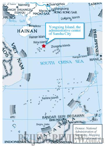
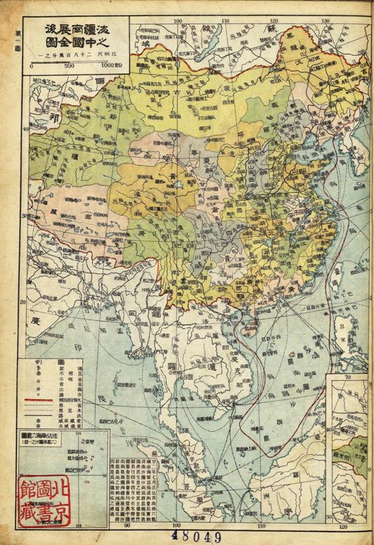
Just been sent a fascinating US Govt telegram shedding light on Washington's attitude to territorial claims in the South China Sea during the 1956 episode that really restarted the whole contest. (I haven't seen the original piece of paper, just a scan.) Thread...
2. This was triggered by the Philippine entrepreneur Tomas Cloma who, in 1956, claimed most of the Spratly Islands for himself as his own personal country called 'Freedomland'. This upset everyone else - both Chinas, Vietnam and even his own government (story is in my SCS book)
In response, the Republic of China (Taiwan) government sent some navy ships to evict Cloma's brother and supporters from the huts they had erected on Itu Aba (Taiping Island) and some other features. They forced Cloma's brother to sign a paper saying he wouldn't come back.
4. Meanwhile, the ROC, the PRC and the Republic of Vietnam (South Vietnam) all started shouting about their own territorial claims. (France had sent an expedition to Itu Aba in October 1946 to re-claim it after WW2. The ROC had claimed it for the first time two months later)
5. From the telegram it looks like the Vietnamese were intending to send their own naval ships to contest the ROC claim on Itu Aba. The US government absolutely did not want a fracture in the anti-communist front in the middle of the 1950s over a pathetic rock
6. The telegram is warning that the Government of the Republic of China (GRC) would use force against the Vietnamese if they tried to land on any of the 'Spratleys' (sic)
7. So, presumably, after this telegram is sent, US diplomats in Saigon lean heavily on the Vietnamese to dissuade them from taking any action to firm up their territorial claim in the Spratlys. Thus it looks like the US is taking sides with the ROC on the question of sovereignty
8. When, in fact they're more worried about maintaining an anti-communist front.
9. Instead, the Taiwan embassy tries to get everyone to focus on the Paracels where there had been recent occupations of some of the eastern reefs by PRC forces, despite the presence of Vietnamese in the western reefs
10. There may have been a pre-disposition among US officials to regard the Chinese claim as stronger (further research required...) but in this episode it's all about the geopolitics. END

• • •

Missing some Tweet in this thread? You can try to force a refresh
 

Keep Current with Bill Hayton

Bill Hayton Profile picture

Stay in touch and get notified when new unrolls are available from this author!

Read all threads

This Thread may be Removed Anytime!

PDF

Twitter may remove this content at anytime! Save it as PDF for later use!

Try unrolling a thread yourself!

how to unroll video
  1. Follow @ThreadReaderApp to mention us!

  2. From a Twitter thread mention us with a keyword "unroll"
@threadreaderapp unroll

Practice here first or read more on our help page!

More from @bill_hayton

10 Aug
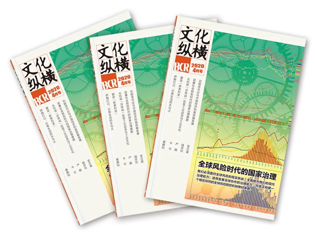
How does China see Vietnam’s South China Sea policy? Very clearly, according to this April 2020 article by Zhao Weihua of Guangdong University of Foreign Studies in 文化纵横 / Wénhuà zònghéng / ‘Cultural aspect’. Thanks to @khacgiang for alerting me to it. mp.weixin.qq.com/s/LAsrVIVVcFGw…
Caveat - I’m working off Google Translate so there may be errors…
The author is a Southeast Asia ‘watcher’ and on the 'Research Team' of @SCS_PI scspi.org/en/gywm
Read 30 tweets
13 Jul
It's taken six years since my book came out, but finally a response from some Chinese researchers. Let's see what they have to say...
The first point is one of translation. @Zhengyimingdao states that the title of the 1934 map "中国南海各岛屿图" is "Map of the South China Sea Islands of China". I think that's wrong. It's ambiguous but I believe a better translation is simply "Map of the South China Sea Islands"
2. Contrary to what @Zhengyimingdao asserts, there is no indication whatsoever on this map of any territorial claim by any country - including the Republic of China.
Read 19 tweets
30 May
Very pleased that my chapter on "History as Problem, History as Solution: A Means to Resolve the South China Sea Disputes" has just been published in this @unihh collection. Other authors include @R_Ebbighausen @SteinTonnesson @FelixHeiduk @HSFK_PRIF
peterlang.com/view/978363180…
My argument is as follows...
To untangle the rival claims to territorial sovereignty in the South China Sea we need to understand the historical evidence. No state has ever physically occupied ALL the features that they claim. This applies to China/Taiwan, Malaysia, the Philippines, Brunei and Vietnam
Read 10 tweets
20 Apr
China establishes two districts to manage the South China Sea - a little thread to explain why this decision exposes the nonsense of China's territorial claims globaltimes.cn/content/118600…
"Xisha District is set to administer the Xisha and Zhongsha islands" - the problem is that the 'Zhongsha islands' don't actually exist.
Here is a Chinese map showing the 'Zhongsha islands'
Read 18 tweets
13 Mar
1/10 I’m very pleased to unveil the cover of my new book ‘The Invention of China’ due for publication in September 2020 by @YaleBooks. I thought I would explain why I think the cover - designed by @Mister_Kirby - is so great.
2/10 The book shows how many contemporary East Asian problems (Taiwan, Tibet, Xinjiang, Hong Kong, South China Sea etc) emerged from the construction of Chinese nationhood in the late nineteenth and early twentieth centuries.
3/10 I show how European ideas about race, nation, history and territory were adopted by reformers and revolutionaries in the late-Qing era who sought to impose new ideas of singular ‘Chinese-ness’ on a diverse population.
Read 10 tweets
8 Jan
A thread about the historical explanation for Indonesia’s current stand-off with China in the South China Sea. Image
The dispute is over who has the right to fish in an area of sea off the Natuna islands. The area is defined by an overlap of China’s ‘U-shaped line’ with Indonesia’s Exclusive Economic Zone drawn from Natuna. Image
Indonesia’s EEZ is claimed in line with the UN Convention on the Law of the Sea (UNCLOS). Indonesia has the rights to the resources up to 200 nautical miles from inhabited territory. But where does China’s ‘U-shaped line’ come from? (Map: @madeandi ) Image
Read 18 tweets

Did Thread Reader help you today?

Support us! We are indie developers!


This site is made by just two indie developers on a laptop doing marketing, support and development! Read more about the story.

Become a Premium Member ($3/month or $30/year) and get exclusive features!

Become Premium

Too expensive? Make a small donation by buying us coffee ($5) or help with server cost ($10)

Donate via Paypal Become our Patreon

Thank you for your support!

Follow Us on Twitter!