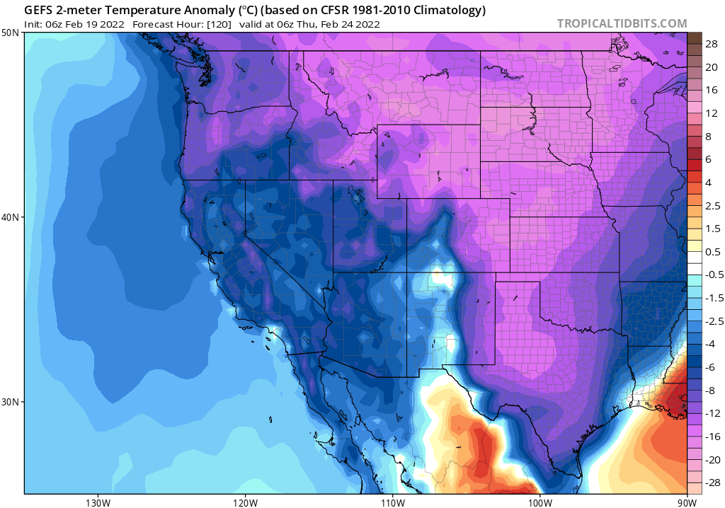
Some mixed news on CA weather front over next couple of weeks. First, by Monday, another "inside slider" system will bring another burst of cooler & winder conditions statewide. Once again, some Sierra snow showers are possible, but most places stay dry. #CAwx#CAwater
Midweek, however, an even colder airmass and associated low pressure center will slide down the coast slightly farther to the west. This system, although still quite dry, stands a better chance of bringing convective activity (scattered showers/isolated thunder) statewide. #CAWx
The biggest impact from this mid-week system, outside of some additional modest Sierra snow accumulations and a few pockets of accumulating small hail showers at lower elevations (like last week in SoCal), will be a dramatic shift toward much colder temperatures. #CAwx
In fact, I would expect significant agricultural impacts in Central Valley where several consecutive nights of sub-freezing temperatures are possible. This may be especially disruptive following weeks of record warmth, which allowed some tree crops to bud unusually early. #CAwx
Despite this fairly active/unsettled pattern, I still don't foresee widespread hydrologically meaningful precipitation over the next 10+ days. But heading into early March, the pattern gets a bit murkier... #CAwx
It is possible that a cool & modestly unsettled pattern will bring slightly more widespread rain and mountain snow by early March. There are currently still *no signs* of big storms, but this would still represent a departure from unrelentingly dry Jan/Feb 2022. Stay tuned! #CAwx
• • •
Missing some Tweet in this thread? You can try to
force a refresh
They find a strong trend toward increased nighttime fire activity across most regions globally, driven primarily by increases in overnight vapor pressure deficit (VPD). In western U.S., number of flammable nights have increased by 45% in past 4 decades! nature.com/articles/s4158…
These quantitative findings strongly corroborate widespread anecdotes from wildland firefighters, who have reported remarkable increases in nighttime burning activity that seriously challenge historical fire management strategies--which assume fires usually "lie down" at night.
Folks with self-described severe climate anxiety now reach out to me (& other climate scientists I know) essentially every week. It is often hard to know how to respond, since climate scientists are not trained clinical psychologists. (1/12) nytimes.com/2022/02/06/hea…
The nature and volume of these requests can become overwhelming for those not professionally equipped to help people in that way. This is especially frustrating since many of these folks have actually sought professional help, yet those practitioners have been dismissive...(2/12)
...telling people that climate change won't affect them personally, or that it's "not as bad as you read about in the news," or that there's nothing they can do about it, so you need to "let it go." Well, as many folks who are paying attention realize, none of this is true.(3/12)
Increasing air pollution co-occurrence trends are widespread across the U.S. West over the last ~20 years, and encompass almost all of the West's major population centers from the Rocky Mountain Front Range to the Pacific Coast. (2/n) science.org/doi/full/10.11…
This increasing trend in co-occurring high levels of two key classes of air pollutants, ozone (photochemical pollution; think smog) & PM2.5 (fine particulate matter; think smoke) is almost entirely due to increasing frequency of extreme PM2.5 events. science.org/doi/full/10.11… (3/n)
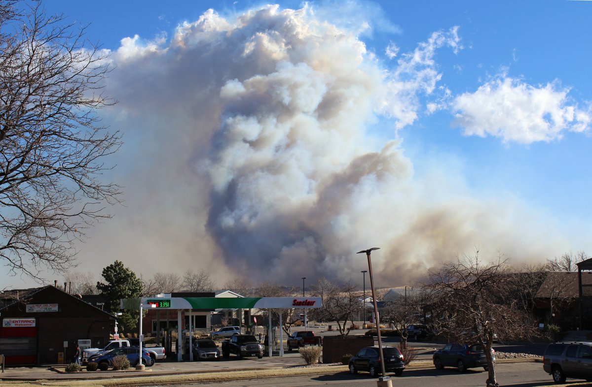
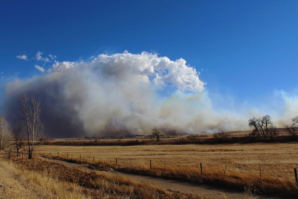
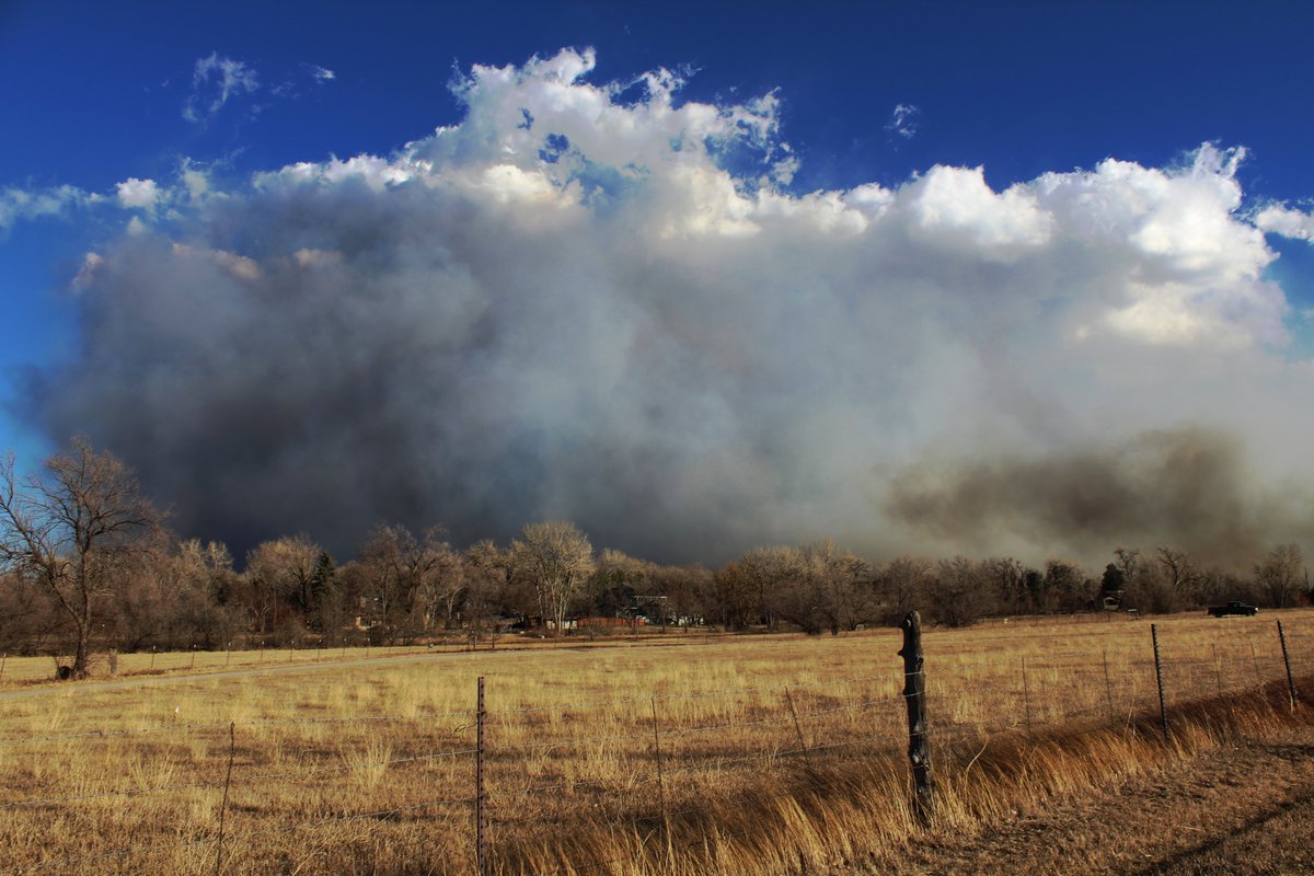
Some photos, footage, and commentary from yesterday's devastating #MarshallFire in Boulder County. All photos and videos taken at various points along South Boulder Road (north side of the fire, looking south, on 12/30/21). Winds were gusting around 90mph at the time. #COwx (1/4)
Fire behavior was as you'd expect in grass/brush amid extreme wind & drought conditions: rapid rates of spread, continuous spotting and periodic sheeting fire. Fire jumped 6-lane Hwy 36 like it was nothing, and there was a 2+ mile long active fireline. #MarshallFire#COwx (2/4)
Behavior and dynamics of the fire plume were fascinating...and scary. A nearly horizontal plume, tilted by extreme westerly downslope winds, transitioned into a shallow pyroCu plume at the top of a hydraulic jump within a pronounced mountain wave. #MarshallFire#COwx (3/4)
Unfortunately can confirm that numerous structures are now burning, many of them homes. This is an extreme/dangerous wildland-urban interface fire. Mainly Superior/Louisville. Gusts in excess of 80mph continue.
Serious wind driven brush fire in wildland-urban within/just south of Boulder, CO city limits. Along Marshall road. Estimating downslope wind gusts near 90 mph. #COwx@NWSBoulder@mitchellbyars