I saw these weird circular mounds in the ocean off the west coast of Scotland, and wondered what they were.
Turns out: they're extinct volcanoes, beveled flat by wind and waves, sunk deep beneath the sea. 🧵1/
Turns out: they're extinct volcanoes, beveled flat by wind and waves, sunk deep beneath the sea. 🧵1/

Where did they come from? Look 1000 km to the NNW & you'll see Iceland - a region with not one, but two sources of volcanoes:
-> Atlantic Ocean spreading & associated decompression melting, and
-> A plume of hot material rising through the mantle.
2/
semanticscholar.org/paper/Geology-…
-> Atlantic Ocean spreading & associated decompression melting, and
-> A plume of hot material rising through the mantle.
2/
semanticscholar.org/paper/Geology-…

(Let's briefly admire what that volcanism looks like.) 🤩 🌋
3/
3/
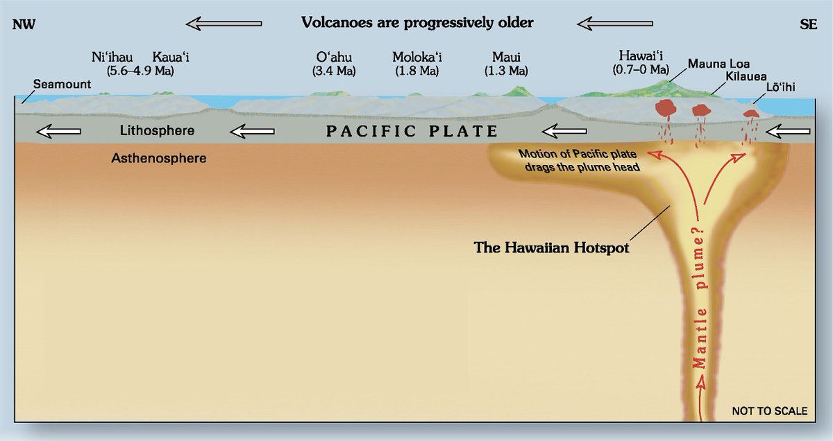
So what does a double-volcano region 1000 km away have to do with a 50 million year old volcano? Mantle plumes are long-lived, & the one below Iceland is no exception. Here, you can see the slower velocity rock (i.e. hotter) below Iceland today. 4/
doi.org/10.1016/j.epsl…
doi.org/10.1016/j.epsl…

Track eruptions from that plume over time & you'll find volcanic rocks extending NW across Greenland, going back 70 million yrs.
And, because the plume is below a spreading center, a mirrored set to the SE - reaching our old volcanoes W of Scotland. 5/
steemit.com/geology/@soofl…
And, because the plume is below a spreading center, a mirrored set to the SE - reaching our old volcanoes W of Scotland. 5/
steemit.com/geology/@soofl…

The volcanoes are long dead - last erupted 40-70 million yrs ago - but the mountains they left behind persist. Erosion is slow under water! These higher deeper halves remained undetected until the last century. 6/
researchgate.net/publication/23…
researchgate.net/publication/23…

At the base of the seamounts is 2 km deep seafloor in pure darkness. Life clusters around these highs (reaching 500-600 m depth), taking advantage of the relative proximity of light. This is the "twilight" zone of the ocean. 7/
oceanservice.noaa.gov/facts/light_tr…
oceanservice.noaa.gov/facts/light_tr…

Expeditions to one of the volcanoes - the Anton Dohrn seamount - found coral gardens, starfish, barnacles, sponges, lobsters and eels. This life is supported by the nutrient-rich water flowing up the steep sides of the seamount. 8/
So excess heat in the mantle caused eruptions tens of millions of years ago that created the conditions for a hidden garden of corals today far from the volcanic source.
And some weird bumps on the seafloor, mapped in Google Earth but invisible to people. 9/
And some weird bumps on the seafloor, mapped in Google Earth but invisible to people. 9/
It's almost hard to remember a time before Google Earth - the tools & data available for free for anyone curious about the Earth far outpace even the best data scientists could access 20 years ago.
Download it here and explore! google.com/earth/versions/
10/end
Download it here and explore! google.com/earth/versions/
10/end
• • •
Missing some Tweet in this thread? You can try to
force a refresh


