How did agricultural land use upstream of the Aral Sea change in the last three decades? Here is our new #openaccess paper in @IOPenvironment: “Post-Soviet changes in cropping practices in the irrigated drylands of the Aral Sea basin”: dx.doi.org/10.1088/1748-9… (1/n) 

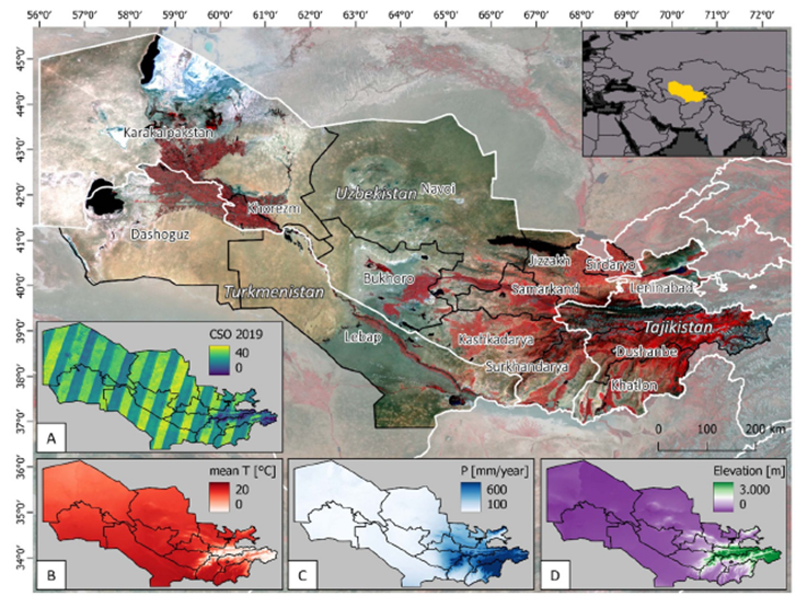
The study area covers 650 000 km2 of drylands in #CentralAsia, covering #Uzbekistan, #Turkmenistan, and #Tajikistan and including the entire #AmuDarya and parts of the #SyrDarya basins. (2/n) 

We computed seasonal spectral temporal metrics from the entire #Landsat archive (1987 to 2019) to produce annual maps of cropping practices using #GoogleEarthEngine #GEE. (3/n) 

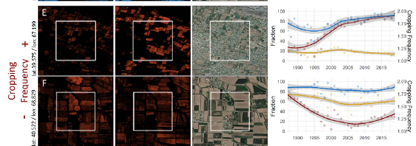
Wet season cropping increased until 2000, then stabilized. Dry season cropping is the most extensive category, but gradually declined, particularly during the 1990s. Double cropping expanded particularly rapid after 2000, raising demand for irrigation water. (4/n) 

We use emblematic examples of local changes to highlight underlying change processes. An example is shown here: (5/n) 

All resulting data are available at zenodo.org/record/6957723. We hope these data will provide useful input for analyzing crop-water demand and other salient developments in this understudied region (6/n) 

The work emerged from a fantastic collaboration between @philrufin, @DanielMu11er @madapegue. Shoutout to @HumboldtEOLab @iamoLeibniz. Comments and critiques welcome! Enjoy reading! (7/7)
• • •
Missing some Tweet in this thread? You can try to
force a refresh


