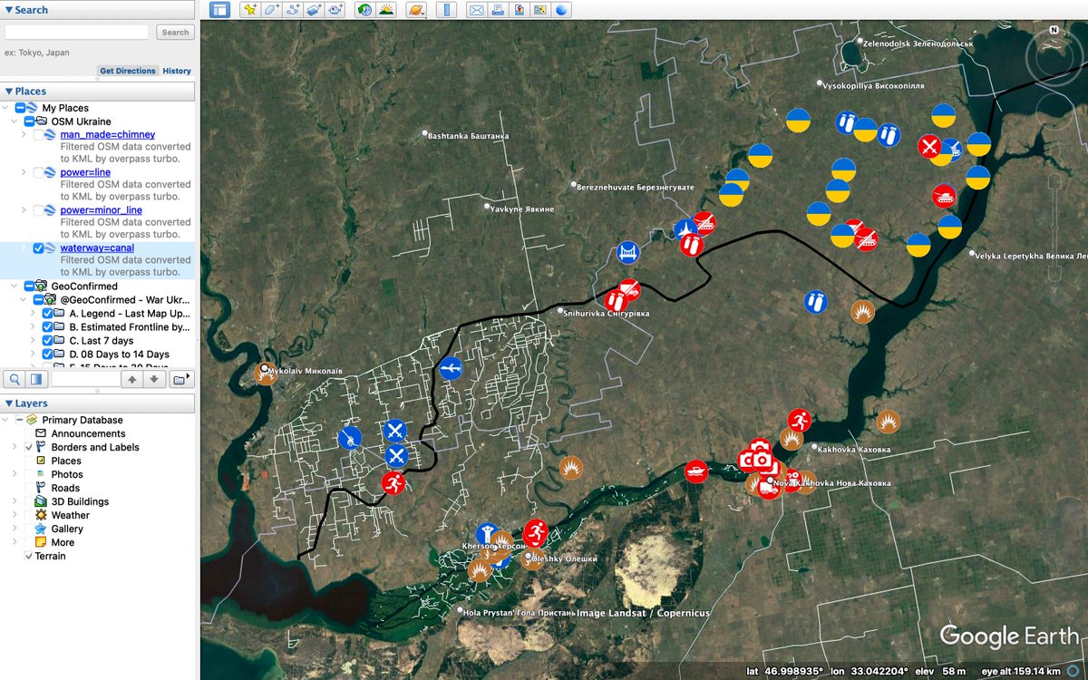
Geolocation of Russian soldier heading south (!) in IFV and passing bus stop in #Suvorove, #Crimea.
Source: t.me/separ_13/3274
Bus stop coordinates: 46.091765 33.698906
@GeoConfirmed with help from @stillesich
Proof in thread. 1/
Source: t.me/separ_13/3274
Bus stop coordinates: 46.091765 33.698906
@GeoConfirmed with help from @stillesich
Proof in thread. 1/
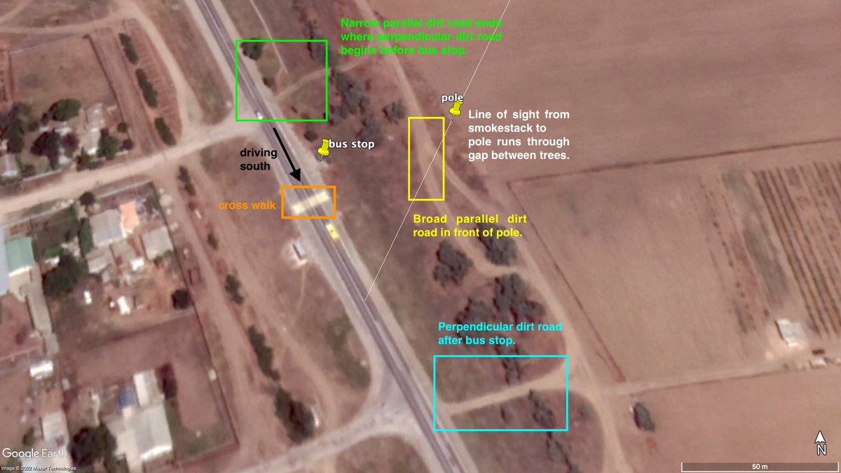
For reference: line of sight from smokestack to pole next to bus stop (see rest of thread)
2/
2/

Smokestack and adjacent building are good match for shape, color, and angle at 00:06. Credit goes to @Peter_0_0_g for finding the smokestack.
3/
3/


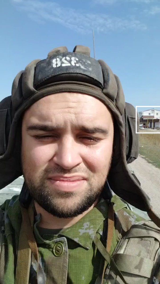
Now, starting from the very first frame, these two buildings at 46.093147 33.697102 seem like a nice match. Note: Selfie videos have a mirroring effect, that's why the buildings appear on opposite sides of the road (h/t @ve5ukka).
4/
4/

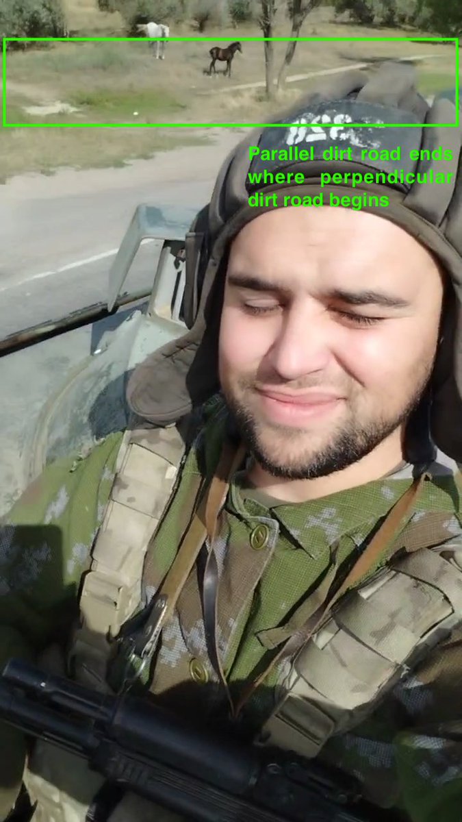
At 00:02, a narrow dirt path running parallel to the main road ends, right where a dirt road perpendicular to the main road begins.
5/
5/

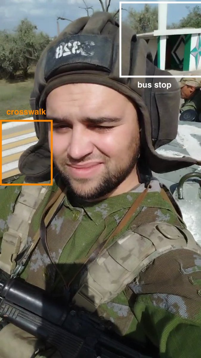
Bus stop and cross walk at 00:05. The bus stop has been repainted to more Russian colors, I'm assuming after annexation (#CrimeaIsUkraine). Credit goes to @stillesich for finding the bus stop and photo. ru.wikipedia.org/wiki/%D0%A1%D1…
6/
6/


This tree right next to the bus stop, visible at 00:05, is a nice match to the tree in the photo, with the trunk splitting into two branches near the ground. (h/t @nicomen)
7/
7/


The line of sight from the smoke stack to the pole runs through a gap between the trees after the bus stop. A dirt road running parallel to the main road can be seen next to the pole at 00:06.
8/
8/


A dirt road perpendicular to the main road after the bus stop can be seen at 00:11.
9/
9/

This was a group effort, so thank you to everyone who helped. @stillesich performed the hardest task of actually finding the bus stop. Additional thanks to @Peter_0_0_g @vladberesh @B44_er @VoldemortessaLJ @nicomen @ve5ukka and anyone I forgot to mention.
10/
10/
• • •
Missing some Tweet in this thread? You can try to
force a refresh