
#ExtremeWeather #ClimateChangeNOW update THREAD (ongoing coverage)
While Tropical Storm #Karl is finished, the #ExtremeWeather event associated with #HurricaneJulia and #TSKarl is not yet over.
While Tropical Storm #Karl is finished, the #ExtremeWeather event associated with #HurricaneJulia and #TSKarl is not yet over.
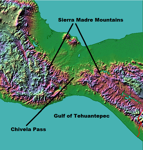
In the animation above you can see the end of #TSKarl #Karl as it, like its parent storm #HurricaneJulia was pushed through the Tehuantepec wind gap into the Gulf of Tehuantepec in the Pacific. 
This animation pics up the story over southern Mexico's Pacific coast this afternoon and evening and shows several convective bursts over land. The one at the end on the bottom left hand side is directly over Acapulco.
Acapulco has been experiencing spectacular flooding for the past five days. And it looks like they are getting some more now. [Twitter Search link for coverage >> twitter.com/search?q=%23ac…]
https://twitter.com/WeAreProtestors/status/1581640036466176000?s=20&t=hTC3fVpWSs08JAHF68iU0g
This animation shows the latest convective burst over the city which appears to be be too recent to account for the events seen in the tweet above. But this won't help.
And there is potentially something much worse heading #Acapulco #Mexico's way..
And there is potentially something much worse heading #Acapulco #Mexico's way..
A third Tehuantepec Wind Gap event involving significant amounts of atmospheric water is forecast to begin in roughly 48 hours - a week after the event that ended #HurricaneJulia October 11th.
& It is forecast to result in 2 new Pacific Cyclones.
threadreaderapp.com/thread/1579807…
& It is forecast to result in 2 new Pacific Cyclones.
threadreaderapp.com/thread/1579807…
This view from the same model run shows the cause of this third #TehuantepecWindGap event - which is the same as that for the events that ended #HurricaneJuliua and #TSKarl - a northerly dry air arctic sourced blast.
https://twitter.com/althecat/status/1579807362420191233?s=20&t=M-Ai-6LMI_J6FcgsRzTbqg
In this simulation it looks as if the smaller cyclonic vortex closer to the Mexico Coast is responsible for making the larger hurricane suddenly turn right and make a landfall on the South Mexico Coast.
The result will be extreme winds and heavy rains over Mexico into Sth Texas.
The result will be extreme winds and heavy rains over Mexico into Sth Texas.

What happens next in the GFS3 Simulation is possibly even worse - albeit completely dependant on the consequences of the 3rd Tehuantepec Wind Gap outcome resulting in the Pacific Hurricane turning right over Mexico - possibly over Mexico City.
And it includes a 4th #TehuantepecWindGap event - and the creation of yet another Pacific Hurricane - and flooding in Texas.
In ^^ the PWAT animation you can see the initiation of a tropical atmospheric river- a strong one - led by transit of the hurricane over Mexico.
Below is GFS Forecast for 6hrly rainfall totals from 22nd to 26th October.
[Note: Qualifications earlier r.e. cyclone formation]
Below is GFS Forecast for 6hrly rainfall totals from 22nd to 26th October.
[Note: Qualifications earlier r.e. cyclone formation]
Here you can see what is happening over the United States thrroughout the 16 period of this simulation forecast. From before the formation of Pacific Hurricane through to the presentation of the atmospheric river which it helps form.
And here you can see the total forecast rains expected from this over 16 days in the US. And 10 days in Mexico.


/ends
@Threadreaderapp unroll
(Ongoing #ExtremeWeather event - coverage will continue)
@Threadreaderapp unroll
(Ongoing #ExtremeWeather event - coverage will continue)
• • •
Missing some Tweet in this thread? You can try to
force a refresh


