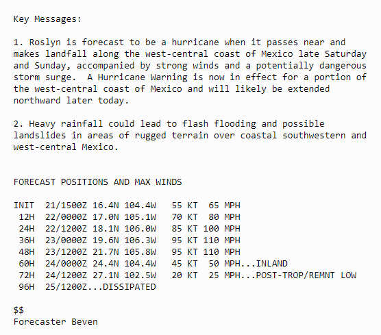
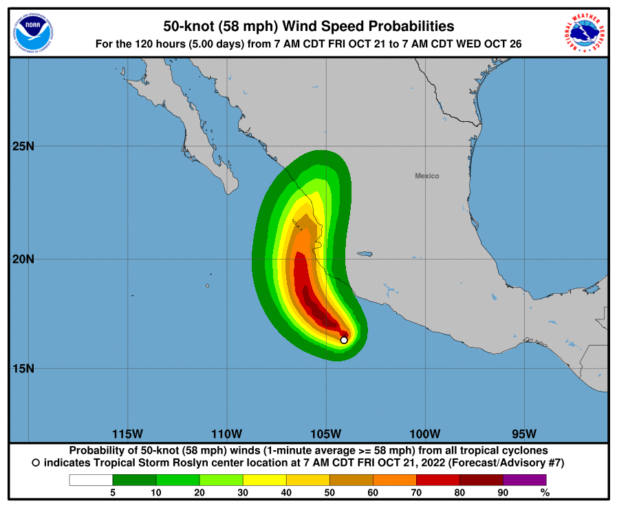
#Roslyn is shaping up to be another truly terrible Hurricane with massive size & widespread heavy rain (flooding) impacts, similar to #Julia & #Ian.
But with much more time to strengthen in favourable conditions #Roslyn also forecast to develop major major hurricane wind speed.
New NHC advice now predicts 95 Knot winds on landfall the threshold for Cat 3 Major Hurricane status, but strengthening beyond that is possible with Landfall not expected till 7pm Sunday.
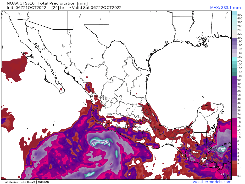
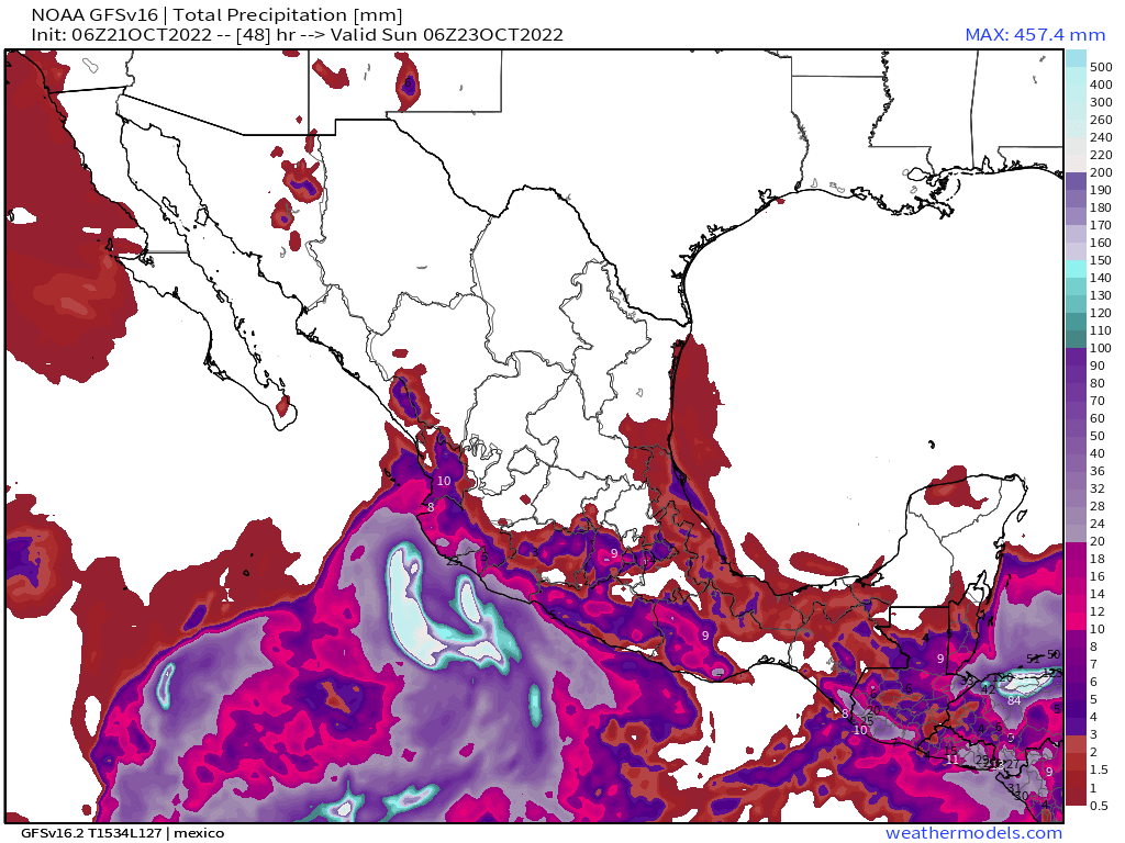
Current GFS model rainfall estimates at 24, 48, 72 & 96 hours.
Here's the GFS3 IWVT view of the next 96 hours - after which the remnants of #Roslyn will be over Mexico.
A complicated set up over continental US follows with an atmospheric river coming into play and merging with #Roslyn outflows into an intense storm which heads through the midwest and up over the Great Lakes into Canada. Another storm spins of and heads east to the Carolinas.
• • •
Missing some Tweet in this thread? You can try to
force a refresh
This latest video by TPLF Central Cmtte member and @WHO DG @DrTedros echoing a phrase used by the UNSG @antonioguterres is exactly the sort of thing that needs to be avoided, as it emboldens the TPLF to continue their lethal struggle.
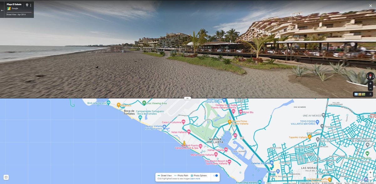
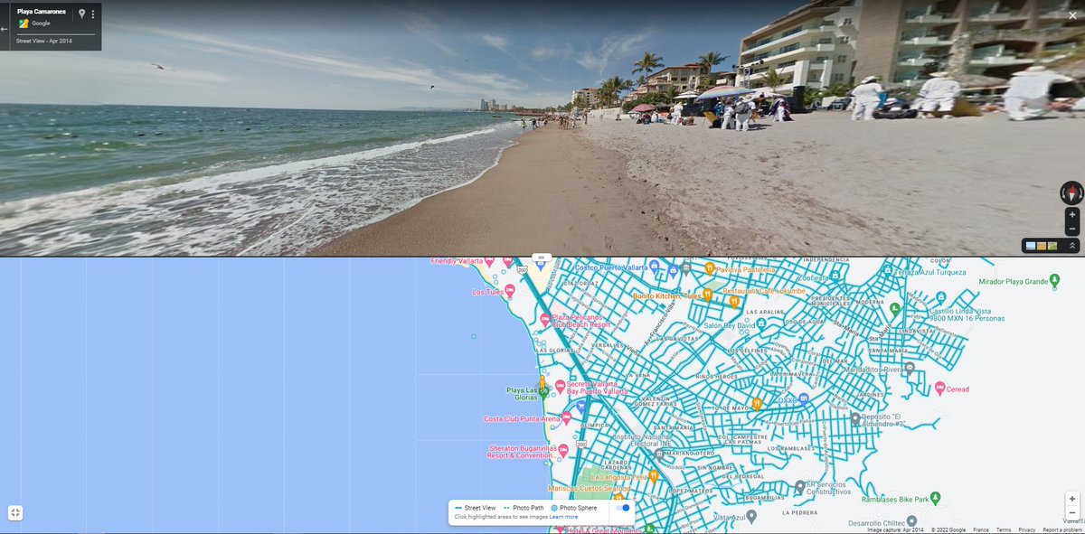
Mexico's West coast is preparing for the landfall of Major #HurricaneRoslyn in coming hours. A Code Red maximum warning has been issued in Puerto Vallarta a tourist resort town south of the landfall location of the center of the hurricane. vallartadaily.com/civil-protecti…
The forecast path of the hurricane is similar in relation to the coast line to that of #HurricaneIan, and #Roslyn is of simlar strength.
#Roslyn will cause significant storm surge to its East as it travels up the coast, blowing water ashore along a 462km stretch of coastline.
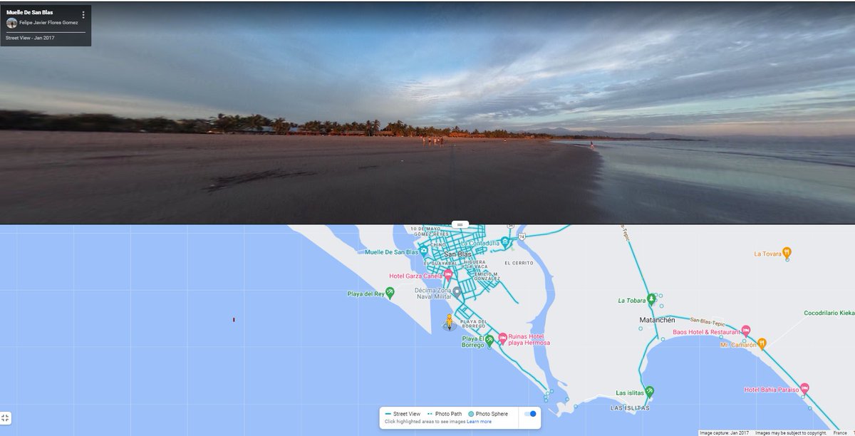
Puerto Vallarta is not the only coastal town in its path and, not the most vulnerable. These three towns are closer to the landfall point which is over a low lying flood plain.
If this is an eyewall replacement cycle we can see here with #Roslyn, then it barely missed a beat. Similar to the extremely rapid strengthening #Ian experienced after crossing Western Cuba.
It looks like the Bay of Bengal's #Invest92b is at least a tropical storm. Its definitely spinning and has become quite well organised.
That looks to me like a spinning eye, for night time visual satellite imagery, that is pretty rare. #92b Bay of Bengal storm.
In the context of a completely saturated Bay of Bengal, and with little room to move the capacity of #92b to strengthen wind wise may be limited, but its room to get very large and wet is considerable.
A thunderous riposte to IC players who continue to cling to the hope of somehow resurrecting the TPLF in planned peace talks in South Africa on Monday, whilst their remaining military force prepares for a final stand at historic Adwa.
The protests today across Ethiopia and around the world have hopefully been noticed by the IC, which has steadfastly remained supportive or silent on the TPLF’s repeated aggressions and refusals to engage in peace efforts since May, culminating in the start of a new war on 24/8.
Ethiopia’s peoples at home and abroad have made it clear that they want peace, but not at the cost of continuing to have to co-exist with an armed terrorist group using the hashtags #DisarmTPF and #TPLFMustGo in recent weeks.
Breaking news THREAD of english @YouTube videos from @sajid_nadeem78’s “My Views on News” channel, starting Friday night following failed UNSC Meeting. It has been a very busy 36 hours.
Journalist @sajid_nadeem78 has been ceaselessly following developments in the Ethiopian war for as long as I can remember back in early 2021.
His 1st video today:
Update from Shire | New party to Ethiopia-Tigray talks | Huge protests 2/4
Previous video has 2 interesting stories out of the US, AAA seeking to be a party to talks + Temporary Protected Status being granted to Ethiopians in the US. Allowing them to stay. 3/4
Ethiopian & Eritrean armies enter Tigray's historic city of Aksum