Thread:
I'll summarise the #Chennai cyclone event and the flooding issue once again as I feel that there is a lot of misinformation floating around which could guide people and government in wrong way w.r.t future actions
#ChennaiFloods2023
1/n
I'll summarise the #Chennai cyclone event and the flooding issue once again as I feel that there is a lot of misinformation floating around which could guide people and government in wrong way w.r.t future actions
#ChennaiFloods2023
1/n

1. The cyclone path had been more or less accurately predicted by IMD, private forecasters
2. The intensity of rainfall however was not clear as per official forecast though it was expected to be heavy, it was not indicated that it would be near record rainfall
2. The intensity of rainfall however was not clear as per official forecast though it was expected to be heavy, it was not indicated that it would be near record rainfall
3. Though private forecasters including myself had warned about the possibility of extreme nature of rainfall, there was always a doubt and it is difficult for the government to take decisions based on non-official arms like mine and it would be too much of a risk for them 

4. But short term forecasting though can be helpful to some extent, it doesn't play a great role in flood mitigation. Long term measures are usually required
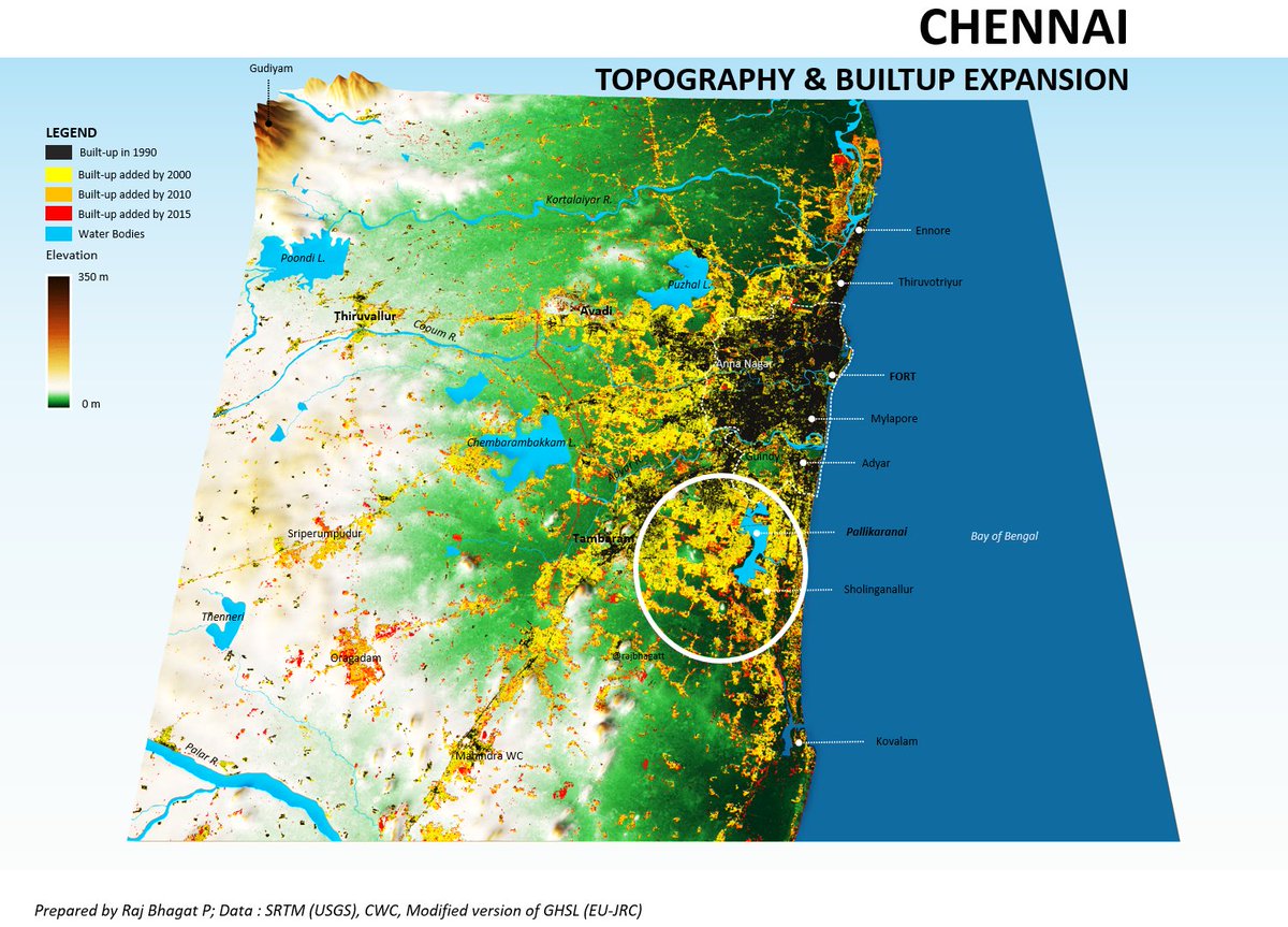
5. Along with extreme rainfall, geography, and our urbanisation pattern were the primary reasons behind flooding.
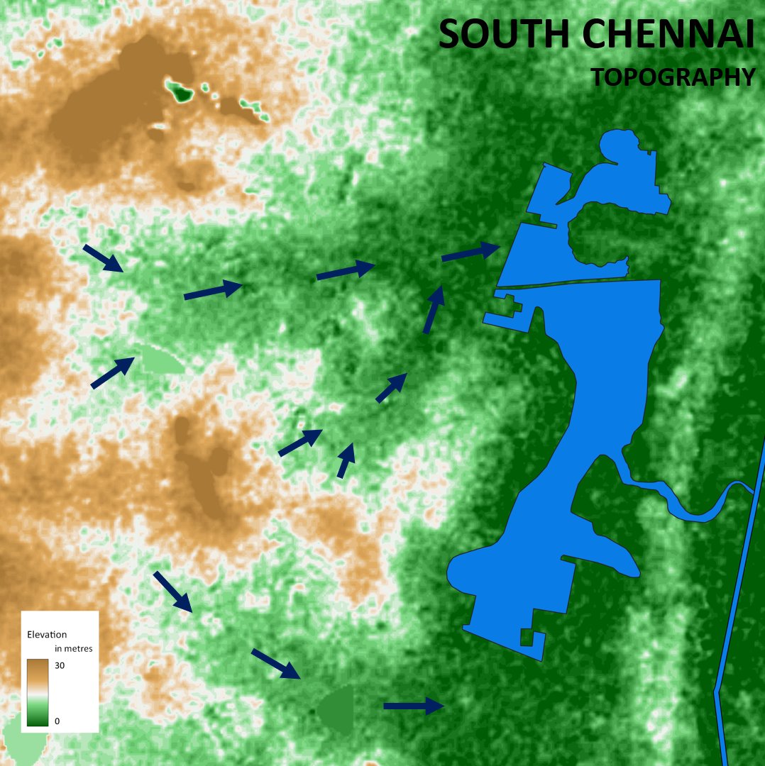
Chennai is extremely flat and very close to sea level. Places like Pallikaranai are at sea level which means water won't gush out easily
Chennai is extremely flat and very close to sea level. Places like Pallikaranai are at sea level which means water won't gush out easily
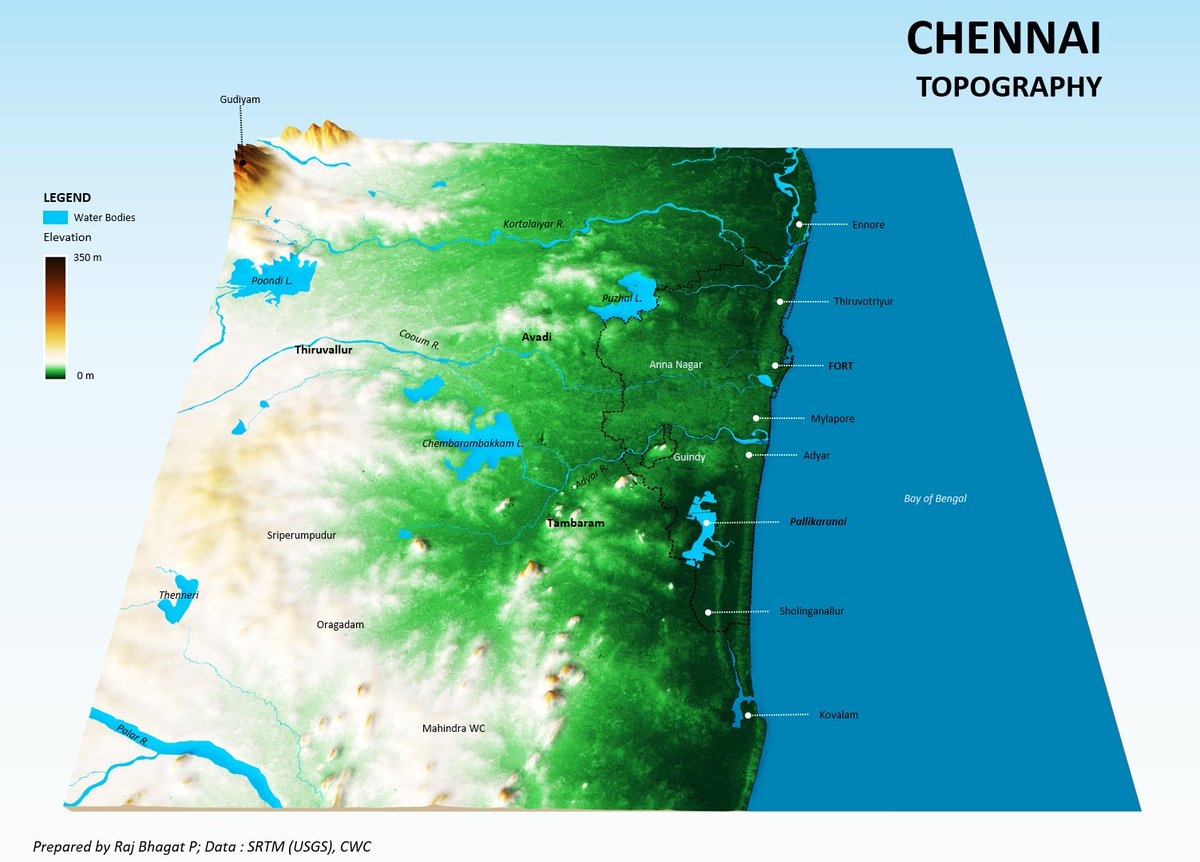
These lowlying areas have been built-up a lot in the last few decades. If that is the case, why was it not regulated?
6. Our authorities didn't have the institutional or technical capacities 30 years ago to do this. Nor did the awareness was there. This is an India wife problem
6. Our authorities didn't have the institutional or technical capacities 30 years ago to do this. Nor did the awareness was there. This is an India wife problem
7. Only in the last 2 years, CMDA was getting revamped. It can't be done in a single night also. We had to notify, interview, and hire people with necessary qualities. Post this, they needed to do stakeholder meetings, researches, and create master plans which would take time
8. This is not a Chennai only problem, but Chennai's location makes it vulnerable to drought and floods frequently than other cities & hence more visible. If we randomly take any photo of an Indian city street, without other context info, it would be difficult to distinguish
9. All Indian cities have been building with the same practices and urbanizing in similar patterns with market driven and without regulation. The only difference hence is whether disasters would come to the place or not.
10. Please don't bring the lake encroachment argument. Lake lands can be a buffer, yes. But as a lake, they are not helpful in floods. Lakes are NOT flood mitigation structures, they are water retaining structures which are useful for holding water without running away
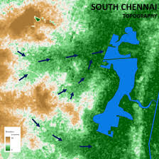
11. It is always water flow paths that matters. The places which are built here get flooded or they cause flooding by blocking the movement of water as we build by raising the levels of ground and preventing water flow. 
12. It takes quite a lot of time to get the data, survey the land, survey existing drains to bring up a storm water management plan. Designing the storm water drain plan is complex and time consuming work and it was undertaken by the city by bringing in consultants
13. Once plans are brought up, the execution is another mammoth task in itself. From money to human resources, our urban local bodies are short on everything. However in the last two years many drains were taken up and a lot of hotspots have been managed well inside the city
14. But outside the city, it has remained worse. It is also important to note that storm water drains can reduce the issue in many parts but when it is extreme rain, ultimately the question is where have we built?
We can't expect to sit on a hot stove and expect not to get burnt
We can't expect to sit on a hot stove and expect not to get burnt
15. So what do we do about the buildings in low lying areas? To some extent, it can be reduced by diverting water upstream but it can never be stopped. We can't evacuate people in a single generation anyway, hence we have to come up with a road map in long term for rehabilitation
16. For new development, master plan should talk about protection of such lowlying water flow paths with schemes that won't affect the financial aspirations of the land owners.
17. Storm water drain plan, it's execution, master plan, it's execution, rehabilitation plan, it's execution - all these are complex, time &resource consuming. They can't be accomplished over short time period.
Without understanding these complexities, we can never move forward
Without understanding these complexities, we can never move forward
18. Why haven't people like me advised the govt? For many years no one listened, last 2 years things changed but now we have too many advisors. I could have entered also but too many cooks can spoil the broth.
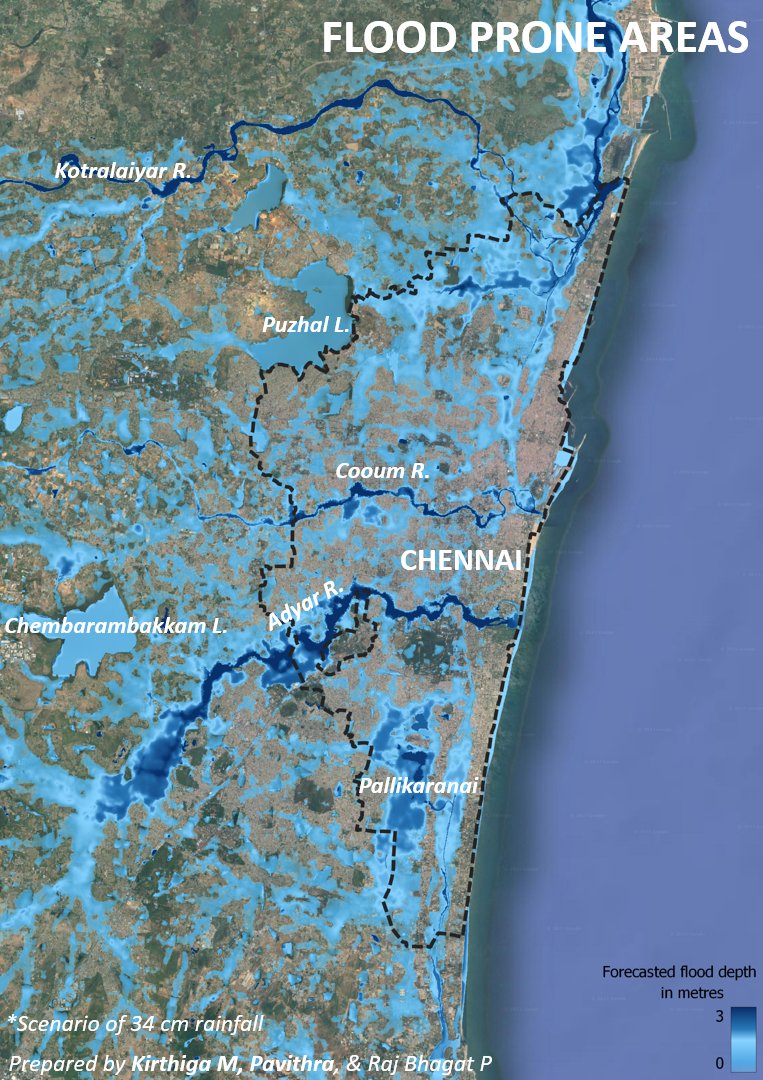
19. Chennai immediately needs to map with high spatial granularity, the topography of the city and the areas that would flood. These should be made open to public and other researchers for build upon. 
20. Govt should also make sure that it explains the projects that it does, the details of them, and why certain decisions are made, so that people understand the complexities and participate in making the process better.
21. There is also a widescale destruction of drains by public (by building outside their property and blocking drains). Awareness hence has to be improved among public as it would be difficult to implement if violation becomes normal
22. Like I have always said, these changes could take many years but the processes have to be set right now so that we enjoy later. @CMOTamilnadu @mkstalin
23. One I forgot to add is the Chembarambakkam situation. The successful operation of the lake this year compared to 2015, is to be a model for every lake. All lakes in urban areas need SOP procedures for operation.
• • •
Missing some Tweet in this thread? You can try to
force a refresh

 Read on Twitter


