
Meteorologist | Adventurer | Occasional Twitter dropout. jack (dot) sillin (at) gmail (dot) com if you need me. Long live 🇺🇸🇺🇦
 Indeed, the latest scan shows higher CC values (though still enough of a drop to be considered a TDS IMO), a weaker/broader couplet, and a lack of a clearly-defined reflectivity hook.
 SPC is clearly on the same page with a new MD saying that this storm could remain at or near this intensity (producing a strong to violent tornado) for *at least* another HOUR #KYwx
 Right now, of the three storms that have yet to develop, the new Caribbean system probably deserves the most scrutiny.

 @NHC_Atlantic Both of these outlets are well-known purveyors of misinformation about tropical cyclones. If you're following them, I suggest the unfollow button.
 Checking in on the #WobblePlot roughly an hour later, #Ida is still following the NE side of the ensemble guidance envelope.
 Spinning up a hurricane’s eyewall is in some ways a lot like spinning pizza dough.

 With ocean temperatures approaching 30C, no dry air in sight and near total command of the upper-level wind field, it's honestly hard to see a scenario where #99L doesn't rapidly intensify in the Gulf.

 Now for the classic dilemma of which storm to target. Skowhegan looks too far north, a couple cells along the pre-frontal trough farther south look meh, that cell north of MWN though...
 Of course, there are many areas across the country that lack good low-level NEXRAD coverage and are majority white. Plains, Midwest, west, Northeast, etc.
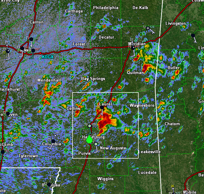
 Looking at dual-pol data (ZDR bottom left), it appears this cell is already size-sorting raindrops with highest ZDR values along the forward flank gust front and lower ZDR values farther west/NW of the mesocyclone.
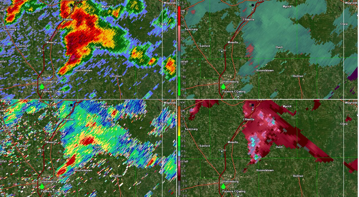
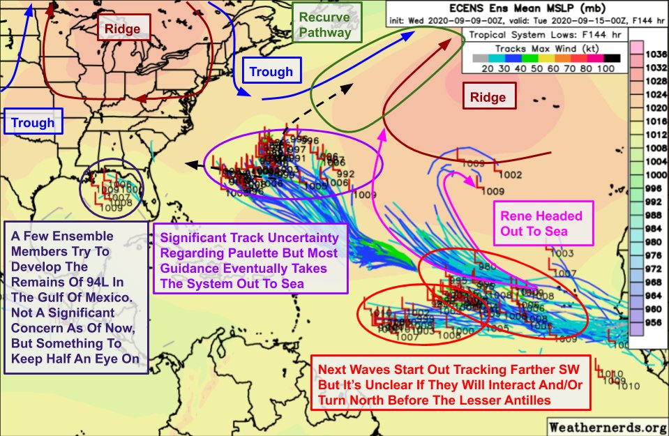 These "recurve pathways" will show up every few days as troughs move east/southeast from Atlantic Canada.