PhD student | University at Albany | I study hurricanes | Self-approved tropical cyclone connoisseur
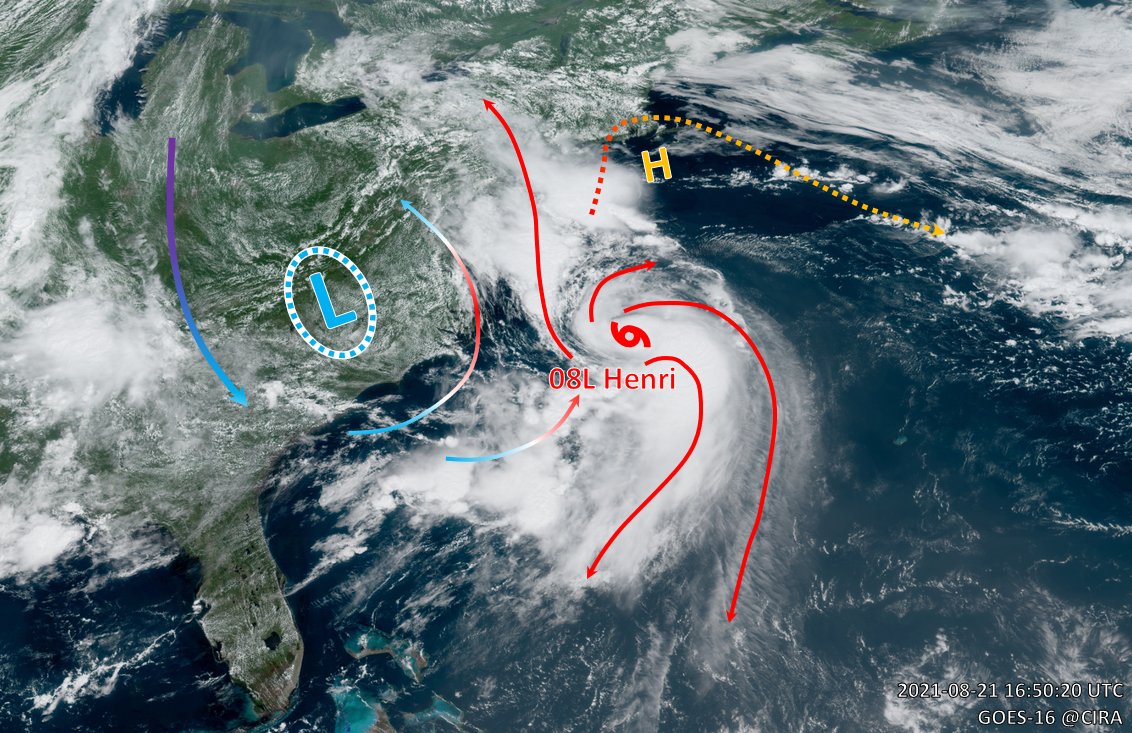 Earlier this morning, the Central Cold Cover (CCC) having trapped #Henri for so long finally came to dissipation. As upper-level SW winds from the cutoff flushed toward #Henri and (briefly) mitigated shear problem, the storm took on new appearance and started to form a real core.


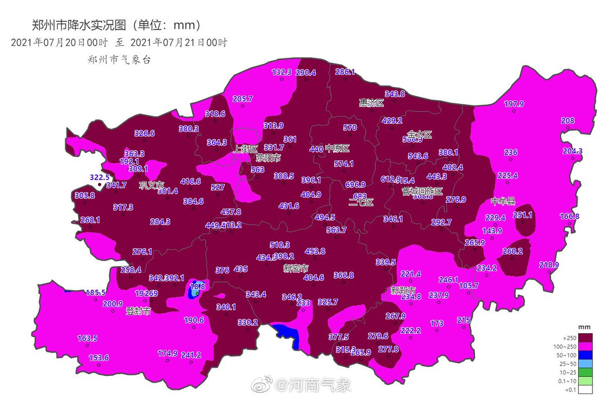
 #Henan province has seen 837 stations with 24 hour rainfall amount of 100mm+ (~4"+), 195 stations above 250mm+ (~10"+), with the bullseye centered over the state capital of #Zhengzhou, which was submerged under widespread 400~600mm totals.
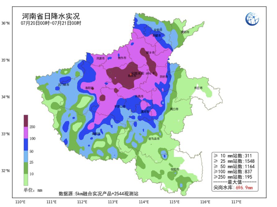
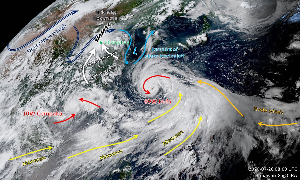
 That is one big monsoon gyre circulation over the northwest Pacific, formed by converging easterly trade winds and westerly monsoons. It gave birth to #Cempaka and #Infa. It might give birth to more typhoons.