
Tracking usage/capture/destruction of weapon systems in #Ukraine theater of operations. Sharing combat footage and more follow @nlwartracker to keep up-to-date!
 Units, which would not only jam but also record used frequencies by Ukrainian forces in these area's. These pole-21 systems would be mainly placed in cellphone or other comms masts, spaced about 5 km. apart. Thus creating a sort of overlapping wall of jamming.

 2/3 This could indicate part of the 🇷🇺 defensive lines around this part of the front might be weaker around Pervomais'ke then other parts, most likely also because units from this part were moved to support the 3rd army on the south flank of Bakhmut.
 2/3 This in it self can mean different things, either Russian & Wagner forces are preparing a retreat to more favourable defensive positions outside Soledar, or Russian forces are setting up obstacles to prevent the retreat of the Wagner forces stationed in Soledar.
 2/6 In which they suffered serious losses including most of their tanks and IFV's. They had been regrouping near the town of Lysychansk and seems to have been re-plenished with new mobik recruits from all over Russia but mostly recruits from Buryatia.


 since beginning of jan. From Rovenki and Rossosj along the highway to Novopskov and on to staroblisk & Svatove. Presumable elements of the 31st & 76th Airborne disivion have been spotted in the area around Svatove since 2 weeks and are leading the attack.

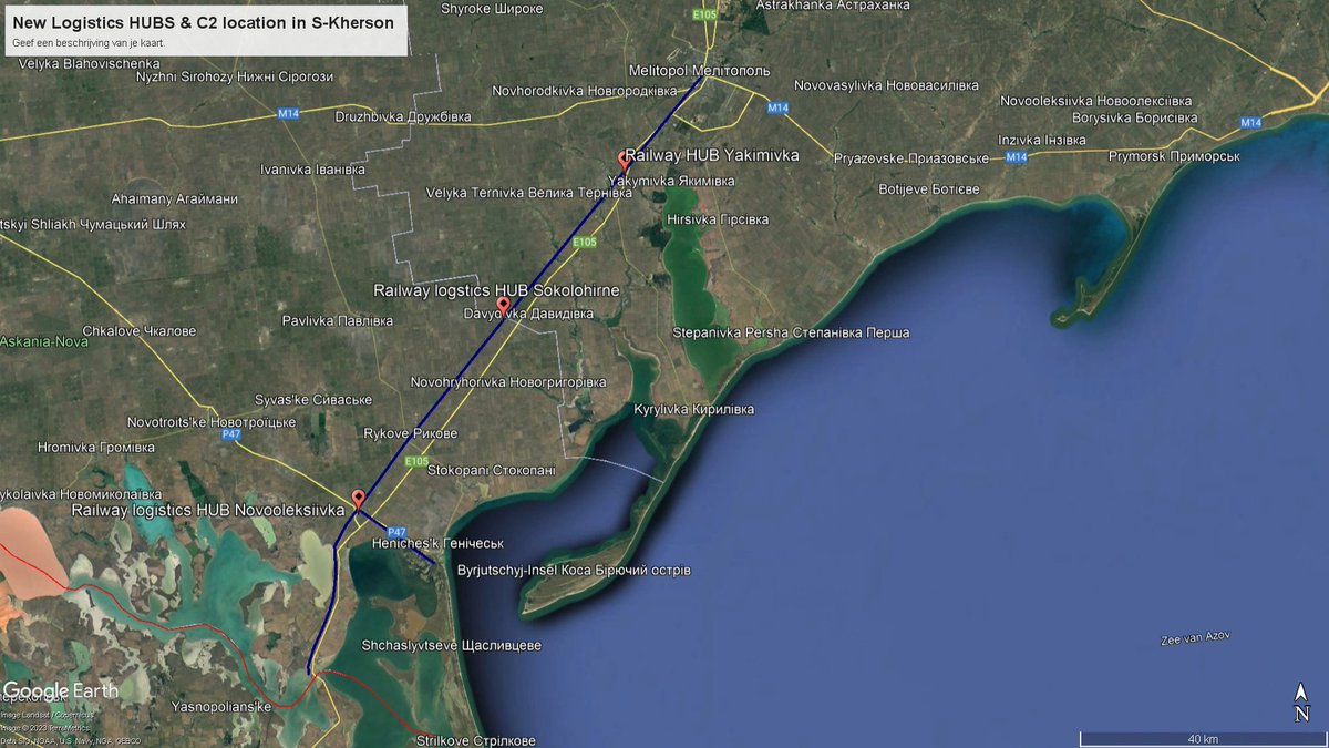
 2/11 This so-called 100 km rule made them look for alternatives, because of their dependance on railtransport their options in S-Kherson were limited to towns along the Crimea-Melitopol railway lines, which enters Ukraine at Chonhar.Along this line only 4 towns had the facilities

 @DefMon3 @COUPSURE @ArtisanalAPT @Tatarigami_UA @MindyNL79 @AndrewPerpetua @secretsqrl123 @kr007t @GeoConfirmed @oryxspioenkop @Official_NAFO @Kama_Kamilia @davidhelms570 @secretsqrl123 @Blue_Sauron @bayraktar_1love @SehaRajvosa @robert_bor @RALee85 @SquareCoinTalk1 @J_JHelin

 Shifts around this time, which would definitly means a well planned operation, distance to the target assuming it was launched somewhere in the Kharkiv region would be +- 700KM. Indications are a TU-141 drone might have been used which would mean a flight time of approx. 1 hour.
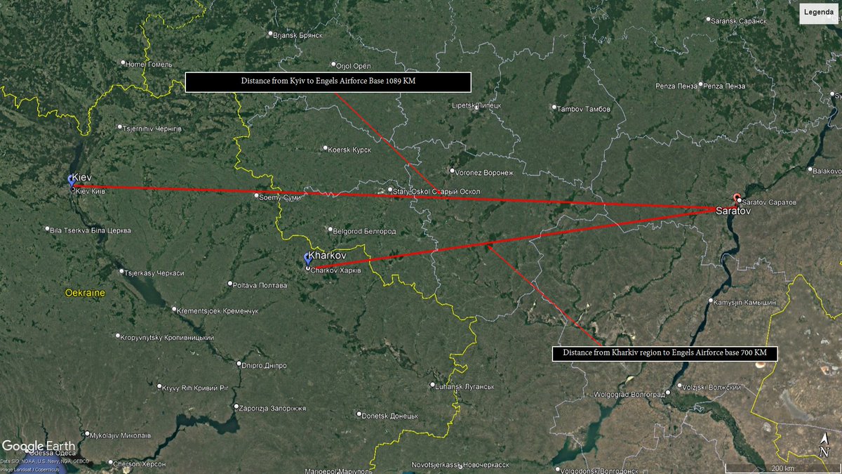

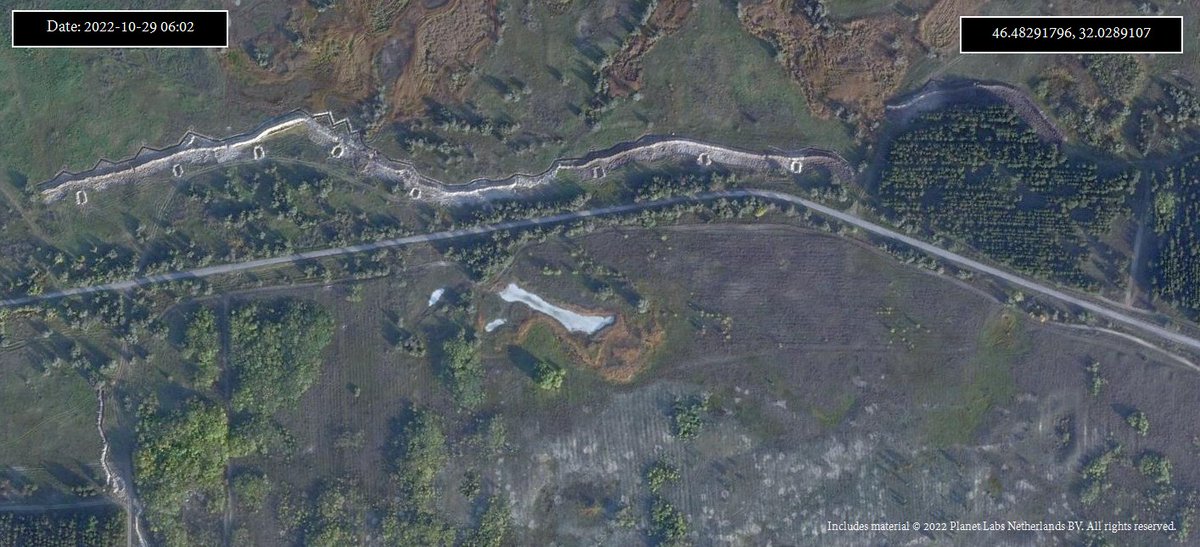
 2/11 The brunt of these defensive structures seem to be build around the T0504 Hwy between Popasna & Bakhmut.These defense resemble alot the defenses created in Kherson and seem to consist of a large AT-wall, minefield, dragonteeth obstacles and trenches.

 2/11 🇷🇺 forces were using different area's around town to store and distribute ammo & other supply's to forces on the Kherson front, also this was the main supply hub for Chaplynka airbase,(main forward helicopter base) & Kairka(main vehicle repair base)


 The terrain there is very rough(marshlands) and it would be extremly hard for 🇷🇺 forces to advance and push the 🇺🇦 forces out once they settled there, the only road is under fire control from 🇺🇦 artillery based in the Stanislav & Shyroka Balka area. 🇷🇺 defensive positions here
 2/12 These ferry's and multiple barges have been operating continuesly, first there objective was to supply troops on the west-side of the river, since last week that changed, we have seen columns of vehicles move the other direction.

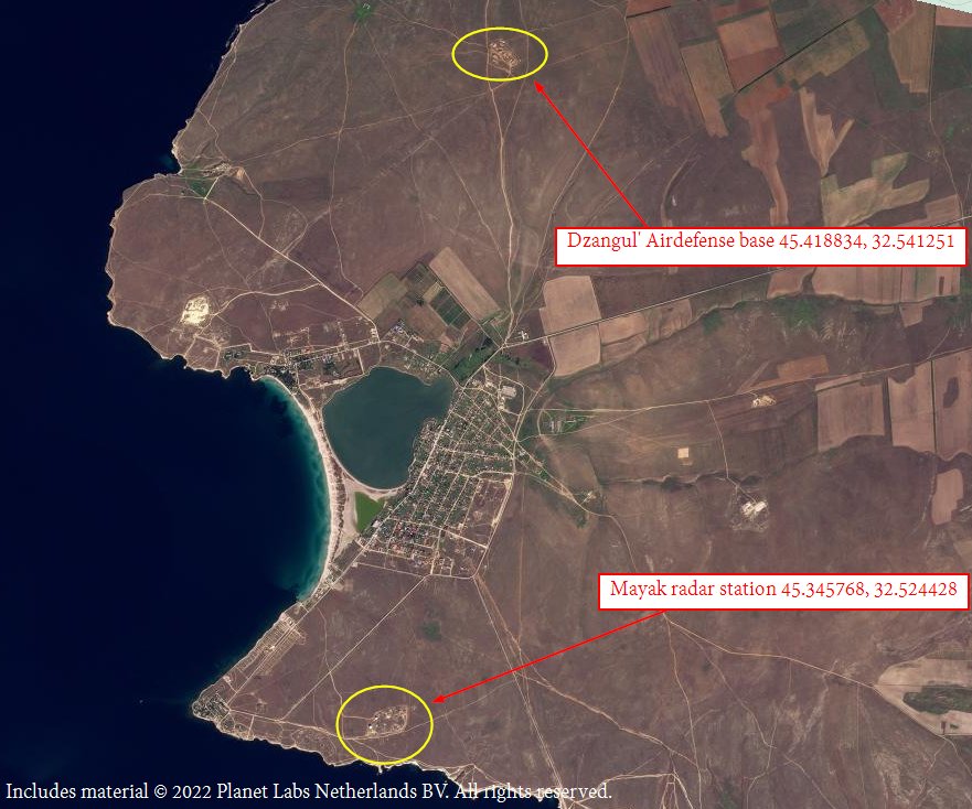
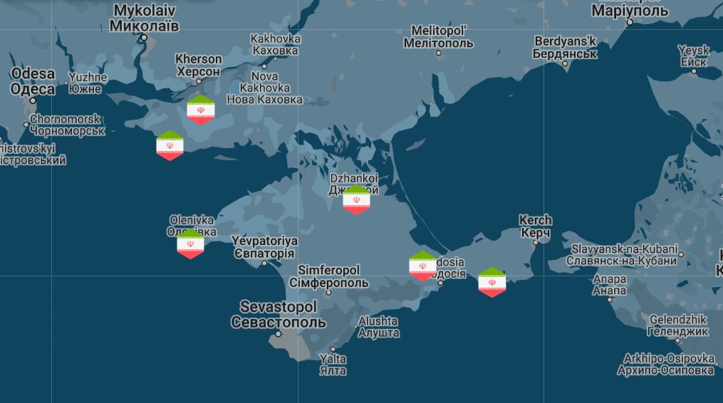 Russia is using the Ukrainian peninsula to launch Iranian-made kamikaze drones on civilian infrastructure in the southern part of Ukraine, main targets seem to be civilian targets such as the powergrid and municipal services.
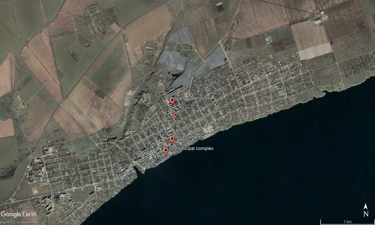
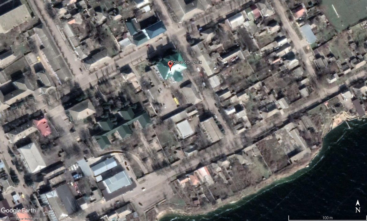

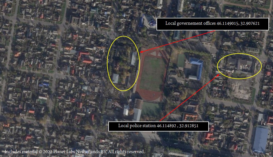
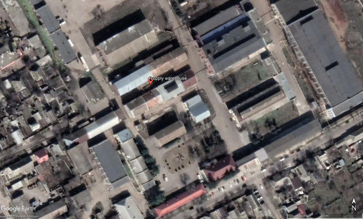 29th of august when three targets the city admin, police complex & supply warehouse where hit simultaniously, resulting in the complete destruction of these. The police complex [Geolocation 46.83848, 33.42661] consisted of 3 buildings that were destroyed by a volley of missiles.