My Authors
Read all threads
#Short Story/Thread :

In 2003, A stream/river (seasonal) was flowing in #Dehradun near Sahastradhara Road..

Satellite Image snapshot from Google Earth
1/4
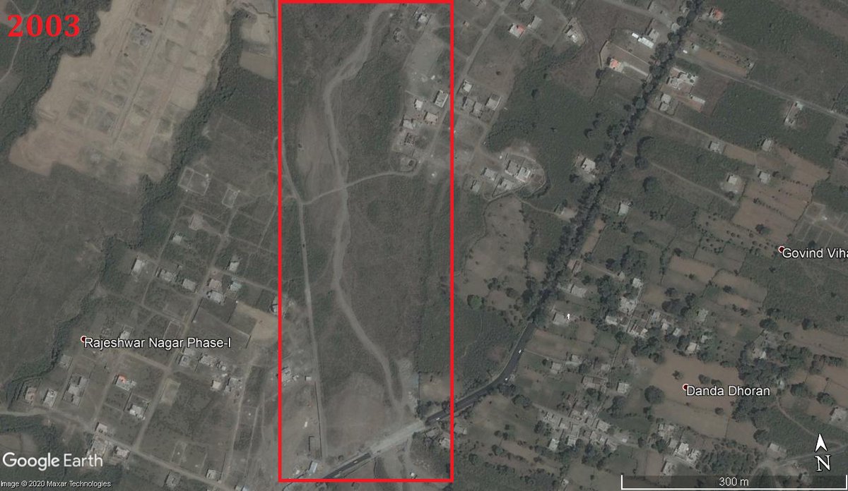
Someone thought that it was wise to construct an IT Park right on top of the river..

Satellite image shows it now (Google Earth Snapshot)

2/4
In Google Maps, It's still marked as a waterbody "Nala Pani ki Rao"

3/4
People might have forgotten the river/stream But the stream definitely didnt forget where it had to flow.

In 2020 after a spell of monsoon rains, the stream overflowed and the IT Park flooded!

Video below shows what happened (first of the lot)

Please do read the entire thread. This is not an isolated incident and is not something done by one government official or a political party!
Missing some Tweet in this thread? You can try to force a refresh.

Keep Current with Raj Bhagat P #Mapper4Life

Profile picture

Stay in touch and get notified when new unrolls are available from this author!

Read all threads

This Thread may be Removed Anytime!

Twitter may remove this content at anytime, convert it as a PDF, save and print for later use!

Try unrolling a thread yourself!

how to unroll video

1) Follow Thread Reader App on Twitter so you can easily mention us!

2) Go to a Twitter thread (series of Tweets by the same owner) and mention us with a keyword "unroll" @threadreaderapp unroll

You can practice here first or read more on our help page!

Follow Us on Twitter!

Did Thread Reader help you today?

Support us! We are indie developers!


This site is made by just two indie developers on a laptop doing marketing, support and development! Read more about the story.

Become a Premium Member ($3.00/month or $30.00/year) and get exclusive features!

Become Premium

Too expensive? Make a small donation by buying us coffee ($5) or help with server cost ($10)

Donate via Paypal Become our Patreon

Thank you for your support!