

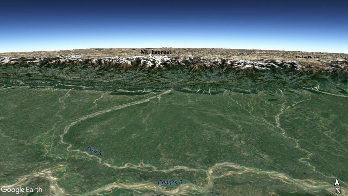
R.Kosi is a tributary of Ganga. It's watershed covers Mt.Everest but at it's confluence with Ganges, the elevation is just 25 m above sea level. All this within an aerial distance of 300kms! Along with seasonal rainfall, this has led to massive erosion as well as deposition 
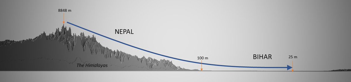
Cross-sectional profile of the watershed shows this variation
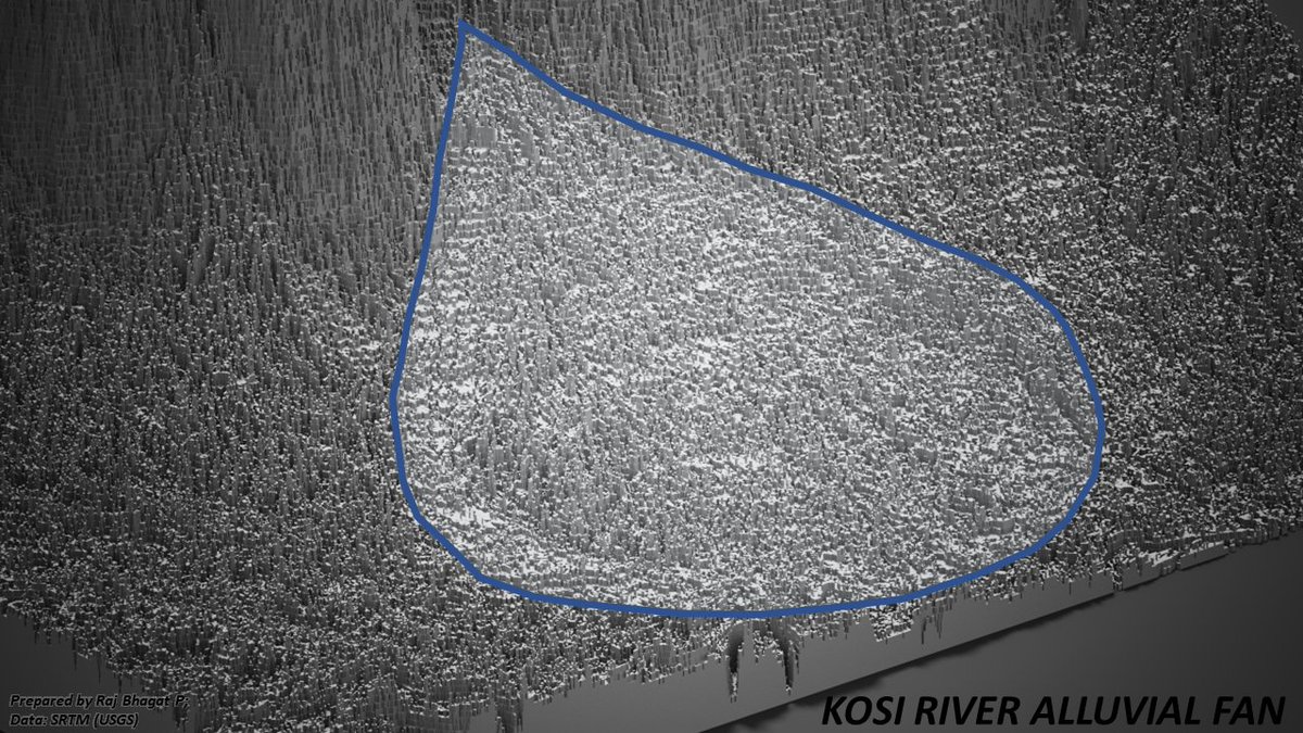
After flowing in higher gradients cutting through the himalayas, Kosi river exits n meets flatter plains section with very less gradient. This leads to millions of tonnes of silt deposition in this section every year
After flowing in higher gradients cutting through the himalayas, Kosi river exits n meets flatter plains section with very less gradient. This leads to millions of tonnes of silt deposition in this section every year
The deposition has led to formation of an alluvial megafan which is d largest of it's kind in the world
Exaggerated relief shows this fan
When the river deposits silt in it's course,the river bed height increases w.r.t neighbouring land n leads the river to change to new course
Exaggerated relief shows this fan
When the river deposits silt in it's course,the river bed height increases w.r.t neighbouring land n leads the river to change to new course
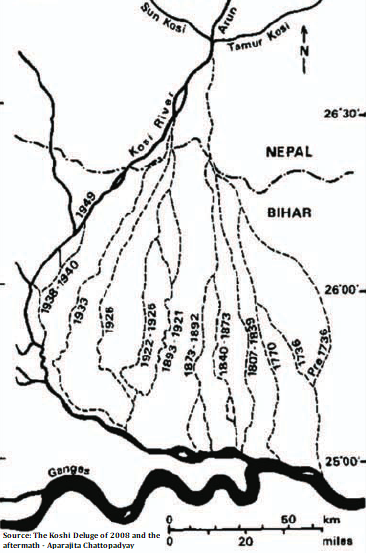
The Kosi River had shifted it's course numerous times (avulsion). This has been easier in Bihar because of flatter plains n high deposition rate. This constant course changes and depositions created the fan seen in previous tweet
Map shows past courses of Koshi R
Map shows past courses of Koshi R
Inorder to "tame" the river, embankments have been constructed (shown in google maps snapshot) almost all through the course of Kosi River. This image shows wing dikes which could reduce the erosion of river banks.

Through this way the entire river has been "contained" and has not been allowed to shift course.
But here's where the problem starts.
The river has now been exclusively depositing silt in one course for decades and the height has increased significantly.
But here's where the problem starts.
The river has now been exclusively depositing silt in one course for decades and the height has increased significantly.

This has led to water seepage and water logging outside the embankments. Rain water or flood water from other places can't drain into the Kosi river. In the past seepages in the embankment have led to failure of embankment and the blame was put on Rats n foxes

In 2008, Kosi Eastern Embankment failed which led to flooding that killed hundreds of people.
Animation shows the effect of the flooding (alluvial deposits) as captured by satellites.
Animation shows the effect of the flooding (alluvial deposits) as captured by satellites.
Currently, we have walled the entire river. This has led to risk related to embankment failures which magnifies the effects of floods and also water stagnation in places where water is not able to drain into river leading to the chaos every year.. Damming n embankments dont help.
Gyan: All the river wants to do is to sediment in one place and run in a new course. It's upto us to decide on how to facilitate this without affecting the livelihoods of people living nearby
After all,it's this fertile soil deposited by the river that gave birth to Civilization
After all,it's this fertile soil deposited by the river that gave birth to Civilization

