
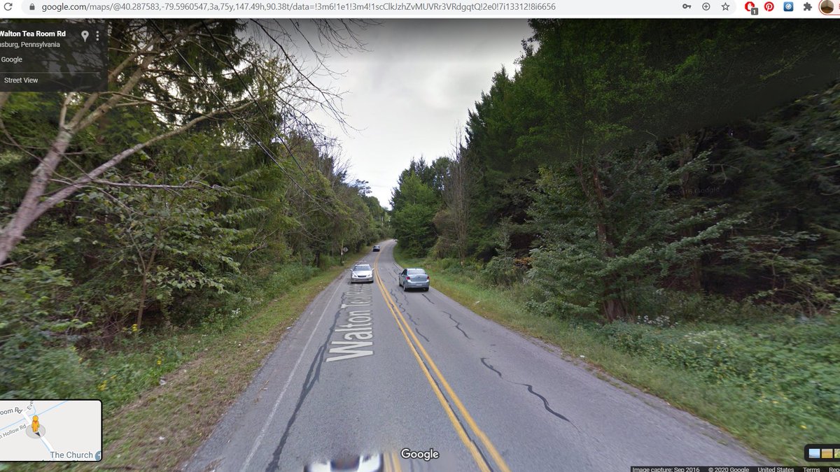
.@akgerber successfully goaded me into making a southwards bend, so we're making a detour down to Morgantown WV, aiming to resume normal route back at Johnstown #SEANYC 
On one of these mountain-defying highways. Geographic aesthetics aside, road building really transformed the jobs geography of river towns: post-highways, industry/employment had an unprecedented ability to sprawl away from valley sites/routes.
https://twitter.com/mtsw/status/1294087174766247941?s=20
Some of the stuff seen yesterday in McKeesport is just that: malls (and office/industrial parks) in the Mon Valley wouldn't have been nearly as possible if activity had been constrained to rail/water-proximate valley sites
Another good image of this topographical freedom issue. I-70 can just go over hills and soar across valleys, while the railroad has to studiously (and slowly) follow the Youghiogheny below. #SEANYC

These bridges carry the Wheeling & Lake Erie railroad towards its gigantic bridge over the Monongahela (pic 2). The left bridge goes to the lower bridge in the second pic, which descends into the river valley to serve Monessen -- another ex-steel town. #SEANYC


The W&LE has an interesting history. It was once part of the Alphabet Route -- a group of small eastern/midwestern railroads offering an alternative to the main Chicago-NYC carriers -- but ended up in the control of the Norfolk and Western. NS sold most of its lines in 1990...

...to create a new railroad called -- wait for it -- the Wheeling and Lake Erie. #SEANYC
graphic from en.wikipedia.org/wiki/Alphabet_…
graphic from en.wikipedia.org/wiki/Alphabet_…
One of the locks/dams along the Monongahela. While much less glamorous than ventures such as the Erie Canal, the damming of rivers such as the Mon was really what made inland water transport viable -- no more portages!

Monessen PA is a great example of the linear river city downtown. In terms of the forms created, I must say I really appreciate the constrained urbanism practiced in places like this. #SEANYC


The coke works in Monessen. Last active bit of the former Wheeling-Pittsburgh mill that once employed thousands here. Now operated by ArcelorMittal, the world's largest steel producer. #SEANYC


The constraint products of riverbank development really show here. For a place that peaked at just over 8,000 people, Brownsville is quite a vertical place. It has some interesting typological peers growing along the Yangtze around the Three Gorges today. #SEANYC
(among other places, ofc)
A completed segment of the Mon-Fayette Expressway, the latest and greatest in regional economic development initiatives for the steel valley. This project is quite galling; as @liameoconnell notes, this Mon Valley has settlement/transpo structure patterns conducive to transit.


(on top of what Liam said, all these towns have once-dense cores abutting the river and RR ROWs)
To be sure, I don't think transit is much more of a 'fix' for the region's multifaceted economic woes than highways, but at least it won't contribute to the sorts of urban disinvestment that have so hurt places like McKeesport, and won't accelerate climate change. #SEANYC
lol

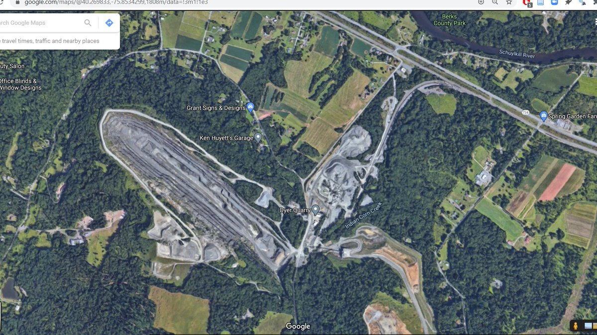
Southwestern PA produces a _lot_ of coal. Seams in this part of the state are generally high grade bituminous coal, making them suitable for metallurgical uses. Needless to say, this resource had everything to do with the prominence of Pittsburgh and Johnstown as steel centers.

Even today, despite only ~10% of US coal production being devoted to metal production, >40% of PA coal production is metallurgical coal. A lot of that goes to export users, flowing through coal docks in Baltimore, Norfolk and Sandusky/Toledo to Europe and Canada. #SEANYC
Southern cultural connections in SW PA really show through in the prevalence of front porches on buildings here... #SEANYC


Close enough to the mines that the bridges have these fenders to catch falling coal. #SEANYC

The railroad that owns this bit of trackage, the Cumberland Mine Railroad, is among the more obscure isolated operations in the US. Despite being in a rail-dense region, it has no connection to the national network, acting solely as a shuttle from a mine to a barge terminal.
> Puts shiny sidewalk over new bridge
> Does not connect it to anything, creating a curb cut to nowhere
networks, people. networks.
#SEANYC
> Does not connect it to anything, creating a curb cut to nowhere
networks, people. networks.
#SEANYC

The confluence of the Monongahela and Cheat Rivers in Point Marion, PA. The Cheat is one of the east's more untouched watercourses, though it did fall victim to some acid mine drainage in the '80s and '90s IIRC. #SEANYC

West Virginia! #SEANYC

(no, I don't know what happened to the I in Jim or the actual welcome sign)
IDK how to classify these (rowhouses? multiplexes?), but based on past explorations of Appalachian cities, you seemingly see a lot of this in sorta-new multifam construction in the region. #SEANYC

It's not *really* that distinct from your classic '60s-'80s courtyard or garden apartment development, just newer. I find their continuing prevalence interesting given the slow movement away from those typologies in other urban markets
Now, for this detour's real raison d'etre: the Morgantown Personal Rapid Transit system, or PRT

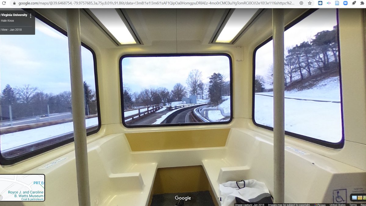

The PRT isn't really a system. It's a single rapid transit line that runs these little 15 person cars along a line that stretches from Downtown Morgantown to the WVU campus pictured in the first photo above.
As per the _personal_ rapid transit model, the system is laid out to facilitate mixed express and local operations; each station has bypass tracks. In this regard, and in this regard only, the system sorta resembles the Shinkansen 🙃 #SEANYC
As I understand it, the PRT has three operating modes. In one, it acts as true demand response, collecting riders heading to the same destination and bypassing stops without passengers. In another, cars run fixed routes on fixed intervals. In yet another, cars just make all stops
At 2800 riders/route-kilometer (about on par with a busy bus route in NYC, for example the B6), it's a successful -- albeit white elephant-y -- bit of transit infrastructure for a small city like Morgantown. #SEANYC
For the first time....ever? I will be starting my daily streetview when the clock shows an AM value (that isn't like 00:30 or smth).
Currently enjoying some sidewalk streetview in Morgantown. More of this @googlemaps!
Currently enjoying some sidewalk streetview in Morgantown. More of this @googlemaps!
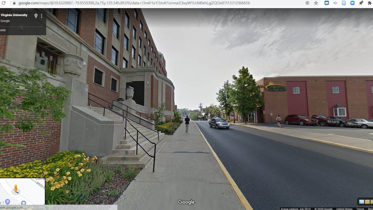
Some more Morgantown scenes. Once again am here to shill for Eastern river valley urbanism. #SEANYC


Morgantown is an interesting case of a small city that, in part thanks to WVU, has been really successful in diversifying and weathering the downturn of regional mining/industrial fortunes. It's one of the few parts of WV that's experiencing population growth. #SEANYC
En route to Terra Alta, WV #SEANYC

A lumber mill in Kingwood, WV. The forests of WV are the far northern end of the dense region of forest production that arcs south along the Appalachains to the Mississippi River -- a region which now makes up the lion's share of US forest production. #SEANYC

Maryland!

This may just look like some boring double track, but what we're looking at here is actually one of the more important bits of railroad in US history: the summit of the Baltimore and Ohio's Seventeen Mile Grade.

This segment is significant for two reasons: the first is that it was part of the B&Os original (1853) route from Baltimore, MD to Wheeling, WV -- a line which helped secure Baltimore's relevance and accelerated the development of Appalachian coal seams and the Midwest.
The second, perhaps more interesting significance is that the 17 Mile Grade's physical gradient (of 2.2%, or 116 feet/mile) became the standard for western railroads. The Pacific Railroad Act stipulated that first transcon's line profile match in quality the B&O...

...a standard which was later adopted by the CP, NP, GN, Milwaukee and others when building their mountain crossings. #SEANYC
Actually making some progress now. Just so happens that I've basically done a big loop #SEANYC


Lovely old bus in the MD pandhandle #SEANYC

Back in PA. #SEANYC

The ex-Western Maryland Salisbury Viaduct. The WM (like the W&LE covered previously) was a component of the Alphabet Route, and through this traffic + coal from WV, it remained prosperous throughout until its absorption by the Chessie System. #SEANYC


Given how extensively the WM duplicated the B&O (another Chessie component), much of the WM was abandoned after the merger, including the trackage over this bridge. The ROW is now the Great Allegheny Passage trail.
img creds:
en.wikipedia.org/wiki/Alphabet_…
appalachianrailroadmodeling.com/arm2/wp-conten…
img creds:
en.wikipedia.org/wiki/Alphabet_…
appalachianrailroadmodeling.com/arm2/wp-conten…
The rise to the left of the train tracks in this photo is the remainder of the South Fork Hunting Club dam that collapsed and caused the Johnstown Flood in 1889. #SEANYC

Among other effects, the collapse altered the way liability is treated in the courts. The club's escape from legal responsiblity for the disaster contributed to the shift towards a broader concept of liability, which included defective products/infrastructure. #SEANYC
For an exhaustive history of this movement, see PDF pages 26 and onwards here
digitalcommons.law.yale.edu/cgi/viewconten…
digitalcommons.law.yale.edu/cgi/viewconten…
Great view of Johnstown here. On the left, ascending the hill is the Johnstown incline, a funicular built two years after the flood to facilitate escape from the valley and to provide expedient transpo into the hills around Johnstown.

It's part of the proud Pennsylvanian funicular tradition that began with the portage railroads associated with the state's Main Line of Public Works, and grew into passenger funiculars as seen here and in Pittsburgh. #SEANYC
https://twitter.com/RobtNS/status/1295199487980384256?s=20
As @RobtNS notes, Johnstown had a long streetcar tradition. They ran streetcar service until 1960 (!), and trolleybus service until 1967 -- service lives that exceed places like NYC, and certainly most other small cities.
A 1958 => present @ Market/Main


Much like New Castle, Johnstown (the darker area in the center of this map) retains a substantial share of its county's employment. Downtown Johnstown and the river valley heading south remain quite job-dense.
https://twitter.com/A320Lga/status/1291955320068222977?s=20

Yet Another Engineered American River. We really do love channelizing watercourses in this here country -- especially in the South, where the USACE and TVA were sorta allowed free reign. #SEANYC

This was -- you guessed it -- a steel mill, Bethlehem's Johnstown works. The facility was built in 1898, but is notable in that it was built by the Cambria Iron Company which had pioneered large scale iron production in the US at their Johnstown works closer to downtown in 1852.

Cresson, PA, another post-industrial town in the Northeast. Cresson also models the deindustrialization-prison expansion linkage; after the flight of industry, many towns turned to/became dependent on the expanding prison system for employment.


This dependence creates a strong economic incentive for rural pols to oppose any movement away from the carceral state; navigation towards justice issue will have to grapple with this legacy. #SEANYC
(The prison in Cresson was SCI-Cresson, which closed in 2013)
Looking down over the portals of the Gallitzin and Allegheny Tunnels along the old Pennsylvania Railroad main line. The terrain here gives you a sense for just how exceptional New York Central's almost completely flat main line was/is.
https://twitter.com/A320Lga/status/1290501642685747200?s=20

Some details: Allegheny is fed by the tracks at left; Gallitzin was the grassy trackway at right. Gallitzin was abandoned (and Allegheny reopened) by Conrail when they cleared their main line through PA for double stacks in the 1990s.
Back when energy insecurity was _the_ topic of the day (so the late '70s), Conrail studied electrifying this stretch of the Pennsylvania main so that they could run electric freight trains from New York and Washington all the way to Pittsburgh.
The study indicated the economics made sense (though, oddly, it elects to exclude the train performance benefits), but the plan was shelved given the unavailability of capital and declines in oil prices.
railroads.dot.gov/sites/fra.dot.…
railroads.dot.gov/sites/fra.dot.…
(This was also important: Amtrak was assigned ownership of the Northeast Corridor in 1976 and proceeded to charge Conrail rel high access fees; Conrail wanted to move freight away from those lines, which ofc = moving freight away from tracks w wires)
https://twitter.com/A320Lga/status/1295532166110158849?s=20
Horseshoe Curve, the PRR's ingenious means of easing gradients over the Alleghenies on the climb out of Altoona. It's an operational headache (sharp curves create derailment risks and introduce more rolling resistance), but it works!


This crossing of the Alleghenies (Altoona<>Cresson/Johnstown) is also one of the rel few places in the US where you still find manned helper locos, which help get trains up hills. These were once common, but have fallen out of favor w/ ^ loco power and remote loco control tech
A nice concrete footbridge to a platform that sees...one train/day/direction. Yeah, the NS main line is busy, but a) train volumes are down given the long term transition towards fewer, longer trains, b) this whole line has space for quad tracking, and

c) it feels...off that railroads whose common carrier duties to psgrs were nationalized w/ Amtrak can prevent its expansion. Yeah, Amtrak can be a difficult tenant and yeah, we should invest a lot more in freight system capacity, but there's gotta be movement on both sides!
Some interesting balcony apartments in Altoona, PA. It would seem these are owned by the Altoona Housing Authority? altoonahousing.org/towers.html


These two images tell basically the same story. Allow me to explain why.


Many moons ago, Altoona was a relatively major freight yard on the Pennsylvania RR. Aside from handling freight trains too heavy to go over the Alleghenies in one piece, its other major traffic source was coal mined in the region. altoonaworks.info/graphics/altoo…

Coal has declined in general, but what really did in Altoona was coal's transformation into a commodity shipped largely from mine to power plant (rather than from mine to industry/coal dealer)...
...and thus one that could be run in large volumes on shuttle trains, without much/any need for sorting en route. #SEANYC
bUt yOu cAnT bUiLd oN nArRoW lOtS #SEANYC

Train ↗️ car ↘️#SEANYC

Tyrone's development is inextricable from its surrounding topography. This are of PA is dominated by landforms characteristic of the Appalachian ridge-and-valley province -- long, consistent ridgelines with valleys in between.


That supersized washboard created quite the barrier to transportation; sites at easily reached gaps in these ridgelines frequently developed into towns. #SEANYC
If you make a chart of cities ranked by their number of transit service-hrs per capita, you end up with, essentially, a list of college towns with some big cities thrown in. State College PA is one such town; its transit service outranks such places as...Boston, or Chicago.


College towns like this also frequently have employment patterns quite conducive to high transit ridership! Downtown State College is that little red Census Block Group in the middle here; it alone contains ~1/4 of the employment in the county.

Should clarify re: this -- what's being ranked here are transit service hours in the census-defined urbanized area per capita. So this reflects transit svc (or the lack thereof) in the suburbs of [insert major american city here]

Getting closer! Now only 212 miles (as the crow flies) from our final destination. Needless to say, we will not be taking a route that in any way approximates directness + it's a sure bet that we'll get bogged down in NJ for a few days, but still...progress #SEANYC


Bellefonte, PA! Lots of Victorian architecture, lots of lime quarries. #SEANYC


Now in Lock Haven, which (unsurprisingly) derives its name from its placement along PA's once-extensive canal system. Being a well-located gathering point for resources from the Allegheny Plateau, it developed into a sizable lumber/paper/coal town.


Also was once home of Piper Aircraft, which made the ubiquitous Piper Cub!
This bridge once carried the New York Central/Penn Central/Conrail Corning Secondary into the town of Jersey Shore. This was their route into the coal fields of west-central PA, gaining them traffic and fuel for their steam locos.


North of here, the line goes through PA's Grand Canyon, the Pine Creek Gorge. Can't find any pics of trains in the gorge, but here's one of an excursion train in a nearby town. The line was abandoned in '88 or '89, supposedly after the retirement of a high ranking ex-NYC manager

An interesting multiplex in Jersey Shore with what looks like a bunch of additions so you enter through these balcony/canopy areas. #SEANYC

Some more Victorian-y architecture in Williamsport. Seems to be a lot of Victorians in this area of PA -- could just be a function of the area's growth's timing, but would love to know more abt the history. #SEANYC

Williamsport is an interesting blend of regional node eds and meds employment + resource extraction. It has a hospital and two colleges, but also has been one of the biggest winners (thanks to its legacy freight infra + good placement btwn fields and markets) in the fracking boom


https://twitter.com/bensh__/status/1296551260775219201?s=20
Seems that lumber was initial the driver of wealth in Williamsport/the force that built those Victorians
In case there was any doubt about whether Williamsport was a Real City, it has an interstate separating it from its river so it can check that box off of the list of common American urban traits #SEANYC


Looks like @googlemaps drove through some aggregate yard as they were doing streetview imagery for Route 2014

This juxtaposition could be a stock photo for the cover of any report describing railroad profit centers 1960-2015. Coal was, as late as '06, 45% of US carloads and 24% of total traffic (carloads + intermodal units). #SEANYC

The power plant here is also an excellent example of this trend:
https://twitter.com/A320Lga/status/1278913186276786176?s=20
Danville, PA. Another fun little river town. I know next to nothing about Danville's history, but I can tell you that its ironworks were pioneers in rolling cast iron T rails domestically in the 1840s. Previously, to get shaped iron rails, one had to import from England...


...a cost which hampered US railroad development and incentivized reliance on crappy strap rail (strips of iron nailed to wood, which had an uncanny tendency to come loose). #SEANYC
Ah, the Susquehanna. It sure looks impressive, but in reality it's extremely shallow -- it in fact has the distinction of being the longest river not navigable to commercial traffic in the US #SEANYC

Welcome to anthracite country. If you zoom in on the map, we're near Mount Carmel. davidrumsey.com/luna/servlet/d…


I've been told I'm a bit of an anthracite determinist, but I really don't think it's possible to tell the story of the East Coast without discussing it.
Before anthracite, the US was astonishingly pre-industrial. Outside textiles (which, unlike most industry, was not heat-intensive => water power colud support production at scale), few large firms existed, and we imported most manufactured products (mostly iron from the UK)
This wasn't for any lack of technology: these pre-industrial conditions prevailed well into the 1820s and 30s, at which time England was already in the throes of coal driven industrialism; for example, by 1800 British iron production was almost 100% by coke rather than charcoal
Anthracite changed this calculus in the US. After we figured out where to find it (NE PA), how to transport it (canals, and later railroads), and how to make it burn (specialized furnace designs, and a rather extensive education campaign)..
...the US East Coast all of the sudden had a seemingly limitless supply of high-efficiency, clean burning fuel. That, in turn, unleashed growth in heat- or energy-intensive industries like iron, glass and paper.
Perhaps most importantly, anthracite allowed urbanization. Its transportability and power meant that industry could grow rapidly, and (in industries where water had even been an option before) grow away from potential water mill sites along rivers...
...but its dependence on canals, railroads and coastal ships meant that there were still defined corridors for potential growth. What we ended up with were industrial cities along canals (think Allentown), at key ports (NY, Philly, Baltimore) or by the mines themselves (Scranton)
Once established, these basic spatial relationships have been lasting -- not just because cities are path dependent, but also because the transpo corridors of anthracite have been reused extensively for other typologies of industry or urbanization.
My favorite example is North Jersey railroad suburbia. The DL&W and CNJ were anthracite haulers and their route structures reflect that initial role as high-efficiency pathways from the mines to tidewater, but their placement on the NJ landscape gave us Summit, Westfield, etc
Centralia, PA. This town has been on fire since 1962, and will probably keep burning for hundreds of years. #SEANYC


The mine fire all began (we think) during what was to be a controlled burn of a town dump which had once been a strip mine. The burn spread into a nearby mine cavern, and has been smoldering through anthracite ever since.
Officials have long since given up on quenching it; the name of the game is now damage control and containment, which produces the depopulation visible above. This is truly an environmental disaster for the ages. #SEANYC
Some of the most famous images of Centralia come from this road (once part of PA-61, which now runs a few hundred feet to the east); it is a rare bit of the town that has been abandoned but not obliterated. #SEANYC

This collection of rooflines is really something else (Girardville, PA). If nothing else, they're a reminder of how ad-hoc development was in many of these mining towns, even after their initial growth. These communities were never the planned company towns seen elsewhere.

Driving through the anthracite now. As aerials like this show, most anthracite mining left in PA is done via surface extraction vs tunneling (which was once dominant). Many surface mines active today actually sit atop old underground sites and dig down to the level of old tunnels


Movement to strip mining here (as elsewhere) has accelerated job losses in coal on top of technology + reduced production. Even if you were environmentally nihilistic enough to restore past production, you'd not get nearly the same levels of employment. siepr.stanford.edu/research/publi…

(forgot to include the productivity by mine type chart; see below and note that there are left and right y axes) nap.edu/read/11977/cha…

Because most viable warehouse sites in North Jersey have been built out and because our freight transpo incentive systems are a yikes, a ton of warehousing has been moving to the Scranton-Hazleton-Allentown-Harrisburg-Hagerstown corridor of late.

These locations are nice bc they're within easy reach of most E Coast cities; the way they generally function is by taking containers off trains from Chicago/CA, doing some sorting/processing at these big PA warehouses, and then trucking the last 200-odd miles to [destination]
Issue with that is of course that these arrangements end up spamming tons of truck-miles into the (congested, polluted) Northeast while costing taxpayers loads in excess road damage.
I'd imagine that, if we properly priced trucking externalities, the rail-truck break would happen much closer to the destination, or we'd see some welcome experimentation in short haul rail from these points to eastern cities
At Solomon's Gap, one of the routes through the ridges that ring the Lackawanna Valley. Above us are two rail ROWs (ex-CNJ and LV) that for about a century (until the CNJ pulled out of PA in '72) almost exactly duplicated each other from here to Phillipsburg NJ.


All traffic uses CNJ through here now.
Unsurprisingly, given area topography, Scranton and Wilkes-Barre retain relatively dense employment cores. The red (employment density >10k/sq mi) block groups on this map hold ~20% of employment in Luzerne and Lackawanna Counties.


What's interesting is that they've managed to retain that density w/o significant transit (there's lots of parking in those CBDs), and w regional employment growth patterns (warehousing, for example) that favor sprawl. The Lackawanna Valley has good bones! #SEANYC
(Also, jeez, if there ever was a valley just _begging_ for an S-Bahn...)


Wilkes Barre seems to have a lot of these small first floor retail conversions (?). Am very here for it -- I imagine this is what many townhouse tracts will look like in 50 years. #SEANYC


It may *look* like we're close, but between us and NYC lies New Jersey, the greatest state. So no, we're not close. #SEANYC


In Port Griffith PA, site of the 1959 Knox Mine Disaster. Scranton/Wilkes Barre lie directly over an anthracite seam; below the surface, there is a warrens of mining tunnels. In 1959, one of those got too close to the Susquehanna River, which broke into/flooded a mine, killing 12

That disaster essentially ended anthracite mining in the valley, with only a few surface operations remaining. You can still 'see' the its aftermath in the reddish acid mine drainage leaching from the still partially flooded tunnels. #SEANYC

Pittston, PA, another town in the string of settlements between Scranton and Wilkes Barre. Interestingly, after years of decline, Pittston's population is once again (very slowly) growing; +.8% since 2010 #SEANYC

The Anthracite Apartments


The amount of acid mine drainage visible in Scranton is really depressing/gives a sense for just how much once went on below the surface here. #SEANYC

A nice old DL&W station along the Bloomsburg Branch in Old Forge, PA. Dunno when passenger service ended here. This line (which ran from Scranton to Sunbury) was an important freight artery for the DL&W, getting them access to mines in the Scranton area and interchanges at west.

At Scranton's Taylor Yard, the one and only rail intermodal facility in the valley (operated by NS). The facility has a lot of potential, but is limited by its small footprint and the fact that the only place you can ship to/from here is an NS terminal in Chicago!


As noted before, Scranton/environs has a growing warehousing economy, so I have faith that this operation will grow, but ensuring that rail intermodal offerings aren't so limiting should be more of a priority than it is (if we're going to stick w/ the intermodal model)
Now in downtown Scranton. As noted upthread, the CBD remains dense.


I must say I'm _fascinated_ by Scranton's population growth patterns. Other cities this size grow by sprawl, but it seems most population growth is in the legacy core -- and indeed Scranton is growing while the region at large is shrinking. #SEANYC

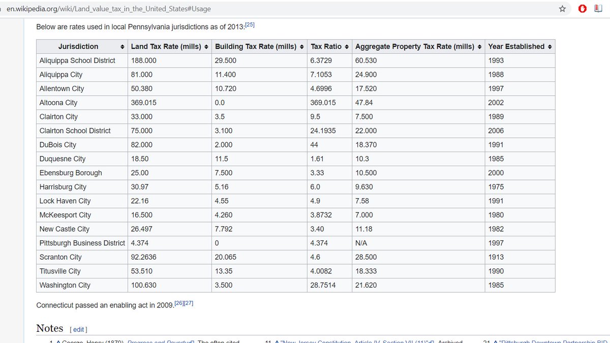
Well whadda ya know, Scranton has a LVT!
https://twitter.com/DY_MAX_ION/status/1298344511513468929?s=20
Looking down at the DL&W's old main line. The stretch of track from Stroudsburg to Clark's Summit was among the most tortured bits of that railroad; you went up the Poconos to Pocono Summit down the Poconos to Scranton, and then back up into the hills to head towards Binghampton.

Elsewhere in their network, the DL&W bypassed big climbs with highly engineered low grade routes (like the famous Lackawanna Cutoff, or the series of grade improvements that gave us the Tunkhannock Viaduct), but the DL&W never got around to fixing this series of climbs
Folks,,,,,,,,,,,,NEW JERSEY #SEANYC

One of my favorite roads in NJ:

Why we're really here. These piers are some of the precious few visible traces of the New York, Susquehanna & Western's line to Scranton, which lasted for only from 1892-1939.


While the NYS&W exists/thrives to this day, very little of its current trackage is actually NYS&W trackage; only the bit of the NJ mainline from Little Ferry to Sparta is original, the rest being a mix of L&HR, Erie and DL&W trackage picked up from Conrail/NS from the 80s onwards

As for why the original system shrank...it's complicated, and I'll get into it more when we visit Hainesburg, but the NYS&W was a late entrant into Scranton, so its opportunities to get traffic were limited/it had a bad route.
For the section of the line in NJ west of Sparta, NYSW also lost a critical western connection in 1961 when the Lehigh and New England gave up the ghost, causing abandonment of that segment. american-rails.com/images/785910s…

Crossing under the Lackawanna Cutoff on I-80. The cutoff was quite the feet of engineering; it basically drew a level path across the washboard hills and valleys of Northern NJ, bypassing a steep older main line. Last train ran here in '79; tracks lifted in '84. #SEANYC

I cover the history of the Cutoff in a bit more detail here (scroll a few tweets down):
https://twitter.com/A320Lga/status/1244085659406647296?s=20
"Ye Olde Highway" I love PA

Bangor, PA. #SEANYC


This area of PA -- loosely, the Lehigh Valley south of the Blue Mountain Ridge -- once produced 75% of cement in the US. Unsurprisingly, the industry has delocalized (cement isn't economical to ship long distances by land); the entire state of PA now produces only 4% of US cement
Cement has certainly left some ~interesting~ landscapes. Note all the quarry-ponds here in Pen Argyl

Now in the Allentown exurbs here in Wind Gap. This region has had a really frustrating history around land use/transpo planning -- lots of missed opportunities. #SEANYC
https://twitter.com/A320Lga/status/1285025171213094919?s=20

One of the remaining area cement plants (hiding behind the trees here). Of note, the tracks in the foreground are among the precious few active bits of the former Lehigh and New England Railway, which once linked PA cement/anthracite country with the New Haven RR at Maybrook.


Above pic from american-rails.com/images/785910s…
When it existed, the L&NE wasn't particularly unusual in its emphasis on anthracite and cement traffic; it essentially acted as a funnel for those products to New England (hence the name).
It did so on a route that was highly optimized for that purpose (~a straight line from coal/cement to Maybrook), but only that purpose; when anthracite entered its decline, it was left w viable-ish lines in PA, but a long and essentially traffic-free mainline through NW NJ and NY
The L&NE never actually lost any money--it was profitable until the end--but these headwinds were ones that mgmt felt weren't worth fighting; in 1961, the L&NE board voted to preemtively abandon the entire system (aside from the Lehigh Valley branches, which were sold)
So after 1961, no more Alco PA's with their fried egg logo traversed the rails of NJ. This also spelled the end of the NYSW west of Sparta, as discussed earler. gsmrrclub.org/HISTORY/histor…

One of my favorite bits of industrial kitsch: the giant cup atop the ex-Dixie Cup factory in Easton. #SEANYC

Like any self respecting PA settlement, Easton has teensy little alley streets. #SEANYC

If I may go backwards for just a sec, I had no idea about this:
https://twitter.com/erstwhileboffin/status/1299159074328674304?s=20
More Easton. Aside from being the one-time home of the Dixie Cup factory, Crayola's HQ is also here, as well as a number of small industrial concerns. Historically, Easton was a point of great transportational import -- it lies at the confluence of the Delaware and Lehigh Rivers

.....and where the Lehigh and Delaware Canals connected. Fun fact about the Lehigh Canal: before they actually built dams and locks and all, they would ship stuff downriver by building and then breaking temporary dams to create freshets that would rudimentary barges over rapids.


^that would *carry* rudimentary barges over rapids. Verbs, they are important
The former Lehigh Valley Easton station -- hasn't seen any use since 1961, when the LV ended passenger service. I would argue that one of the more high value passenger extensions in the NYC area would be NJT or Amtrak to Allentown/Reading...

....and some sort of 1-line regional rail service to circulate people in Allentown/Bethlehem/Easton and Phillipsburg, which is across the river from Easton in NJ.


On the former site of Bethlehem Steel's Bethlehem Works. While a chunk of the old blast furnace support area and machine shop is now SteelStacks and the (in)famous casino, the vast majority of the old plant's area is now warehousing + an intermodal terminal. #SEANYC


While this transition means Bethlehem has retained blue collar jobs (albeit ones which pay much less than old steel jobs), it's a mixed blessing. This variety of warehousing = massive air pollution by trucks, (sometimes) exploitative labor practices, job sprawl, etc. #SEANYC
A bulk crane seems to have become an industro-chic entrance to the casino in Bethlehem

Looking down into SteelStacks in Bethlehem, where the developer left the old blast furnaces standing as a sort of historical curio.

There's a line to be drawn from efforts to 'heritagize' industrial landscapes in deindustrializing regions to the creation of an unnuanced vision of those places/ppl as being purely and artifacts of heritage/history to the toxic politics of cultural insecurity we see today, IMO
When global perceptions _as well as local economies_ become nontrivially wrapped up in the performance of some place-based history...well, I'd have to imagine that causes discomfort, given that many of the ppl employed in performance once worked in/linked to the real thing
I think that discomfort amounts to a statistical error in the face of the ~completely uncoordinated response to deindustrialization (which itself was caused in part by gov't uncoordination via tax/labor reg arbitrage), but is still interesting to think about
(Hopefully) coming soon to CA #SB1120

Looking at NS's Allentown yard, which was closed last year. Before then, Allentown had existed in a fascinating and fraught ecosystem of eastern PA railyards whose rationalization evaded planners for decades.
https://twitter.com/A320Lga/status/1282008912221343749?s=20
Looking south at CP-HAM in Allentown, the north/west end of Allentown yard and the beginning of the Lehigh Line's much less busy northern section, which carries trains through the Lehigh Gorge to Scranton and beyond (the other section of the LEHL goes to NJ/is v busy). #SEANYC

This subdivision of duplexes lies on the old site of Western Electric's Allentown Works, part of a sizable ecosystem of northeastern telecoms manufacturing that also included WE's Kearny Works in NJ and facilities in Reading and Mountain Top PA.

Bell Labs, which did the research/product development for WE was also located nearby: they built a massive campus in Murray Hill (where,= two of my grandparents worked for a time) that replaced their NYC location (yay job sprawl) and became the center of their operations. #SEANYC
The Allentown plant, for its part was at one time a site of some real innovation in high tech mfg: the first transistors were produced here, as were lot of microelectronics used in mid/late 20c US telecoms equipment. #SEANYC mcall.com/news/mc-xpm-19…
.@shadow (who originally clued me into this historical thread in PA) has some more resources linked here if you wanna learn more
https://twitter.com/shadow/status/1298096297400991745?s=20
This is actually sorta cool: this subdivision has preserved the PA (and Radburn-esque) planning tradition of putting service functions (like parking) in back and putting houses at low setbacks against the main street. #SEANYC


Honestly, one of the best things that cld be done in places like these is allowing neighborhood grocery stores. As subdivisions go, this is decently walkable, but by merit of being 100% resi that walkability doesn't get you much in terms of destinations => you drive to stores etc

Scenes from around Allentown. The architecture here is an interesting--the Victorian influence is as present as in the other small PA cities visited, but is presented in a more Philly-esque (or simply more urban) attached town-home format for a slightly West Philly vibe #SEANYC


One last thought about Allentown: it typifies the small American city that's remained relevant largely thanks to POC. Lehigh County's non-Hispanic white population has declined by 10% since 1980 against overall growth of 35%.
This isn't an unusual story, but is one lost in the infinite stream of takes by commentators whose perceptions of these places is shaped by interviews with Real Americans in diners after the 2016 election. #SEANYC
Kutztown, one of E PA's (many) German/PA Dutch towns. Transportationally, Kutztown embodies the Lehigh Valley region's priorities: it is surrounded by a massive bypass road, because LOS is king (note that the 4 lane bypass feeds from 3 lane roads on either side) #SEANYC


As is expected for a town its size, it once lay on an interurban route from Allentown to Reading. Service ended in 1929-30. #SEANYC

we love

progress #SEANYC


Some old mill buildings in Reading. Dunno for sure, but Reading once was a big textiles/hosiery town, so it's likely these buildings once were involved in that trade.
Rail line in foreground is NS's ex-Reading Harrisburg Line to Philly.
Rail line in foreground is NS's ex-Reading Harrisburg Line to Philly.

Carpenter Steel's Reading facility. They produce a lot of aerospace-grade steel alloys at places like these (landing gear, engine parts, etc), the high value of which is evidenced by the plant's disconnection from nearby rail lines. #SEANYC


Driving through some more garden apartment complexes; this one also has rear-facing garages. #SEANYC


More interesting PA architecture, this time some colonial-ish rowhouses in Wyomissing. #SEANYC

...and some interestingly wide duplexes in West Lawn. #SEANYC

Unlike many of the other PA cities we've visited, Reading has a _huge_ job sprawl problem. The densest employment concentration is at a hospital across the river from downtown, and much of the rest of employment is spread out across the innumerable office parks along 422/222

Ah, the Schuylkill! The Delaware is bigger, but if a river defined Philly's development it was this one. The Lehigh and Delaware Canal systems predated their equivalents on the Schuylkill, but the Schuylkill beat the Delaware/Lehigh systems to the punch on bidirectionality...

...and once railroads came along, the Schuylkill was the logical route to the anthracite fields/points west, and once had two entirely duplicate routes following its banks to show for it. #SEANYC
The limestone quarries in greater Reading dispatch huge amounts of stone into the Philly market. I believe this specific one (in Birdsboro) ships trains via NS to South Jersey (Winslow Jct) and Delaware. Rock train moves are among the shortest rail hauls you'll find. #SEANYC

The ex-Reading station in Pottstown. Passenger service hear lasted into the SEPTA era, ending in 1981. Some (very well founded) efforts to resuscitate service have been underway since then but to no avail--see @bensh__'s thread here:
https://twitter.com/bensh__/status/1290952904883478528?s=20

Behind these houses is the portal to the Phoenixville tunnel, which allows the railroad to avoid a long loop around a point in the Schuylkill.


Because it's single track, this tunnel is supposedly a huge impediment to passenger svc on the line, but a) it sees *maybe* 12 freights/day and b) the limits of the single track are contained w/in the view above. So I'm skeptical.
behind me: Valley Forge
in front of me: King of Prussia
hard to think of two more different landscapes, yet our national fixation with 'authentic' pastoral scenes as can be found in the former is, culturally, much of what drove the creation of the latter. #SEANYC
in front of me: King of Prussia
hard to think of two more different landscapes, yet our national fixation with 'authentic' pastoral scenes as can be found in the former is, culturally, much of what drove the creation of the latter. #SEANYC


For those not familiar, King of Prussia is like a more mall-oriented version of Tysons Corner. It may look like there's a lot going on in this landscape, but it *barely* shows up on employment density maps (its near the far western edge of the map, below the river).


Left: PRR Schuylkill Valley Branch
Right: Reading RR Norristown Branch.
Both lines were once electrified, and once carried commuter service. Psgr ervice on the PRR ended in 1960 (cut back to Manayunk) and the line's electrification was removed, w/ freight ending ~15 yrs later.
Right: Reading RR Norristown Branch.
Both lines were once electrified, and once carried commuter service. Psgr ervice on the PRR ended in 1960 (cut back to Manayunk) and the line's electrification was removed, w/ freight ending ~15 yrs later.

SEPTA still runs on the Reading into Norristown, but all that's left of the PRR now is the stub to Cynwyd. #SEANYC
Some interesting architectural flourishes on this chiropractor's office in Conshohocken #SEANYC


This particular motif seems to be alive in Conshohocken. Go Schuylkill vernacular!
https://twitter.com/A320Lga/status/1299852513689165829?s=20

The (spectacular) PRR bridge over the Schuylkill in Manayunk. Structural issues with this span were what caused SEPTA to cut service on the Schuylkill Valley Branch to Cynwyd, but despite their repair in the early aughts, SEPTA never resumed svc. Bridge is now a trail. #SEANYC

Manayunk is Philly's little Lowell. After the construction of the Schuylkill Canal (& most importantly, Flat Rock Dam), Manayunk became rich in water power dev opportunities which attracted a large number of textile mills, as well as other water-reliant industries (ex: paper).

Always found it a bit ironic that this little pocket of pre-fossil fuel industrial development only came to be because of one of the country's great early pieces of fossil fuel infrastructure (the canal) #SEANYC
😍

A surviving coal trestle. Trains would shove hopper cars onto the elevated spur, and the hoppers would dump the coal into the bins below, where coal would be sold to businesses/residences. You can find traces of these all along the lines of the anthracite roads in the NE. #SEANYC

One last Manayunk thought: Manayunk was the Lenape name for the Schuylkill itself; the Schuylkill was a Dutch-ism made from the Dutch word for skulking and the word for river "kill" (which also is part of the names of the Kill van Kull and Arthur Kill in NYC)
Not only were older industrial districts denser, but light industry and housing extensively mixed. Scenes like this were v common in NYC/Philly/Baltimore/Boston, contributing to diversity in immediately available job opportunities to urban residents.

This, to be sure, had its downsides as well: especially when fewer pollution regs existed, particulate matter/runoff from things like metalwork or vehicle repair or carpentry shops did few favors for neighbors -- and things only got worse when trucks became a thing.
Nevertheless, it's an industrial typology and variety of urban economic landscape that we've largely lost to a potent cocktail of zoning, (sometimes well-justified) NIMBYism and industrial sprawl. #SEANYC
Philly probably has more rowhouses per capita than any other major US city... #SEANYC


This PHA development (along Diamond St in N Philly) typifies post-1970 public housing projects in the US. After the failures that were the postwar high rise developments, housing advocates turned to scatter-site projects and/or more human scale things like this for PH. #SEANYC

In their recognition of some of the failings of original PH efforts, these projects have prob been a net +, but some which act as replacements for preexisting PH have led to reductions in housing capacity...
...or have been so budgetarily constrained that they emphasize needs of/capacity for higher income tenants over the needs of housing insecure PH residents. These fights are quite a sad commentary on our (in)ability to consistently provide for the poor.

Crossing the Northeast Corridor for the first time! Fun fact: the track all the way at left is technically not part of the NEC--it's Conrail Shared Assets' Delair Branch, which allows freight trains to get to the Delair bridge to Camden w/o interfering w passenger traffic #SEANYC

Girard Avenue, with Route 15 streetcar tracks in the middle. From 2005 until this year (when the route was bustituted for equipment issues), the line ran refurbished PCC cars. #SEANYC
en.wikipedia.org/wiki/SEPTA_Rou…
en.wikipedia.org/wiki/SEPTA_Rou…

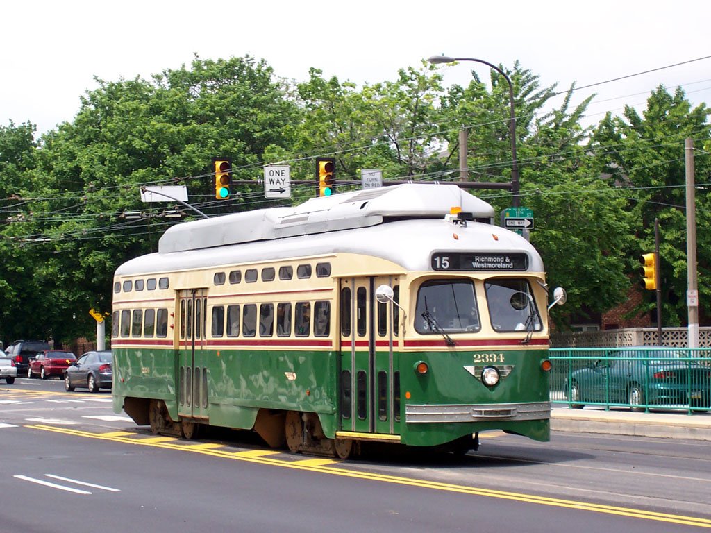
'Twas a fun operation, but reliability suffered from mixed-traffic stretches such as this one. Hopefully a return to streetcar operation will be accompanied with more serious transit priority. #SEANYC
Above us: the NEC entering ZOO interlocking, where trains are sorted btwn routes to NY, Harrisburg, the upper/lower levels of 30 St, Philly's High Line and the old Junction Railroad. Next to us: a boarding island--one of those lil bits of transit infra that can do wonders for ops


West Philly scenes.


West Philly is interesting. The dominant narrative has been one of Penn-led gentrification -- which certainly is true towards the Schuylkill -- but other areas further west and away from the Market St corridor seem to be undergoing some level of downfiltering #SEANYC

Will defer to the Philly folks ofc, but this map suggests a trend towards the inner ring suburbanization of poverty #SEANYC
The new rowhouses on this block of Osage St are a physical tell of the destruction that once took place here. This is where the Philly PD _dropped a bomb_ on the headquarters of MOVE, a Black liberation group, after a standoff.
vox.com/the-highlight/…
vox.com/the-highlight/…

The western portal of Philly's subway-surface tunnel. The tunnel -- which runs into Center City, and forms the trunk of a network which stretches out across West Philly -- can carry north of 60 trains/hour during the peak, the best of the US's three subway-surface systems

(Philly has a bit of an advantage, though, insofar as it has shorter trains, though what seems to make the most difference is extensive use of double-berthing at high-dwell downtown stations)
More info on the MOVE block:
https://twitter.com/bensh__/status/1301647535480680449?s=20
In Penn-land now. Growth in the Penn campus/campus employment have hugely increased job densities in West Philly, which has been good for transit/regional economic fortunes, but has raised issues in university-community relationships...


...which have, in general, been quite fraught in cities as higher ed institutions navigate urban surroundings that have, on the whole, become poorer/more POC since WW2.
The legacies of urban renewal are esp critical to understanding this problem; unis were frequent benefactors of revitalization/clearance projects #SEANYC
Philly's High Line! This route was -- and is -- a freight bypass around 30 St, which soars over the Penn/Drexel area on a large viaduct on its way south to a junction with the NEC to Washington and the freight route to yards in South Philly. #SEANYC


C E N T E R C I T Y #SEANYC

Suburban Station! PRR's downtown Philly commuter terminal, now a stop on Philadelphia's Center City Commuter Tunnel, which I am comfortable calling the most frustratingly underutilized bit of transit infrastructure in this country.

See, the CCCT has enough capacity to -- and indeed is designed to -- act as a trunk subway for a high frequency Philly regional rail network that would provide fast/flexible transit to the city and region.
This indeed was the plan, but thanks to funding issues/politics/labor issues, it never came to fruition. If you want to tear your hair out over things that could have been (and still could be!) look up Vukan Vuchic's plans for the system, ex:
core.ac.uk/download/pdf/2…
core.ac.uk/download/pdf/2…
Before the CCCT, the other half of SEPTA's regional rail services (those once operated by the Reading) terminated here at Reading Terminal. The building is now a market #SEANYC

Reading's City Branch! A freight artery through ex industrial districts north of Center City to the massive facilities at Port Richmond. The line, which runs in a subway for part of its length, was active until '92 when the last load of newsprint arrived at the Inquirer's spur


Some 'urban suburbia' in Poplar. A lot of HOPE VI, CDBG and HUD-community partnership projects ended up taking forms like these, in part thanks to the backlash to the classic high rise public housing typology. Another famous example is the redev of Charlotte St in the S Bx

Some old industrial trackage in Northern Liberties. This area has become residential (another post-industrial sacrifice zone for housing production) as industry sprawled and headed/south/west/overseas; am surprised these bits of track haven't been paved over. #SEANYC

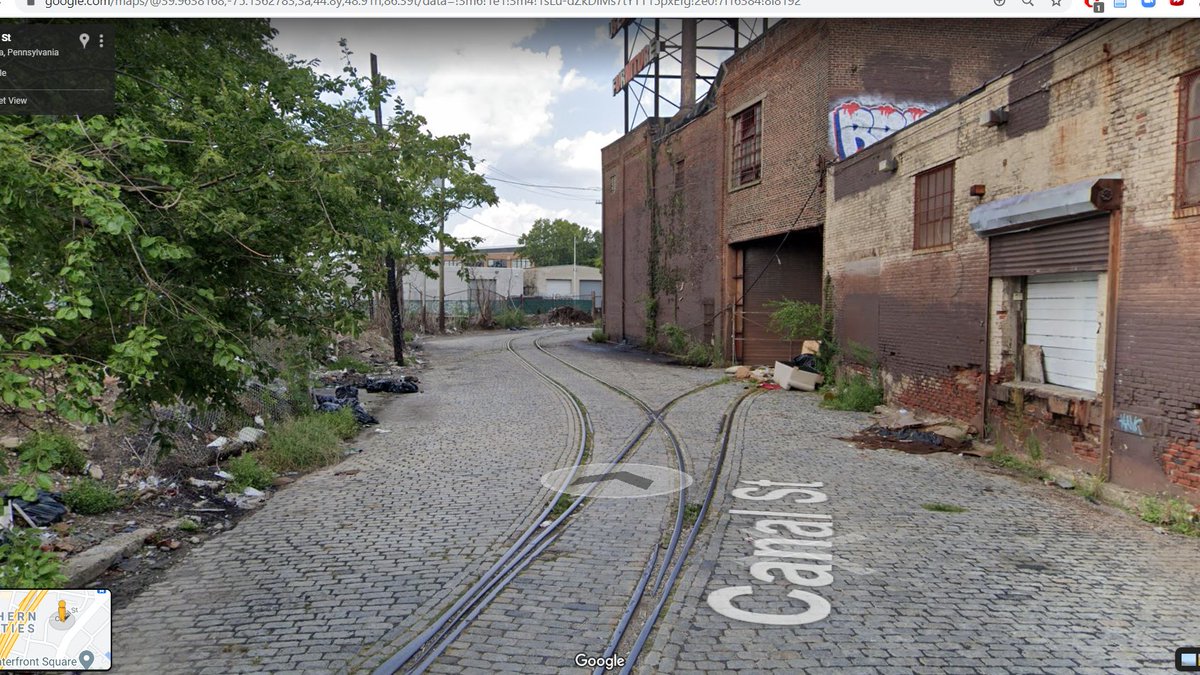
Let this also be a friendly reminder that there was a fully functional goods distribution system for cities before trucks that minimized emissions/pedestrian risks/etc, and we essentially subsidized its competition into total market dominance.
Other factors, like a wish to escape union power, build larger plants, and realize the full industrial engineering gains of plant electrification, were at play in sprawl, but freight transport shifts were absolutely key. #SEANYC
This empty expanse was once a gigantic rail-to-water coal transshipment facility. Anthracite from PA would come on Reading RR trains here to be loaded onto barges/freighters for distribution along the Delaware and up/down the coast. #SEANYC
reddit.com/r/philadelphia…
reddit.com/r/philadelphia…


Tioga Terminal! Among other things, this facility is an important import point for eucalyptus pulp, which travels from Brazil/Ecuador to here, and then is loaded into boxcars for the haul to mills -- some of which are as close as Chester and Mehoopany #SEANYC


Eucalyptus pulp production isn't great for the environment, though. Its value in world pulp markets lead to extensive plantations, replacing native vegetation and frequently increasing erosion and fire risks. #SEANYC
Looking through the approaches to the Delair bridge (used by Conrail/NJT to South Jerz) at the Betsy Ross Bridge, a span whose story is one of self-justifying infra.

When built, the Betsy Ross connected to little of import on the NJ side...but in order to get a good ROI, that had to change, so a bunch of highway expansions were done to increase access to the bridge. Now it gets more -- though still underwhelming -- use. #SEANYC
Rowhouse-duplexes in Bridesburg #SEANYC

Philly, too, has trolleybuses (though they seem hell bent on changing that, sadly)...#SEANYC

It's a common refrain on transit twitter, but it bears repeating: trolleybuses are a _really_ underrated solution to urban bus electrification. They work! They don't have issues in the winter! #SEANYC
Northeast Philly has mile upon mile of buildings that use this material palette and general vernacular. Very postwar. #SEANYC

Like folks,,,
Ok looks like the N Philly trolleybuses are safe
https://twitter.com/bensh__/status/1302420546404130816
Northeast Philly is politically, demographically and geographically quite similar to Staten Island.
- Postwar growth w/in city limits
- White, but diversifying
- Votes R much more than the median metro-area suburb
#SEANYC
- Postwar growth w/in city limits
- White, but diversifying
- Votes R much more than the median metro-area suburb
#SEANYC

Roosevelt Boulevard is like the least endearing parts of Eastern Parkway and Conduit Avenue got made into one road and put in a y i k e s land use regime. One day, sometime far in the future, it'll get a subway. Hopefully. It sure could use it. #SEANYC

SEPTA Eddington: literally two sheds across from each other along the NEC in the midst of an extremely ped-hostile street environment. The state of regional rail in Philly makes me so, so sad. #SEANYC


Try as Amtrak might to scare freight users away, a decent amount of freight still uses spurs fronting the NEC. It's a far cry from what it once was, but this industrial park has a boxcar user at left, and at right (hiding behind the parked cars) some covered hoppers. #SEANYC

Burlington NJ. Back when NJ was two separate colonies (East and West Jersey) Burlington was the capital of West Jersey. The two halves were consolidated to make the current whole in 1702, but the old boundary lives on in the SW borders of Ocean, Monmouth and Somerset Counties.


(Burlington is also where Burlington Coat Factory was founded, as sort of the prototypical outlet store selling discount clothes out of some sort of cheap industrial space)
NJT's River Line runs right through downtown Burlington. This route, which actually could be v useful if not for SJ's land use choices, was a pioneering user of second gen (ie not RDC) DMUs....

...and, after applications in San Diego and Baltimore, became (and still is) a user of temporal separation arrangements to allow FTA-regulated passenger trains and FRA-regulated freight trains to share tracks safely.
On the River Line, this is achieved by moving most freight to night hours, and by providing short intervals of absolute protection for daytime freight moves across River Line trackage. #SEANYC
Roebling NJ. In the early 1900s, the Roeblings (yes, the famous ones involved w/ the Brooklyn Bridge) built a large mill and wire works here, and a company town along w/ it. Unlike many other US company towns, a decent amount of effort was invested in the urban design in Roebling


(though, ofc, design features reflected the corporate and social hierarchies present at the time, in keeping with the mission of social control that undergirded many such developments)
Nevertheless, Robeling and this landscape of rooted industry is quite the contrast with the surrounding landscape of industrial mobility -- distribution centers, warehouses and the like.

Having been unbound from site by trucks, containers and consolidation, industry (as we all know) has a huge degree of locational freedom, with these warehouses the only thing that must be near fixed places, like cities.
But even warehouses exist in their own ecosystem of transiency -- much of modern warehousing's cost-effectiveness relies on high turnover/low wage/de-skilled labor and various forms of temp work. #SEANYC
Bordentown, NJ:
- Contains much good S Jersey architecture
- Joseph Bonaparte lived here
- Was on one of the first railroads in the US, the Camden and Amboy. The C&A ran from Camden to the Raritan Bay at S Amboy and was opened in 1832
- Has alleys
...so, an interesting place
- Contains much good S Jersey architecture
- Joseph Bonaparte lived here
- Was on one of the first railroads in the US, the Camden and Amboy. The C&A ran from Camden to the Raritan Bay at S Amboy and was opened in 1832
- Has alleys
...so, an interesting place


Chesterfield Township is among a handful of municipalities that has a transfer of development rights provision.


The TL;DR on TDR is that areas are zoned for conservation or development, and those owning conserved lands can sell dev rights to those wishing to build above zoned density on buildable plots
The area zoned for development, shown above, has been built up along vaguely New Urbanist lines with alleys and sidewalks and small setbacks (though, oddly for such a clearly sustainability-planned community, I don't see any walkable retail?) #SEANYC
It's an interesting sprawl control technique in a state whose modern history has been largely defined by various sorts of satellite development from out of state urban cores. #SEANYC
The entrance to the McGuire-Dix-Lakehurst joint base, an amalgamation of Army (Dix), AF (McGuire) and Navy (Lakehurst) bases.

These bases have seen a lot -- the Hindenburg disaster, numerous anti-submarine patrols during WW2, a large complement of nuclear SAMs, a very early computer radar processing installation. #SEANYC
The Pines, the lovely lovely Pines. The NJ Pine Barrens are a massive, fascinating, and largely untouched ecosystem defined by its awful soils, gigantic aquifer, carniverous plants and dense pine forests (containing some rel obscure pine species)


A lot of the area (which, speaking in terms of ecoregions, also includes much of LI and far eastern/southeastern MA) was formed from sandy glacial outwash during the last ice age.
LI and SE MA having been largely built up, the pines are the largest remaining example of this nutty type of forest -- and they're now preserved, under the jurisdiction of the Pinelands Commission.
While the pines have remained untouched, their resources haven't. The high quality sand that lies under the pines gave birth to the American glassmaking industry; what's believed to have been the first glass factory in the current US was set up in South Jerz in 1739.
Fueled by this high quality sand (as well as plentiful lime from -- get this -- oyster shells discarded by SJ oyster canneries) the SJ glass industry grew massively with industrialization and the growth of bottled things and windows.
As the former market shrank the glass industry did too, but it, and associated sand mining activities, are very much still around! (Pics from when I dragged the family to a SJ sand mine) #SEANYC


Looking down over the CNJ Southern Div in Lakehurst. This line, which once linked SJ towns/sand mines/oyster canneries/glass plants with North Jersey and NYC via the Pines, has been out of service south of here since 1985ish, and south of Lakewood (a few miles north) since 2010.

Efforts have been underway to bring the line back as far as the sand pits at Woodmansie, but so far no trains have run. This really should be done -- sand trucks aren't doing Ocean County roads any favors!
Some shots of the line while active (incl one from under my overpass):
Some shots of the line while active (incl one from under my overpass):


All shots from:
web.archive.org/web/2007031905…
web.archive.org/web/2007031905…
Ocean County's demographic landscape is defined by the belt of second-wave sprawl that stretches from Somerville to Toms River. The median home in OC was built in 1980, and the landscape shows it.
Sorta unsurprisngly, OC was where Trump won his largest margin in NJ #SEANYC
Sorta unsurprisngly, OC was where Trump won his largest margin in NJ #SEANYC


Behind these gates lie the former Ciba Geigy Toms River dye plant. Active from 1952 to the mid '80s, the plant is infamous for having hugely polluted the groundwater in/around Toms River, discharged large amounts of untreated waste into the Toms River itself...

...and (perhaps) caused a cancer cluster.
I say "perhaps" because the Ciba plant wasn't the only polluting mess in the Toms River area; someone also once had the bright idea of dumping a bunch of chemical waste into an unlined pit near the source of Toms River's drinking water.
I say "perhaps" because the Ciba plant wasn't the only polluting mess in the Toms River area; someone also once had the bright idea of dumping a bunch of chemical waste into an unlined pit near the source of Toms River's drinking water.
A truly massive grade crossing gantry protecting the spur that once served the Ciba plant #SEANYC

The actual town of Toms River is quite old. Before 1812, there was an inlet to the sea adjacent to it (see map; look for Cranberry Inlet) which made it a decent harbor for (among other things) privateers. Inlet is gone, but the town remains. #SEANYC


Seaside Heights! Before I talk abt Sandy, fires, and local vacationing, I want to point out the width of the street here. This stroad-with-service-roads is not just highway engineer excess -- it's a remnant of when there was a railroad here.


For a brief period in the late 20s and early 30s, the PRR (through its partnership w/ the Reading, the PRSL, and its control of the Tuckerton RR) had a nearly comprehensive NJ coast network.

Since then, storms, fires, cars, and airplanes have deconstructed it, but the current NJCL and Atlantic City lines remain, as does the Cape May route (albeit w/o passenger svc). #SEANYC
Pics from christophervaz.wordpress.com/tag/pennsylvan…
seasideparknj.org/images/train.j…
Pics from christophervaz.wordpress.com/tag/pennsylvan…
seasideparknj.org/images/train.j…
What Seaside Heights is best known for, however, is its boardwalk and amusement park.
Back when NJ coast towns (and Coney Island/Rockaways) were the beach vacation options for those in NY/Philly, there existed a massive beachfront entertainment industry on top of beachgoing.
Back when NJ coast towns (and Coney Island/Rockaways) were the beach vacation options for those in NY/Philly, there existed a massive beachfront entertainment industry on top of beachgoing.

Seaside Heights' boardwalk was part of that; it once was lined with all sorts of stores, shops and rides, with massive hotels like this one not far away. seasideparknj.org/images/history…

Places like these declined the world over as car and (especially) air travel became more accessible. You see this same pathology in Brighton, England as well, for example.
Seaside Heights has persevered, though hardly has been free of challenge: Sandy, and then a massive fire in 2013 (which destroyed things that had just been rebuilt after Sandy) didn't do the town any favors. inquirer.com/philly/news/ne…

*IF* COVID leads to any behavioral shifts, it'll be interesting to see how things shake out for more accessible vacation spots like these. #SEANYC
Sandy in buildings: new things on the shore don't have more than garage space below flood elevation #SEANYC
New Jersey's coast is littered with shipwrecks. Being near a big port and on the path of frequently extreme weather, an unimaginable amount of misfortune has befallen shipping off this coast. It's difficult to find a mile of beach that hasn't been the unplanned end of a voyage.


This stretch of the Atlantic coast was especially...tense during the earlier years of WW2. Pipeline and rail capacity wasn't sufficient for domestic fuel transportation, so a lot of oil moved by sea from the Gulf to the East Coast -- movements targeted by Nazi U-Boats.
Tons of money was thus spent on watchtowers, Lakehurst-based blimp patrols, convoying, etc. -- infrastructure that in large part still exists.
Cold War coastal defense schemes have also left their mark on the bottom of NJ's coastal waters. One of the more strange military installations of the Cold War were the Texas Towers, a group of early warning radar stations mounted on oil rig-like platforms off of NY.
One of these -- Texas Tower 4 -- was built in rel. deep waters, damaged in transport to its emplacement, had its integrity repeatedly questioned by its crew, and ended up collapsing in a storm in 1961. en.wikipedia.org/wiki/Texas_Tow…

Loving the road-style 5mph sign for NJT trains entering Bay Head Yard #SEANYC

...and Bay Head station itself, among the few NJT stations that has a 'real' platform serving only one of its two tracks. If your southbound train arrives on the left track (which most do IINM), get ready to walk over some gravel. #SEANYC

The only other NJT station with this feature is Manasquan, two stops to the north of Bay Head.
Semi-relatedly, it's just nuts to me that the NJCL isn't electrified to Bay Head. Stop spacings are so short -- the acceleration capabilities of EMUs would be put to good use!
Semi-relatedly, it's just nuts to me that the NJCL isn't electrified to Bay Head. Stop spacings are so short -- the acceleration capabilities of EMUs would be put to good use!

I KNEW I had forgotten something. (Lincoln Park on the MoBo and Bernardsville/Murray Hill/Stirling on the Gladstone are like this too, I realize now that I've thought about this more properly. Not sure the Bernardsville one is actually used though.)
https://twitter.com/jeremyzorek/status/1304264867654840320?s=20
Lakewood is an interesting place. Like Toms River, it's second gen car sprawl, but unlike TR the town has become home to a large Orthodox community (seeded by migrants from Brooklyn IINM), who comprise 60% of the town's population. One of the largest yeshivas in the world is here

One of Monmouth's many stroads. More so than Ocean County, which has rel sparse legacy rail infra in growing areas as a passable excuse for their transpo...issues, I find the way Monmouth has grown to be quite sad. They have the NJCL, and active/low-density freight lines inland

Roosevelt, NJ was one of a number of collective settlements founded during the New Deal. This one was intended as a resettlement location for tenement-dwelling Jewish garment workers in the Northeast, and originally had a garment factory attached.


Tenants bought a share in the scheme, and then got settled in one of the Louis Kahn designed houses pictured above. The experiment was a failure, but remains an interesting artefact of a certain era in anti-urban collectivist/modernist planning thinking. #SEANYC
Possible it's just me, but if you plopped me down in Hightstown NJ and gave me no context, I'd probably place myself a decent bit further south than I am? Like rural MD or smth?


The other half of the equation that creates NY-related industrial sprawl in places as far flung as Hazleton is land use like this. AFAICT, the avg NJ municipal zoning code limits industrial building heights to 50', making multi-storey complexes barely possible/impossible.

So what we've ended up with in Northern NJ is a structurally undersupplied warehouse market gobbling up what little brownfields/greenfields remain undeveloped, and then tons of less geography-sensitive things wandering out into the beyond. Not! Good!
(Sprawling industrial land use also reinforces car-dependency by making transit less economical to operate, thus hurting generally low wage drayage/distribution workforces)
You'd never know given how truck-oriented it's become now, but a key factor in the growth of this warehouse cluster *here* was that shippers could access rail _and_ the Jersey Turnpike from cheap-to-develop greenfield land. historicaerials.com/location/40.36…

I've talked a lot now about the failures in modern garden apartment neighborhood location/planning, but one super frustrating angle to the whole issue in NJ is that these apartment complexes .built away from transit/amenities/etc are frequently those mandated by...

.. NJ's fair share housing doctrine, the Mount Laurel doctrine (which you should read about). So you get the new housing, but it's not always well located, and location means a lot! #SEANYC
(NB: I'm not sure whether the dev pictured above is an example of this particular trend!)
(NB: I'm not sure whether the dev pictured above is an example of this particular trend!)
Obviously this is better than is done in most US suburbs, and not all NJ suburbs do this marginalization, but still, an issue worth discussing.
Now in New Brunswick, a fascinating, dense NY satellite city home to Rutgers. It hasn't become as big of a secondary office destination as, say, Stamford, but the hospital and J&J HQ make it v job dense. #SEANYC


Rutgers and a Schneider dry van: doesn't get more Central NJ than this! #SEANYC

For @jeremyzorek, who if it wasn't for *gestures around* would be here:
https://twitter.com/jeremyzorek/status/1304616675288010753?s=20

The Delaware and Raritan Canal along the Raritan near New Brunswick. This canal was an important artery for coal/bulk goods/mfg things during the early/mid 1800s, but was eclipsed by the piece of infra in the tweet above. Unlike other NJ canals, most of the D&R still exists.

In Somerset County's belt of post-2000 sprawl on my way to Manville. Unsurprisingly, very few people in this area commute on transit. But when NYC and inner ring NY suburbs don't build housing... #SEANYC


Downtown Manville. As its name suggests, Manville was a company town built in the 20s and 30s for the Johns Manville Company's asbestos insulation and roofing plant. The plant's toxicity was really...something. Workers involved in asbestos processing were, ofc, hugely impacted...
...but so, too, were those in the town: the plant used to emit so much asbestos dust that residents would talk of 'asbestos snow' during the summer. Asbestos being a carcinogen whose pathway is respiratory, that was...bad. #SEANYC
Manville today seems to have integrated itself into the landscape of central jersey suburbia; its demographic profile is not *too* dissimilar from other middle/working class towns that generally follow the Raritan Valley Line corridor.
(Aside: I hope one day to have the time to study suburban deindustrialization in more detail. The jobs/opportunity/replacement ecosystem therein is would seem to be v different from those seen in urban/rural cases.) #SEANYC
NJ's Chemical Coast (along the Arthur Kill from Elizabeth to Perth Amboy) is the best known locus of chemical production in the state, but there once existed a sizable cluster of chemical industries in the Manville-Bound Brook corridor. (pictured: fmr site of American Cyanamid)


These funky looking duplexes (?) are something I've only ever seen in this part of NJ. #SEANYC

Now in Bound Brook. Like many NY-area suburbs, Bound Brook saw a late-20c/21c influx of immigrants -- in this case, many Costa Ricans. The town is now somewhat of a cultural hub for the CR-American community; I believe CR's president actually visited the town a few years ago.


Honestly this is one of the more clever integrations of a power line ROW into a development I've seen. Free lawn! #SEANYC

One of the easiest ways to date factory buildings is by their window use. Older factories, built before electric lighting was cheap, have tons--they were called "daylight factories." If I had to guess, this building was built sometime btwn 1900 and 1930. #SEANYC

(h/t to @MarketUrbanism for catching typo in original version)
There's a lot to unpack here, in this multiplex. Really here for the different siding colors. #SEANYC

This diner in Plainfield was the flashpoint of a 1967 riot in the town, which was one of many suburban/rural conflicts that summer whose histories are not nearly as well represented in mainstream history as urban riots in places like NY. #SEANYC

The causes of riots in Plainfield were similar to those in cities -- discriminatory treatment by gov't and police, disinvestment, inequality, poor representation in town politics, a middling gov't response to organizing + protest in the earlier years of the Civil Rights Mvmt --
...and were followed by a similar pattern of further disinvestment and white flight, but I think it's worth remarking on how the classically-metropolitan dynamics of racialized spatial social inequality and white flight played out within a small industrial/bedroom suburb of NYC.
.@TomSugrue and Andrew Goodman makes these observations much more eloquently than I here; if you can get access, I highly recommend reading this article. Has really informed my thinking on inner ring suburban demographic/political dynamics.
journals.sagepub.com/doi/abs/10.117…
journals.sagepub.com/doi/abs/10.117…
(This sort of suburban industrial growth => POC pop growth dynamic is also an important one to look for when trying to determine how mid-century suburban municipalities treated POC when they were present w/in their gov't boundaries. Answers are ~never positive, IME)
(There's def a through line from the patterns of institutional behavior observed in places like Plainfield in the 50s and 60s to what has been taking place in places like Ferguson as poverty and BIPOC populations increasingly move outwards from urban cores)
Something else I learned when reading the Sugrue piece: into the '60s, Plainfield was a more important regional shopping center than Elizabeth or New Brunswick. #SEANYC

US 22 btwn Plainfield and Newark definitely ranks among the top 10 worst stroads in NJ. It's an almost completely impermeable barrier to pedestrian traffic and encourages all sorts of job sprawl and poor land use. #SEANYC

The day 22 gets complete street-ed is the day I'll know the urbanists have won in the suburbs, is all I'm saying #SEANYC
Climbing into the Watchung Mountains now. The Watchungs are a series of parallel volcanic ridges, formed from lava flows that covered the Newark Basin as Pangea was breaking up. Their function in more recent history has been to serve as a transportation/urbanization barrier.


This road once led to a Nike missile base. The Nike missiles were essentially last-ditch surface-to-air missile systems built around major urban centers in the US to protect them in event of a nuclear attack. NJ, being btwn NYC and PHL had...14 of them. #SEANYC


(img from: nikemissile.org/sandyhook.shtml)
One last note b4 I log off for the night: apologies for the slower pace these past few weeks. College has begun again!
Coming into Summit NJ now. This abutment used to carry one of NJ's more obscure railroads -- the Rahway Valley -- over this road. The RVRR ran from Summit to Cranford and Roselle, serving the once-dense industrial districts in Kenilworth/Irvington/etc. #SEANYC

Deindustrialization/trucks didn't do the carrier any favors, and after a short period of operation by the same holding company that controls the NYSW, the little railroad was abandoned in 1992. trainweb.org/rahwayvalley/e…
e#SEANYC
e#SEANYC
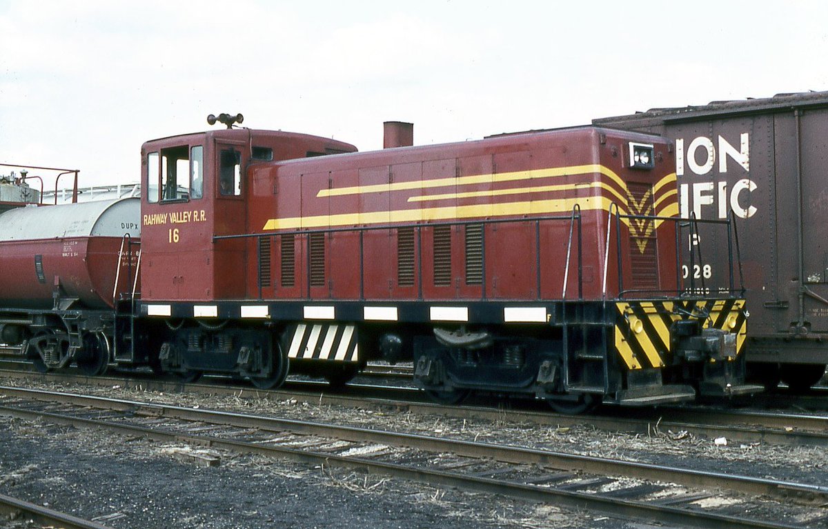

Union County tried to revive it in the aughts, but thanks to a lovely cocktail of corruption, directionlessness, and lack of market, the effort was unsuccessful. #SEANYC
Summit derives its name from the fact that it was, well, a summit--specifically of the Morris and Essex Railroad's crossing of the Watchungs. Built in 1837 (!) this line remains (very) active today as NJT's Morris and Essex line...
...though the legacies of 1830s rail engineering are all too present in the line's steep (for NYC) grades and curves.
These certainly are not insurmountable issues, but NJT's taste for loco-hauled equipment (which is ~always slower than multiple units, where most/every car is powered) makes speed and performance in low-adhesion conditions an issue to this day. #SEANYC
Summit is an example of a suburban town with a public housing authority. What little I've been able to piece together about Summit's PH history is v intriguing -- it seems that some of their projects (incl the one pictured) in the '60s were funded in part by local philanthropy.

The general layout of downtown Summit is worth a note. The rail-oriented core remains dense and largely intact, but has only retained that distinction at the expense of a parking sacrifice zone a bit to the north. IME, this general arrangement is not at all uncommon. #SEANYC

Most of Summit, however, is more your classic large lot suburb. #SEANYC


I present, Madison's ornate station: #SEANYC

Driverless cars may be years away, but Google's AI is just bad enough that it can stitch together plausible future car designs. You just know someone is going to make a pickup-limo, esp now that pickups are so divorced from their original use cases...

In terms of direct impact on cities, and instrumentalization towards racist goals, the urban freeway certainly holds the crown of most damaging highway typology. But beltways--like 287 shown here--were, much moreso than their radial kin, the bringers of industrial and job sprawl

If you read planning reports of the 50s and early 60s, you'll frequently find passages extolling the virtues of beltway-adjacent office parks, many citing the office growth boom that accompanied the construction of route 128 in Boston.
By linking suburban communities together outside of the normal patterns of radial traffic, highways like these made economic sprawl _that_ much easier; it's no accident that so much office space was placed alongside them, or at their intersections w/ radial roads. #SEANYC
Morristown! Like Summit, it's a hub along the old DL&W, but older. Morristown is where Washington's army spent Jan-Mar 1777 (now a Nat Hist Pk), where the first telegraph was assembled.

Like Plainfield, Morristown once had a strong industrial base in parallel to its commuter suburb status, and also like Plainfield, has long had a small but significant Black population and (more recently) a large Hispanic minority as well.
These sorts of industrial-commuter suburbs were once extremely common in the NYC Area -- not just in North Jersey, but also on Long Island, where numbers once worked at aerospace/defense plants in eastern Nassau and Suffolk Counties.
(Again, something I'd just love to research more...)
Some more suburban public housing:

They really were not kidding around with the "Mount" in "Mount Tabor" huh

There's an astronaut meme to be made w this house and "nature is healing" "never was hurt" or smth...
In all seriousness: Mt Tabor was founded as a Methodist camp meeting site (hence the name), which transformed into a town In the process, it got tons of Victorian architecture
In all seriousness: Mt Tabor was founded as a Methodist camp meeting site (hence the name), which transformed into a town In the process, it got tons of Victorian architecture


Mt Tabor can also proudly count itself among the elite group of NJT stations with platforms along only one of their two tracks. #SEANYC

Dover is NJ's largest former mining town. Believe it or not, the center of US iron production used to be in the hills around here, which, for a brief period, made Dover a critically important point in the mining and pig iron producing trades.

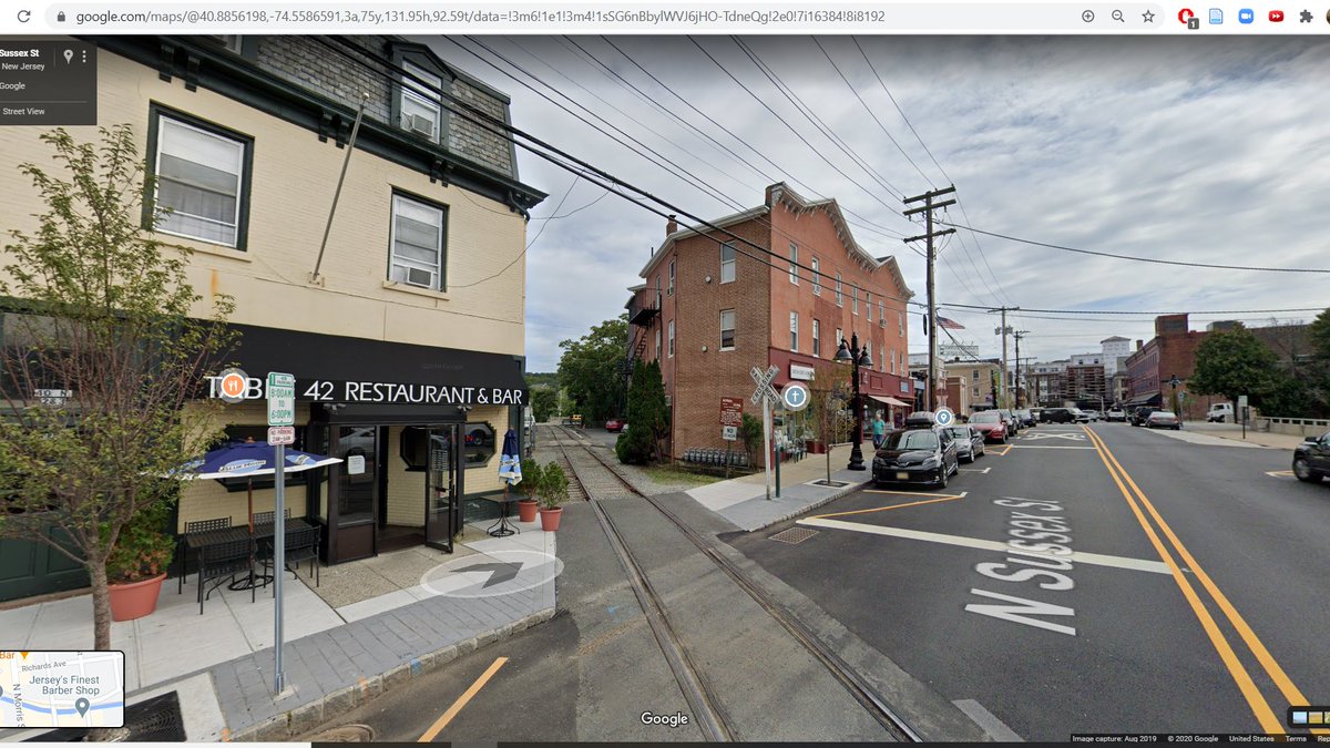


You can see that legacy in the names of nearby Mine Hill Township, Ferremonte Jct, etc.
Dover also lay along the Morris Canal (last picture above) and, in a too-perfect encapsulation of 19 century transpo dynamics, is now paralleled by a railroad (which remains active!) #SEANYC
Dover also lay along the Morris Canal (last picture above) and, in a too-perfect encapsulation of 19 century transpo dynamics, is now paralleled by a railroad (which remains active!) #SEANYC

Boonton has one of my favorite downtowns in the state. It's on a steep hill, and as longtime followers of this thread know, I am a _sucker_ for hilly urbanism. #SEANYC

Boonton's sad little NJT station is among the least served in the system -- only 14 trains/day, split (and this is the bit that really drives me up the wall) as 5 inbound and 9 outbound. Makes sense if your priorities are serving the AM peak, and the (much flatter) PM peak...
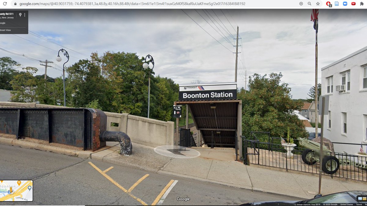
...but this sort of svc planning (as encouraged by the line's meh infra, lack of electrification, curviness and poor surrounding land use) makes it v difficult to use the line for much outside peaks, contributing to regional transit efficiency issues: homesignalblog.wordpress.com/2020/09/13/ine…
It is not much of an overstatement to say that this switch killed the Lackawanna Cutoff. Allow me to explain.

What we call the "Montclair-Boonton Line" today is actually an amalgamation of three previously separate rail lines: the DL&W Montclair Branch, the Erie Greenwood Lake Branch, and the DL&W Boonton Line.

The latter bit of railroad was once quite important: it was a well engineered low grade route for freight traffic heading from PA to NYC. Along its alignment once existed one of the largest mainline rail bridges in NJ, near where the route went around Garrett Mtn. #SEANYC

But, in 1963, it was abandoned. At that time, the Erie Lackawanna believed that the former DL&W route from Binghampton to NYC (via Scranton and the Cutoff) would be secondary to the former Erie (via the Delaware Valley); the Erie, after all...
...was the route to the lucrative Maybrook interchange gateway (also target of the L&NE).
https://twitter.com/A320Lga/status/1299147829156425729?s=20
So, when NJDOT asked whether they could use the rail ROW around Garrett Mtn for what would become I-80, the Erie Lackawanna agreed. Trains would now have to reach the cutoff via the former Erie Greenwood Lake Branch, whose engineering was...poor.
So poor, in fact, that in a metro area not really known for topography, the Erie Lackawanna and then Conrail somewhat regularly had to split trains in half to make it over the hill at Great Notch.

This isn't what you want on a mainline freight railroad, so Conrail, awash with alternate routes, shifted traffic away from this bottleneck, and thus away from the Cutoff => abandonment.
(The last piece of the current Montclair-Boonton Line, the DL&W Montclair Branch, was added into this when the Montclair Connection opened, allowing trains to run from the Montclair Branch to the Greenwood Lake line => get access to Newark)

Now, you may be wondering what the above switch has to do with any of this. Well, it is where the Greenwood Lake Branch connects with the former Boonton Line! A lowly spot, but historic! #SEANYC

I can honestly promise that we will be in NYC before the end of the month. #SEANYC

The Passaic River gap north of Garrett Mountain is probably the most dramatic of the gaps in the Watchungs, in part because Garrett Mountain's eastern edge is partially a cliff. An _extremely_ scenic spot. #SEANYC


Paterson is home to one of the largest (or is it _the_ largest) Peruvian diasporic communities in the world -- somewhere btwn 10-30k in a town of 140k.

Much like Allentown, Paterson exemplifies the city whose postindustrial success has been largely thanks to immigration.
(This is a relative statement; I do not mean to demean the challenges faced by immigrants/Hispanic communities in the US, nor those faced by cities)
(This is a relative statement; I do not mean to demean the challenges faced by immigrants/Hispanic communities in the US, nor those faced by cities)
And while Paterson is certainly an urban place, I think it serves as an important reminder that many immigrants now settle outside of core cities -- I think that stat is >60% now.
Fun fact: NJT bus carries significantly more passengers than do NJT's trains, but there doesn't even exist a map of the network! #SEANYC

Paterson has truly fascinating and fantastic urban bones, which, by suburban US downtown standards, has remained relatively untouched by parking cratering.


(Nilo points out an important problem -- a lot of transit in Paterson is NYC, rather than local travel, oriented. If you wanna read more about what a vision for better transit in north jersey could look like, dare I recommend:
homesignalblog.wordpress.com/2020/09/13/ine…)
homesignalblog.wordpress.com/2020/09/13/ine…)
https://twitter.com/nilocobau/status/1307882856048242689?s=20
What makes Paterson all the more fascinating is its rootedness to a pre-fossil fuel energy regime. The town became the manufacturing hub that it did because of the falls along the Passaic, whose elevation change that could provide mills w/ significant water power


Much of that industry is now gone, but its early and labor-intensive growth meant that Paterson became a true satellite city of New York, in broad strokes not unlike Lowell or Lawrence in MA. #SEANYC
The Erie built a fun station on a viaduct above Paterson along their main line, which remains in use by NJT today. #SEANYC

Passing through Paterson's East Side now, home to large Jamaican and Dominican immigrant communities. #SEANYC


Now crossing over the New York, Susquehanna and Western's line through the area. This route once hosted hourly clockface passenger service to a bus transfer to NYC, using these amazing looking streamlined DMUs. Sadly, the service did not last long enough to be absorbed into NJT.


There's talk these days of reactivating the line. This would be good, IMO, though it'd be a lot better if someone wanted to spend the $$$ to bring trains into downtown Paterson. #SEANYC
(photo credz on the above:
flickr.com/photos/railpho…)
flickr.com/photos/railpho…)
Hospitals need more visibility in transit discourse. They're massive trip generators, and are frequently significant islands of job density in otherwise undistinguished economic sprawl. The hospital pictured is the red block noted by the arrow. #SEANYC


The south side of Paterson is home to a large Middle Eastern/Turkish immigrant community, whose roots (I learned today from @MarketUrbanism and @erstwhileboffin) lie in pre-Johnson-Reed Act immigration to the area.

Bergen and Passaic Counties have so, so many of these 4 lane limited access state highways. 3, 4, 208, 20, 21, 46...

^4-6 lane
Passaic! Another fascinating satellite CBD. Where I'm "standing" right now once hosted the Erie's mainline pinterest.com/pin/2338354056…


Very here for these rowhouses #SEANYC

Marcal, the last paper mill left in NJ. They suffered a horrible fire seventy years ago (Jan 2019), from which they're rebuilding/is the reason for the empty plot of land at left.

Marcal was once part of a larger ecosystem of Passaic River mills, whose small size and extremely urban locations make them rare and fascinating case studies of interstitial industry in the suburbs. #SEANYC

As you can imagine, none of these mills did pulp processing on site. They either brought in pulp from other facilities or (as in the case of Marcal) relied heavily on recycled pulp from the torrential waste streams of the tri-state area.
Pratt Industries, NYC's last paper mill, is a very similar operation -- 100% recycled feed into their small facility on New York's lost coast.

One last note on this scene: Marcal's mill is located in a municipality called Elmwood Park, which was formerly known as East Paterson; they changed their name in the '70s to escape association with the deindustrializing urban center to their west.
That progression -- and their choice of replacement name -- is such a fantastic encapsulation of the dynamic between the ideal of suburban pastoralism and the (one time) necessity of proximity to an urban core
(also, where are my municipal fragmentation haters -- bergen county must be one of the most overdivided counties on earth) upload.wikimedia.org/wikipedia/comm…
There's a stretch of 21 in Clifton that's built on the bed of an old canal -- the Dundee Canal, which provided hydropower for manufacturers along the Passaic. Much easier to visualize this from the sky:
upload.wikimedia.org/wikipedia/comm…
upload.wikimedia.org/wikipedia/comm…


Former Botany Worsted textile mills in Passaic, site of a large and long communist-led strike in 1926-27. Like most other NE textile mills, this one saw its employment crater immediately after WW2; by 1955, only 150 ppl worked here. Seems to be under redev into a mall now :(
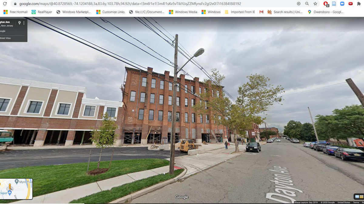

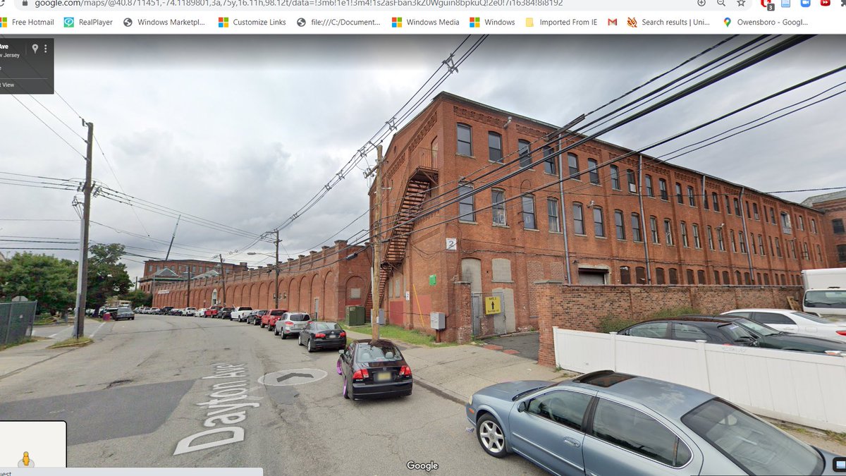
More old industrial buildings in Passaic: #SEANYC

One of the (many) things I love about inner ring North Jersey is that while 1-2 fam detached housing is by far the predominant typology, you see a lot of architectural variety, especially on the level of post-construction mods/details. #SEANYC
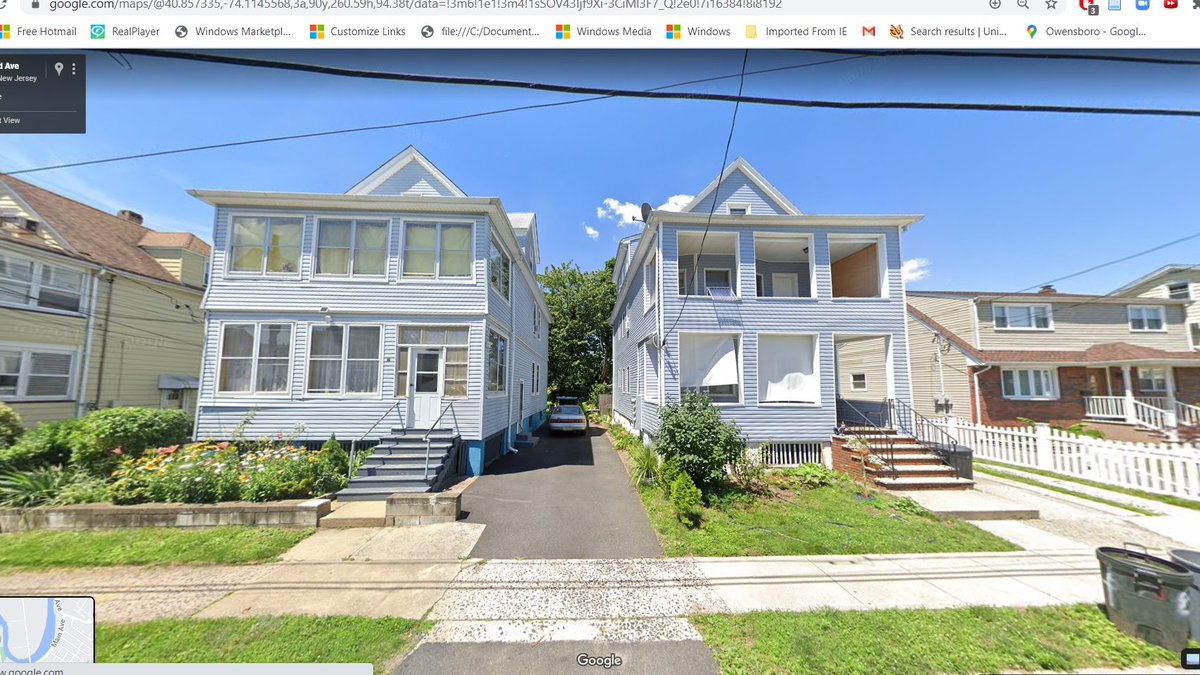


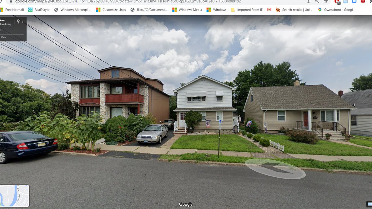
^^^that's just two blocks in Wallington, NJ.
Wallington is home to a small but extremely concentrated Polish community, many of whom are first gen immigrants post-91. #SEANYC


The Erie main via Passaic used to pass through here--we're not too far from where the original junction with the Bergen County Line (BJ Tower) was. Interestingly, the one stop on this spur (Carlton Hill) retained passenger service for 3 years after the Passaic main was severed.

Hey look, a PABT bus! #SEANYC
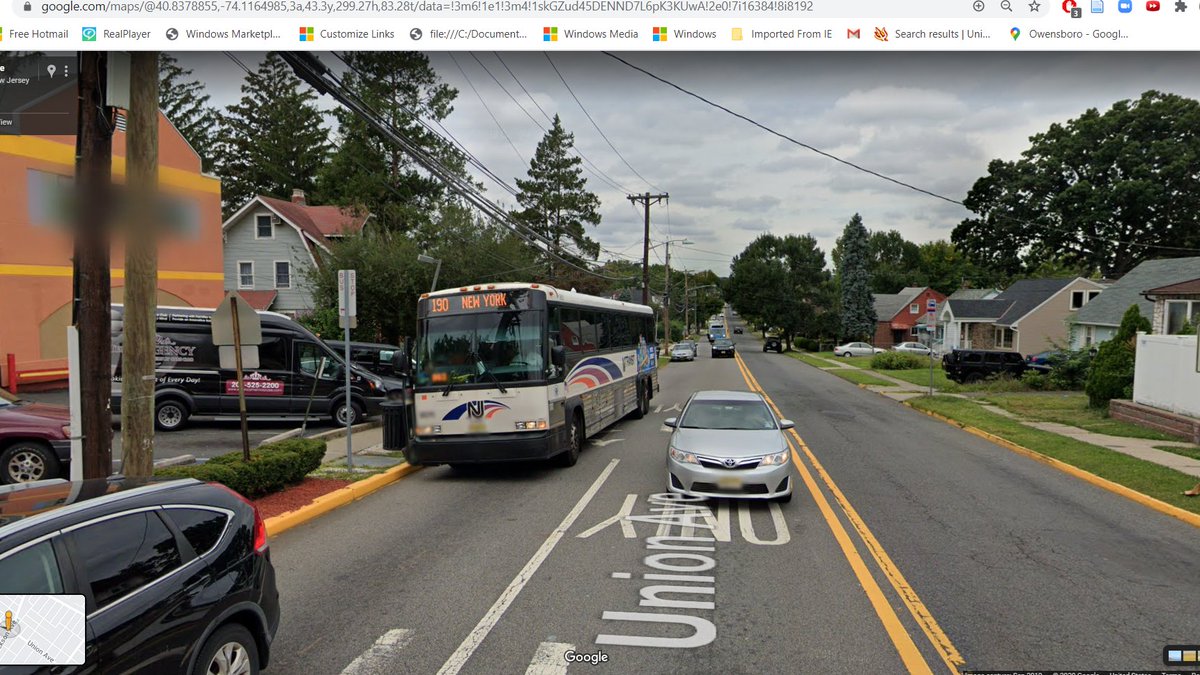
Less well known than Branch Brook Park to its south is Nutley's string of parks along the Third River -- they're really quite nice. Above us: the former Erie Newark Branch, IMO one of the stronger candidates for LRT expansion in the NYC area (wld go NWK to Paterson). #SEANYC

Of course, we must ask who has access to these parks: Nutley isn't really known for its embrace of fair housing, for example:
tapinto.net/towns/nutley/s…
tapinto.net/towns/nutley/s…
Now I'm just wandering down back streets towards Newark #SEANYC


One of the Olmsteads' less well known works: Newark's Branch Brook Park. #SEANYC

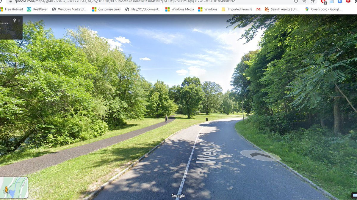

These tracks carry the Newark City Subway, a fascinating (and high ridership) LRT between Downtown Newark and Bloomfield -- the last bit of the once _massive_ (1000+ miles of track) NJ PSC streetcar network. #SEANYC


The ROW here, as well as in the tunneled section thru Downtown Newark, is actually the former bed of the Morris Canal. #SEANYC
If this building looks like the Seagram to you...you have a good eye! The Pavilion and Colonnade Apartments (which consists of this bldg, as well as another 2 a few blocks away) are the only (?) one of Ludwig Mies van der Rohe's residential works on this side of the Appalachians.

These were, I believe, also among the earliest urban renewal projects in Newark. The Mies buildings were targeted to upmarket renters, and were located next to the Christopher Columbus Homes for low-income fams.
The Columbus Homes were demolished in the 90s (?), and were replaced with vaguely New Urbanist townhouses after what I believe to have been a lengthy period of litigation over a potential loss in public housing capacity. #SEANYC
These towers stand near what is, undoubtedly, among the worst scars of that era in American urban planning: I-280. This highway tore through dense neighborhoods in Newark and East Orange, and today just spews pollution into the black and brown communities alongside it.

To the extent that there exists a silver lining for this road, it is that highway engineers did not get to build the planned NJ-75, which would have displaced thousands more in Newark during the '70s. Organized resistance thankfully killed the proposal.

Scenes of Downtown Newark. Anywhere else in the US, ~40k jobs in a square mile of land would be a significant bit of job density, but relative to NYC it's but another satellite CBD. #SEANYC


"what if we took a sleek art deco facade and stuck a fugly glass tube right into it, like a pencil in someone's eye"

(Americans have too little respect for the architectural commons, etc etc etc)
Newark's Ironbound district, home to a large Portuguese community. The name is derived from the fact that it was (at one time) entirely surrounded by railroads. #SEANYC
North Jersey has sprouted a lot of container piles over the years. It's a fitting commentary on the sort of industrial landscape it has become. This one I'm proud to say that I have visited. #SEANYC

Scenes from that lovely winter day...


Progress update. In the grand scheme of things, we are really not that far from being done.


One of the NY region's many waste-to-rail transloads. These facilities are becoming increasingly common across the country as local landfills are closed/filled up. #SEANYC

Oak Island, the NY region's primary loose carload classification yard.

This yard, along with most of the NJ terminal area, is run by a neutral switching carrier owned by CSX and NS called Conrail Shared Assets Operations. CSAO basically runs the bits of the former Conrail system that were too traffic dense to be neatly/uncontestedly partitioned.
Port Newark. This is one of the few places in the world whose increasing insignificance can be read as a sign of its success: Port Newark is the birthplace of the shipping container, and thus the modern systems of global trade which make it--as a port--relatively small globally.

Before containers, things had to be moved by hand btwn ship and shore, which made for extremely time consuming and costly shore procedures => seaborne trade was a relatively expensive proposition.
McLean's leap was twofold. The first was to use boxes (in his case, truck trailers detached from chassis) that could be moved across modes (novel, but he wasn't the first), the second was to aggressively emphasize standardization/scalability.
The first container ship set sail in *1957* and quickly ushered in a sea change in logistics: containers were 1-2 orders of magnitude cheaper to ship in than classic breakbulk. So breakbulk died, and all of the sudden it became much more economical to run a global supply chain.
The global impacts of containerization are all too visible in our lives/in The Discourse today, but I think it's also worth noting the impact they had in NYC. Almost all port activity (+ associated warehousing, port-centric mfg, longshoring) jobs moved to NJ...
...not only because the NYC gov't stuck its head in the sand for far too long about the potential impact containers would have on NYC's legacy docks, but also because containers are fundamentally anti-urban:
they are tailored to the limitations of trucks (and thus promote the sorts of truck-centric, sprawly industrial land use that's been a frequent theme in this thread) and require tons of laydown space at ports which cities cannot provide.
more container pics

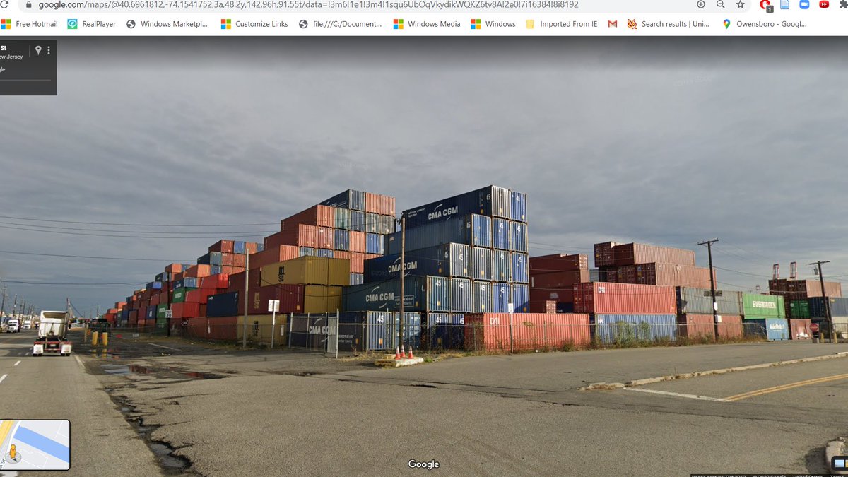
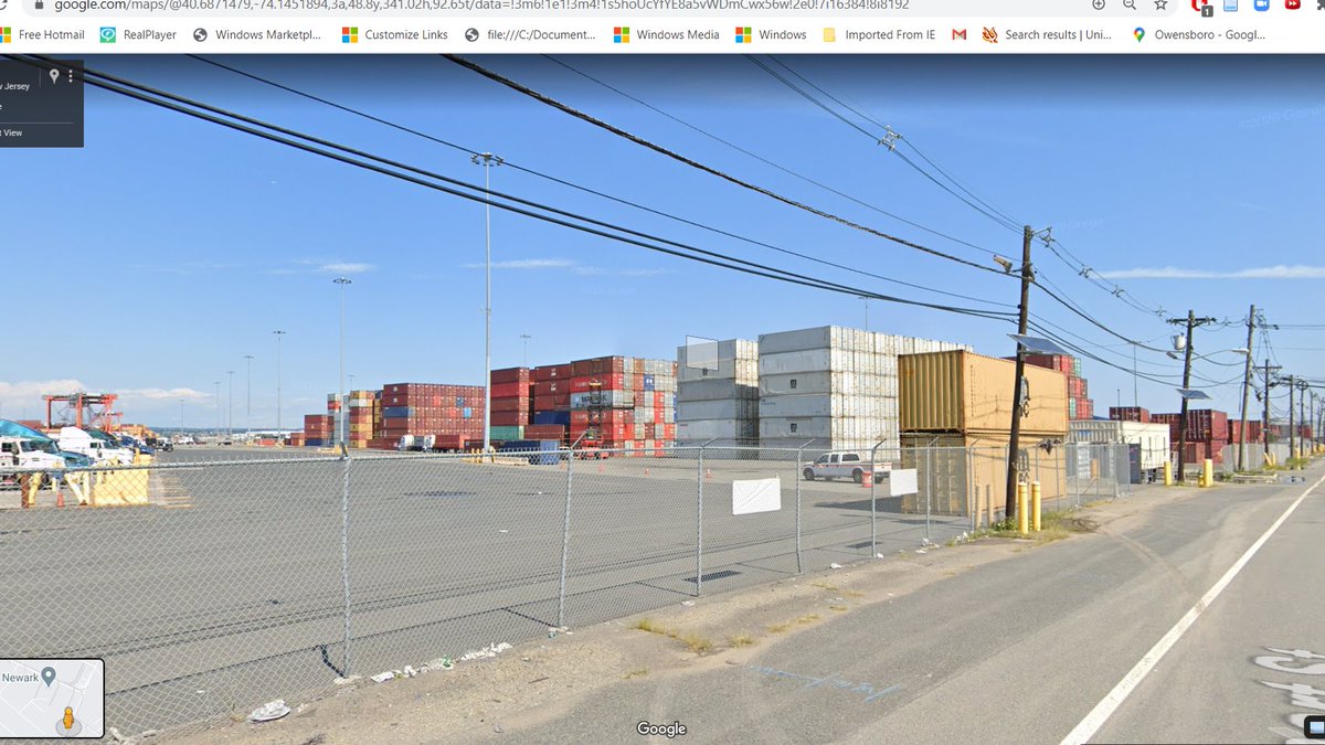

Portside Yard was among the first rail intermodal terminals in the US. It's still active today as a part of the PANYNJ's network of ship-to-rail terminals.
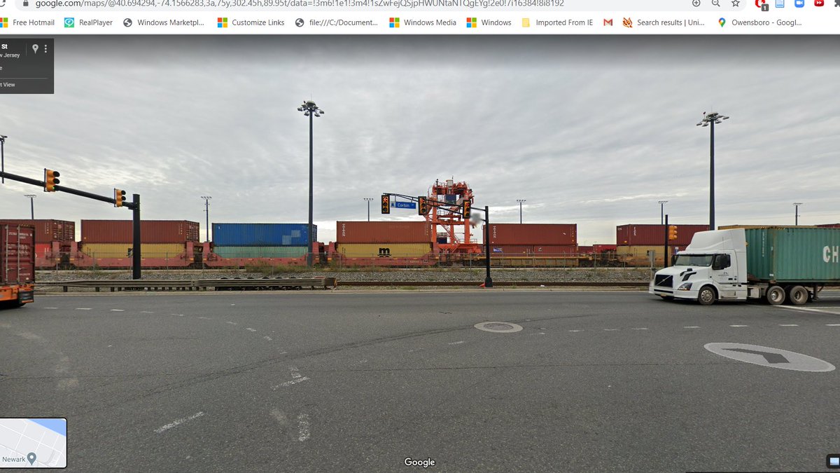
Moving international boxes inland has been a big business for the railroads. After spending week(s) at sea, nobody usually cares if the container takes 2 days or 4 to get to, idk, Kansas City, so RRs frequently capture large portions of traffic moving beyond the port's metro area
But it's a traffic source under threat: increasingly, companies transload international boxes into domestic boxes at warehouses near ports, to allow for shipments to be mixed and for international boxes to be turned more efficiently for their next load.
The resulting crop of domestic moves is generally more time sensitive => less rail-friendly.

Shout out to the giant Tropicana facility in JC, which receives some massive amount of fruit juice concentrate by rail from Florida. The juice trains were always fun, back before they mixed the juice cars in w/ general traffic. #SEANYC

Am now actually in Jersey City. #SEANYC

Scenes of Jersey City. The areas I am driving through now are plurality non-Hispanic Black, though they do have significant Hispanic minorities. In keeping with Jersey City's generally flexible urbanism, the buildings types around here are v diverse #SEANYC


(If you're interested in learning more abt JC and land use, give @erstwhileboffin a follow. They know *so* much about the area, both in terms of historic trends and current events)
McGinley Square, Journal Square's little cousin to the south:

And now, Journal Square! JSQ is one of NYC's more fascinating satellite CBDs. Built up around the PATH station under the pictured plaza (which is the terminus for PATH service using the Uptown Tubes) and its intersection w/ JFK Blvd (a main N-S spine of JC)...
...the area has a college, lots of retail, a decent amt of office space, and is currently slated for a good bit more development.
JSQ is also about the easternmost edge of JC's large South Asian immigrant community, whose business district along Newark Avenue to the west of here my fam frequents on trips to NJ...
One of the more disappointing almost-was's of JC history probably is the abortive plan to consolidate CNJ passenger service at the PRR's old Exchange Place terminal, which would have placed JSQ (and downtown JC) on NY's regional rail network.
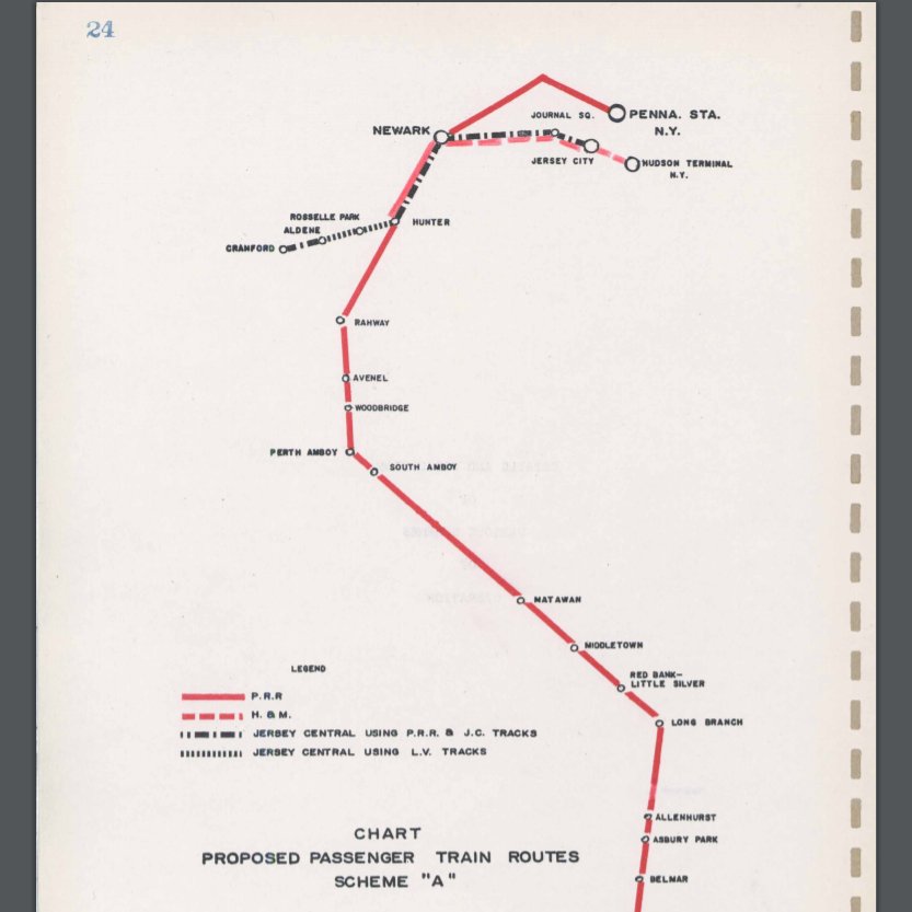
Alas, planners at the time thought that Exchange Place couldn't handle combined PRR and CNJ traffic (lol), so this plan never came to be.
Now in 'lower' JC, ie the bit of the city that lies under the Palisaides. In tandem with the city's high housing prod'n rates (which are much of what stands btwn NYC and total SF-ification of housing prices), JC has been pursuing some interesting street design stuff, like this:


(h/t to @bigmoodenergy for this suggested destination)
As recently as the 1970s, most of Jersey City's waterfront was adorned with railyards. Thanks to the natural barrier presented by the Hudson River, an ICC case mandating that railroads not charge cars crossing into NYC more than those terminating in NJ...


...and the ship-driven and then path-dependent nature of industrial/residential geography in the NYC region, railroads once did a huge business in floating rail cars or their contents (whether they be passengers or freight) across the harbor, which required large waterfront yards
The viaduct pictured above was the route into one such yard, and indeed was the last used for freight, only falling out of use in 1987 when Colgate wound down operations at their JC plant (whose clock graces the waterfront, somewhat incongruously, to this day)
The Holland Tunnel entrance: pouring PM2.5, soot, and other noxious pollutants into urban neighborhoods while endangering ped safety since 1927!

The things we did for automobility in this country...
https://twitter.com/erstwhileboffin/status/1145865190661136384?s=20
It's worth remarking on how the Holland Tunnel -- anti-urban, car-oriented infrastructure, was the love child of urban interests. Manhattan businessmen (esp. port interests) were concerned that trucks/cars had too hard of a time getting to the boro, so they built a tunnel
Relevant to current discussions around disasters and infrastructure culture, advocacy for such a link grew especially strong after the winter of 1917-1918, during which the Hudson River froze, paralyzing the aforementioned system of rail-barge freight movement from NJ terminals.
The Lackawanna Warehouse, probably the most spectacular remnant of the once-vibrant rail freight ecosystem of JC. It had an elevated rail spur (the bridge in the pic) with truck doors for local delivery below + tons of storage space.


This sort of typology (though sadly w/o trains) seems to be making a comeback in the US, as the returns to urban warehouse capacity go up. #SEANYC
This container storage yard is exactly sort of low-intensity that so frequently dominates recently-deindustrialized urban areas (huge swaths of JC once looked like this). Except this prolly won't be transient, bc land next to the Holland Tunnel portal has low redev potential

This intersection was a very active autorack terminal in 1979. Impossible to overstate how rapid change has been here. historicaerials.com/location/40.72…

Re: container lot, well I'll be damned!
https://twitter.com/sydchan1616/status/1312576517893951489?s=20
The part of the 'old' JC waterfront that's carried over best to the new is undoubtedly PATH. Originally conceived as means of linking JC rail terminals with NYC, the little operation has become the enabler of the dense development visible along the w'front


(map from: transitmap.net/hudson-and-man…)
Jersey City's *other* rail line: the Hudson-Bergen Light Rail. #SEANYC

JC has brownstone-y things too.

Welcome to Hoboken, land of NJT diesel trains, small streets and Cake Boss. #SEANYC


For all ye sports people out there, Hoboken was also where the first game of baseball was played, at the Elysian Fields (now gone).
Like Jersey City to the south, Hoboken also once had a port-centric economy. In Hoboken, however, its manifestation was much more in docks for oceangoing ships, and (more importantly) in shipbuilding. Where we're 'standing' right now once was a Bethlehem Steel shipyard.


If you think a better view of New York exists, you're wrong. #SEANYC

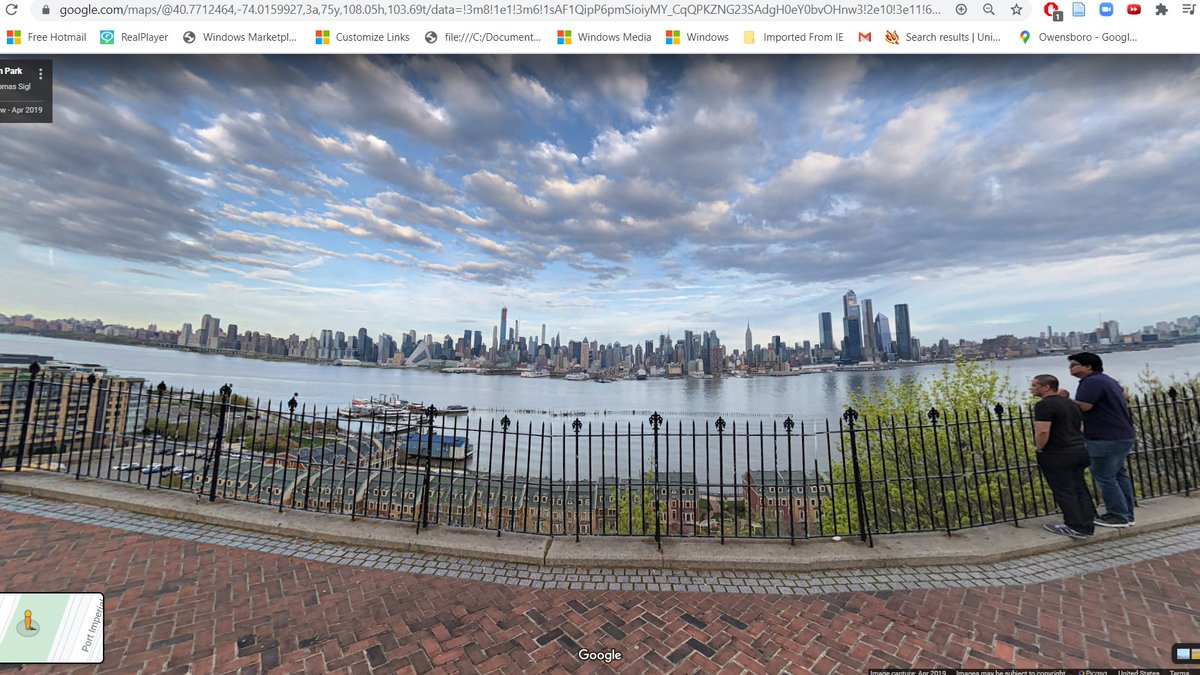
The apartment buildings along the edge of the Palisades are among many excellent examples of high density bus-oriented development in a broadly rail-centric region. The census tracts in this area have 30-40% bus shares, and extremely high frequency NJT bus service to the PABT.


(this one has always been my favorite) #SEANYC

While today, Edgewater is an area of medium density development in seas of parking, the area was previously an interesting industrial hub, with a Ford plant, and a dock for SeaTrain, which shipped entire train cars on boats to Puerto Rico and Cuba.


Fort Lee NJ is home to one of the larger (largest?) Korean communities in the NYC area. Fort Lee also seems to be sprouting bus-oriented towers; the town is just a short bus ride across the GWB from 175 St on the A. #SEANYC


"Time for some traffic problems in Fort Lee"

Across we go. #SEANYC

Last pic from within the state of NJ 😢😢😢😢😢😢😢 #SEANYC


Progress


GWB bus terminal. Much less busy than the PABT, but still an important terminal point for Bergen County buses, as well as a number of NYC routes. Lots of people transfer onto the A here. #SEANYC

In an extremely early example of urban highway capping, the Trans-Manhattan sprouted these towers in the early '60s. Capping/dev schemes like these were actually called for as a part of Moses's plans for future expressways in Manhattan -- which ofc were never built. #SEANYC

Crossing the High Bridge, which, starting in 1842, brought Croton Aqueduct water to NYC, hugely improving water quality/capacity => increased growth on Manhattan Island.
@foxandcity did an excellent piece on this w some cool pics from inside the aqueduct
thefoxandthecity.com/articles/silen…
@foxandcity did an excellent piece on this w some cool pics from inside the aqueduct
thefoxandthecity.com/articles/silen…

Looking down on MNR's Hudson Line and Highbridge Yard. The latter facility constituted one end of New York's only modern era intermodal train: the Empire State Express, which Conrail ran w/ RoadRailers during the early 80s. klnl.org/magazine/KLLNe…

Welcome to the Bronx! This is Highbridge, a Black and Latino neighborhood perched on the cliffs overlooking the Harlem River.

Like its neighbor to the north (Morris Heights), Highbridge has been hit rel. badly by COVID -- something likely linked to the highways to its north and west
thecity.nyc/2020/9/28/2149…
thecity.nyc/2020/9/28/2149…

guys its the subway. we made it.

(This is the 4's 170th St station on the Jerome Avenue line. Fun fact: this stretch of trackage was the last bit of NYC subway mainline to retain semaphore signals; I think it lost its last only in the late 60s or early 70s #SEANYC)
Like many other Dual Contract lines, this bit of the 4 is also an object lesson in development-oriented transit. This is the line under construction _south of here_. (from:nycsubway.org/wiki/IRT_Woodl…)
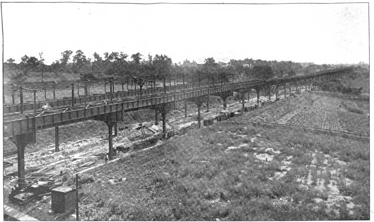
You used to be able to enter an underground subway line from below here. #SEANYC

Apartments on a hill #SEANYC


I dream of the day when residents of the NYC area can think of this piece of transit infrastructure no differently than the 4 train previously pictured. It would be transformative. #SEANYC

Bathgate Industrial Park may not look like much, but insofar as it tells a story of a certain type/era of urban thinking, it should be regarded as an important NYC planning landmark.

During the '70s, when NYC was losing population and its government was in increasing fiscal trouble, some thinkers in the city--notably the Housing and Development administrator at that time, one Roger Starr--wondered out loud if the best strategy was 'planned shrinkage'
or the gradual retreat of gov't support for some neighborhoods deemed too costly to support. The famous Starr quote was that NYC was "better a thriving city of five million than a Calcutta of seven, destroyed by its internal wrangling"
What would replace these shrinking neighborhoods? Industrial parks. City leaders identified deindustrialization as a key headwind to urban prosperity at the time, and decided that replacing blighted n'hoods w/ industry would at least get them tax revenue and create jobs.
The racist nature of this kind of thinking should be self evident, and IMO captures a singularly toxic confluence of the worst excesses of Moses-era elitist/racist planning and post-crisis economic development-orientedness. This was recognized by electeds at the time, and...
...planned shrinkage as an official tenet of policy was beaten back, but little bits of it (like the above) remain on the landscape.
And, ofc, just because it wasn't explicit policy doesn't mean that it was eschewed entirely by the city: the late '70s and '80s saw _plenty_ of gov't retreat in NYC, and in cities around the country.
(1951/2012 @ Bathgate, via NYC Then & Now) #SEANYC

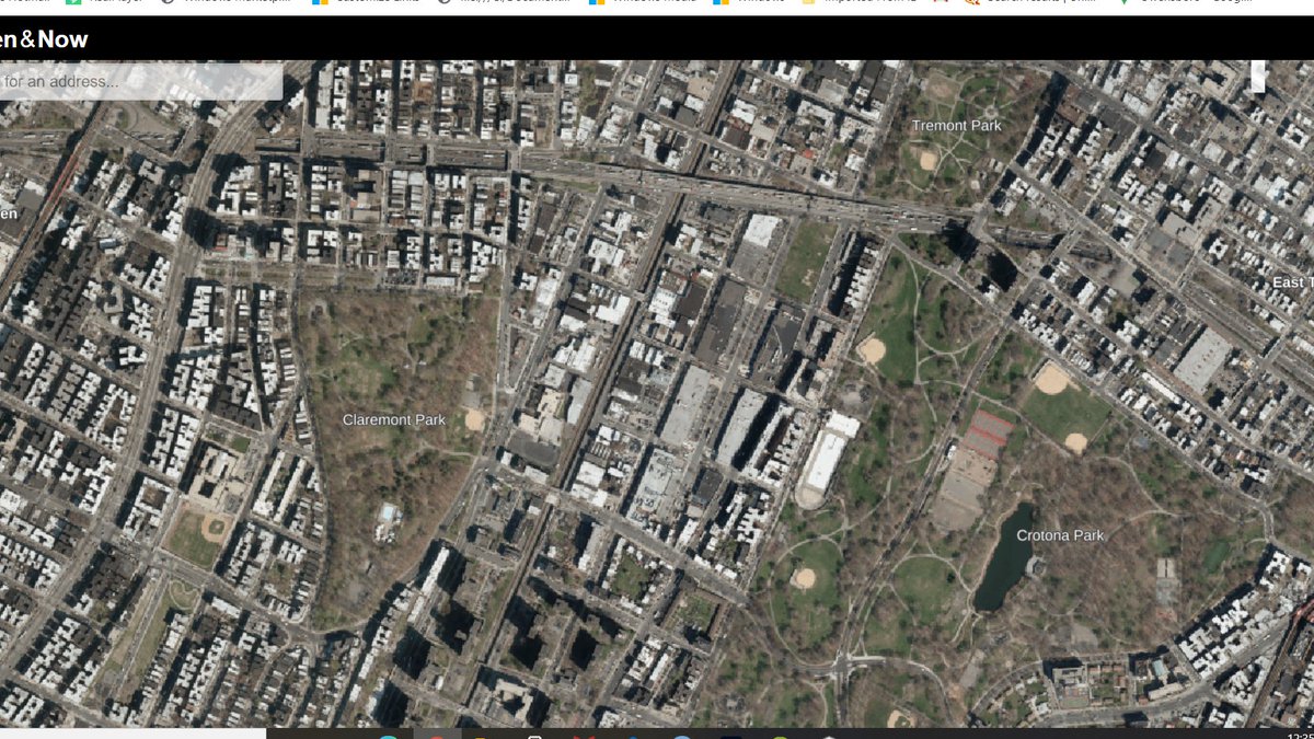
Of all the bends in the road, the hint of southwards curvature you see in the Cross Bronx expressway here is probably the one which looms largest in the popular imagination. This is the section of highway about which Robert Caro wrote the "One Mile" chapter in the Power Broker.

If you want to read the chapter (and I think you should, see here: eportfolios.macaulay.cuny.edu/annb/files/201…). The tl;dr is that the above stretch of highway displaced thousands, thus wrecking fabric of the then-present Jewish community -- and that the damage was poorly managed/preventable.

This story is moving, and an important one for planners. I think that it falls into the quintessentially first-wave gentrifier trope of romanticizing white ethnic neighborhoods, and that the presentation of neighborhood change following the construction of the highway is...
...if an accurate representation of the sociology of the white residents, a story which should have at the very least begged a more nuanced treatment of causality/impact. Nevertheless, an important 35 pages. #SEANYC
Crotona Terrace is a good example of the "looks like yuppie housing/actually is 100% affordable" phenomenon. It's also a good example of how current-day housing policies are actively failing environmental justice: the building is right next to the CBX. #SEANYC


174 St/surroundings -- classic station-oriented retail in an eclectic mix of low and mid rise buildings.


Charlotte St: the little bit of the Bronx that Jimmy Carter (in)famously visited in 1977. In an effort led by a number of local non-profits, the neighborhood was redeveloped in the '80s w/ these modular ranch homes.


Southern Blvd is a truly fascinating mix of commercial/light industrial/residential. It's a sort of mixed use landscape that is (for better or worse) becoming increasingly rare in cities.

Trading places on Westchester Avenue: bent in the foreground is the 2/5 turning north onto Southern Blvd; the truss over the hill is the 6 turning east over W'chester. #SEANYC

folks,,,,,,,,,,,,,it's a timer
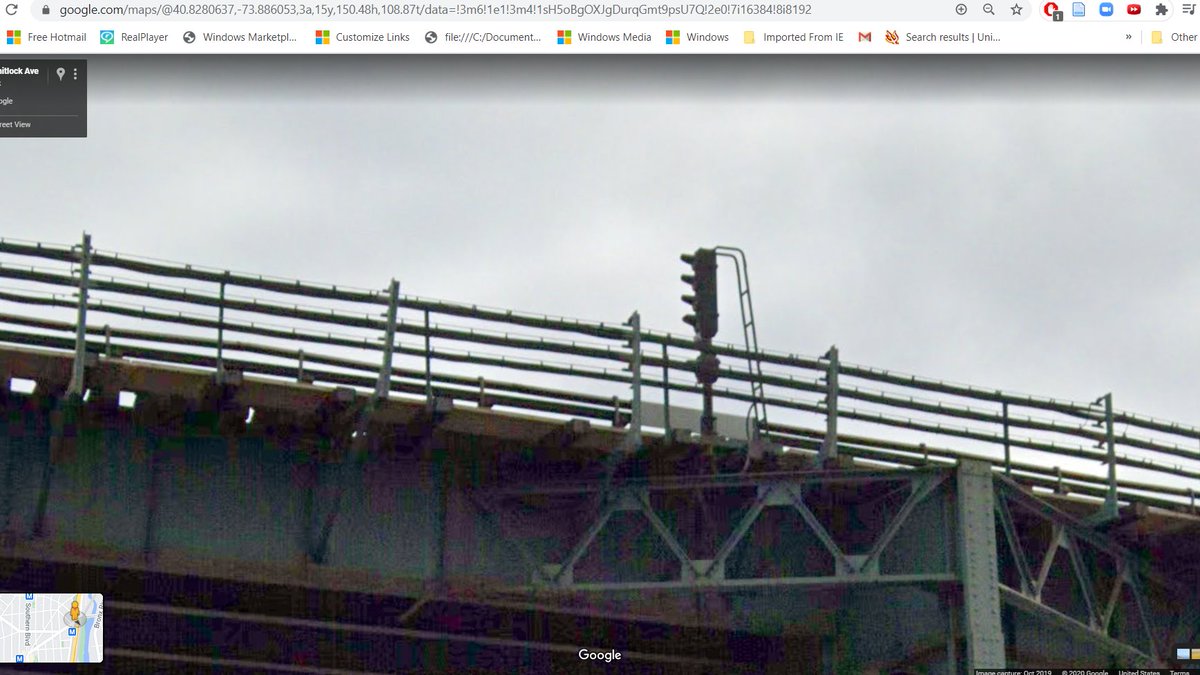
(actually this signal is TWO timers -- it's part of a two-shot grade time series that regulates the speed of 6 trains going through the curve into Whitlock, and it's a station time signal, which allows a train to close in on its leader near stations)
(former type is the "bad" timer, the second type is "good" timer. obv it's a bit more nuanced than that, but you get the point)
This structure here is a remnant of one of NYC's more fascinating and obscure bits of rail infrastructure: the New York, Westchester and Boston railway.

Running from the Bronx into Westchester, this short lived interurban was owned by the New Haven, and built to extremely high standards--high platforms, quad tracking, etc--with frequent (15-30min headway) svc. Its fatal flaw? No direct svc to Manhattan.
pinterest.com/pin/3521252646…
pinterest.com/pin/3521252646…

After its abandonment in 1937, there were a series of competing proposals made for the ROW. Robert Moses wished for it to become part of the regional highway network; former riders wished for train service to be preserved.
Rail advocates won out south of the Westchester line, with the former NYW&B being slowly incorporated into the NYCT network as the Dyre Avenue Branch (now served by the 5 train); north of there, the ROW was obliterated.
Hunts Point! #SEANYC

The Hunts Point Cooperative Market. The 35 wholesale merchants here do $2 billion of business annually, supplying 60% of the produce consumed in NYC. It is a _gigantic_ operation. #SEANYC

😍

New York ranks last in many freight rail metrics, but one bright spot in its story is the success of beer by rail in the city. Manhattan Beer Distributors recieves...70%? of their product by rail, largely through their Bronx facility pictured here.


Down tracks: CSX to Harlem River Yard, the Oak Point Link, and points north via MNR's Hudson Line (freight)
Up tracks: Amtrak to Penn Station (passenger), and CSX to Fresh Pond (not shown)
Up tracks: Amtrak to Penn Station (passenger), and CSX to Fresh Pond (not shown)

The Hell Gate Bridge. This arch span, which carries Amtrak and CSX over its eponymous watercourse, was massively overbuilt, and would be the last significant structure to collapse if humans abandoned New York. #SEANYC

The Hell Gate itself is worth a note. This bit of water got its name from the once-treacherous reefs that lay beneath its surface, which, in combination with the turbulent mixing of the Long Island Sound created quite the hazard for navigation.
So, in 1885, they...dynamited the reefs! They did this just as the primary route into NY switched to the southerly approach through the New York Bight, so these channels got much less than projected use.
upload.wikimedia.org/wikipedia/comm…
upload.wikimedia.org/wikipedia/comm…

guys look its the LGA AirTrain

Quintessential Astoria.

Astoria's recent demographic history reads like a history of NYC: working class ethnic white communities of the 50s became a dazzling variety of immigrant groups in the 80s which then gentrified in the aughts/2010s.
(It has gentrified enough with so little new housing prod'n that the area has seen something like a 10% population loss from 2000.)
The neighborhood is, too my knowledge, home to one of NYC's largest concentrations of Balkan Muslims.
Astoria has a lot of these vaguely Philly-esque midblock alleys. I'd love to know why cc @MarketUrbanism
For good value planespotting in NYC, few spots can beat this one. Very bus-accessible; planes fly very low. My pfp is from here. #SEANYC
One of New York's "moar turn" buses. These jogs do have some logic to them, but BOY are they symptomatic of the broader problems NYC's buses face. #SEANYC


For an American city, NYC proper has relatively little single family zoning. What it does have are a lot of R3/R4 districts, whose FAR <1, parking minima generally = 1, which (depending on the exact variety of zoning) generally caps you at 1-2 fam homes. #SEANYC


While we should ofc be reviewing the single fam districts in the city, I'd argue that to gain a more expansive understanding of anti-multifam zoning regs, you should be looking at districts like these as well.
Now in Jackson Heights proper. The neighborhood is today home to large South Asian, Colombian and Peruvian communities -- though at one time these apartments excluded by covenant everyone except WASPs. #SEANYC

Scenes from under the Flushing El. Roosevelt Avenue in this area is home to a truly amazing commercial district -- if you haven't been here, you're missing out.


Patel Brothers. In the Before Times, I used to do a good bit of shopping for (the Indian half of my) fam here...a one seat ride home on the F, and walking distance from industrial sites of interest in Maspeth. I miss it. #SEANYC

(Also, much more of this area should be pedestrianized, or have wider sidewalks)
https://twitter.com/A320Lga/status/1315148325381984261?s=20
More of this plz:
Under the street in front of us lies a truly god-tier subway ops disaster: Roosevelt Avenue. Peak-hour dwell times at this station are so long that peak-direction runtimes on the E and F can easily be *double* their off peak values.

Some of this has to do with passenger volume (a not-insignificant percentage of Queens' population transfers from the 7 and MR to the E and F -- which are expresses -- at Roosevelt), some of this is infrastructure (this station was like the 1 IND stop to get weirdly narrow plats)
and some of this is service patterns (you have ~no incentive to stay on the M, and only a small one to stay on the R here; merges upstream in both directions of Roosevelt make service delivery a challenge), some of this is signals, but it makes for an all-around *fun* time.
I have Some Thoughts on how this can be fixed, FWIW:
https://twitter.com/A320Lga/status/1260044962617573382?s=20
https://twitter.com/A320Lga/status/1236142254990848000?s=20
Some medium-density infill action here:


This street is among the most dangerous in New York. #SEANYC

We’ve got some reptilian company this eve

Maspeth has underrated hills. #SEANYC

Scenes of sixty-land in Maspeth. The Queens street (+ place, lane)/avenue (+ road, drive, terrace) naming system would make a lot of sense if Queens had been consistently gridded, but lol


Garage rowhouses. There are so, so many of these scattered around the more subway-distant parts of the outer boros + the odd infill lot closer in

Objectively one of the coolest bldgs in NYC -- the Bushwick Branch runs right through it. #SEANYC

A warehouse next to a parking alley next to an industrial track next to a house next to a communications infrastructure company. Welcome to Bushwick, folks! #SEANYC

The (now demolished) Norampac/Cascades building in Maspeth. This facility once supplied a nontrivial fraction of the corrugated cardboard boxes used in the NYC area. Site is now being made into an Amazon warehouse. #SEANYC

Young Shing Trading is one of many medium sized food businesses in the NY area to use rail -- here, for the receipt of bagged rice and canned goods, IINM.

While rail generally has lost ~all of its former market share in food (outside grains/oils), shipments like these make up a lot of NYC rail traffic these days, in part thanks to the food warehousing's perseverance through NYC/LI's deindustrialization.
The Grand Avenue bus depot, home to many a Brooklyn and Queens bus route. One of the (many) reasons why running more off peak bus service is a good network efficiency move is that it allows you to minimize non-revenue hours to/from out-of-the-way depots like this one.
Like most other large industrial neighborhoods in NYC, Maspeth/Bushwick owe their existence to the Newtown Creek, whose barge access afforded them extremely cheap transportation through this archipelagic city.

So great was its import and so great was the industrial density along its banks that around the turn of the 20th Century, this lowly backwater carried more traffic than the Mississippi River (no, I'm not making this up timesmachine.nytimes.com/timesmachine/1…)
It's one thing to be lazy w xwalk markings on low volume residential streets, but to neglect to mark crosswalks at an intersection as busy (with fast moving, truck heavy traffic) as Metropolitan and Grand St is a whole different level of bad. I've personally almost been hit here.


Road salt is one of things that ~nobody thinks about, but is just so fascinating. There's a whole, highly seasonal economy around its mining, transportation and stockpiling whose surface I feel I've just barely scratched w/ my reading on NYS salt mines. #SEANYC

This vestigial ROW you see here once hosted the LIRR's Evergreen Branch. This odd bit of railroad, which once connected the Bay Ridge Branch at Cooper Avenue to a ferry in Greenpoint, lost importance early on in NYC history, and was slowly cut back. from: forgotten-ny.com/2009/03/long-d…
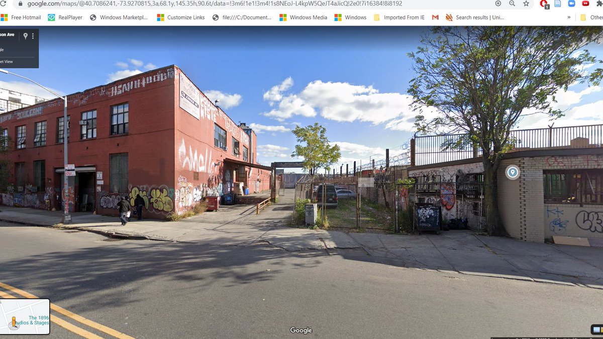

The section from Greenpoint to the Bushwick Branch was abandoned sometime in the 1890s. The middle section of the route -- from the Bushwick Branch to the Bay Ridge Branch -- remained intact until 1939, after which it was progressively cut back from west to east through the '80s.
In 1956, a special fantrip on the line was run, which left us with some truly amazing (and rare) pix of the route. From:
trainsarefun.com/lirr/lirr_rdc.…
trainsarefun.com/lirr/lirr_rdc.…


Before I leave Bushwick (the last major industrial zone on our route 😭😭😭), I do think it's worth pointing out how NYC's deindustrialization interfaced w/ its decline.

NYC lost huge amounts of population in the 70s, but contrary to the popular narrative, that loss wasn't one simply powered by an exodus of white ppl (a process which had been underway since the 1950s)
but instead was one in which losses in NHW pop were, through that decade not counterbalanced by large inflows of POC -- whose immigration into NYC had been the driving force in demographic ^^ before/after the 70s.
There are a number of reasons why this took place, but one worth highlighting given where we 'are' in this journey is the massive deindustrialization experience by NYC in that time period. Good paying industrial jobs just...weren't available anymore.
Remember folks: NYC has lost more manufacturing employment from peak to present than the state of Ohio.
(a non-exhaustive list of other key ingredients in the reduction of POC arrivals in the 70s: massive shrinkage in the scope of & quality degradation in city services after the '75 crisis, poor/expensive housing options, bad transit)
Spot the NIMBY legacy:

Answer: the fact that the L train is underground here! The line was supposed to be elevated, but local property owners forced the PSC to built it below grade. #SEANYC
The rising trackways here once carried the Myrtle Avenue El to Downtown Brooklyn; the descending ones carry the M onto the Broadway (J) line at Myrtle Avenue. The Downtown Brooklyn leg of the line (much) predated the J link to the Williamsburg Bridge; here's the connection u/c


Important to today's discussion about the future of NYC's tax lien sales should be Koch's Housing New York plan of the 80s. From 1986 into the '90s, NYC renovated about 120k units of in rem housing + built 20k new as a part of a massive aff. housing push.

Funding for the program was diverse -- some renos were done in partnership w/ non-profits, some with NYS/CDBG money, some w/ private capex. Program was successful in improving the state of NYC's housing...
...though some (ex: innovations.harvard.edu/sites/default/…) have raised the q of whether the concentration of low income hhlds in n'hoods which had lots of in rem housing is good social policy.
As the maps in that doc show, units were disproportionately concentrated in the S. Bx, and parts of central and eastern Bklyn (Bed-Stuy, one of those neighborhoods, is in the Streetview pic)
Bed Stuy is also notable for having been the site of a relatively early gerrymandering suit, brought by local leaders against an electoral map that divided the neighborhood among 5 CDs, thus diluting the Black vote.
They won the suit, and the newly created NY-12 elected Shirley Chisholm.
IMO, the B38 is one of NYC's more fascinating buses. You'd think that a slow route largely duplicating the G wouldn't do so hot, but the line is busy enough to justify 5ish min all day headways (split across local and limited-stop variants) and articulated ("bendy") buses.

My explanation of its success: high frequency, a straight (rather than boomerang-shaped, as is the G's) route, an honest to god transfer with the J, and infinitely better subway connections in Downtown Bk => a strong contender for radial and hyper-local traffic.

Friendly reminder that NYC car volumes are, to a first approximation, flat through the day, and that the most urgent battles for mode shift thus need to be fought in the off peaks and over weekends--aims poorly served by 12 hour weekday buslanes like this one. #SEANYC

Nostrand and Fulton! Home to one of NYC's stranger express stops, big bus transfer crowds (wider sidewalks WHEN), and a ton of retail.

On the express station front: the IND had planned for Nostrand to be an express stop, but ended up making it exp, placing the express tracks through what was to be the station mezzanine. Gave the area this layout:

.@LIRR stopping at their Nostrand Avenue station (seemingly during a single track operation). One of NYC's best hidden 'transfers' is AC to LIRR here -- so much better than the Barclays walk or Penn.

h/t to @jeremyzorek for catching a lolzy typo in my earlier tweet: IND meant for Nostrand to be a _local_ stop.

This looks like a nice, if stroady, intersection, right? THINK AGAIN. If there is a (transit ops) hell, it's the trackage that lies under here. Folks, we've arrived at Nostrand Junction.

Nostrand Junction is one of the subway's more deeply frustrating and impactful routing-operations-infrastructure messes. Since the 1960s, trains from NYC's busiest subway trunks have been criss-crossing in front of one another, wrecking capacity and reliability across the city.
The issue was studied in the 60s, 90s and aughts, and yet it remains. Fixing the problem requires installing two new switches, and then swapping the 3 and 5 beyond Franklin Avenue. Sounds simple, but in a city as viciously anti-change as NYC...................
I've threaded this issue a number of times. Searching "nostrand" in my tweets should turn up a lot, for those curious to learn more of the finer points here. Suffice to say: if I had a magic subway wand, this would be among the first 3 things at which it'd be pointed.
If Brooklyn had a Main St, Flatbush Avenue would probably be it.

....and along that Main Street, one of Brooklyn's most important transit lines: the B41! It's a high frequency, decent productivity route, though one sorely in need of some bus priority treatments. #SEANYC


Scenes along Flatbush. #SEANYC


Now along Church Avenue, in the heart of one of NYC's Carribean-American neighborhoods.

On a most basic level, I think it's impossible to tell the story of NYC's rebirth (and crime decline! prospect.org/labor/immigrat…) without discussing immigrant groups who arrived from ~1975-1990. They contributed immeasurably to the city's comeback.
More broadly, though, I think communities like these also speak to modalities of life perhaps not confronted enough in discourse around urban social ecologies. Transnational identities and cultural ties have become an increasingly vital part of immigrant experiences
and inform a different relationship w/ space and place.
.@CarterSonnet also pointed out to me the ways in which transnational identities intersect with existing cultural syncretism/exchange (ex: Guyanese food's Indian and Chinese influences, or ethnomusicological links btwn islands) and create a sorta independent diasporic identity
I think that, especially in the case of NYC, there's also an important story to be told about culture moving in southwards to the islands as well -- you see that a lot in music
Duplex!

Now on Utica, heading south along the route of a subway line that's been promised to New Yorkers innumerable times over the past hundred years. An extension of this sort is once again under study, but at NYC construction costs chances of any construction seem minimal

Flatbush Gardens: a NYCHA property (which was called Vanderveer Estates under public ownership) which has now been converted into rentals for -- and I quote -- "young professionals priced out of Park Slope"
therealdeal.com/new-research/t…
therealdeal.com/new-research/t…

We need renter protections. We also really need Park Slope to build more housing!
Flatbush and Nostrand! The end of the subway, and one of the most important bus hubs in the boro. The station below the street here is one of the system's clearest examples of an unintended terminal; its narrow, U shaped platforms are a passenger flow and legibility LOL

mitigated only somewhat by the fact that the 2 and 5 are 'assigned' to one of the station's two tracks in order to make things clearer.
Bus service from here radiates all across South Brooklyn, pulling traffic from Canarsie, Flatlands, Mill Basin, Marine Park...
Correction! Flatbush Gardens was never NYCHA. H/t to @akgerber.
https://twitter.com/akgerber/status/1317318815194251264?s=20
Kings Highway: one of NYC's scarier roads. #SEANYC

Also is home to a weekdays-only SBS route. Which, ugh:
https://twitter.com/A320Lga/status/1316589027903115265?s=20
Now on the Marine Park/Mill Basin border, home to most of Brooklyn's census tracts with >50% car mode share. The built environment here should offer some hints as to why that's the case. #SEANYC


Kings Plaza mall -- a sizable job and activity hub at the edge of Brooklyn's marshlands. Lots of bus service converges here; I'd hope some future subway extension makes it here one day as well. #SEANYC
Floyd Bennet Field has always struck me as an ironic bit of infrastructure. When it was (barely) a commercial airport, it was seen to be a poor facility thanks to its distance from NYC proper. In order to keep travel traffic in NYC, LaGuardia decided to build...LaGuardia!

Once completed, FBF became a strictly military facility, one which was phased out through the 70s and 80s. The irony here is, of course, that New York's biggest airport -- JFK -- grew up even further from Manhattan than FBF.
A testament to the impact highways (and faster cars) had on perceived possibilities if there ever was one! (and yes, it was mostly about cars. I daresay that pre-jet age, or even pre airline deregulation travelers were not exactly mass transit types)
Ending this trip just like I started it: driving the wrong way across a bridge. #SEANYC
https://twitter.com/A320Lga/status/1273986924684984320?s=20

The Marine Park bridge is among NYC's 25 movable spans. You'd think that this mostly sees pleasure traffic, but there's actually a decent amount of barge activity here to/from the fuel terminals associated w/ JFK. #SEANYC

Volumes through this channel would have been much greater if any of the "Port of Jamaica Bay" proposals had come to pass. Must say I'm glad, if even just from a coastal storm mitigation perspective, that this bit of tidal marshland was left alone. #SEANYC
untappedcities.com/2016/02/10/the…
untappedcities.com/2016/02/10/the…

Belle Harbor: a bit of small lot suburbia in NYC. #SEANYC

You wouldn't know it now, but this intersection was the site of a horrific plane crash months after 9/11. AA587 lost its tail (due to wake turbulence and poor corrective action on the part of the F/O) as it climbed out of JFK in November of 2001.

It plunged into the Rockaways, killing all 260 on board as well as 5 on the ground. The accident hit NYC's Dominican community especially hard; the flight was en route to Santo Domingo.
You get some interesting infill architecture in the rockaways...

Ah! The subway to the sea. This (incomplete) conversion of this former LIRR line to subway service in 1956 was the last major expansion of system coverage, and was one greeted with much fanfare but little ridership.

More on why it took place and why it was, to its planners, a disappointment later; for now, let's appreciate the irony of spending billions to build more airport transit in NYC when one of your best existing links -- this line's stop at Howard Beach -- sees 15-20 min headways.
(also allow me to plug my lil thread on one of my favorite ops-oriented subway investments: the construction of the broad channel spur, which serves the shuttle trains originating at the above pictured stop
https://twitter.com/A320Lga/status/1292576587616002048?s=20)
Thanks to the A's bad headways, long travel times to Manhattan, and somewhat poor location within the peninsula (away from the commercial corridor) the Q52 and 53 offer a strong bus alt across the bay and up to Queens Blvd. This is a fun ride, if ye followers ever have the chance

Hammels' Wye is (to my knowledge) the only place in the NYC subway system where you can move from a northbound track to a southbound track without changing directions, or traveling against the normal flow of traffic. #SEANYC


Under the Rockaway El. #SEANYC

Arverne. This area of gridded-but-never-built streets on the Rockaway peninsula is key to understanding why the subway ended up here at all.
In the '50s and early '60s, when urban renewal sentiment and money were at their peak, Robert Moses dreamed up a scheme to essentially relocate the urban poor to the fringes of New York.
Some of this was a matter of political expediency -- this was where it was easiest to build low income housing -- and some of it was a reflection of the already-impoverished nature of areas like the Rockaways and Coney Island
but equally strong was the exclusive vision of a car-oriented, modernist metropolis. There is an unmistakable 'out of sight, out of mind' mentality displayed in the proposed location of so much public housing at the city's watery edge.
To facilitate these developments, Moses did something unprecedented: encourage the construction of a subway line! Plans for the LIRR recapture had been on the books for a while, but Moses' support was critical in shepherding the project through to completion.
As the subway was under construction, Moses set about demolishing the bungalows that once lined the streets to make way for his towers. In some places, those towers eventually rose, but in Arverne, they didn't.
Arverne was one of the last areas to be cleared, and its urban renewal plan was approved only in the '60s, by which time federal renewal funds were beginning to dry up, and the planning aesthetic of NYC was shifting dramatically.
So, instead of 3,650 housing units, New York was left with streets through a field.
In recent years, this cleared site has begun to see development, as NYC's economy came back, and our chronic housing shortage pushes people ever outwards in search of a place to live. These pics show 2018 vs 1996.

In my eyes, Arverne's story encapsulates so much of postwar urban history. This is a place borne of a racist plan, shaped by the state's haphazard retreat, now being reclaimed by a more cautious, less led urbanism
-- all mere miles from the wealth of the suburbs, and mere feet from the dual threat and imperative towards urban growth that is the rising sea.
It's been a great journey, folks. I'm going to miss flooding your feeds with coal mines, dams, and urban landscapes.

• • •
Missing some Tweet in this thread? You can try to
force a refresh


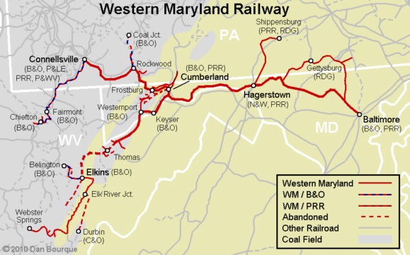
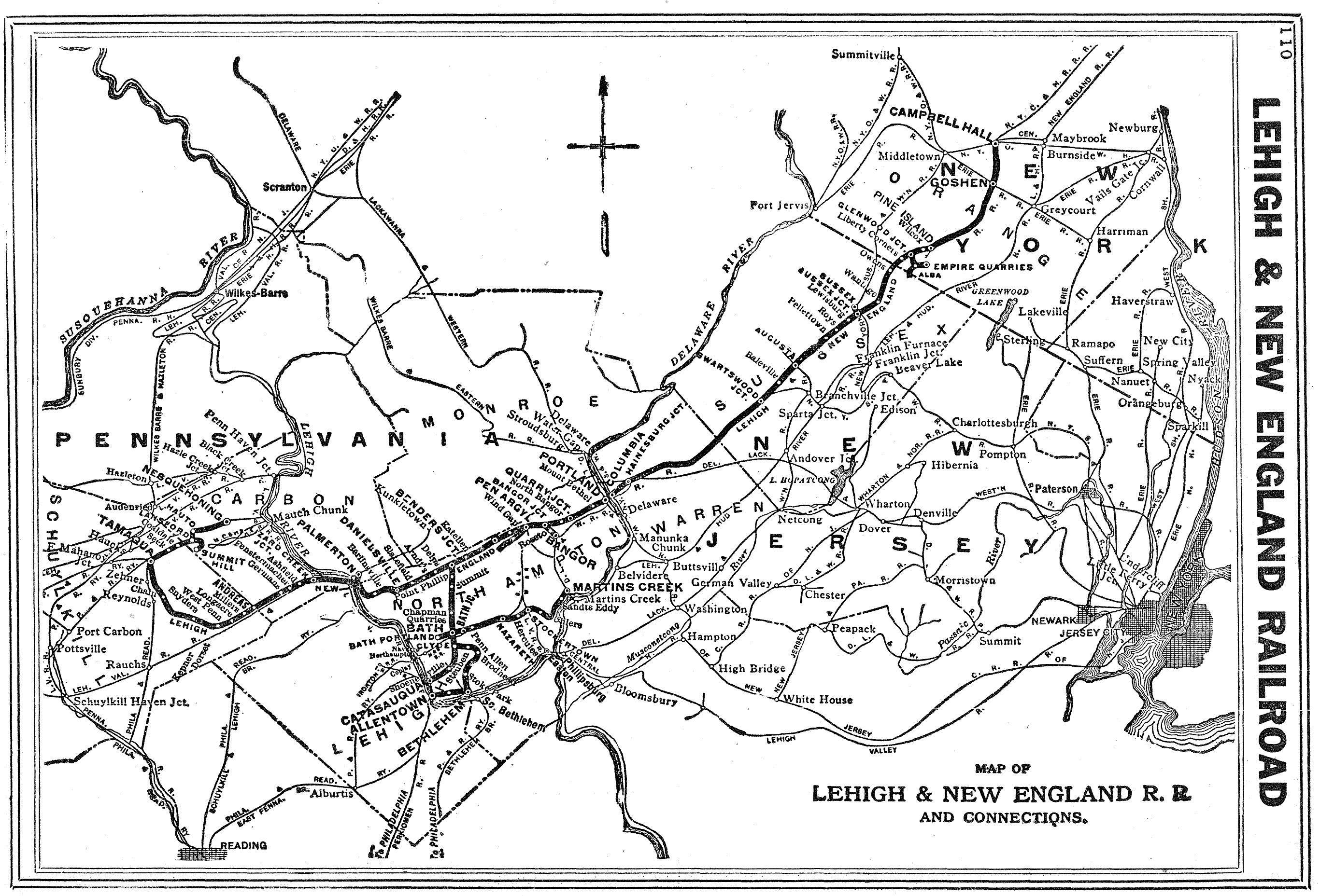
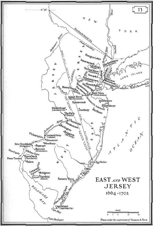
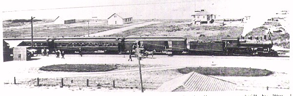
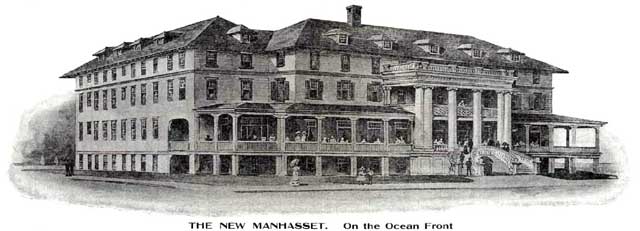