Let's play a collaborative game. Let's imagine the 15-MINUTES-CITY-OF-TOMORROW, where a large amount of white collars work from home.
In this game, I'm of course one of those lucky WFH people. We always are.
I will add a couple of scenes to the scenario, but please add yours
🕗I finally got rid of the necessity to commute downtown and I can wake up at 8AM!🥳Even from home, I'm a busy person and I still order food from outside instead of eating at the Prêt-à-manger downtown. It comes from a nearby café, but not so close b/c zoning doesn't allow it
🕛the guy that brings me the lunch is nice, but he doesn't seem to be living in our "urban village"... By the way, how does he come here, since we scaled down transit? Did I tell you that we moved out since we both needed more space to WFH? We used to live in a 2 Bdr before
🕠the kids are coming from school in their bikes. Remote learning seemed a thing in 2020 during The Pandemic, but we soon realized that nothing can replace the sociability of in-person learning. I heard that their teachers too are having a hard time moving around nowadays...
... and now add your scene from the 15-minutes-city-of-tomorrow!!
• • •
Missing some Tweet in this thread? You can try to
force a refresh
1/ There is not much innovation coming from Italy, honestly. My home country is generally a laggard.
But the recent overhaul of mobility planning started with the creation of PUMSs is, I believe, an exciting example of how mobility planning should look like. A thread.
2/ PUMS (Piano Urbano della Mobilità Sostenibile) - Urban Plan for Sustainable Mobility, is the new planning tool introduced in the Italian legislation in the past decade. All the 14 major metropolitan areas + cities bigger of a certain threshold must draw one.
3/ PUMS per se are not an Italian invention, but the Italian application of a mid 2000s EU "white paper" about planning and mobility and how it can contribute in the effort to curb GHG emission and improve overall quality of urban life through a better mobility.
1/ A first look at the summary of the Regional Transit strategic plan for Montréal just published for consultation by the ARTM: repensonslamobilite.quebec/media/default/…
2/ Unfortunately the first impression is Business as Usual approach. Apart some good news re fare integration and widespread implementation of bus corridors at the metropolitan scale, the structuring choices are just a copy-paste of existing projects: REM, ligne Bleue, BRT Pie IX
3/ The rest is just "advancing-studies-for-further-corridors put-further-by-political-instances-in-recent-years". That is not what a strategic plan looks like, sorry. Strategic planning means making clear mode choices, especially in the context of a climatic crisis
There is a bit of an ON/OFF thinking about the destiny of CBDs in a Work-from-Home postpandemic world. Either fatalism for the inevitable death of the downtown office tower or the refusal to think that some white collars working patterns might change after that pandemic.
That said, rushing now onto predictions of how much the WfH movement will continue after the pandemic (and when will the "after-pandemic" come) is a bit premature, honestly. It's like predicting the future of German cities under WW2 bombings.
Anyway, I would be a little less concerned by CBDs that would better fall under the "city center" category, i.e. a more diversified place with regional destinations for shopping, leisure, higher education, etc.
Most European cities and also a number of Canadian and US cities are
1/ After a recent exchange, here is a thread about the interconnectedness of global and local urban geographies of production and jobs and how they shapes mobility and planning with two Italian examples you never probably heard about : Mirandola and Porretta Terme
2/ The first example is Mirandola, a town of some 20k inhabitants is the flat lands, some 30km North of Modena. You'd probably know it better for being within the production area of both Parmigiano and the Balsamic Vinegar of Modena. But that somehow secondary.
3/The most important thing is that Mirandola is the main center of a cluster of biomedical manufacturing, accounting for more than 1 Bn of annual output, 70% exported, making it the world third largest after Minneapolis and Los Angeles. And that is a city of 20k that looks like⤵️
Geographies of jobs are an important factor that shape cities. The problem with some US-born theories about the evolution of job geographies is that they are too much based on US economic patterns taken as the blueprint of every global trend. They are not.
Aaron Renn's theory works well in the US: a country whose economy is based on large industrial/tertiary corporates, surrounded by a myriad of small service providers. Though, it explains less well urban job geographies in still manufacturing-rich areas, like S-Germany or N-Italy
Not every country went down the same path of completely delocalizing every manufacturing activity out of its borders, keeping the remainder on a lifeline of protectionism (Buy America). Economies are not just more/less advanced, sometimes are simply different. So are their cities
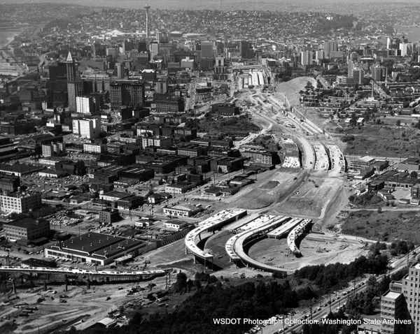
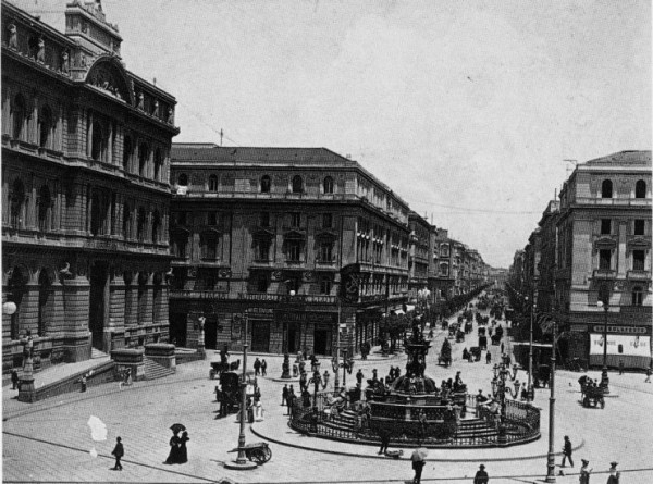
1/ What's in common between the two major urban interventions pictured below, a NA urban freeway and an Italian boulevard? Nothing apparently
Well, not really. Both interventions originated from the same logic of accessibility and resulted in the displacement of poor people
2/ You all know very well the story of US inner-city freeways, the way they were cut through poor, often minority's neighborhoods to increase accessibility of CBDs from the growing white collar suburban sprawl. No need to remind the logic and the results.
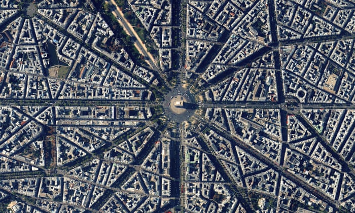
3/ Maybe lesser known is the opening of new thoroughfares in existing urban fabric that characterize part of the European urban planning in the second half of the 19th century. Of course, everybody knows Haussmann's Paris