Thread:
What do our aquifer's rocks look like, when dry?
What are the different aquifer types in India?
Here is an aquifer map of India by ACWADAM. The pink Indian Craton is the base, overlain by the green volcanics, blue sediments, & yellow alluvium.
<Gross Generalizations>
What do our aquifer's rocks look like, when dry?
What are the different aquifer types in India?
Here is an aquifer map of India by ACWADAM. The pink Indian Craton is the base, overlain by the green volcanics, blue sediments, & yellow alluvium.
<Gross Generalizations>

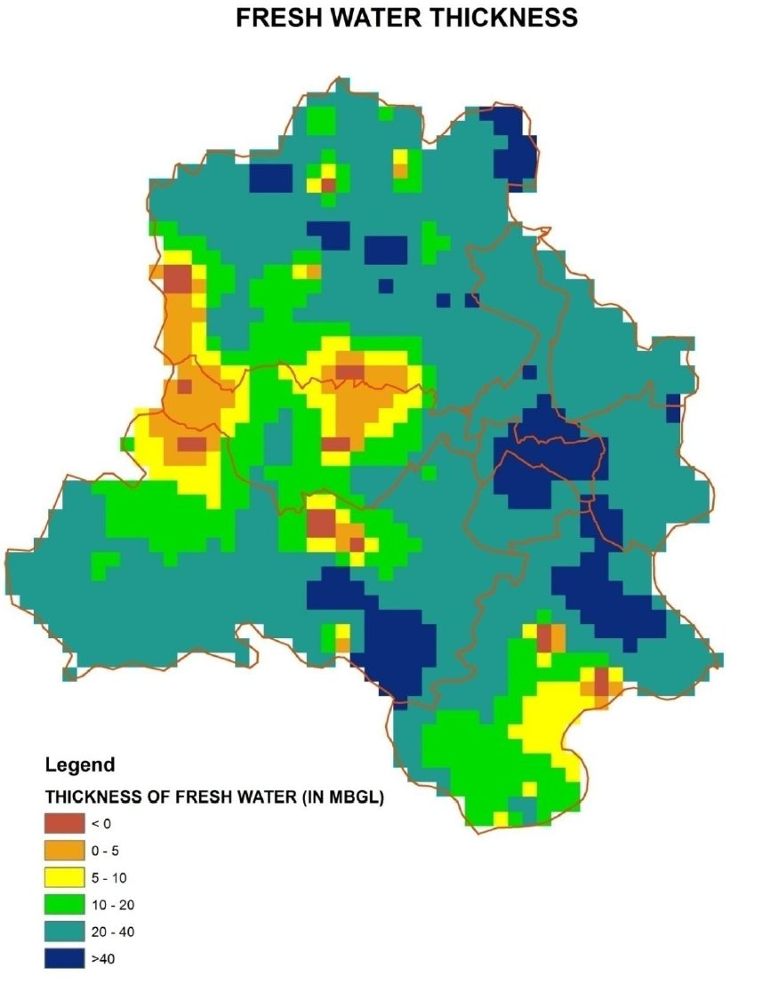
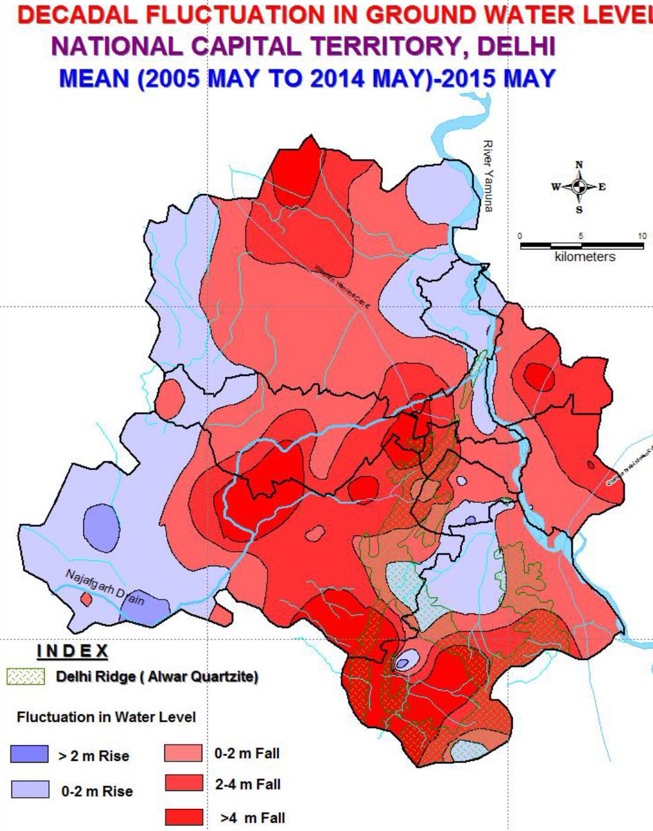
Indus-Ganga Plains aquifer is the most prolific, consisting of alluvium (गाद). The most recent, the thickest, the most porous, & most transmissive!
Contrasting other types, this is "soft rock". When saturated, ~10% is filled with water (CGWB).
Pic: Columbia University
Contrasting other types, this is "soft rock". When saturated, ~10% is filled with water (CGWB).
Pic: Columbia University
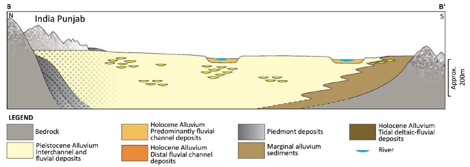
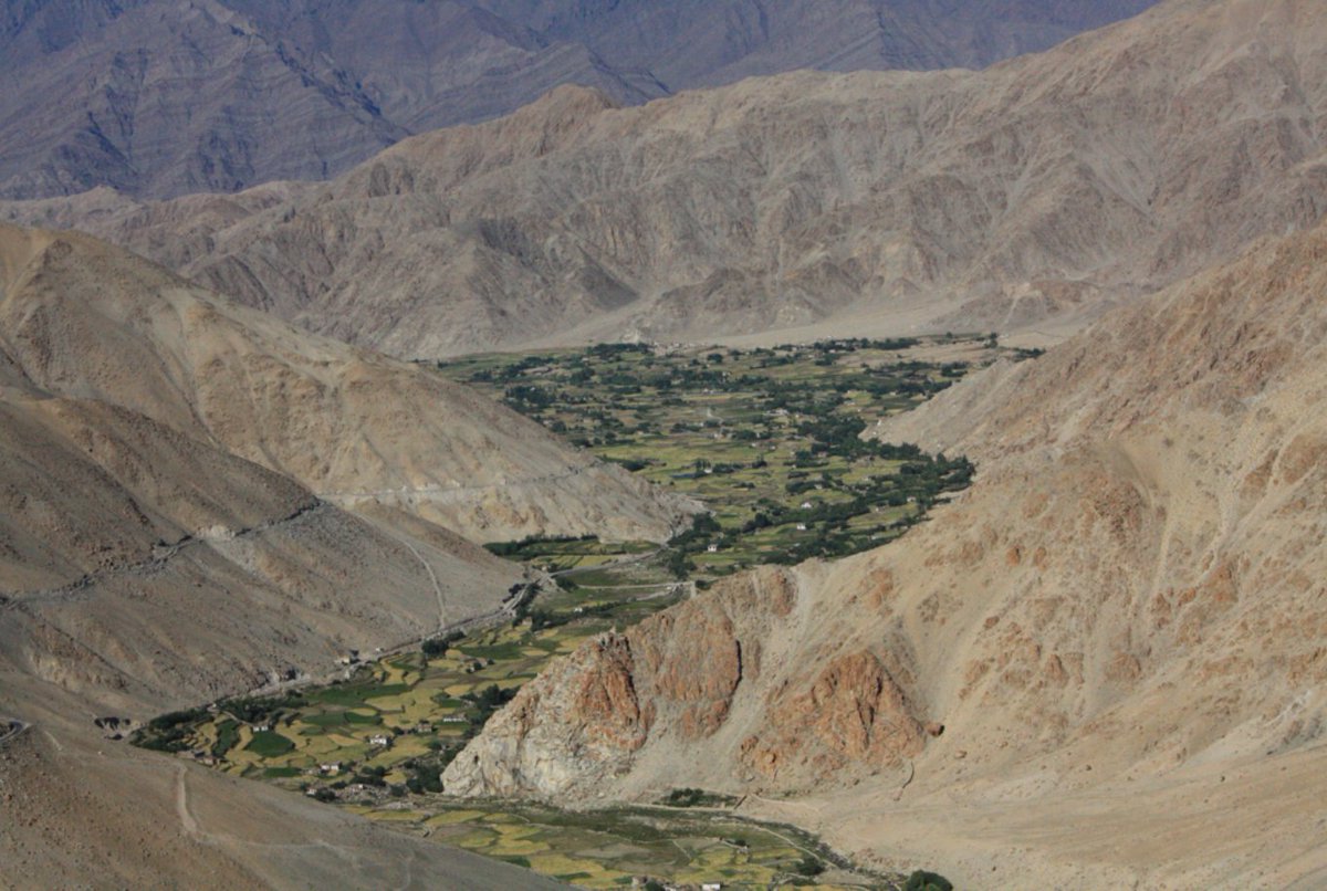
It's 15 million years old, 0.3% of earth's age.
Erosion of the Himalayas (left in pic) has been filling the basin between them & the Indian Craton (right).
While the aquifer is ~250m thick, deeper waters are saline bcoz of ancient seas and high evaporation.
PC: Bonsor (2015)
Erosion of the Himalayas (left in pic) has been filling the basin between them & the Indian Craton (right).
While the aquifer is ~250m thick, deeper waters are saline bcoz of ancient seas and high evaporation.
PC: Bonsor (2015)
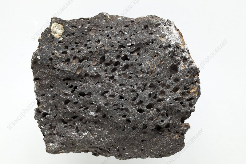
All green on the map is volcanic lava (~2 km thick) that erupted mostly around 65 million years ago (mya), 1.5% of earth's history.
While Basalt lava can be hard without pores (not an aquifer), it is often porous with ~2% space for water (CGWB).
PC: Science Photo Library
While Basalt lava can be hard without pores (not an aquifer), it is often porous with ~2% space for water (CGWB).
PC: Science Photo Library

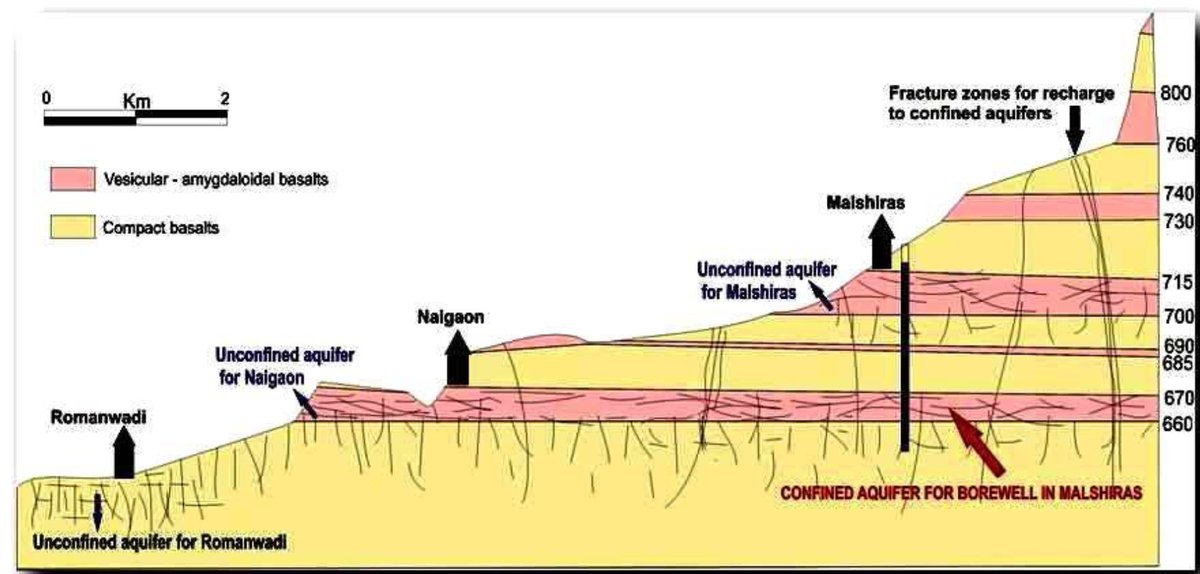
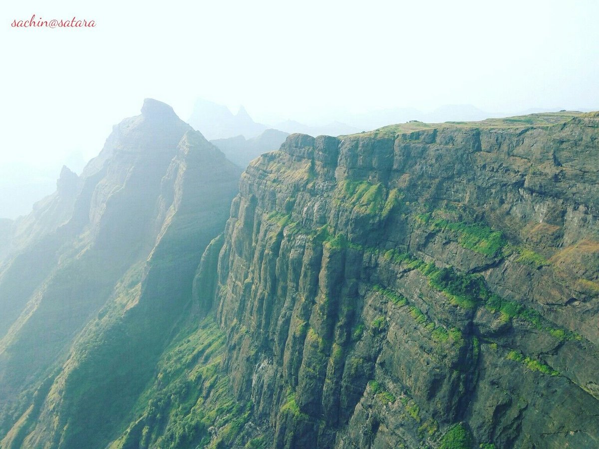
Volcanic systems often occur in layers of porous & non-porous basalt (1st pic: ACWADAM). Hit a porous layer & jackpot.
Layers near-surface are broken down to be more porous. Deeper layers have less space for water.
2nd pic shows 'Hanging Garden Springs', due to layering.
Layers near-surface are broken down to be more porous. Deeper layers have less space for water.
2nd pic shows 'Hanging Garden Springs', due to layering.
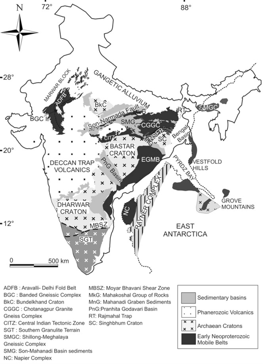
Pink on the map is the basement of India, exposed. Recycled many times, before becoming relatively stable 2500 mya, 55% of history.
There's innumerable variation in Peninsular rocks. But Peninsular Gneiss (last) is the quintessential rock.
PC: Dasgupta (2003), Wikimedia Commons
There's innumerable variation in Peninsular rocks. But Peninsular Gneiss (last) is the quintessential rock.
PC: Dasgupta (2003), Wikimedia Commons

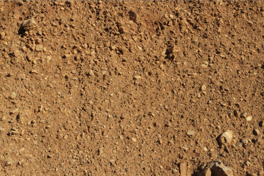
Peninsular rocks don't carry water unless weathered/fractured.
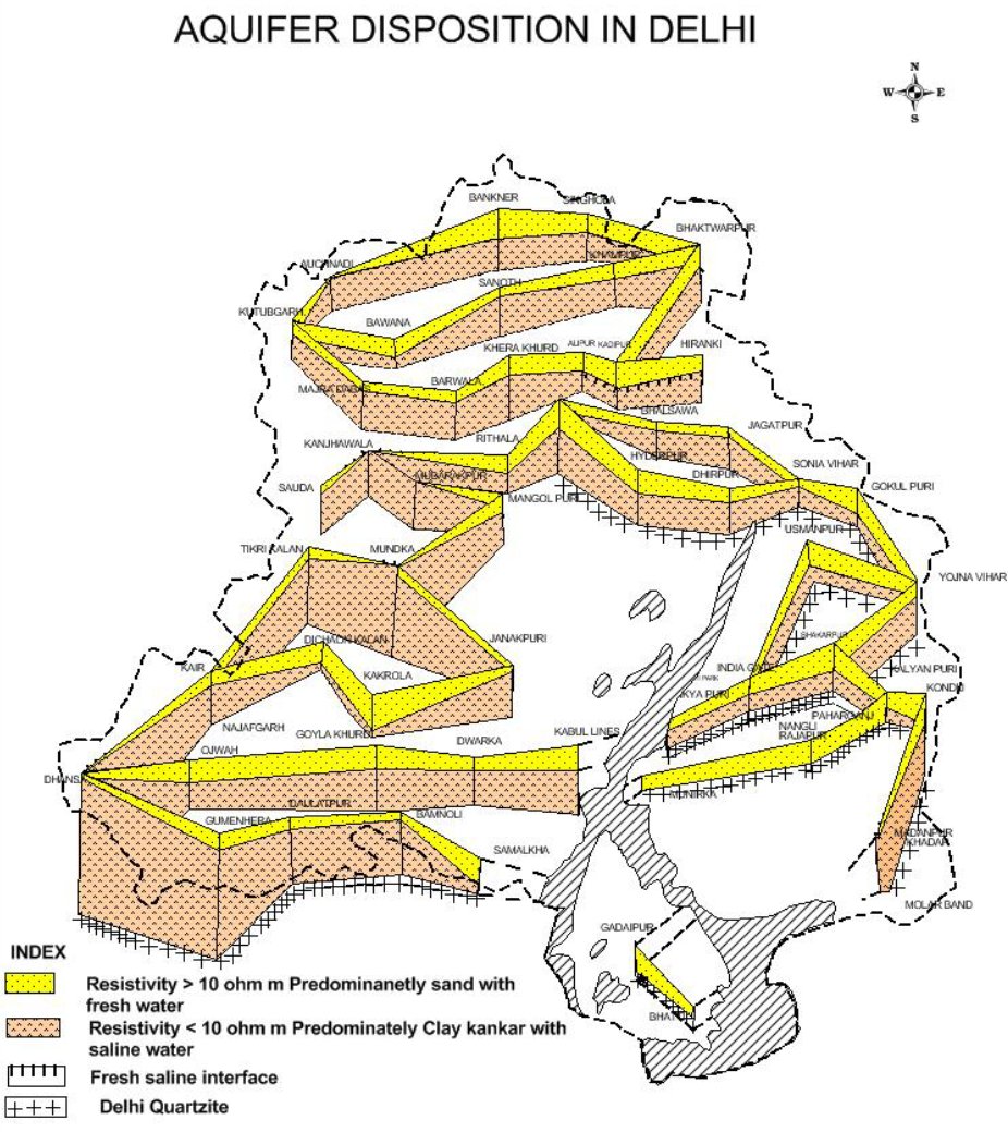
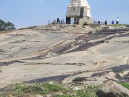
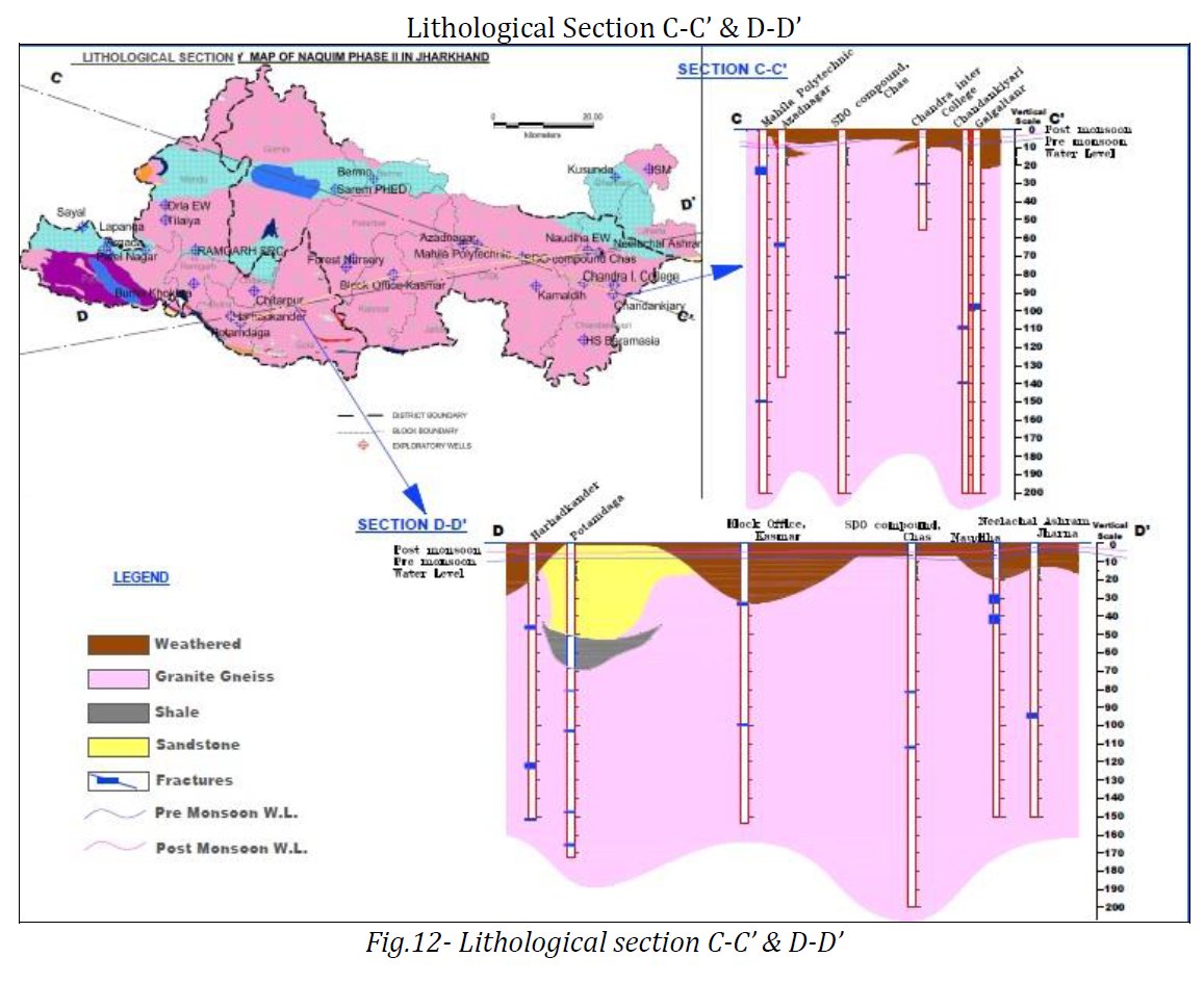
Two aquifer maps by CGWB:
Left: Devanahalli Block, Bengaluru. The Top + Weathered depth is 30m (typical)
Right: Ramgarh to Bokaro. Weathered till ~30m again. Yellow/Grey part of sedimentary typology.
Two aquifer maps by CGWB:
Left: Devanahalli Block, Bengaluru. The Top + Weathered depth is 30m (typical)
Right: Ramgarh to Bokaro. Weathered till ~30m again. Yellow/Grey part of sedimentary typology.
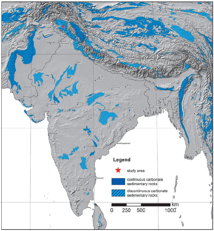
The blues are sedimentary rocks. The light blue are Gondwana sedimentations in valleys of Godavari, Mahanadi and Damodar from ~65 mya.
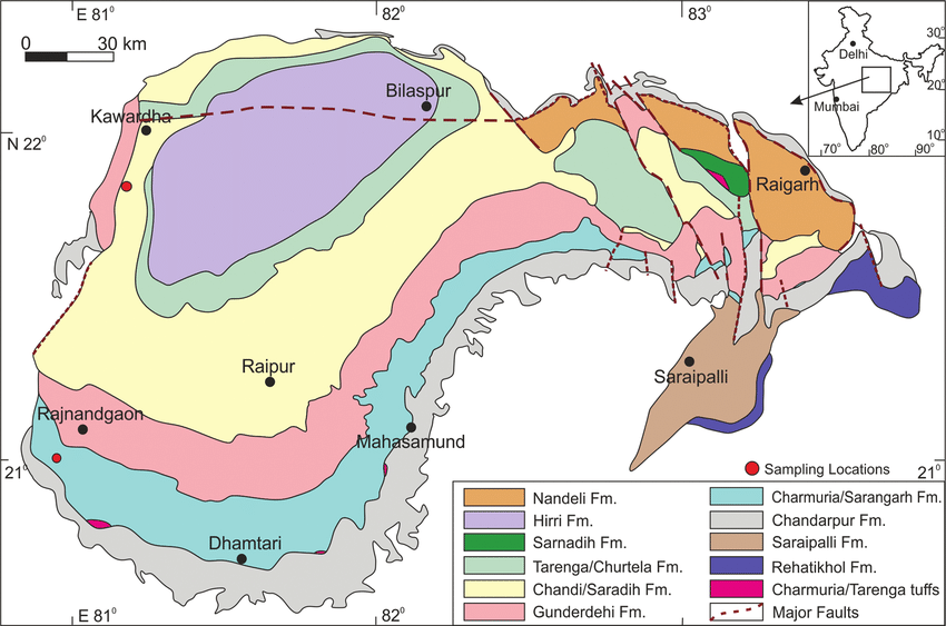
The dark blue are "Purana Basins" of Cuddapah, Chhattisgarh & Vindhyas from ~1000 mya. Most sedimentations are marine. Yes, seas came inland!
The dark blue are "Purana Basins" of Cuddapah, Chhattisgarh & Vindhyas from ~1000 mya. Most sedimentations are marine. Yes, seas came inland!

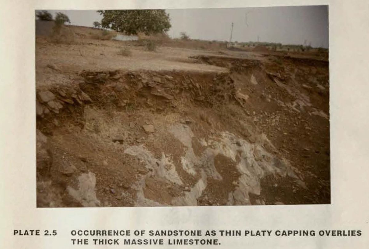
Trace the Chhattisgarh Basin from the above map to the one here, which has 6 layers of marine sediments over the Bastar Craton, like the Grand Canyon.
The Sandstone-Shale-Limestone layers have porosity of 1%-5% (CGWB) & constitute good aquifers.
PC: George (2019) & uncredited.
The Sandstone-Shale-Limestone layers have porosity of 1%-5% (CGWB) & constitute good aquifers.
PC: George (2019) & uncredited.
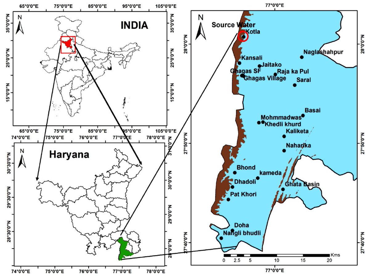
In the Himalayan and other hard rock areas, the valleys may be filled with alluvial aquifers, as shown to have great soft rock aquifers. These are not denoted in maps as the bulk of geology is "hard rock".
PC: ACWADAM
PC: ACWADAM
• • •
Missing some Tweet in this thread? You can try to
force a refresh