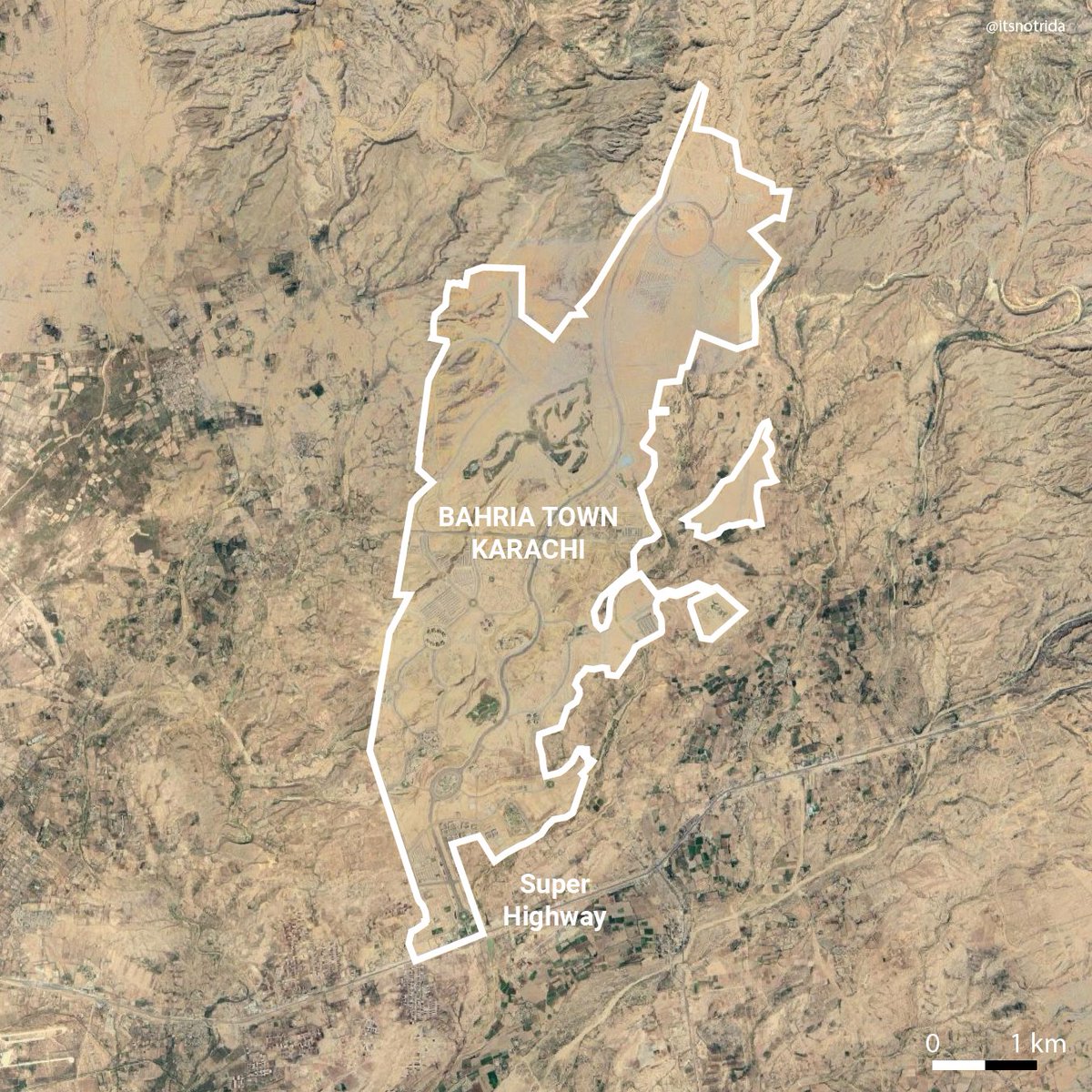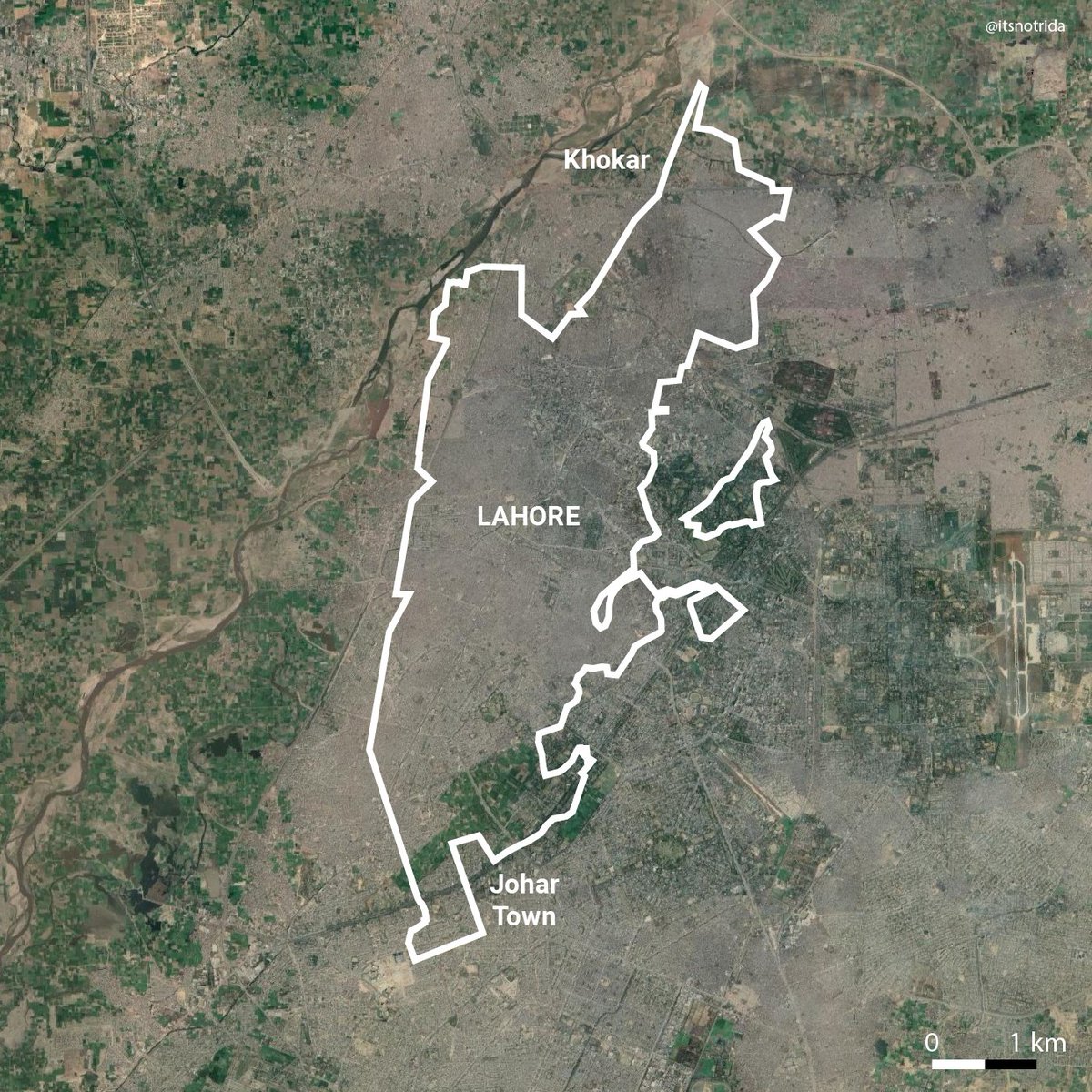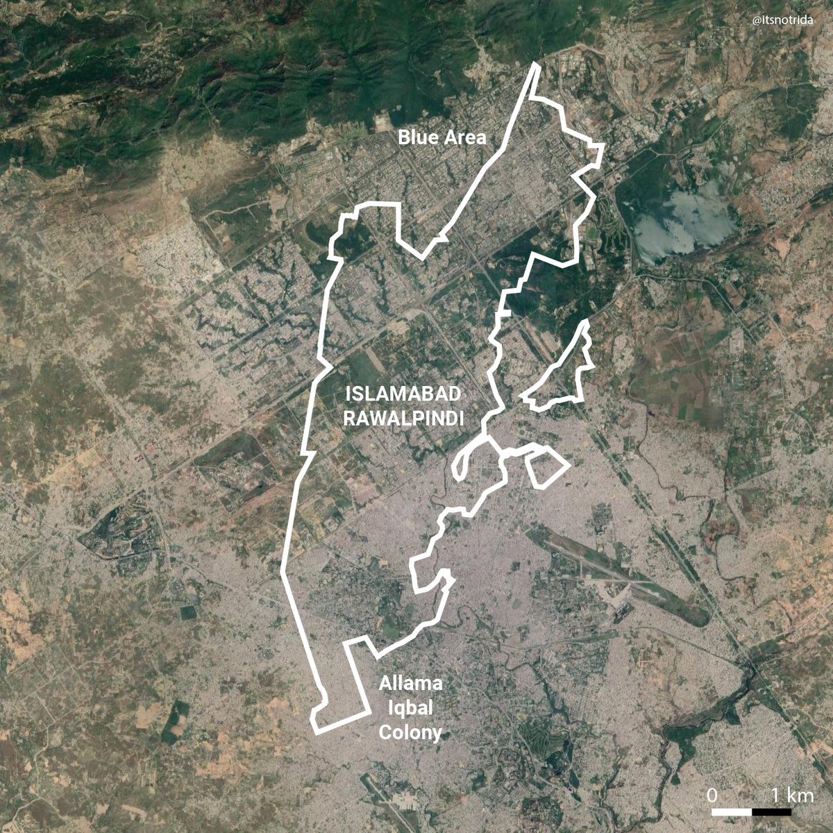
As requested, DHA City scale comparison with urban Karachi. It spans the length of North Nazimabad to Shahra-e-Faisal, Nazimabad to Askari IV.
Its been marketed as the first sustainable city of Pakistan, "self-dependent for water and electricity". Great. Some thoughts...

Its been marketed as the first sustainable city of Pakistan, "self-dependent for water and electricity". Great. Some thoughts...


The Master Plan is dominated by the same old luxurious single-family lot size at a time the world over is moving towards densified developments, mindful of resource scarcity accelerated by climate change. 

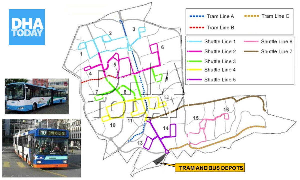
DHAC promises trams & articulated buses to reduce car culture. Meanwhile, the Malir Expy is funded to service DHAC from Karachi, facilitating car culture, increasing impervious surfaces, displacing people, during a climate crisis.
Schrodinger's sustainability.


Schrodinger's sustainability.


Does anyone have specifics of this transit plan? 13 trams in DHAC... who is the streetcar provider? Alstom, Bombardier, Zhuzhou? I am fairly salty that a new development gets streetcars before Karachi, but credit where it's due.
Another element that directly contradicts any mention of sustainability: a golf course. Look at the general topography in the satellite image. Try to grasp how much water will be required to create and maintain the lawns. In a city that struggles with water availability daily. 


The bar is low so I was happy to see that the Master Plan explicitly named the goths that are embedded within the development. Identity is integral to preservation. However, Goth Kareemdad is encircled within a theme park. Like a poor-village-people exhibit. Yikes. 


Another goth nestled between private luxury homes and commercial centres. The extremities in wealth inequity hurts. The silver lining is that they remain on their land. 


A recent relevant protest re: provision of basic services in DHA Karachi
https://twitter.com/UrbanPlannerNED/status/1350060240650326017?s=20
I part with a call to action: speak up and make city oriented discourse popular. Your voice does matter. Let's make maps, analyze, and hold accountable.
Many were asking of a how-to for GIS so here's a step-by-step tutorial for the scale comparison:
Many were asking of a how-to for GIS so here's a step-by-step tutorial for the scale comparison:
The scale comparison of Bahria Town:
https://twitter.com/itsnotrida/status/1345258161264066560?s=20
• • •
Missing some Tweet in this thread? You can try to
force a refresh


