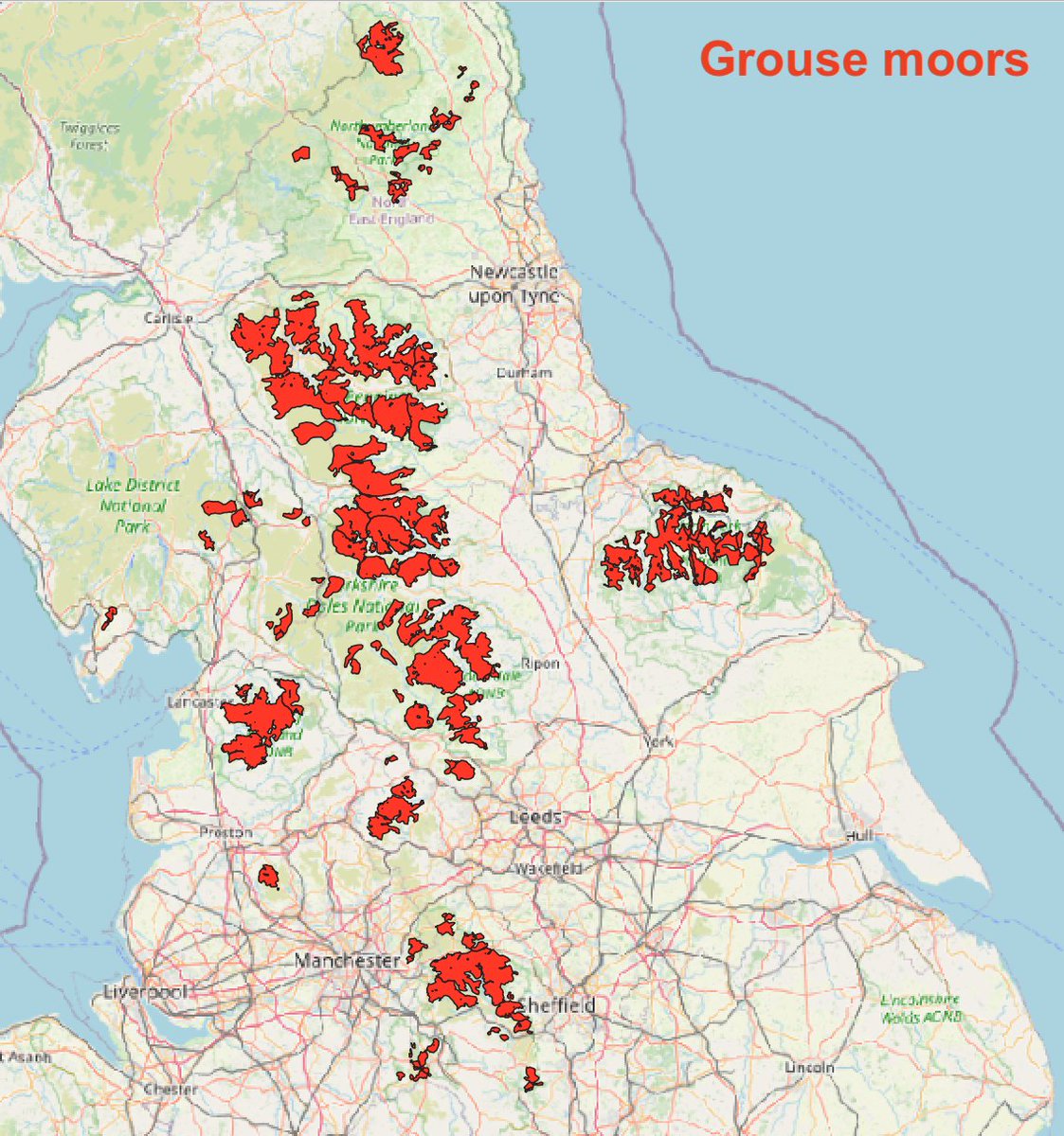
BREAKING: Govt finally announces legislation to ban moorland burning by grouse moor estates – but not before time, & the legislation contains some glaring loopholes that need closing.

Upland estates must end these damaging practices & embrace rewilding.

gov.uk/government/new…
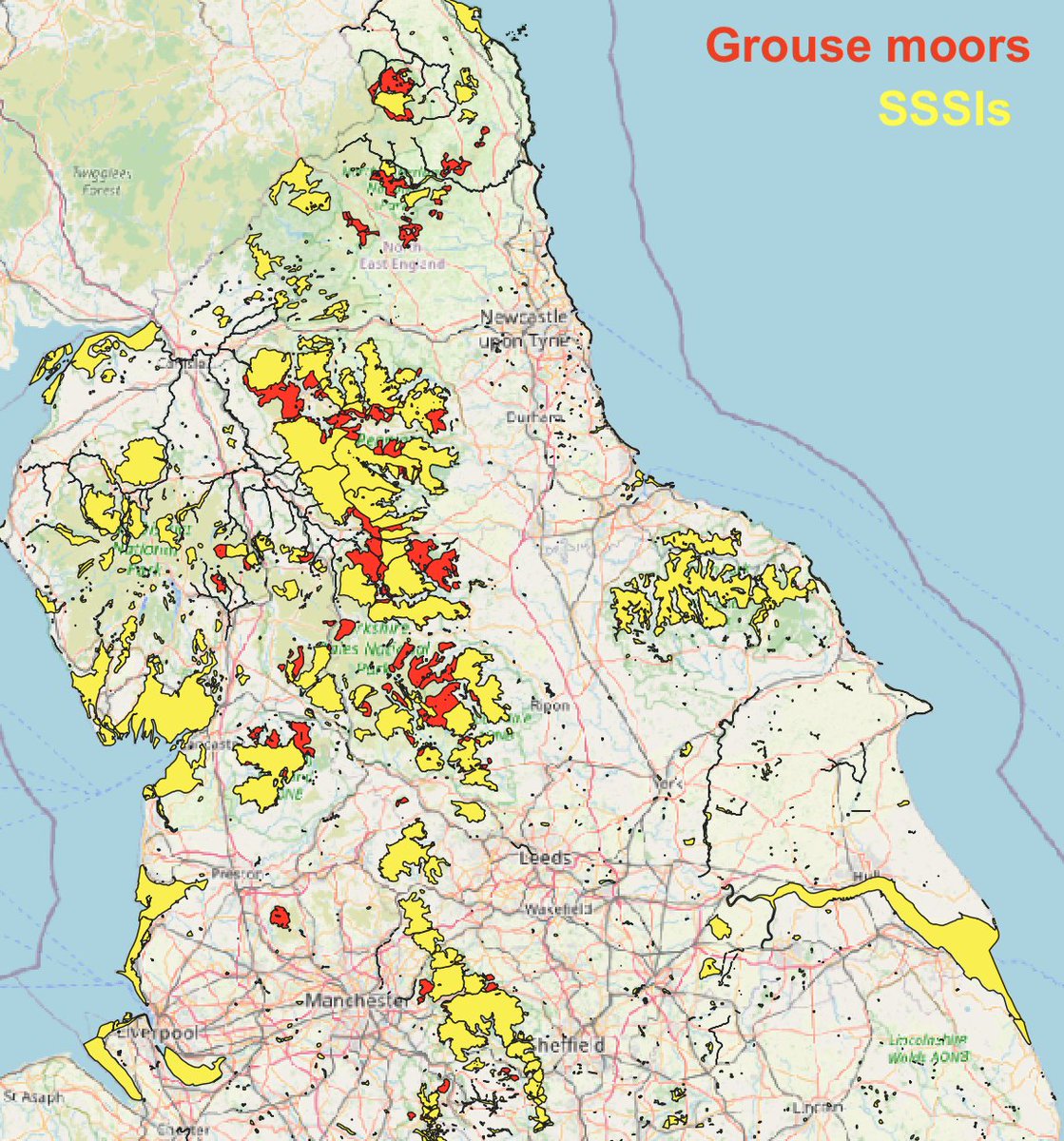
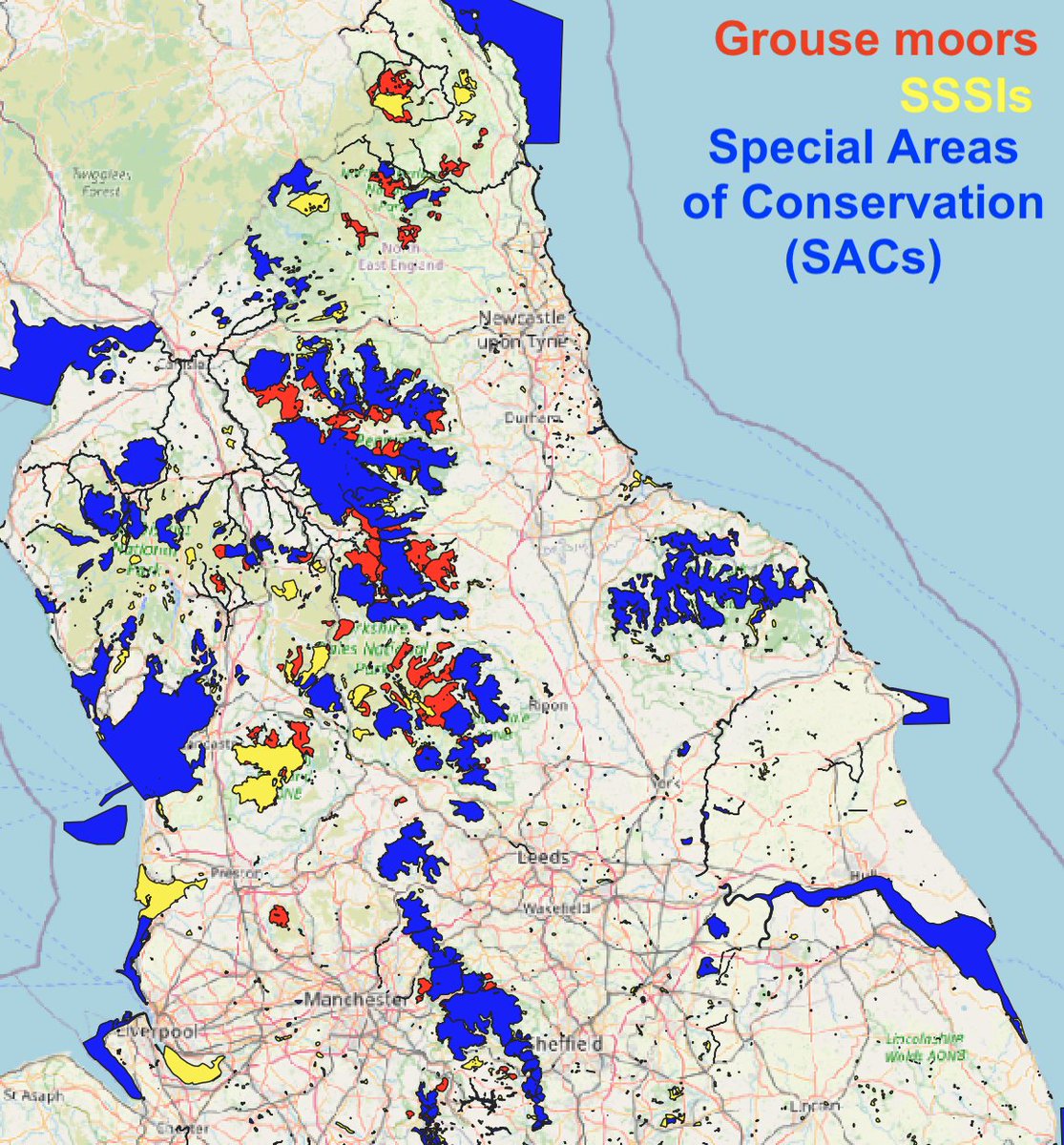
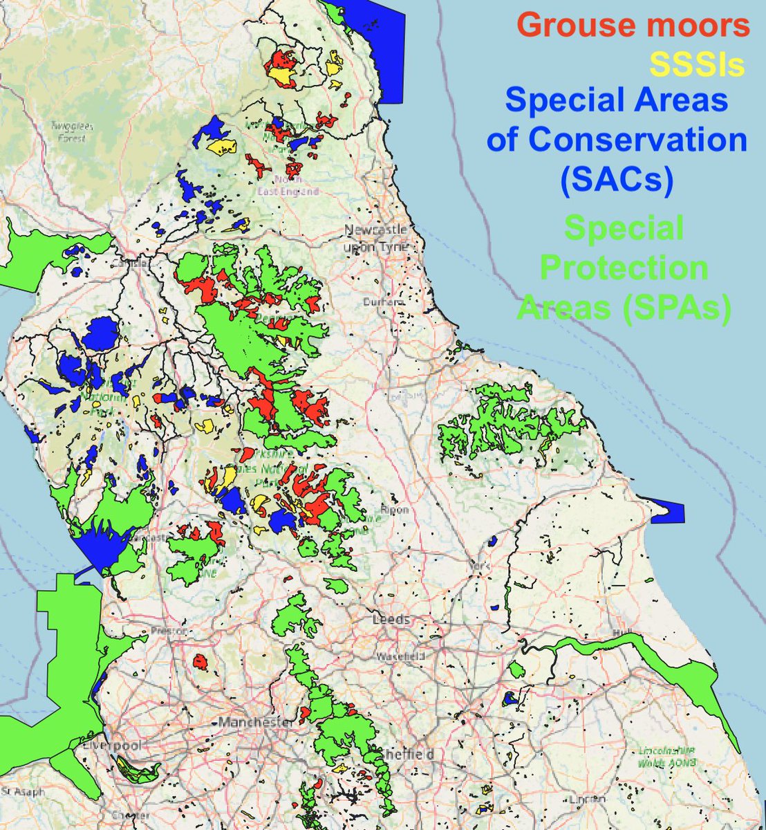
Some further thoughts (1/3): There are plenty of loopholes in there - burning only banned on peat 40cm+ deep, within SSSIs that are also SACs. Plenty of burning takes place on shallow peat outside of designated sites and is equally bad for climate & habitat.
(2/3): There's also a dodgy get-out clause allowing the SoS to issues licences for burning 'for wildfire prevention'. This is a contradiction in terms - healthy blanket bog needs water, not fire. Grouse moor estates create a tinderbox by burning & encouraging heather dominance.
(3/3): Despite all the caveats, it's a step forward that Govt has finally been forced to legislate to restrict moorland burning - despite all the lobbying by grouse moor interests.

England's uplands could be a much wilder, richer place if burning ceases & estates rewild.

• • •

Missing some Tweet in this thread? You can try to force a refresh
 

Keep Current with Guy Shrubsole

Guy Shrubsole Profile picture

Stay in touch and get notified when new unrolls are available from this author!

Read all threads

This Thread may be Removed Anytime!

PDF

Twitter may remove this content at anytime! Save it as PDF for later use!

Try unrolling a thread yourself!

how to unroll video
  1. Follow @ThreadReaderApp to mention us!

  2. From a Twitter thread mention us with a keyword "unroll"
@threadreaderapp unroll

Practice here first or read more on our help page!

More from @guyshrubsole

29 Jan
THREAD: How many grouse moor estates will the Government's (very caveated) moorland burning ban affect? I've been taking a look at some maps...

Firstly, here's a map of where grouse moors are in England, approximately - built by @beadyallen & me a few years ago.

(1/10) Image
Here’s where grouse moors are covered by SSSI designations (Sites of Special Scientific Interest). Many are; the red areas are grouse moors outside of SSSIs. This is the first criterion to be caught by the burning ban. (see gov.uk/government/new…)

(2/10) Image
And here’s where grouse moors are covered by SSSIs, Special Areas of Conservation (SACs) and Special Protection Areas (SPAs). Most are covered by all three nature designations. Areas in red show the grouse moors outside them.

(3/10) ImageImage
Read 10 tweets
11 May 18
Today @LouisaCasson and I visited Ulva, an island off the west coast of Mull, which was brutally cleared of people in the early 19th century. Back then its population was 600. Today its population is 6.

(A thread inspired by @gawanmac)
2/ Ulva is a wind-trammelled expanse of heathland, bog and deciduous forest reached only by a tiny ferry that you summon by sliding an old wooden sign to reveal a red flag.
3/ ‘Ulva’ is a Viking word meaning ‘Wolf’s island’. It has been inhabited by people since prehistoric times, who hunted the deer, and Neolithic remains have been found on the isle.
Read 16 tweets

Did Thread Reader help you today?

Support us! We are indie developers!


This site is made by just two indie developers on a laptop doing marketing, support and development! Read more about the story.

Become a Premium Member ($3/month or $30/year) and get exclusive features!

Become Premium

Too expensive? Make a small donation by buying us coffee ($5) or help with server cost ($10)

Donate via Paypal Become our Patreon

Thank you for your support!

Follow Us on Twitter!