THREAD: How many grouse moor estates will the Government's (very caveated) moorland burning ban affect? I've been taking a look at some maps...
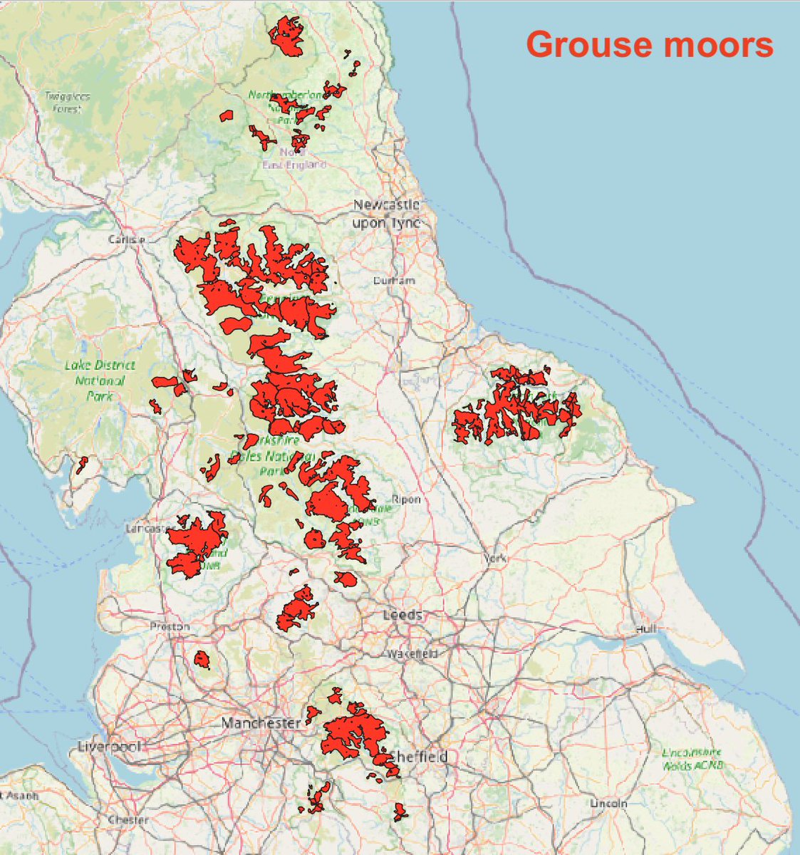
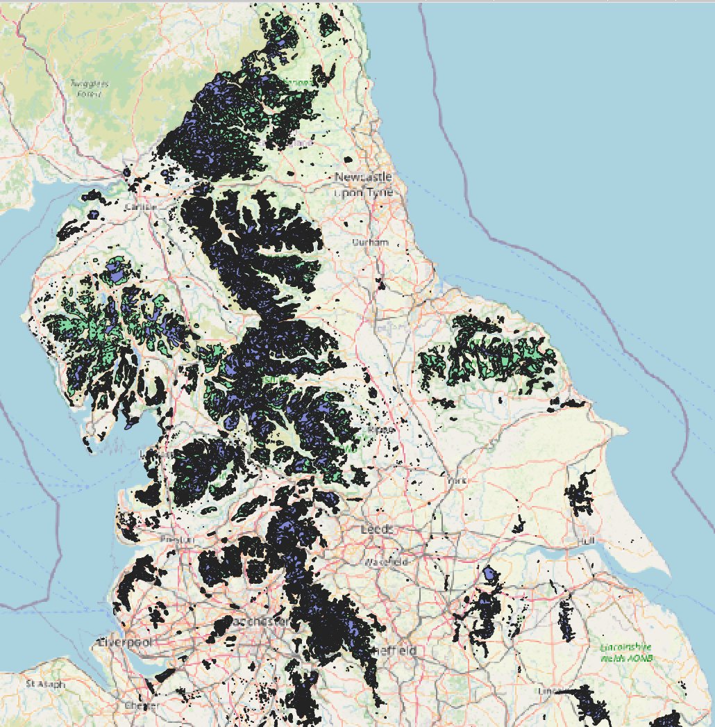
Firstly, here's a map of where grouse moors are in England, approximately - built by @beadyallen & me a few years ago.
(1/10)
Firstly, here's a map of where grouse moors are in England, approximately - built by @beadyallen & me a few years ago.
(1/10)
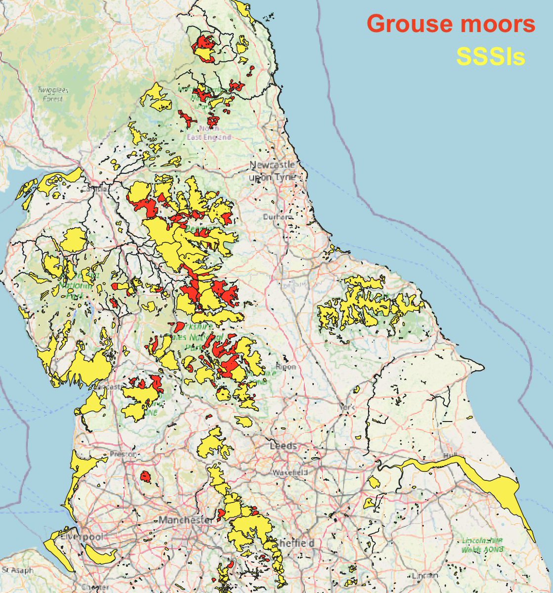
Here’s where grouse moors are covered by SSSI designations (Sites of Special Scientific Interest). Many are; the red areas are grouse moors outside of SSSIs. This is the first criterion to be caught by the burning ban. (see gov.uk/government/new…)
(2/10)
(2/10)
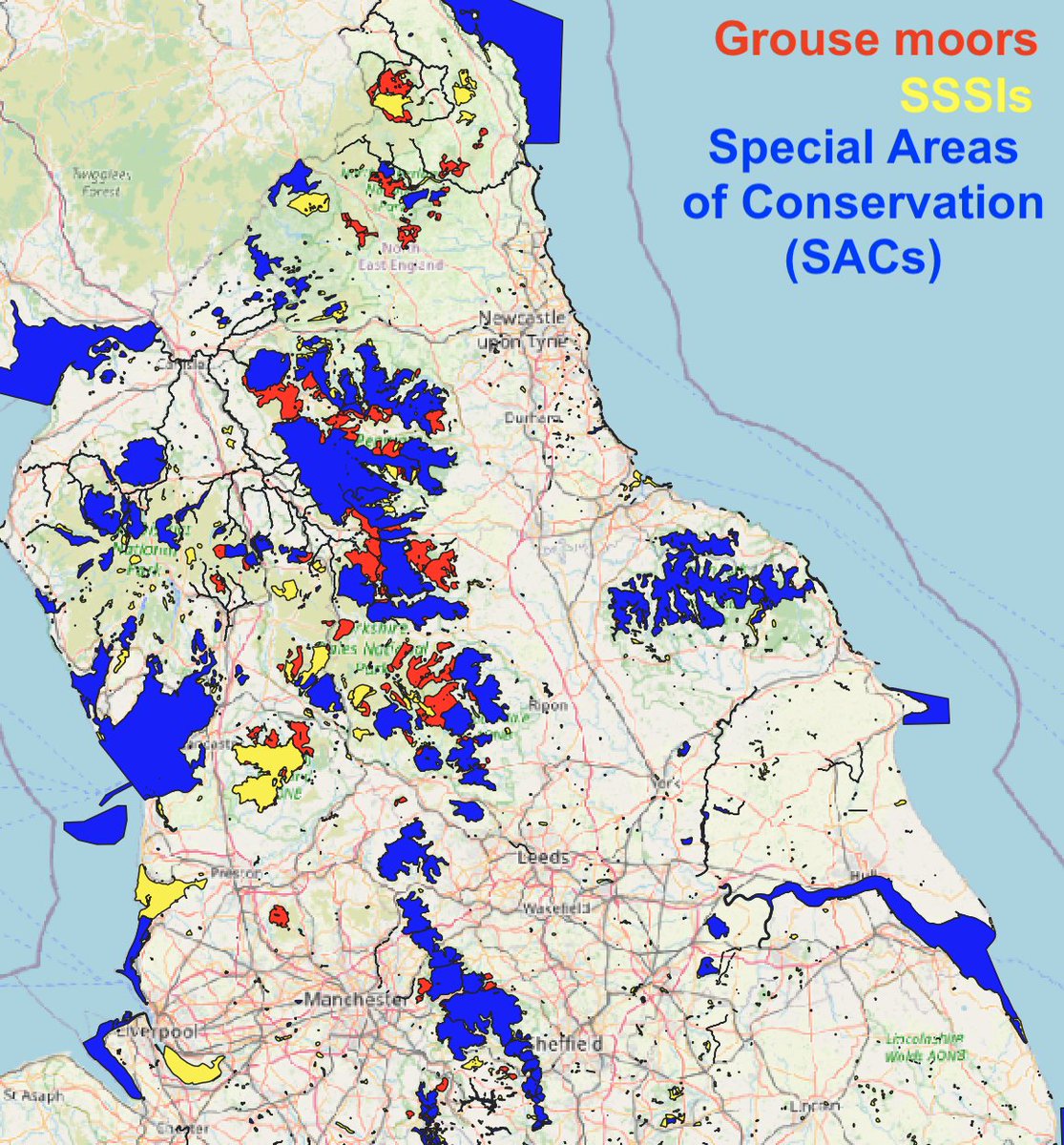
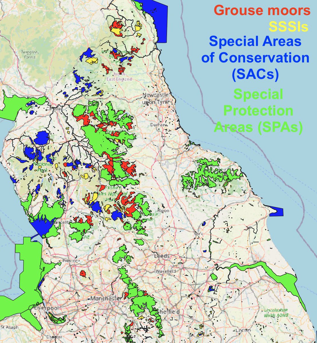
And here’s where grouse moors are covered by SSSIs, Special Areas of Conservation (SACs) and Special Protection Areas (SPAs). Most are covered by all three nature designations. Areas in red show the grouse moors outside them.
(3/10)

(3/10)
BUT WAIT! A further crucial criterion, if a grouse moor is to be caught by the Govt’s new moorland burning ban, is for it to be “on areas of deep peat (over 40cm depth)”.
Yet there is no published GIS map of deep peat, or of peat depth – just some grainy static maps:
(4/10)
Yet there is no published GIS map of deep peat, or of peat depth – just some grainy static maps:
(4/10)
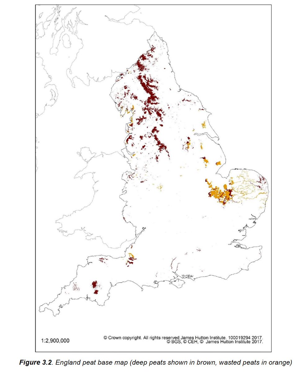
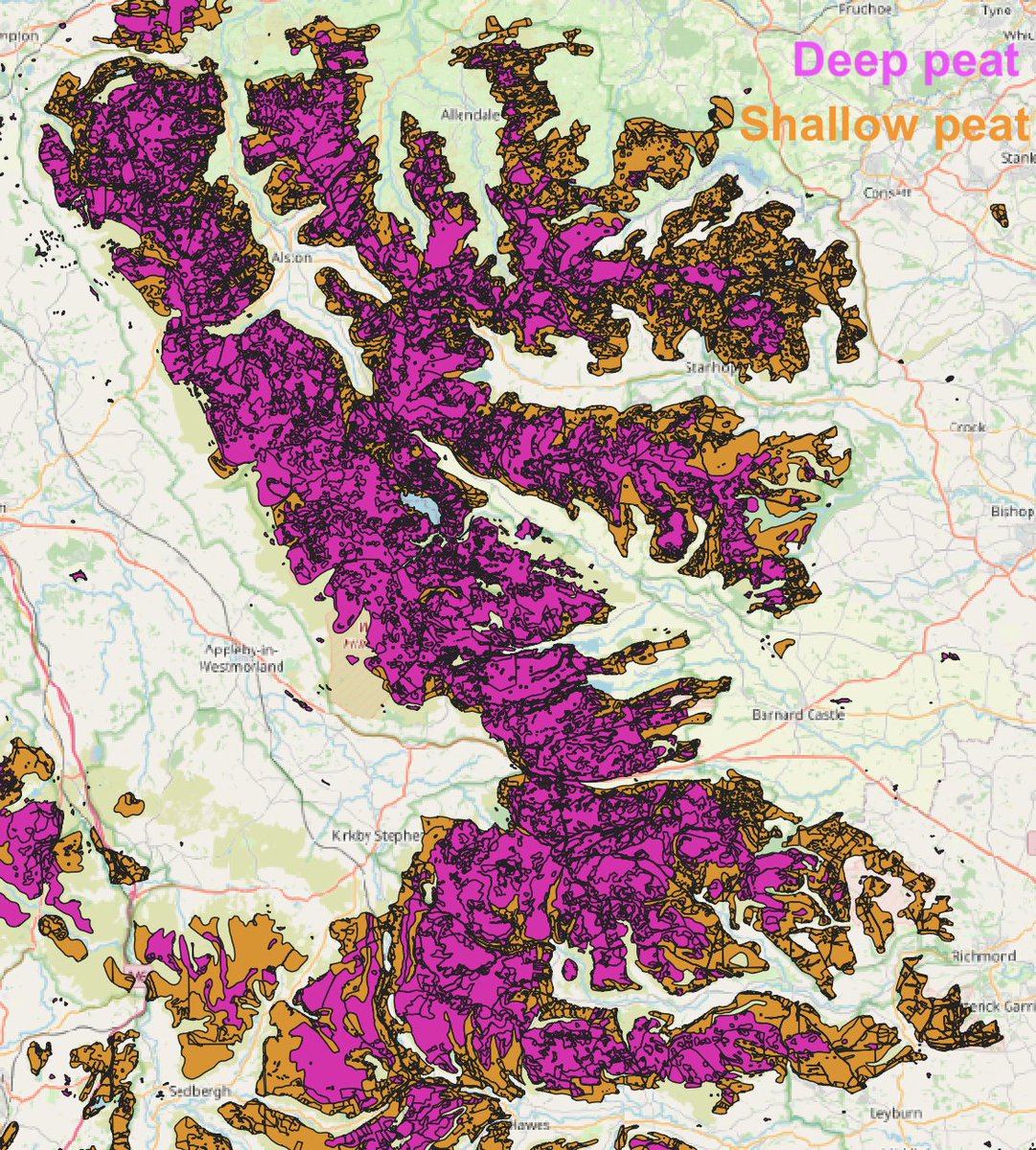
BUT FORTUNATELY… thanks to an FOI request I made to Natural England… I have GIS versions of these maps showing deep and shallow peat. 😏
Ta-daaah:
(5/10)
Ta-daaah:
(5/10)
If we look at grouse moors in the North Pennines, Yorkshire Dales, Forest of Bowland, Northumberland and Peak District, we can see that most of them are on areas of deep peat. Here's the North Pennines, for e.g.:
(6/10)

(6/10)
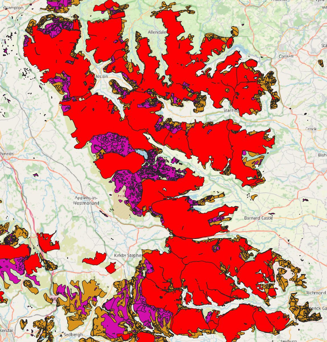
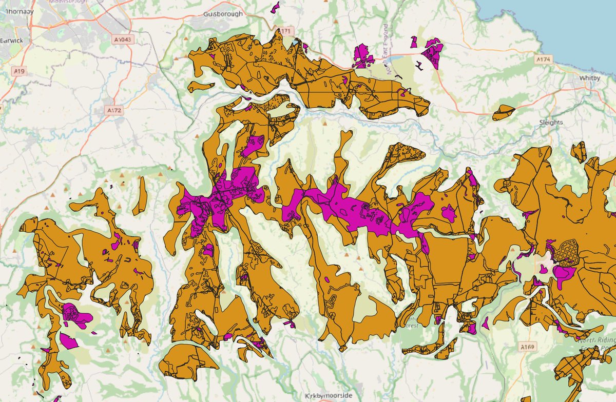
But if we look at the North York Moors – most of the grouse moors that dominate them appear to be on mostly shallow peat.
Let’s be clear – burning heather on shallow peat is not good for the climate crisis either. The Govt should not be allowing it.
(7/10)

Let’s be clear – burning heather on shallow peat is not good for the climate crisis either. The Govt should not be allowing it.
(7/10)
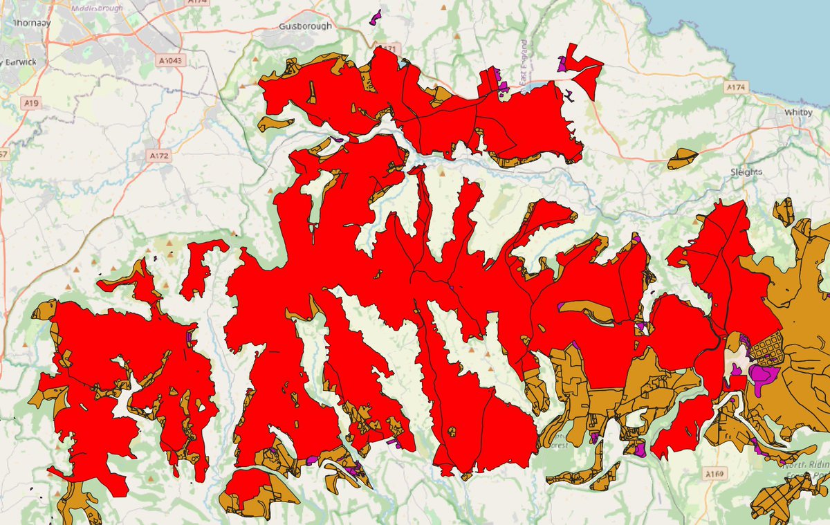
And let’s not forget the grouse moors that are outside of designated sites like SSSIs & SACs, but still like to burn their moorland – much of it on deep and shallow peat. This shouldn’t be happening either.
(8/10)
(8/10)
And of course, grouse moor estates have a ‘get out of jail free card’ they can play, if the Secretary of State gives them a licence to burn ‘for conservation purposes’.
This is a nonsense; healthy peat bogs need water, not fire.
(9/10)
This is a nonsense; healthy peat bogs need water, not fire.
(9/10)
So, who owns the grouse moors not caught by the Govt’s burning ban? Dear reader, I look forward to revealing this… soon. 😘
(Thread ends – or does it?)
(Thread ends – or does it?)
• • •
Missing some Tweet in this thread? You can try to
force a refresh


