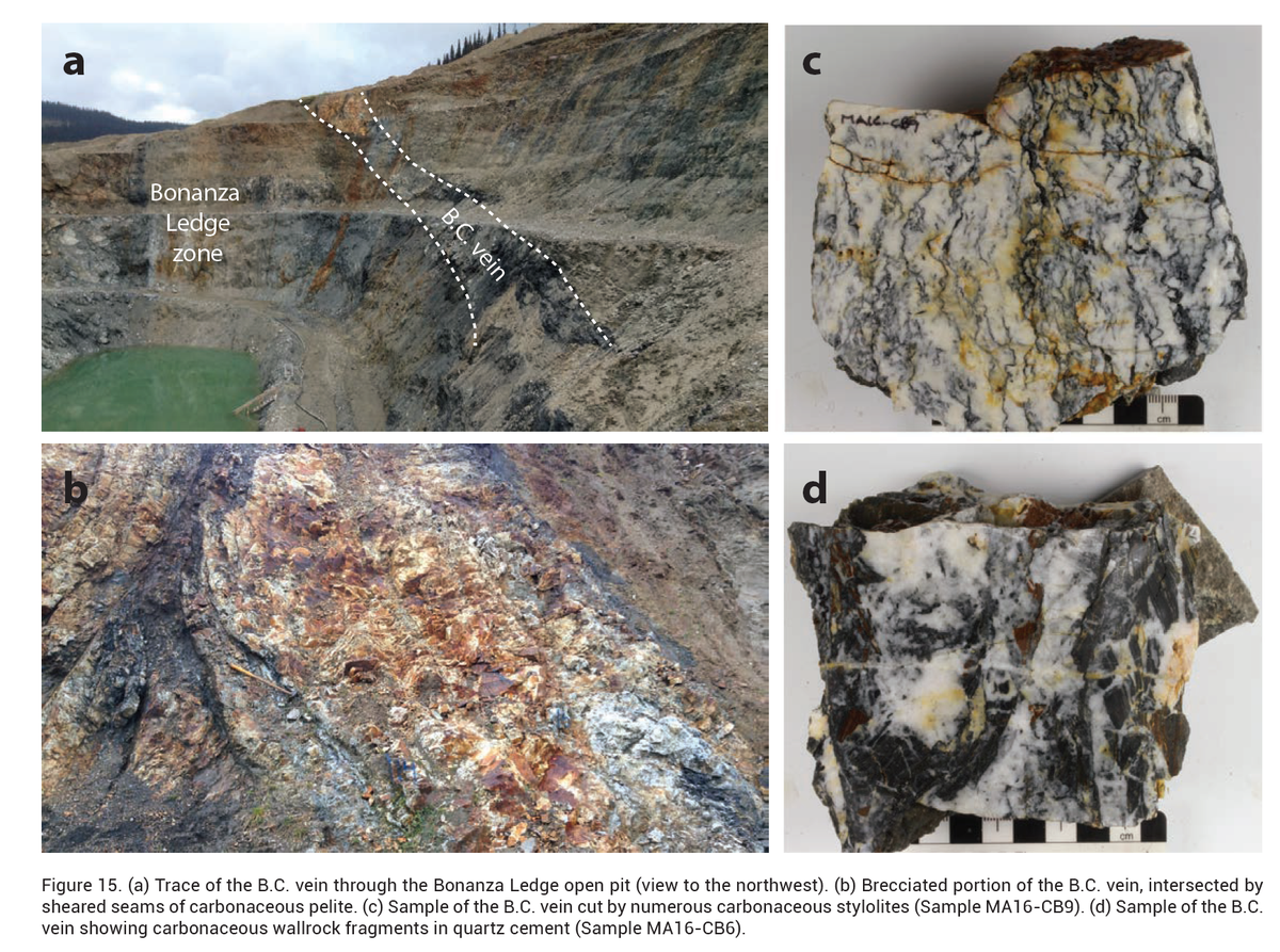
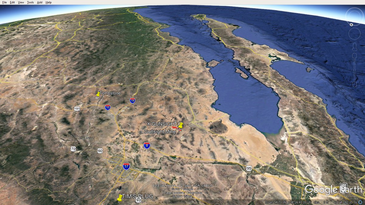
.@allanbreports I'm looking at the "GUNSIGHT" silver mine in Arizona. It's in the TOHONO O'ODHAM NATION property. Respect. The patented mining claims and patented mill site (with water) bring certain rights within the US legal system. I need special advisor @allanbreports ? 


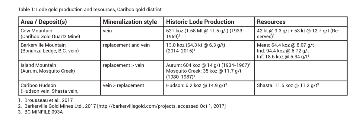
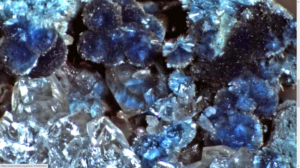
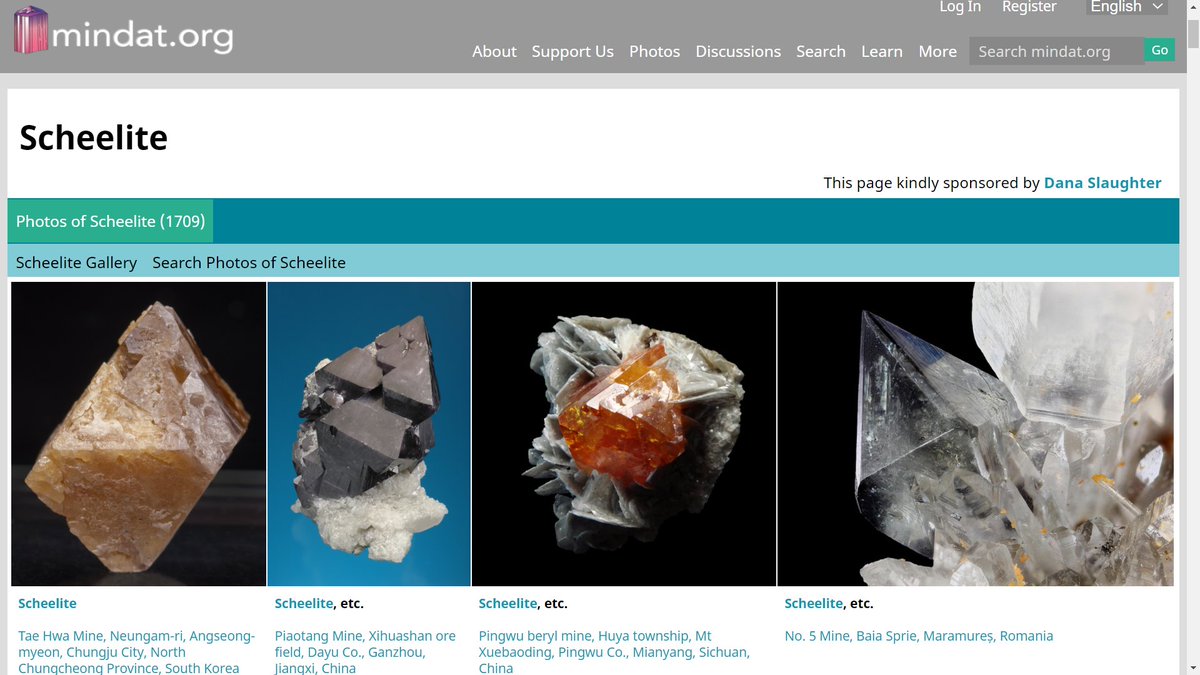
Shattuckite
Shattuck Mine, Bisbee
Cochise County, Arizona, USA Formula:Cu5(Si2O6)2(OH)2
mindat.org/min-3634.html
Morphology:Elongated prismatic crystals
Geological Setting:Oxidation zone in copper deposits
@allanbreports Arizona Copper Queen!
Shattuck Mine, Bisbee
Cochise County, Arizona, USA Formula:Cu5(Si2O6)2(OH)2
mindat.org/min-3634.html
Morphology:Elongated prismatic crystals
Geological Setting:Oxidation zone in copper deposits
@allanbreports Arizona Copper Queen!


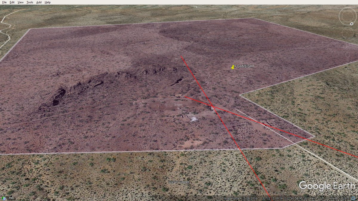
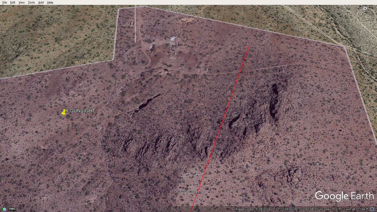
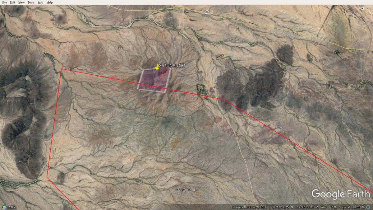
SONORAN DESERT, eh?


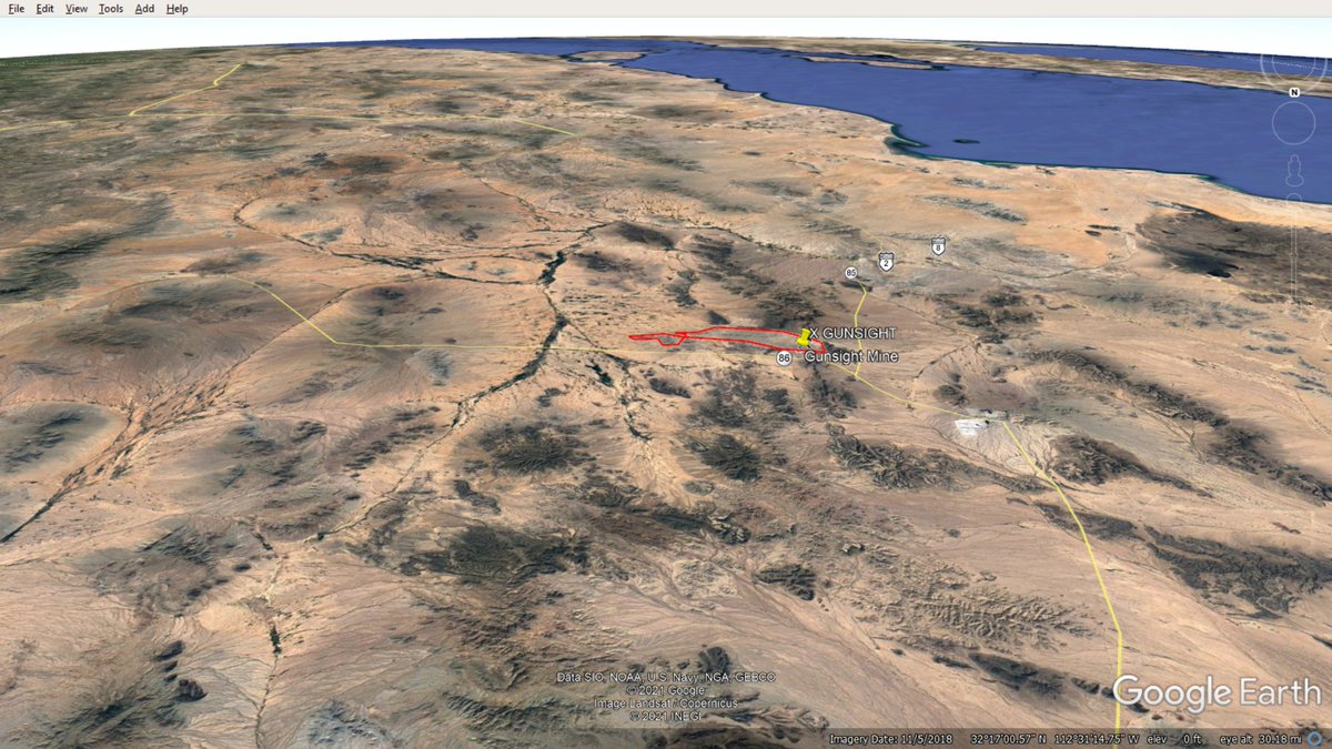
Maybe 1,500m from highway 86?


32°12'10.1"N 112°41'04.9"W
Looks like 1.5 miles from highway 86 to GUNSIGHT ridge. That's 2.5km highway to old GUNSITE MILL? Pretty nice location. And it has "water rights"?
Looks like 1.5 miles from highway 86 to GUNSIGHT ridge. That's 2.5km highway to old GUNSITE MILL? Pretty nice location. And it has "water rights"?


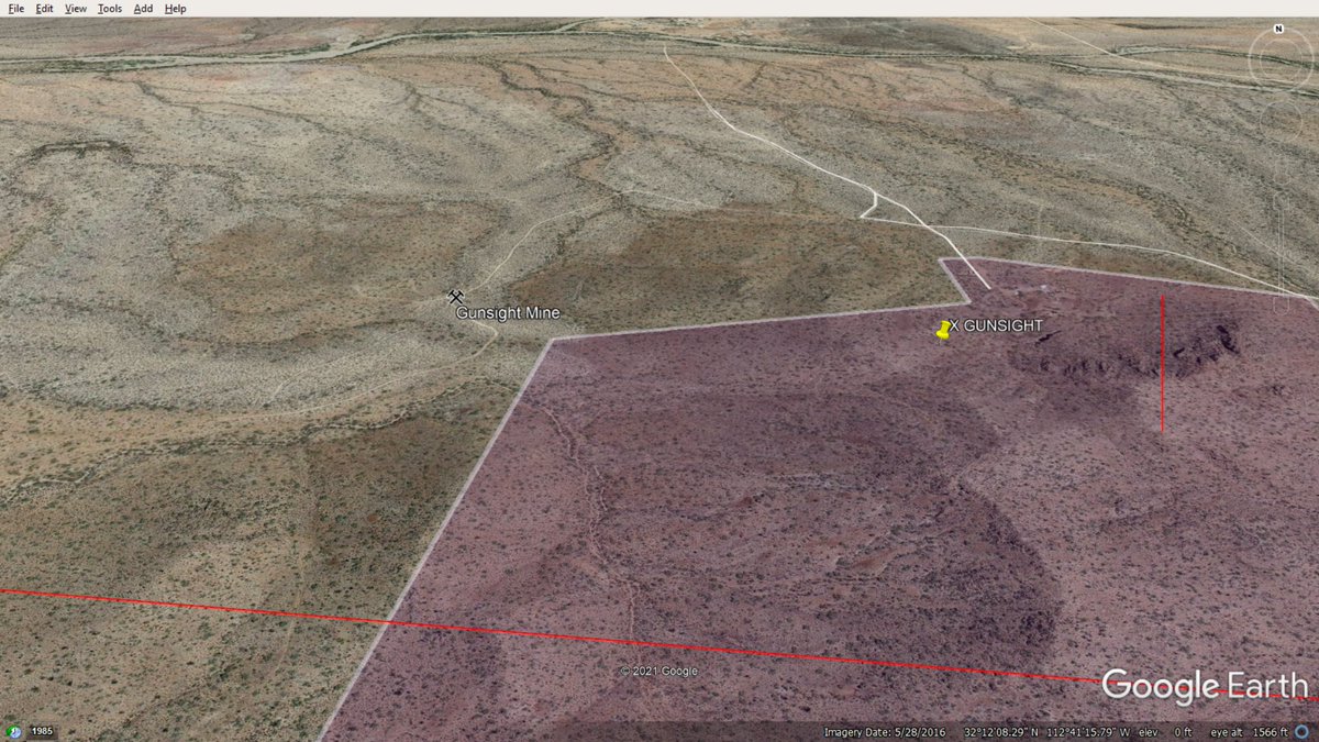
What does 8 mining claims and a mill site look like here? 150 acres?


Maybe?


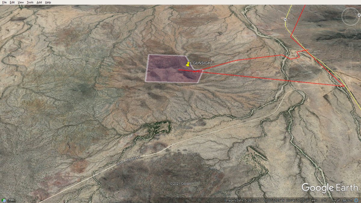

The AJO MINE open pit is +600 acres. 4x the size of GUNSIGHT SILVER claims? What does 500m of strike look like at my hypothetical GUNSIGHT location? The old timers did a good job of covering the ore body...


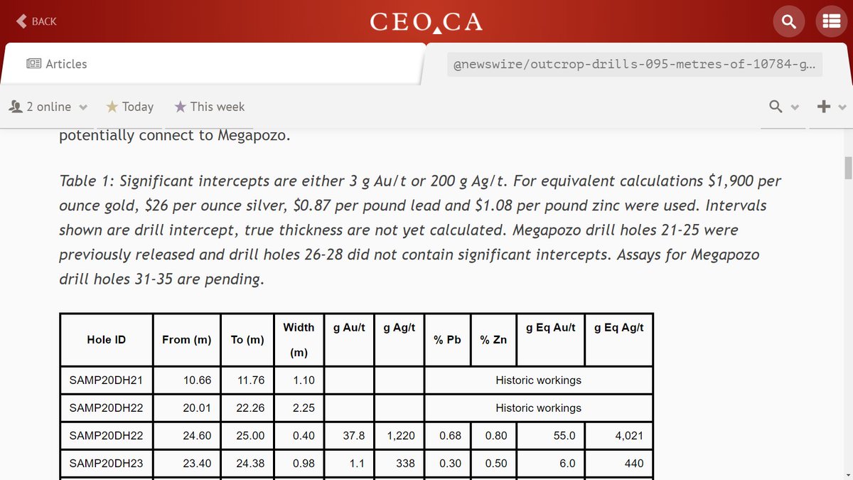
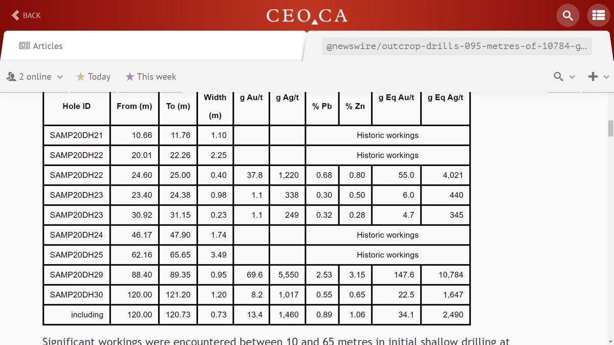
ceo.ca/@Newton/silver…
Is there an untapped market opportunity around premium mineral exploration ground in the USA covered by patented claims?
#NewtonDeals
Is there an untapped market opportunity around premium mineral exploration ground in the USA covered by patented claims?
#NewtonDeals

What does that look like here?
A little steeper than my first line, but in the same ball park...
A little steeper than my first line, but in the same ball park...


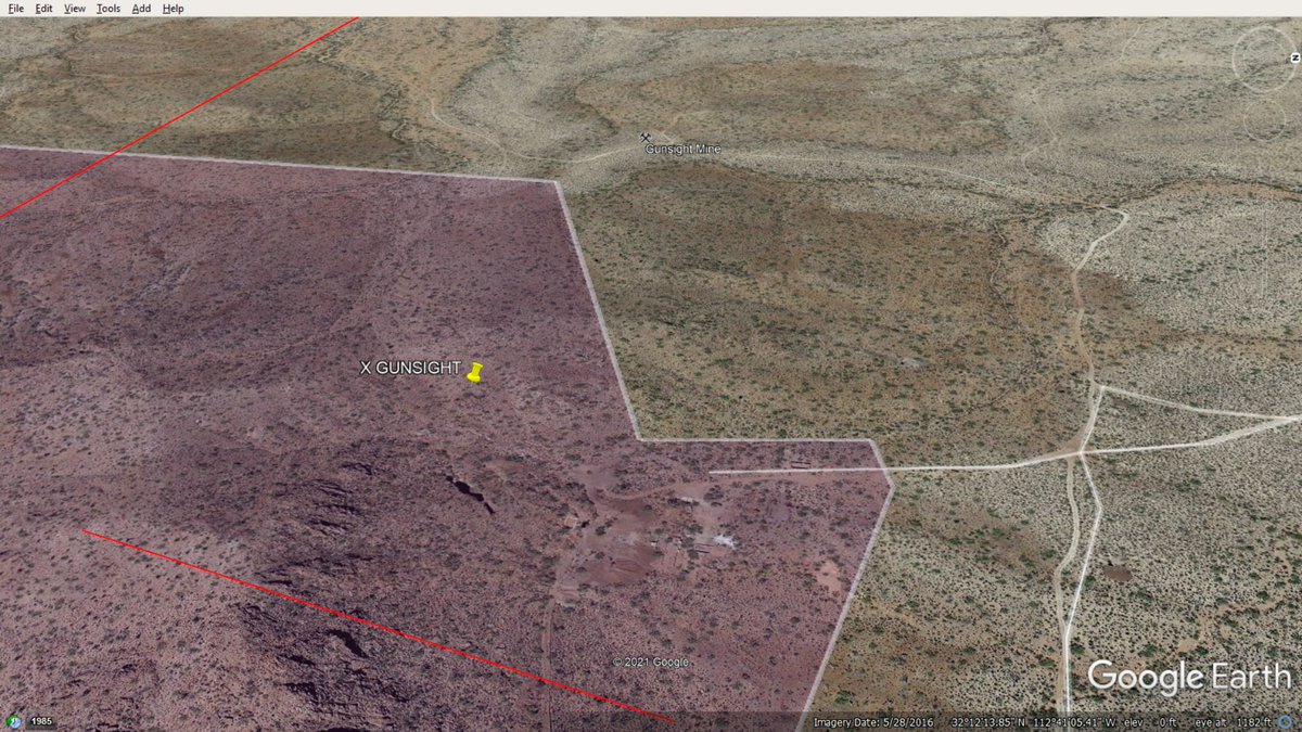
.@WillIrvine GUNSIGHT looks something like this. N25E strike as per USGS record.
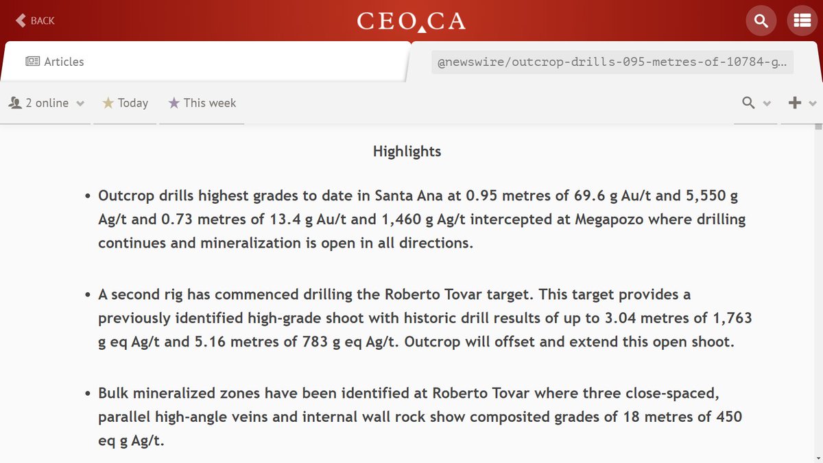
Development status: Producer
Commodity type: Both metallic and non-metallic
Deposit size: Small
Significant: No
Year of first production: 1881
Year of last production: 1965
@USGS hmm
Development status: Producer
Commodity type: Both metallic and non-metallic
Deposit size: Small
Significant: No
Year of first production: 1881
Year of last production: 1965
@USGS hmm
85 years of production is significant. High-grade is good.
(No tungsten mentioned?)
(No tungsten mentioned?)


Looks like GUNSIGHT mine is way "under-studied" ?

Valuation of patented claims? $NEE produced $300K profit per acre over 3 years mining from 200 acres patented claims? Ballpark?
$ORA has the PARA RESOURCES economic study showing $80M NPV. On c. 150 acres at the GOLD ROAD mine? Say $500K NPV per acre?
Big payoffs possible?
$ORA has the PARA RESOURCES economic study showing $80M NPV. On c. 150 acres at the GOLD ROAD mine? Say $500K NPV per acre?
Big payoffs possible?

How do you model an old mine? The $ORA GOLD ROAD MINE probably has a strong "supergene enrichment zone", which is good. Means more high-grade possible. But where is it? Along strike at groundwater. Present water table or paleo water table?
On and on... #Mining #Exploration
On and on... #Mining #Exploration


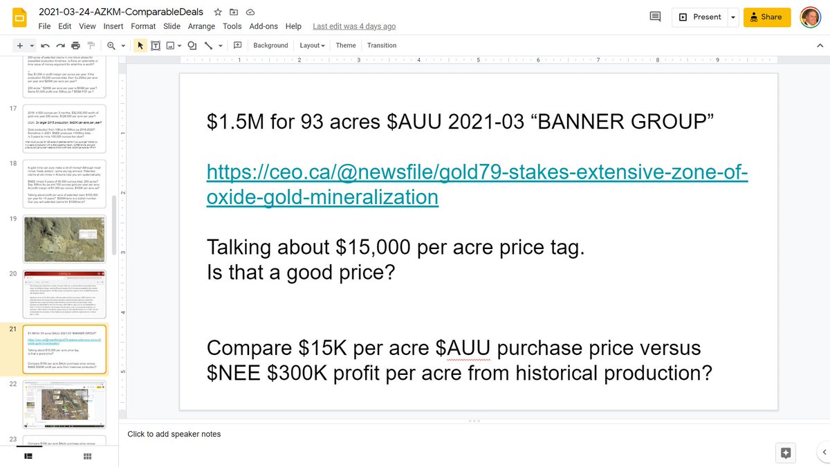
$1.5M for 93 acres $AUU 2021-03 “BANNER GROUP”
(How can we be talking about 100 acres for $1.5M? And isn't that USD anyway? Does something like this ever work? Depends on your finding and production costs ... )
(How can we be talking about 100 acres for $1.5M? And isn't that USD anyway? Does something like this ever work? Depends on your finding and production costs ... )


Not a lot of "Early Tertiary to Late Cretaceous granitic rocks" around here!
Campanian to Ypresian (83.6 - 47.8 Ma), eh? Might have something to do with the color of the rocks there? And some hydrothermal activity?
Campanian to Ypresian (83.6 - 47.8 Ma), eh? Might have something to do with the color of the rocks there? And some hydrothermal activity?


Check it out @OreFox_CEO. Play a game called "Spot the granites"?

Looks like my trace of the fault is a bit far north, but pretty close. Fun. So what?
(I missed a few zeros on the dollar value, I meant to put billions... There could be tremendous mineral wealth hiding here.)
(I missed a few zeros on the dollar value, I meant to put billions... There could be tremendous mineral wealth hiding here.)


Is there a mining hiding in this view worth billions? Can we mine it in a way that is "world leader" @WhittleConsult GREEN LINE MINING ?

USGS has the mine here,
32°12'14.40"N
112°41'23.64"W
Hello GUNSIGHT MINE!
32°12'14.40"N
112°41'23.64"W
Hello GUNSIGHT MINE!


I wonder...


Hi @ElimMining !


Great part of the world!

Plattnerite
Formula:PbO2
Colour:Jet-black; iron-black, brownish black
Lustre:Adamantine, Metallic, Dull
Hardness:5½
Specific Gravity:9.564
OK!
Formula:PbO2
Colour:Jet-black; iron-black, brownish black
Lustre:Adamantine, Metallic, Dull
Hardness:5½
Specific Gravity:9.564
OK!


.@WillIrvine remember the TUNGSTEN?
Scheelite with fluorite is an interesting combo. Tungsten-Tin combo interesting, too.
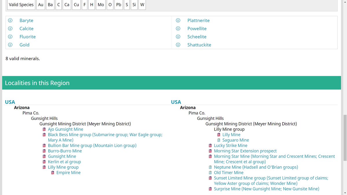
Apparently there is Scheelite in the Gunsight Mining District (Meyer Mining District).
Scheelite with fluorite is an interesting combo. Tungsten-Tin combo interesting, too.
Apparently there is Scheelite in the Gunsight Mining District (Meyer Mining District).


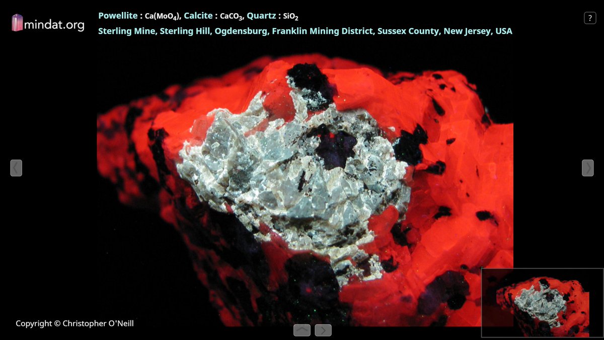
And a molybdenum mineral... Powellite on magnetite is fun. And so is this "short wave UV display" of the Powellite with calcite and quartz...


mindat.org/loc-35966.html
Plattnerite
Powellite
Scheelite
Shattuckite
...
(lead, moly, tungsten, and copper; in that order)
Also Baryte, Calcite, Fluorite, and Gold. But no mention of silver despite fact that USGS has GUNSIGHT mine at 5opt Ag and lead-silver primary?)
Plattnerite
Powellite
Scheelite
Shattuckite
...
(lead, moly, tungsten, and copper; in that order)
Also Baryte, Calcite, Fluorite, and Gold. But no mention of silver despite fact that USGS has GUNSIGHT mine at 5opt Ag and lead-silver primary?)
mrdata.usgs.gov/mrds/show-mrds…
LeadPrimary
SilverPrimary
GoldSecondary
CopperSecondary
ZincSecondary
(USGS page missing tungsten and molybdenum?)
LeadPrimary
SilverPrimary
GoldSecondary
CopperSecondary
ZincSecondary
(USGS page missing tungsten and molybdenum?)
Nice work if you can get it! And you can get it if you try...
Please unroll! Thanks @threadreaderapp
• • •
Missing some Tweet in this thread? You can try to
force a refresh