It’s #HillfortsWednesday and we wonder if the Iron Age univallate Trundle has ever looked more gorgeous than in this incredible pic by @DavidRAbram here, looking N towards the mist swathed #WestSussex Weald 🤩
For more of David’s stunning photos see:
davidabram.co.uk/ancient-britain
For more of David’s stunning photos see:
davidabram.co.uk/ancient-britain

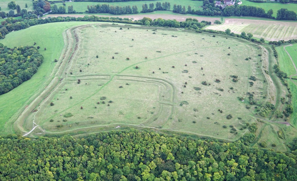
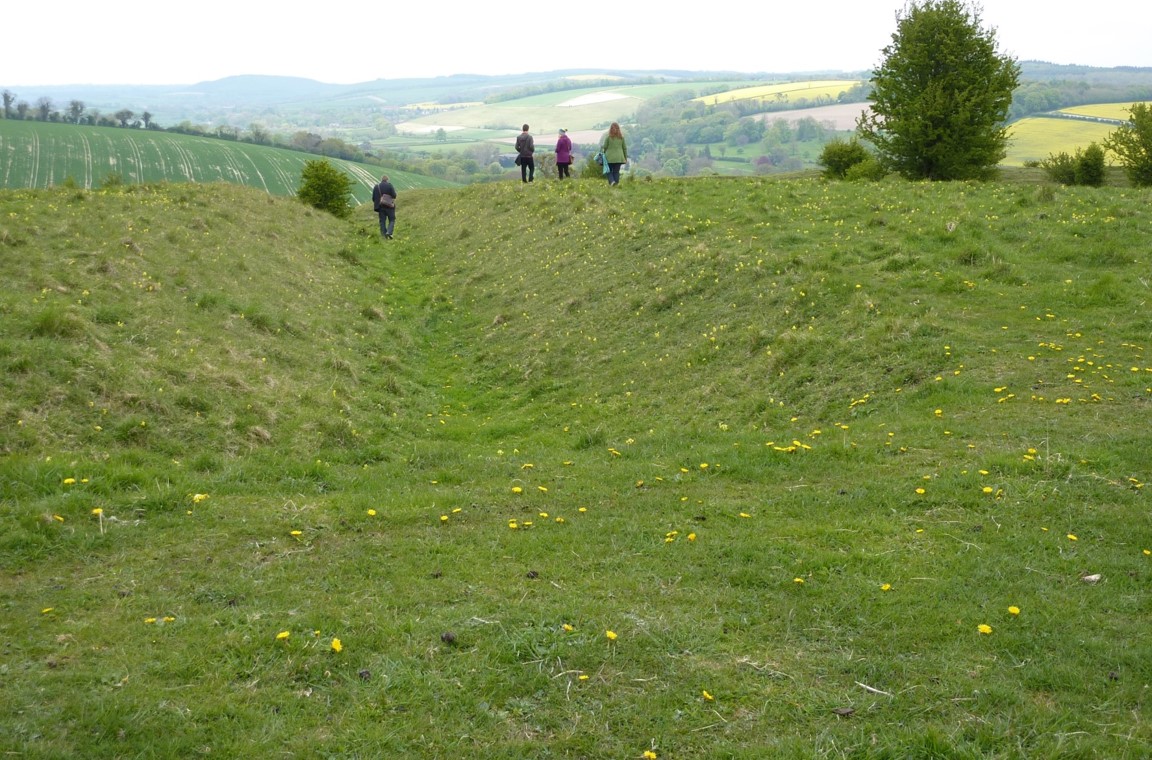
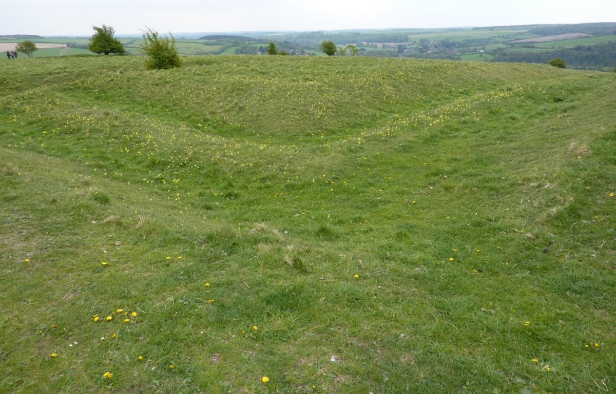
The Iron Age ramparts of the Trundle #WestSussex partially enclose the spiral circuit of an earlier causewayed enclosure, the remains of which can be seen in this epic photo by @DavidRAbram
For more of David’s stunning photos see:
davidabram.co.uk/ancient-britain
#HillfortsWednesday
For more of David’s stunning photos see:
davidabram.co.uk/ancient-britain
#HillfortsWednesday

The distinctive imprint of a Neolithic causewayed enclosure is evident within the polygonal circuit of the Iron Age Trundle #WestSussex as slight earthworks and as dark lines to the SW in this early air photo from the 1930s in @SAS_Library @sussex_society
#HillfortsWednesday
#HillfortsWednesday

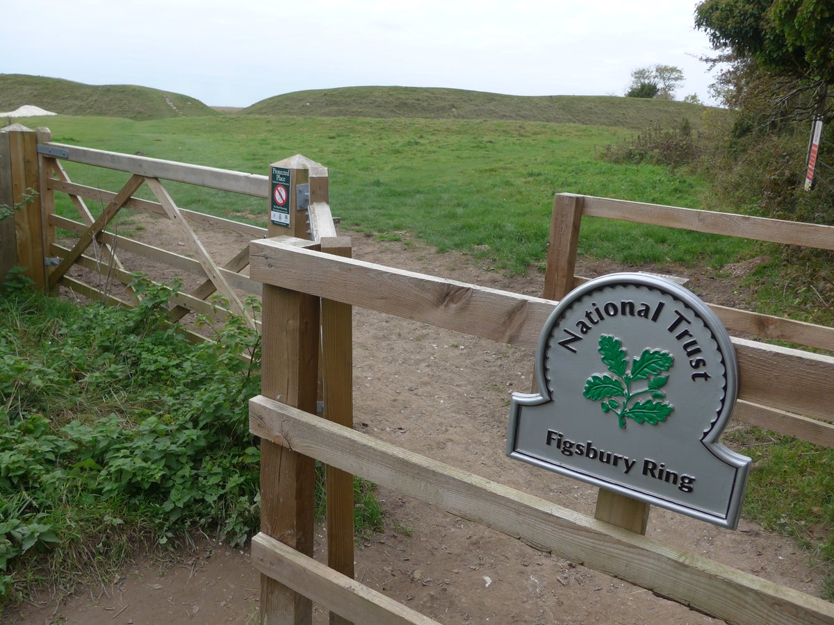
The hillfort above Chichester #WestSussex is today known as the Trundle (from Tryndel *circle*) but was originally called ‘Rooks Hill’, after the chapel of St Roche built here in 1475 to deliver the city from the plague #HillfortsWednesday
See @TheNovium
thenovium.org/article/28855/…
See @TheNovium
thenovium.org/article/28855/…

A slightly (ahem) idealised image of the Trundle hillfort #WestSussex looking out to #Chichester and the #IsleofWight found by @MartynBarber2 in *Goodwood: It's House, Park and Grounds* by WH Mason from 1839
#HillfortsWednesday
#HillfortsWednesday

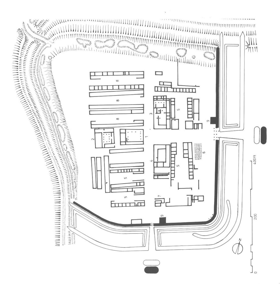
The awe-inspiring RCHME surface survey showing the #Trundle hillfort, causewayed enclosure, St Roche’s chapel and so much more by Al Oswald @MartynBarber2 and Carolyn Dyer can be read for FREE thanks to @ADS_Update @HistoricEngland 😁
archaeologydataservice.ac.uk/archives/view/…
#HillfortsWednesday
archaeologydataservice.ac.uk/archives/view/…
#HillfortsWednesday

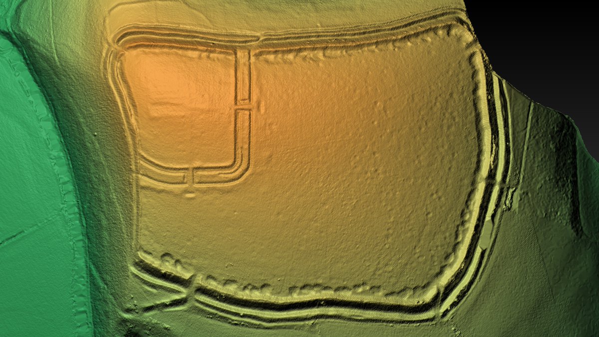
For those seeking to feast on some exquisite archaeology during lockdown, the good people of @sdnpa have put their #SecretsHighWoods LiDAR project online for FREE here:
southdowns.gov.uk/wp-content/upl…
As a taster, here’s the Trundle #WestSussex in all its glory 😍 #HillfortsWednesday
southdowns.gov.uk/wp-content/upl…
As a taster, here’s the Trundle #WestSussex in all its glory 😍 #HillfortsWednesday

Excavations in the E entrance of the Trundle hillfort #WestSussex in 1930 and an Iron Age storage pit freshly opened (health and safety was more relaxed back then 😳) from the wonderful @sussex_society @SAS_Library archive
#HillfortsWednesday
#HillfortsWednesday


The polygonal univallate 5.6ha Iron Age hillfort of the Trundle on St Roche’s Hill #WestSussex looking ESE through the W entrance at sunrise in a beautiful aerial pic by @DavidRAbram 🤩
For more of David’s amazing photos see:
davidabram.co.uk/ancient-britain
Happy #HillfortsWednesday!
For more of David’s amazing photos see:
davidabram.co.uk/ancient-britain
Happy #HillfortsWednesday!

• • •
Missing some Tweet in this thread? You can try to
force a refresh