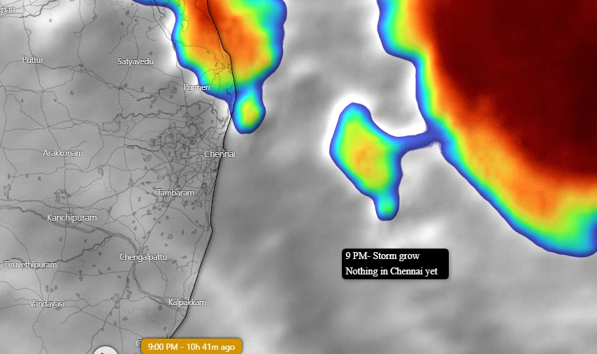
Now that the #rain has stopped for a while in #Chennai, it is time that we get to know what we can expect this week.
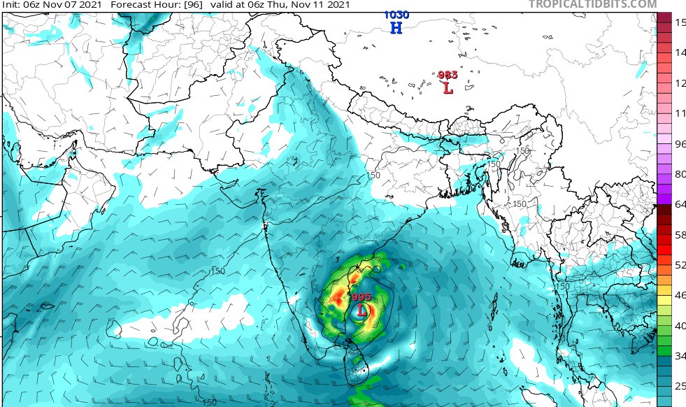
1. A Low-pressure area will likely form in the next 2 days in the Southeast #BayofBengal region.
2. Owing to favourable conditions this will further intensify.
1. A Low-pressure area will likely form in the next 2 days in the Southeast #BayofBengal region.
2. Owing to favourable conditions this will further intensify.

3. Preliminary analysis suggests that this system will likely intensify as deep depression and would move towards Coastal #TamilNadu
4. Possibility of this system intensifying into a cyclone exists. Which means a named #cyclone is a possibility
4. Possibility of this system intensifying into a cyclone exists. Which means a named #cyclone is a possibility
5. Assuming that it becomes a named cyclone, this would be named "#Jawad" named by #SaudiArabia
6. The track that it is likely to take is that it will climb up Northwest - intensify near the coast and move lateral west in between #Chennai and #Pondicherry
6. The track that it is likely to take is that it will climb up Northwest - intensify near the coast and move lateral west in between #Chennai and #Pondicherry
7. The current spell has got nothing to do with the upcoming system. So do not confuse.
8. This is just to intimate that there is a possibility of a "system" in the coming week. Please do not do anything in panic.
8. This is just to intimate that there is a possibility of a "system" in the coming week. Please do not do anything in panic.
9. This is the time that we should all be prudent and safe. Follow #IMDChennai and #Tamilnadugovernment advises carefully. They are being informed by some of the best in this field.
10. There will be #Rain tonight- but not like yesterday.
10. There will be #Rain tonight- but not like yesterday.
11. In this break, please purchase whatever you need immediately. Have some safe foods with you. Boil the water and drink as cross-contamination is highly likely.
12. #WorkfromHome would be a better option tomorrow (if you can afford it).
12. #WorkfromHome would be a better option tomorrow (if you can afford it).
13. One word - this will be a wet week for #Chennai.
#ChennaiRain #Chennai #chennaiairport #ChennaiCorporation #chennaiweather #chennaiflood #ChennaiMetro #TamilNadu #TamilNaduRains #TamilnaduNews #tamilnaduday2021
#ChennaiRain #Chennai #chennaiairport #ChennaiCorporation #chennaiweather #chennaiflood #ChennaiMetro #TamilNadu #TamilNaduRains #TamilnaduNews #tamilnaduday2021
• • •
Missing some Tweet in this thread? You can try to
force a refresh


