#Batsirai #ExtremeWeather Update Thread.
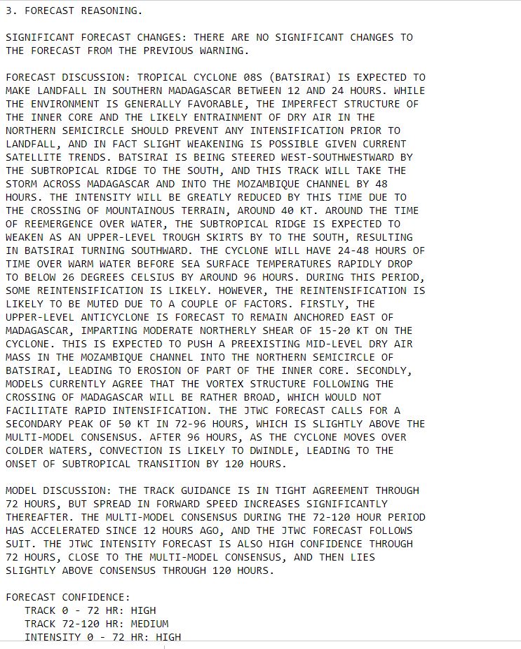
As a poster child for the impact of climate change on developing nations this cyclone, is a truly terrifying phenomena. In the next 24 hours it will make landfall at most likely Cat 4 or Cat 5 Hurricane Strength.
As a poster child for the impact of climate change on developing nations this cyclone, is a truly terrifying phenomena. In the next 24 hours it will make landfall at most likely Cat 4 or Cat 5 Hurricane Strength.
https://twitter.com/althecat/status/1488892346255261702?s=20&t=Cj1vKr5zMMAszjllASBkaA
The animation above is live and covers the last three hours. This animation shows the last 24 hours.
Madagascar is an impoverished nation of nearly 30 million people the majority of whom live in the path of this Cyclone's wind and forecast extreme rain.
Madagascar is an impoverished nation of nearly 30 million people the majority of whom live in the path of this Cyclone's wind and forecast extreme rain.
Whilst at Cat 4 strength a day ago what was already Intense Cyclone #Batsirai underwent a eyewall replacement and slowed down, it is now accelerating and strengthening. 

This is a cyclone with the destructive potential of the Atlantic hurricanes which have become legends, Andrew or Dorian. Had it been approaching Florida, evacuations would have been ordered for those in its path days ago.
Madagascar is three times the size of Florida with 50% greater population. The area which will be effected by hurricane force winds in Madagascar (see above) is likely the size of all of Florida.
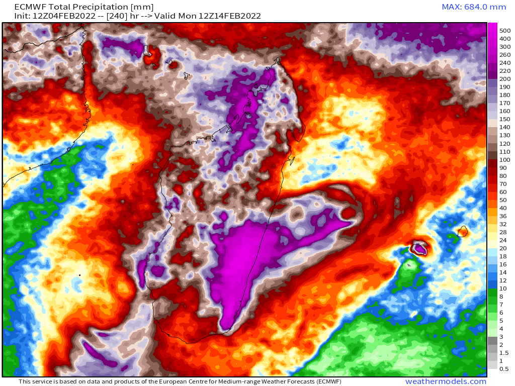
The entire island is - the world's 4th largest at 490k km2 - 50k km2 larger than France - is forecast to receive 50-700mm of rain in the next 10 days, more than half of it looks like it will receive over 200mm of rain. This is forecast to be a truly biblical event, 

What looks likely to be the most impacted area in the south East receives most of this rain over a period of less than 30 hours, between 3am tomorrow morning and 9am on Sunday (UTC). 


Here's an animation of rain accumulation (latest GFS model) over the next 10 days. While Batsirai itself will pass swiftly it is dragging with it a huge mass of extremely wet air with it which will continue to bring rain to the island for 10 days+.
From what I can see there are no Western News reporting teams in Madagascar for this storm. And among major global news sources, only @CNN has covered it. UN has issued flash alerts about it but it has not had as much UN PR attention as Storm Ana did.
As I say, a poster child....
For a world which is doing next to nothing to address the consequences of climate change on those least able to protect themselves.
For a world which isn't even paying attention to a climate catastrophe that was obviously coming a week ago.
/ENDS
For a world which is doing next to nothing to address the consequences of climate change on those least able to protect themselves.
For a world which isn't even paying attention to a climate catastrophe that was obviously coming a week ago.
/ENDS
• • •
Missing some Tweet in this thread? You can try to
force a refresh


