If @ap@afp@bbc and @reuters choose to cover this latest, unsigned, media statement issued by @reda_getachew’s close partner in the TPLF information warfare operation addressed to the AU, it should be called what it is.
I.E. a statement issued by the rebel TPLF leadership.
The “Nutty Professor’s” statement (as he is colloquially known) is an expanded version of @reda_getachew’s recent tweets dressed up to look like it comes from an independent source.
No doubt @reda_getachew was disappointed that his tweets were not picked up and reported on as if they are fact based, as tended to be the case in the past.
This paragraph is particularly absurd. On June 28th the GoE announced a unilateral ceasefire. And on around 15 July the TPLF launched an offensive against Afar, just as they are doing again now.
In doing so TPLF made it clear - as they are now with their latest offensive also being conducted during the Solemn Olympic Truce - their objective is not to relieve a siege or bring aid to starving people, but the exact opposite. I.E. deliberately exacerbating the crisis.
Cyclone 92p has now formed north east of New Caledonia and here you can see in the satellite imagery how an atmospheric river generated from its outflows is strengthening and heading towards NZ's West Coast.
Whilst the formation of a Cyclone in this position has been predicted in the models for a long time, its formation is uncertain until it happens, and a critical point in the unfolding story of this #KiwiDeluge.
In this animation you can see the circulation form and its size.
Towards the end of the animation you can also see that it has started to move south eastwards, also as predicted.
This animation shows the broader picture across the tropics, an area on the RHT here (roughly over Tonga) is also playing an important role in this.
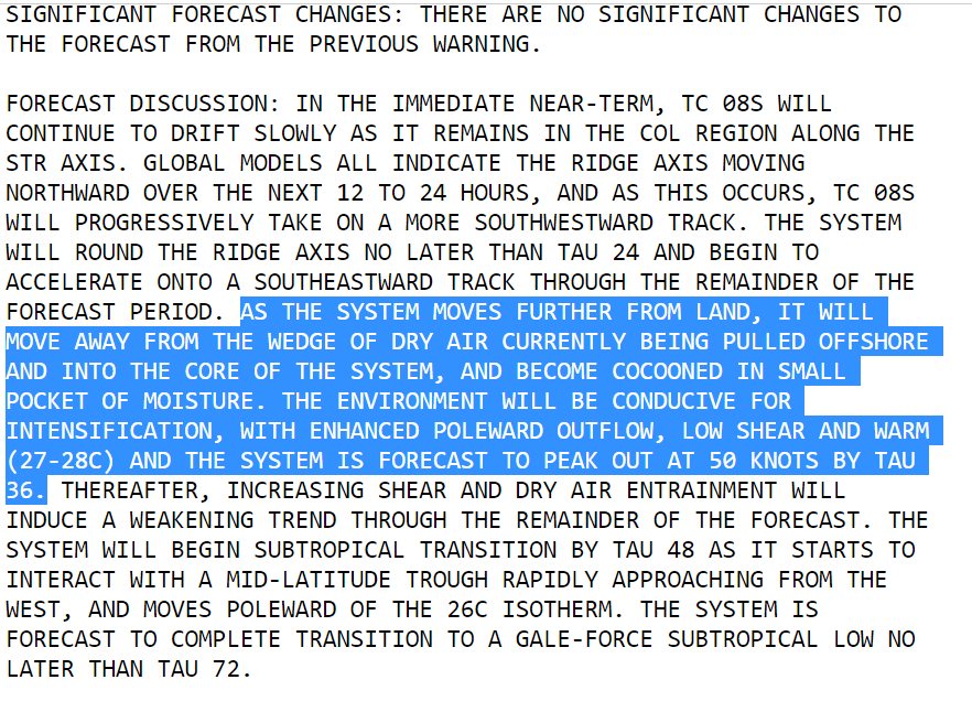
Latest JTWC forecast for #Batsirai shows it deviating from its predicted path. "THE LLCC MOVED OFFSHORE AROUND 061600Z, THEN TRACK NEARLY DUE WEST OR A BIT NORTH OF DUE WEST, BUT BASED ON THE MICROWAVE IMAGERY, APPEARS TO HAVE BECOME QUASI-STATIONARY NEAR THE INITIAL POSITION."
#Batsirai has stalled & is expected to follow its existing track forecast. In the short term (36 hrs) it may intensify. The latest model guidance (GEFS plot below) does not take into account the change in behaviour
The track forecast has now been updated and #Batsirai appears now to be in the process of making the sharp turn to the south in the latest JTWC update.
The center of Intense Cyclone Batsirai has nearly completed its crossing of Madagascar but the storm/wind field continues to impact the southern half of the island.
The most intense rainfall was concentrated near the Capital City Antisirabe, the 4th largest city moving slowly. Extreme flooding in this area appears likely. And there were two additional extreme rainfall events in the North and the West of the island, fueled by the storm.
We see in this image that the eye of the storm (with its most damaging winds) remained intact for several hours after landfall finally losing its structure in the early hours Sunday Morning.
The lightning display as seen in satellite imagery during this period is extraordinary.
The TPLF Leadership who are solely responsible for maintaining their attacks on Afar since mid December are enabled and empowered by the silence of UN Agencies @OCHA_Ethiopia@who and @WFP_Ethiopia on the truth about why aid is not getting to Tigray.
“The humanitarian crisis situation in Tigray is due to ongoing offensive military action against Afar civilians by TPLF forces which has been blocking the aid corridor since July 202.”
Simulations of the area of tropical moisture that brought torrential rains to the South Island now show a storm system moving south into the Tasman Sea resulting in intense rainfall across Northern NZ through Feb 12th.
Forecasts for this system's exact impact remain highly uncertain but four major global forecasting models are in agreement that some form of extreme weather for NZ will be result.
These are the latest ensemble tropical storm "spaghetti" track graphics for storms north of NZ.
The event is expected to begin within 24 hours these are four different models showing the intense area of atmospheric moisture moving over Northern NZ this morning (Sunday) NZT.