Ben Mayne Profile picture
Feb 23 15 tweets 7 min read
Lets take a look at the battle of Breville in June '44, in reality this would be the frontline on the left flank till Operation Paddle at the end of August.

Lets set the scene from 7 June, the 1 Special Service Brigade (Commandos) along with the 6 Airborne Div holding the line.
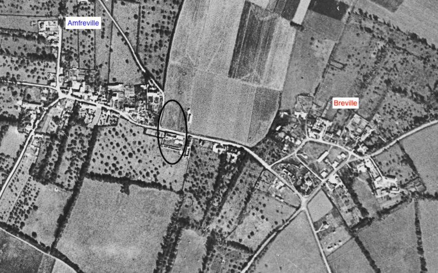
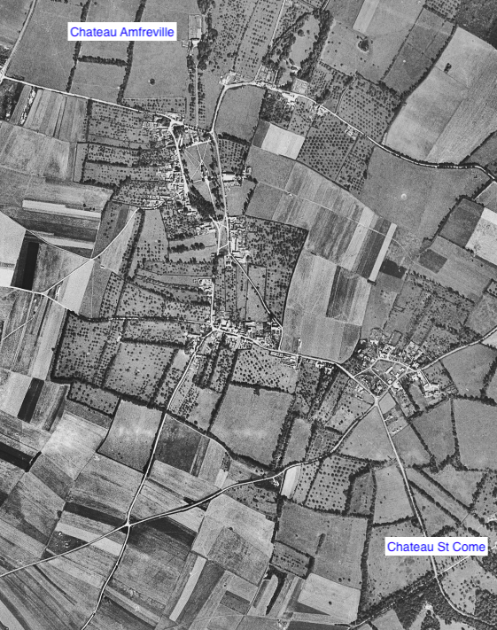
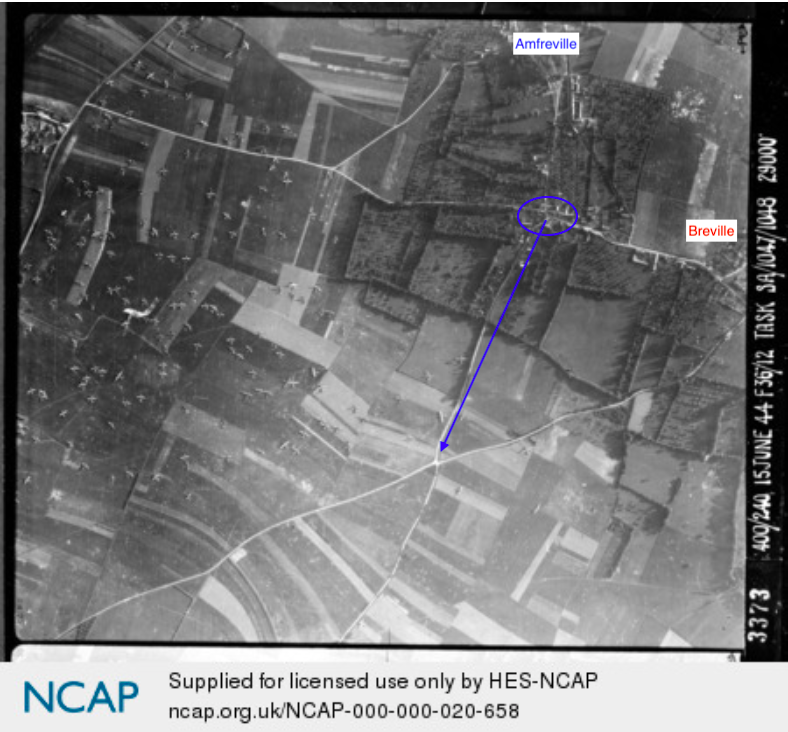
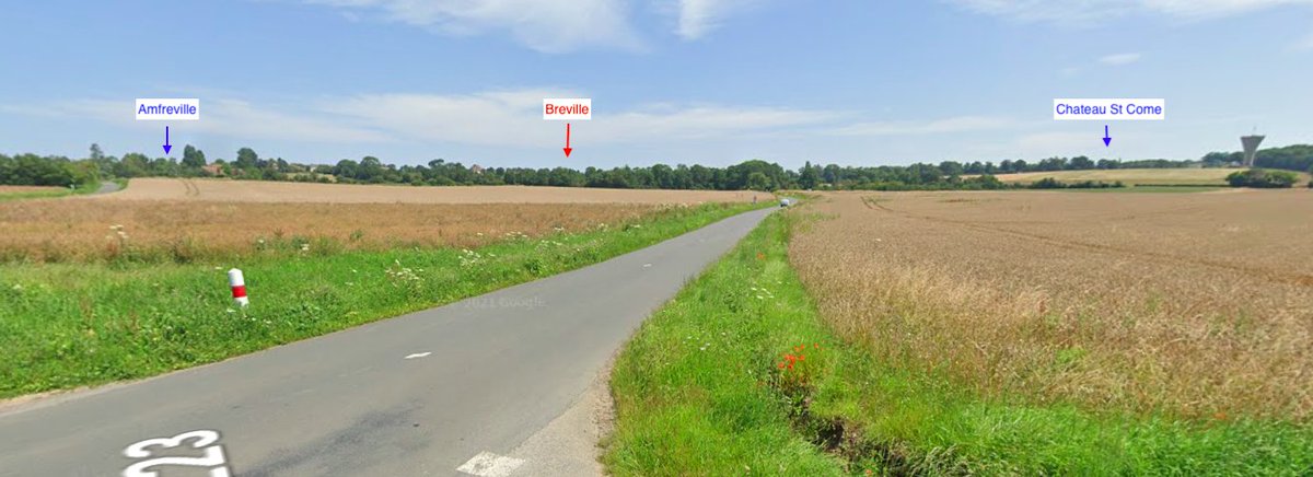
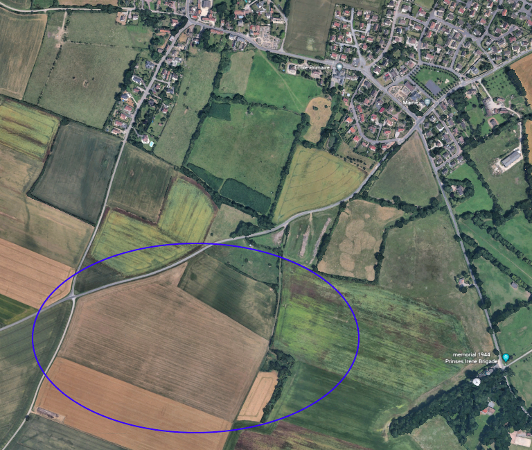
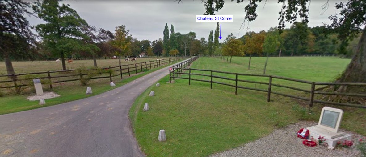
There was a gap between Amfreville and Chateau St Come, about 1 mile long. The British line needed to be closed with the German forces occupying the village of Breville. A large area of no mans land existed during this period around there.
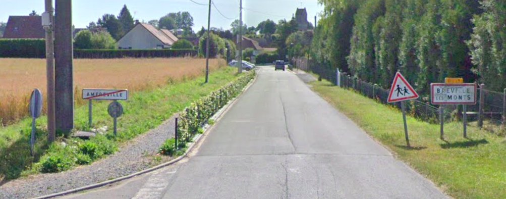
Today's Google gives you an idea of the gap in the line. It does not really give you an appreciation of the terrain from this angle, we will get to that and its relevance of what takes place later.
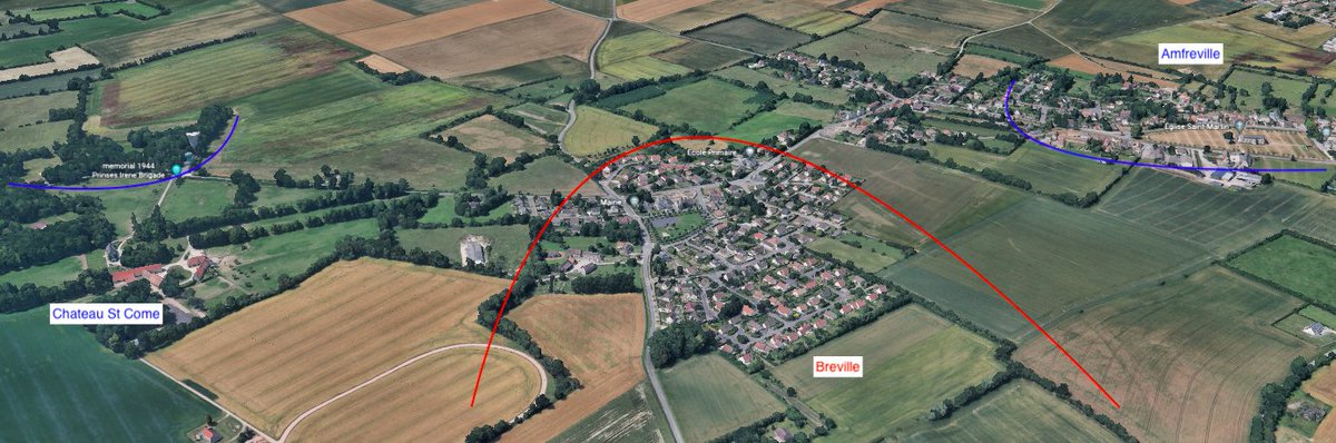
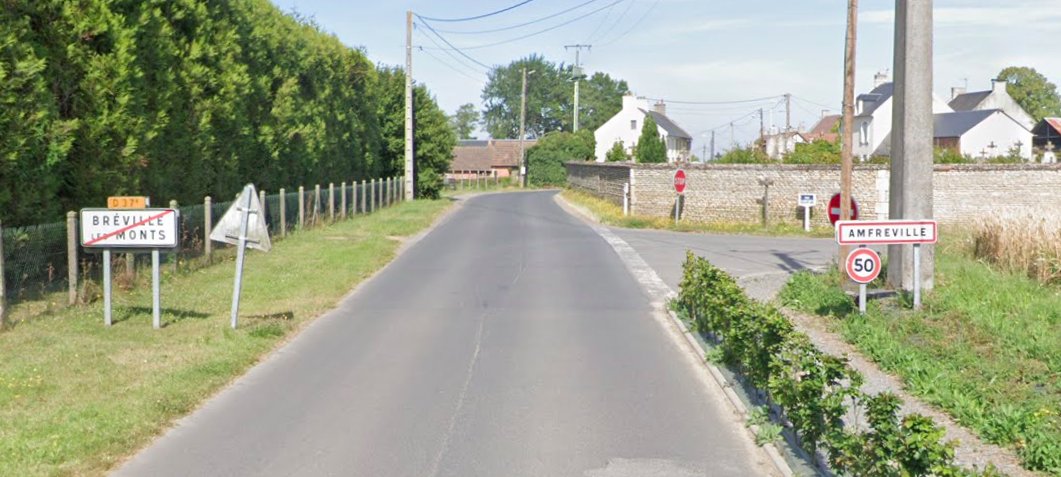
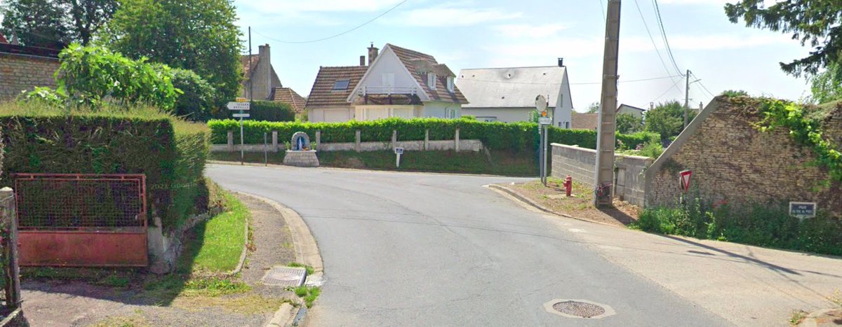
How close was Amfreville and Breville? Basically the road signs are back to back, the villages are pretty much joined. This lower part of what is Amfreville was effectively under no control and possibly classed as Breville by those there in June' 44.
On the 7 June at 2130hrs, Colonel Otway in charge of the 9th Parachute Battalion were relieved at the Chateau Amfreville by Lt Col Peter Young and his men of No.3 Commando. Otway is told he is then to go to the Chateau St Come, take up positions and hold at all costs!
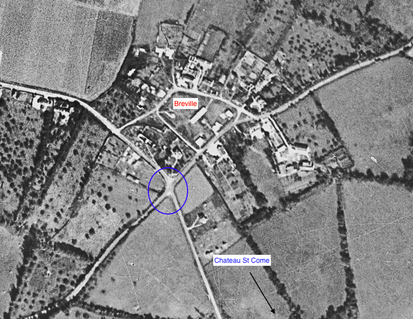
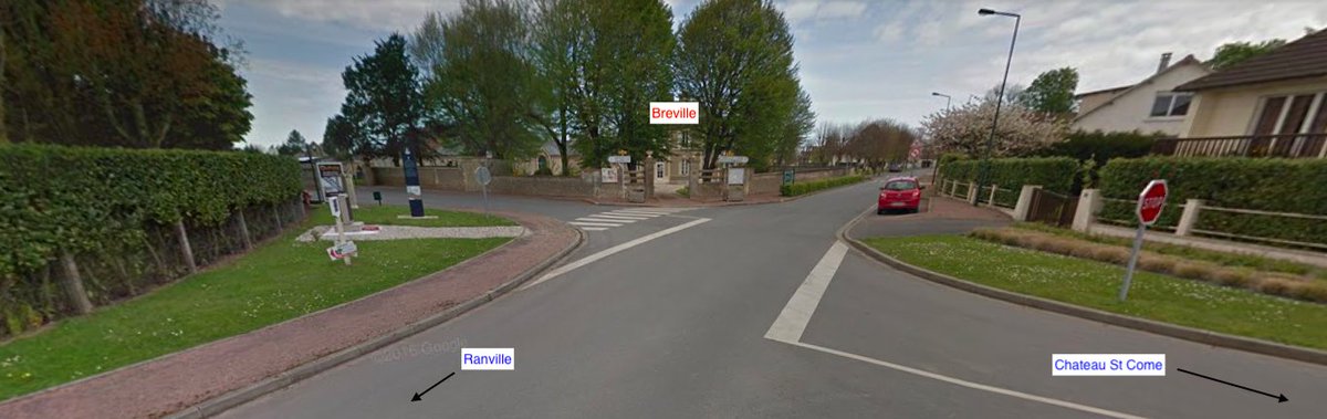
At 2330hrs Otway and his men moved out from the chateau to head to Chateau St Come. They approached what was know as the Breville junction. They arrive at the junction around midnight, Pte Rooke Matthews stated how 'slow and stop start it was'.
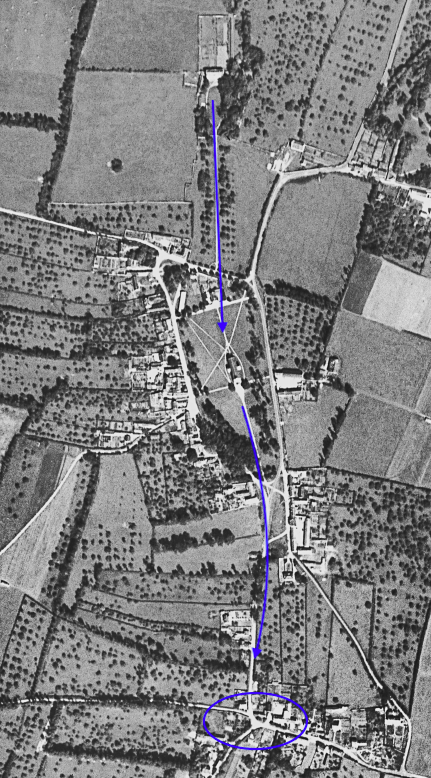
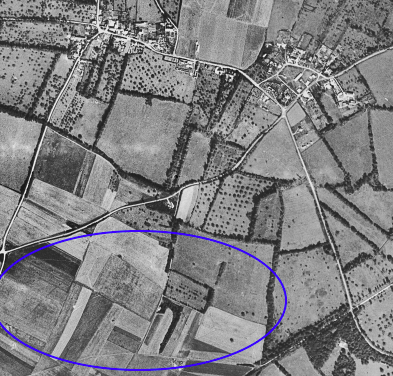
The men had a horse and cart with them, the horse hooves covered in blankets to hide the noise of their advance through the villages. At the crossroad they turned right and headed down towards the road that leads to Ranville. Image- NCAP, 15 June '44
Otway and his men came down the road from the left, you can now see the Breville ridge line from this position. The men were down in a depression below Breville, which offered some protection and out of sight espcially at night. The chateau is up to the right side.
In this area has they moved towards the Chateau, they did encounter a German column on patrol but this was not engaged. The men of the 9th Battalion managed to remain concealed and kept the horses in tow quiet by stroking them. They then continued on when safe.
At around 0130hrs on the 8 June, Otway and his men began arriving in the area at the bottom of a tree lined lane, this became known as the 'sunken lane'. The photograph is looking down towards the bottom where the 9th Battalion came in from.
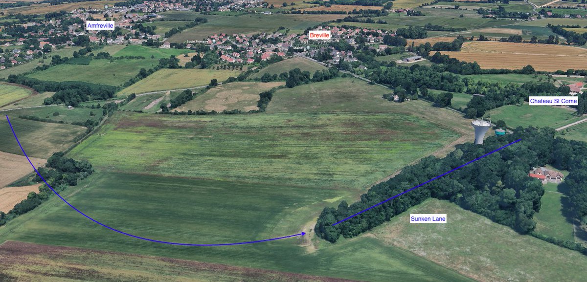
Otway arrived at the top of the Sunken lane and found Major Charlton walking up and down the road opposite the Chateau St Come smoking. No Germans were around and Charlton told him there were none in the chateau about 250 yards away.
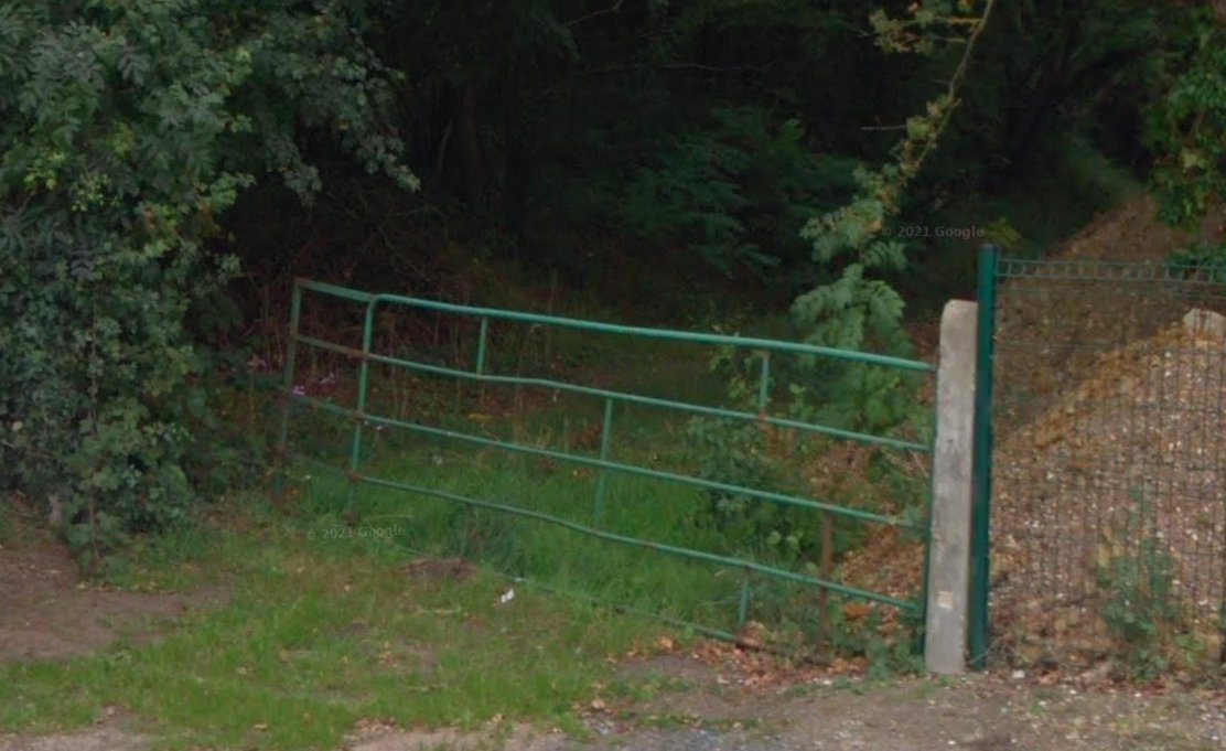
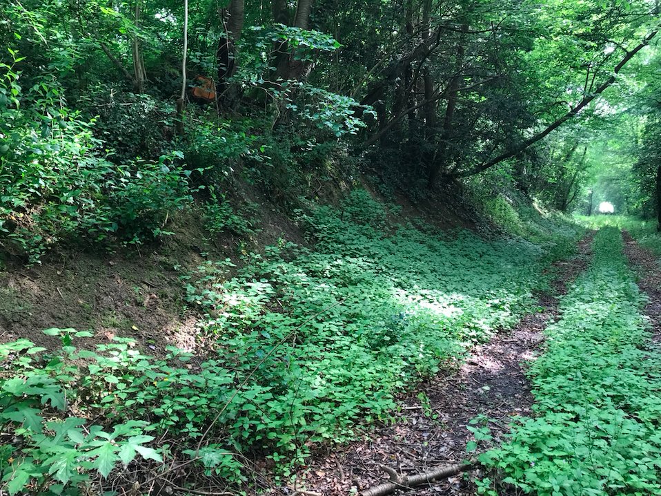
It was now a case of the 9th Battalion digging in and holding this position at all costs. Otay went off to the neighbouring bungalow which land adjoins the sunken lane just off to the left. Positions would be held along the right looking over towards Breville.
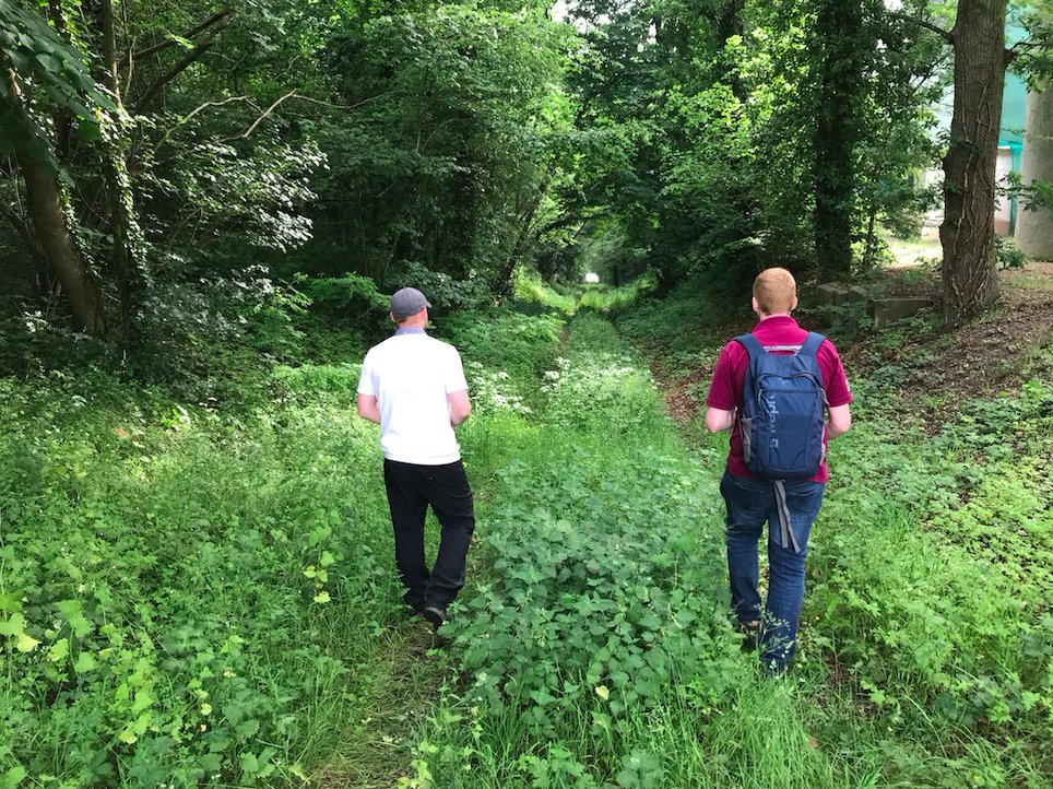
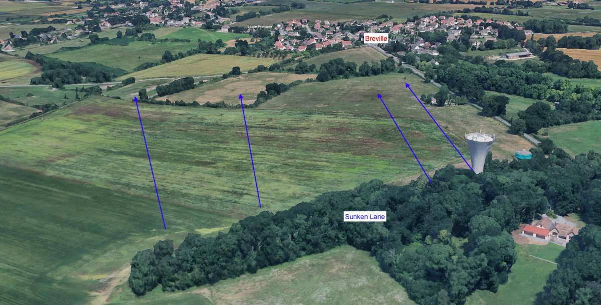
This is the view just in front of the positions within the sunken lane looking towards a crest which hides Breville from view. Once over the crest though the ground drops away on a down slope in full view of Breville. the village is towards the right hand side of the crest.
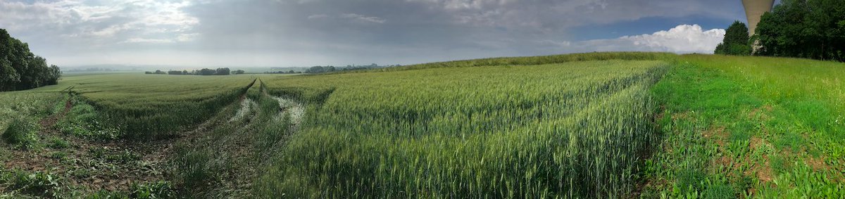
It would be from these very positions that on the 11 June, the men of the 5th Black Watch would make their attack from towards Breville. This view shows the field where they would advance across. We will look at their attack in more detail in another thread.
The 9th Battalion war diary for the 7 June for this move records little apart from the order to move from Amfreville to the St Come area. They only pass Breville on this day and did not hold it, they did not enter into the village. This would not happen untill the 12 June.

• • •

Missing some Tweet in this thread? You can try to force a refresh
 

Keep Current with Ben Mayne

Ben Mayne Profile picture

Stay in touch and get notified when new unrolls are available from this author!

Read all threads

This Thread may be Removed Anytime!

PDF

Twitter may remove this content at anytime! Save it as PDF for later use!

Try unrolling a thread yourself!

how to unroll video
  1. Follow @ThreadReaderApp to mention us!

  2. From a Twitter thread mention us with a keyword "unroll"
@threadreaderapp unroll

Practice here first or read more on our help page!

More from @BattlefieldBen

Feb 23
Staying on the Battle of Breville theme, the 9th Battalion had running battles for the Chateau St Come over the coming days since they arrived on 7 June. On the evening of 10 June '44, 5th Black Watch of the 51st Highland Division had arrived at the sunken lane. Image
The 51st Highland Div had come up onto the Breville Ridge to support the 6th Airborne Div. The 5th Black Watch would look to close the Breville Gap with an attack. Image
At around 0300hrs on the 11 June a patrol from 5th Black Watch passed through the crossroads at Breville. They reported back on limited contact and believed it was not strongly held. They did not enter into Breville to confirm this. Map- Remonter le temps 1950-60, Google SV. ImageImage
Read 17 tweets
Feb 8
Following on from @ww2tv with @ReassessHistory episode British steel in Normandy I wanted to drop a few stats. These are from allied reports reviewing armoured warfare some stats cover all theatres of war.

This study is based on a sample of 12,140 allied tank. American, British, Canadian and French tanks. I will bring it in to British as it progresses. And more so, the Normandy campaign
Note it was recorded that due to incompleteness of Allied records, separate tank casualties for ‘gunfire’ was not broken down into categories of tank/anti tank/artillery.
Read 15 tweets
Dec 15, 2021
December 15, 1944 (Germany)

Dearest Family,
You must consider my writing is for the benefit of you all. The opportune time for writing is sparse to say the least.

Tonight I am in my foxhole which has a log roof. The log roof primarily serves as protection for artillery
but also with it one may have a light. Candles are the fashionable things here in the ETO. I'm getting along just fine, no gripes or complaints of course, living in a foxhole isn't the nicest place in the world. But that ole civilian saying applies, "This is war."
Just don't worry about me I'm getting along swell. My biggest worry and trouble over here is the men in my platoon. Believe me, I have the best damned platoon in the world but still men have to be fed, clothed and sheltered and that is my problem.
Read 12 tweets
Nov 26, 2021
Following on from last weeks look at the 12 SS Panzer Divisions defensive positions around Galmanche and the impact on the British 59th Inf Div during Op Charnwood, today I wanted to look at the ridge leading up to Lebisey that the British 3rd Inf Div would attack...
This photo is the D60 looking south, the road leads into Caen and would be a main axis of advance for the British on the 8 July '44. Behind me, 1km away is the village of Bieville. The British frontline had formed around this area since the 6 June. We will come back to here later
Here's the overview map of where we are just north of Caen. The landscape has changed a lot with urban and industrial sprawl since 1944. The map on the right is from 1950-65. Source- remonterletemps
Read 22 tweets
Nov 16, 2021
Back to Operation Charnwood, this time to look at the defensive positions standing in the way of the 59th Staffordshire Division. In particular the well planned, placed and sighted positions at Galmanche. This position could be classed as a classic hedgehog defence.
Within days of the landings, the Germans looked to bolster their units and defence around Caen. The 12. SS-Panzerdivision "Hitlerjugend" began to move into the villages north of Caen from the 7 June '44. Map- Panzerdivision Hitlerjugend Volume II, Stephen Cazenave
They would hold these positions for nearly four weeks before the British and Canadians launched Op Charnwood on the 8 July '44. Map- The 12th SS Volume one, Hubert Meyer
Read 31 tweets
Feb 4, 2021
Yesterday I mentioned the Naval Operational Orders for the invasion of Normandy, it did not post some of my snippets I extracted on the detail of the planning, a few things that stood out to me contained within were..
Many of you will have seen this detail, but here is the breakdown of each beach area and task force including the beach area names and grid co ordinates. Not ground breaking information but very important to makes sure you head for the correct area.
It wasn't just as simple as sailing over, the convoys were prescribed exact details of formations down to yardage and even angles.
Read 5 tweets

Did Thread Reader help you today?

Support us! We are indie developers!


This site is made by just two indie developers on a laptop doing marketing, support and development! Read more about the story.

Become a Premium Member ($3/month or $30/year) and get exclusive features!

Become Premium

Don't want to be a Premium member but still want to support us?

Make a small donation by buying us coffee ($5) or help with server cost ($10)

Donate via Paypal

Or Donate anonymously using crypto!

Ethereum

0xfe58350B80634f60Fa6Dc149a72b4DFbc17D341E copy

Bitcoin

3ATGMxNzCUFzxpMCHL5sWSt4DVtS8UqXpi copy

Thank you for your support!

Follow Us on Twitter!

:(