#Thread on Ponniyin Selvan #Maps
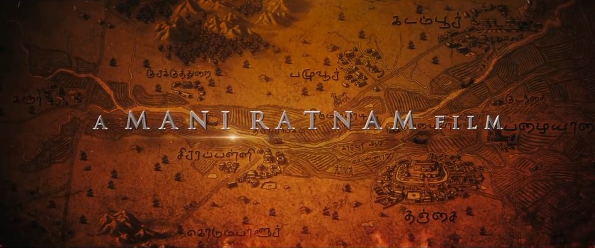
Last year, I had the opportunity to work as map consultant in director Maniratnam's magnum opus, #PonniyinSelvan movie. Though seen only in bg, there was a lot of professional effort put into maps which must be the 1st in Indian film industry 1/n
Last year, I had the opportunity to work as map consultant in director Maniratnam's magnum opus, #PonniyinSelvan movie. Though seen only in bg, there was a lot of professional effort put into maps which must be the 1st in Indian film industry 1/n
Maps show the core Chola territory and the areas that were conquered and subdued.
2/n
2/n


Before going into the details, we need to understand the core concepts behind the map. #Maps are visual representations of spatial realities. But while making balances have to be achieved between science, perceptions, history, creativity, & our ability to tell stories

For example, there is a different between actual geography / science and how people perceive them because of many reasons. Please remember that the maps made for the movie are not for scientific consumption but civilian consumption

Map shows the reference visual that was used for terrain (based on SRTM DEM - exaggerated). These were used for drawing the mountains in the map. The catch is how would people perceive them if we show them as it is?

And we can see how that terrain was translated into the image used. These mountain symbols give us bette perception of mountains than the actual terrain themselves. This is an example of the balance between science and people's perceptions

And if we zoom into these maps, we can notice that the mountains of western ghats have conical shape in some places. Western ghats is a bit complex as it is not exactly flat on either sides but if we talk about an accurate plateau nature of inside, people might have difficulty

Western ghats and Eastern Ghats in reality are more of eroded escarpments of a plateau.

Though we didnt fully imply these escarpments, we did make a bit of sloping visuals in the maps to denote the escarpment and plateau nature of the terrain

But remember these are historic maps and the Chola kingdom was the main focus. Hence it becomes important for us to know what kind of geography existed at the time, and how the cholas imagined the world around them and our ability to recreate their perspectives

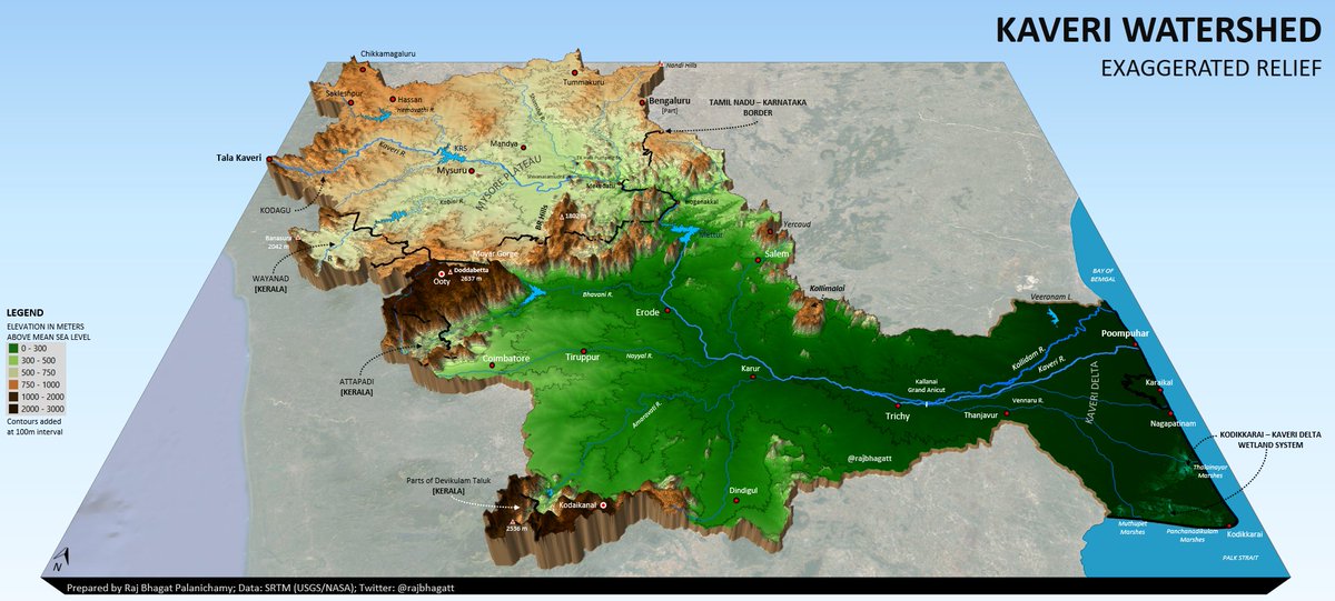
Let us start with one of the cases- the course of Cauvery river. Cauvery is the main focal point (Ponni river) of the empire. But the course it and its distributaries followed particularly in the areas around Kallanai (Grand Anicut) was not the same.

The Vennar river was diverted during the British era when its regulators were pushed together to form the Grand Anicut. But Chola empire was many centuries before that.

If we had used current maps for reference, the river course would have looked different and ofcourse incorrect.

But we used the vennar river course as it had existed pre British. These course maps were results of a research I did on Grand Anicut history. Though there could be similar other changes, it was not possible for us to track all the other smaller changes- a compromise

Video game lovers would know "Fog of War" concept where players wont know the terrain for areas that had not been explored, it would be foggy for areas that were explored/known but not in current view. In the foggy areas, the features could have been outdated but player wont know

Concept as used in Age of Empires 2 game. This concept is essential as there would have been limitations in the updation of information in an era where logistics and travels were not frequent and were limited to certain individuals
This concept was applied and there is a slight reduction of terrain and vegetation information as we move far away from the empire

A good map would be able to tell a story by itself by telling you which is the area of focus, what is the information etc.

Ponni river is the most important river for the cholas and the focal point. It is hence necessary that the map should tell the story of the river very clearly. I used my old map to show the extent and scale to be used for the movie map.

The scale provides us the story on why Kaveri (Ponni) is more important. The moment we see this scale and extent, anyone can realize how the river brought prosperity for the Cholas.And ofcourse we used the historical delta extents only based on geological records

But for a movie viewed by general audience many of whom had never in a giant screen where these flash for a few seconds, scientific accuracy can be a bit compromised and information can be simplified. This has an art component to it


I used a series of maps to provide reference for vegetation and terrain which were simplified to create better looking and interpretable visuals


Compare the maps above and this one. This is a fine balance and simplification of information that will be much easier to perceive

Historical movies contain a lot of accurate information and inaccurate information. It is not possible for certain locations mentioned by Cholas in the far east can be confirmed geographically. And in some cases there are always disagreements.

One example is the location marked for Sevur which was the battleground where Cholas took revenge on the Pandyas which resulted in the events of Ponniyin Selvan

The location of Sevur for some of the historians is based on a small village near Ponamaravathi which might look obvious to anyone looking at a map since it is placed between Thanjavur and Madurai. But I disagree to that simplistic interpretation

The Cholas and Pandyas were both fighting for centuries for the control of Kongu Nadu (where they installed regimes - Kongu Cholas, Kongu Pandyas). It is here the location of Sevur is.

Sevur near Avinashi is the likely location of the two battles of Sevur and the location has temples, inscriptions from Pandya era. But some of the historians still disagree as it is far. I certainly believe that it is Sevur near Avinashi but anyway disagreements can exist

There was a plan to use some maps for Ponniyin Selvan 2 as well. I have attached the landscape referene maps here and was planned to show the map of the Kodiakarai - Nagapattinam mangroves before showing the scene. It was eventually dropped

I am so glad that I was able to contribute to these maps on a movie (a huge fan of the novel). Plz note that I served as a knowledge consultant and i provided info on terrain, vegetation, rivers, locations, some concepts. The graphics were done by MadrasTalkies &StudioKokaachi

I am really thankful to all those who had helped me and the lovely Madras Talkies team I worked with - Aadhitya Anbu, Aashee (@donsrini_ ), Ishan & many others who helped in background as well. And also Director Maniratnam for approaching maps in a professional manner! I dont think anyone has ever done anything like this in maps space in India before

@donsrini_ For a mapper like me, working in popular movies is like a dream. I am so happy that I have made a small signature in big screen (the signature is the vennar river course)

@donsrini_ I hope there would be a day when someone makes movies about us mappers😬

@donsrini_ The maps appeared for only a few seconds in the videos. But you can guess how much time and effort we have put 🙏
In this long thread, missed posting about how we made boundaries a bit fuzzier and you can guess why!

• • •
Missing some Tweet in this thread? You can try to
force a refresh