
Hardcore hurricane chaser. Mississippi transplant. Harvard man. Righteous Bay Rat. The #HurricaneMan. Jamaican name: Mawgaman!
 Heading E at crack of dawn to Cape Breton Island where I'll set up HQ in Sydney (on E end). Since FIONA will be embedded in strong steering flow, & since it'll be a large target (no tight, tropical core like in Dominican Republic), I'm expecting straightforward chase. 2/5
 11:30 am (01 Sep): In a school on a hill—hunkered down in solid-concrete classroom with 11 others, including toddlers. Radar says hurricane’s inner core is just about here. Winds getting nasty—trees coming down, stuff flying. Feel like I'm about to get on rollercoaster. 973.4 mb.

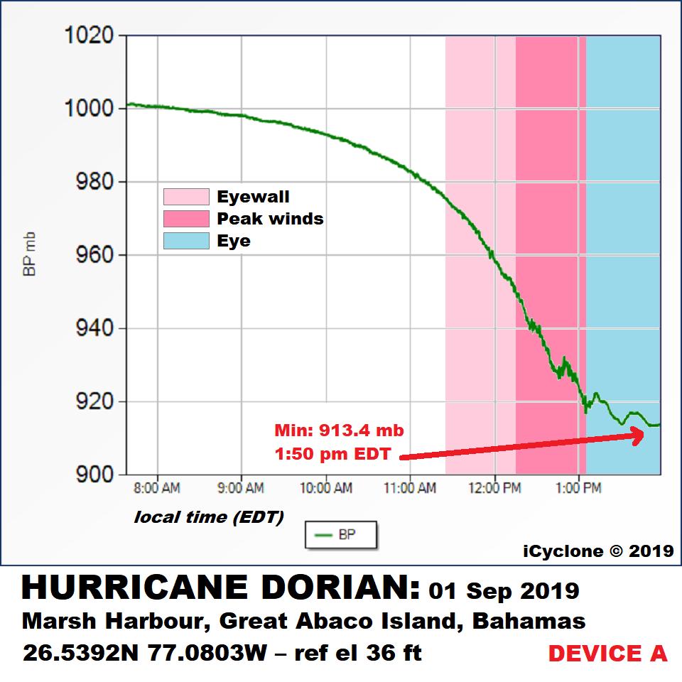 2/5—I collected data w/ 2 devices. They matched well: 913.4mb (1:50pm) & 913.7mb (1:53pm) in eye. I sadly ended data collection in eye, as I needed to relocate to safety. I believe I caught min pressure, as it was starting to edge upwards when I relocated—but can’t be sure. Grrr.