
Geographer/Wildland Fire Expert
Working in the woods since 1990.
Qualified California Burn Boss.
Intel = public data.
Photos by me.
Fire is the best teacher.
 Also, a lack of easements to access the back of residential lots makes it nearly impossible to do tree work or other major vegetation management which could lower wildfire hazards. 2/4


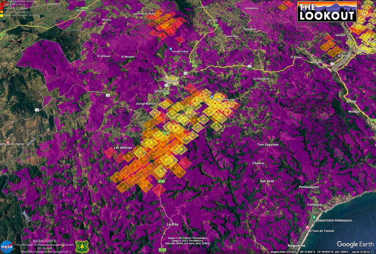 Over 3 million acres of plantations were established in this region in the 80s and 90s. As seen in the American West, during severe weather, conifer tree farms burn like the sun. Even-aged forestry is turning out to be an ecological disaster, all over the globe. 2/x


 Imagery paints a picture of soil types. Along the River, coarser soils settle quickly once floodwaters slow down. Blue areas have more clay, because super-fine soil particles can stay suspended longer, travel farther in slow-moving floodwaters. Orchards prefer coarse soils. 2/x


 The fire started in the Feather River Canyon, near Pulga, and raced up Flea Valley Creek. Once the fire reached the rim of the Canyon, it rained embers all over the Concow Basin. It raced thru heavy fuels in the Concow area, which still had tall dead brush from fires in 2008. 2/x