I've had a few questions over the last couple of days regards to sat. imagery and analysis. Thought some of you might find this following interesting.
At the moment I am looking into the reported #IDF airstrikes in #Syria on the night of 31st August 2020. Reports indicted..
Explosions heard around southern #Damascus, and namely Al-Kiswah, which is a known area to home/house/facilitate #IRGC related activities. Satellite imagery is freely available for interpretation, but the key thing is to look at the details around an event.
See the included, an Army Barrack, Al-Kiswah, Damascus, Syria. An area that could have been targeted by the IDF (the reports suggest otherwise, but it could have been) note the area circled is a fire, causing scared landscape. More often than not, things like fires can be...
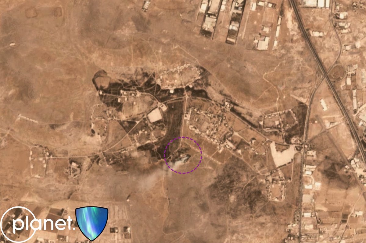
misinterpreted for airstrikes etc. Key point here is an image is a second in time, you need to have the before the before, and the after the after, more often than not this will take some point to dig into too. Hopefully/maybe I'll be able to share something related soon.
Israel announced that it was 181 ballistic missiles launched. Iranian media had a range from 200 to 400, but let’s go with 200 for argument as it’s closed to the 181 that Israel said and I doubt 200 odd missiles broke up mid air.
200 - 181 =19 did 19 fail? Not sure, or was it actually 181 launched. Something to consider, but for this exercise I’ll use 181 and then you can add 19 on if you want.
181 - 32 = 149 left.
Taking into account I have not time synced any videos at all and checked if they are the same on any location (don’t have time) this is going to work on a 1 to 1 ratio.
Footage showed at least 5 impacts at Tel Nof, and another 6 in different location
Initial low resolution satellite imagery from Nevatim Airbase this morning appears to show some damage around 31°12'15.7"N 35°02'19.7"E, which aligns with reports of a building being damaged. Not seeing anything else obvious, currently. Couple of annoying cloud shadows.
Another potential impact on the runway, and just south of it. Can't make up my mind on the one south of it, could be the change in light which can be observed on the larger structures.
Higher resolution required for this.
for those who want to gander themselves, here;
I am not seeing anything overly obvious would contradict the reports of it being hit and sustaining small damage, there are a few markers per se, but it's minimal, if that.browser.dataspace.copernicus.eu/?zoom=14&lat=3…
After following the rhetorics and post event details of these drones for years in the Middle East seeing them now “in the wild” is truly something. The illusive Shahed’s doing their thing, in the public eye.