🌀 (1/3) 10AM CDT Update on TS #Delta: Delta is now a major hurricane in the west-central Caribbean. No major changes to the forecast track as impacts remain likely along the northern Gulf coast late this week and this weekend. #lawx#mswx
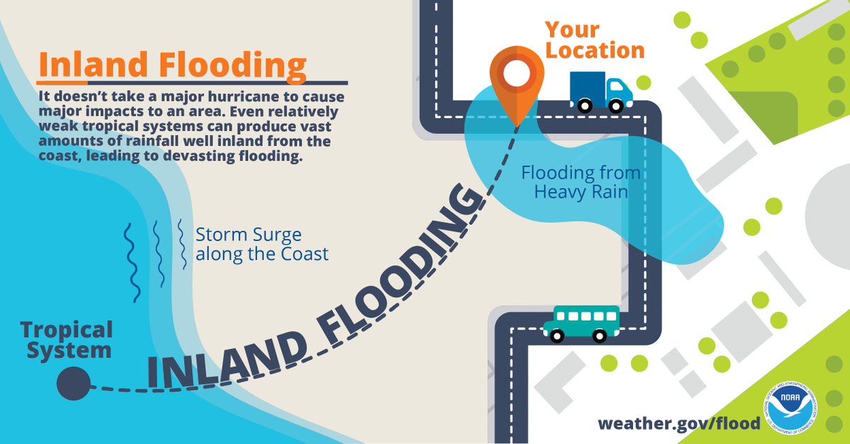
🌀 (2/3) As a reminder, NOW is the time to have a plan! Don't let the recent cool temperatures fool you - it is still Hurricane Season! Impacts remain likely with this system across portions of the northern Gulf coast and you should take it seriously! #lawx#mswx
🌀 (3/3) Do you know which NWS office serves your area? Our neighbors include @NWSLakeCharles to our west including SW LA, @NWSJacksonMS to the north across most of MS, & @NWSMobile to our E including the AL/FL beaches. Follow your local office for the latest updates! #lawx#mswx
Correction *Hurricane Delta. It's definitely a Hurricane 🌀
• • •
Missing some Tweet in this thread? You can try to
force a refresh
🌀 (1/5): Here's the latest with Hurricane #Delta as of 10AM CDT. Some slight strengthening was noted by recent aircraft recon observations with a steady strengthening trend now expected through the day today. Impacts still remain likely across our area Friday. #lawx#mswx
💨(2/5): No changes to the Tropical Storm Watches and Warnings that remain in effect. Expect winds to increase across coastal areas of SE LA later today/tonight, and spread inland during the day on Friday. #lawx#mswx
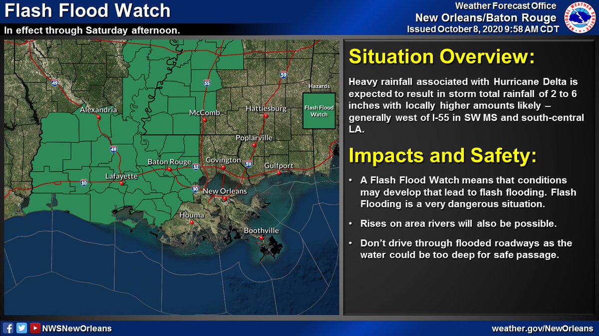
💧 (3/5) Locally heavy rainfall remains likely - with the greatest threat for flash flooding west of I-55 where a Flash Flood Watch remains in effect through Saturday afternoon. #lawx#mswx
🌀 (1/6): Tweet thread with the latest on Hurricane #Delta. The 10AM position has #Delta continuing to cross the Yucatan & will emerge into the Gulf later today. No major changes to the forecast track as impacts, some significant, may be likely later this week/weekend #lawx#mswx
🌀 (2/6) Tropical Storm and Hurricane Watches are now in effect for portions of SE LA and S MS. Expect gusty winds to increase across the area late Thursday and into Friday - lasting into early Saturday. #lawx#mswx
🌀 (3/6) Storm Surge Watches are now in effect for all coastal areas of SE LA and S MS. Expect coastal flooding from storm surge to begin as early as Thurs night across these areas. Have preparations IN PLACE before THURSDAY if you live in a storm surge prone location #lawx#mswx
Here's a thread with the latest on Hurricane #Laura. It continues to strengthen as it moves toward the NW Gulf Coast. Minor to moderate impacts are expected across portions of SE LA and S MS. #lawx#mswx (1/5)
🌊 Life-threatening storm surge flooding is possible across coastal portions of SE LA generally west of Grand Isle.
🌊 Water levels will be highest during high tide today and tomorrow
🌊 Expect several roads to become impassible and some areas to become inaccessible
(2/5)
🌬️ Tropical storm force winds, especially in gusts, will be possible across much of the area
🌬️ The greatest threat for damaging winds will be across areas generally near the Atchafalaya River
🌬️ These winds could cause damage to trees, powerlines, and weak structures.
🌧️🌊Flooding continues to be the greatest threat - both from heavy rain and storm surge
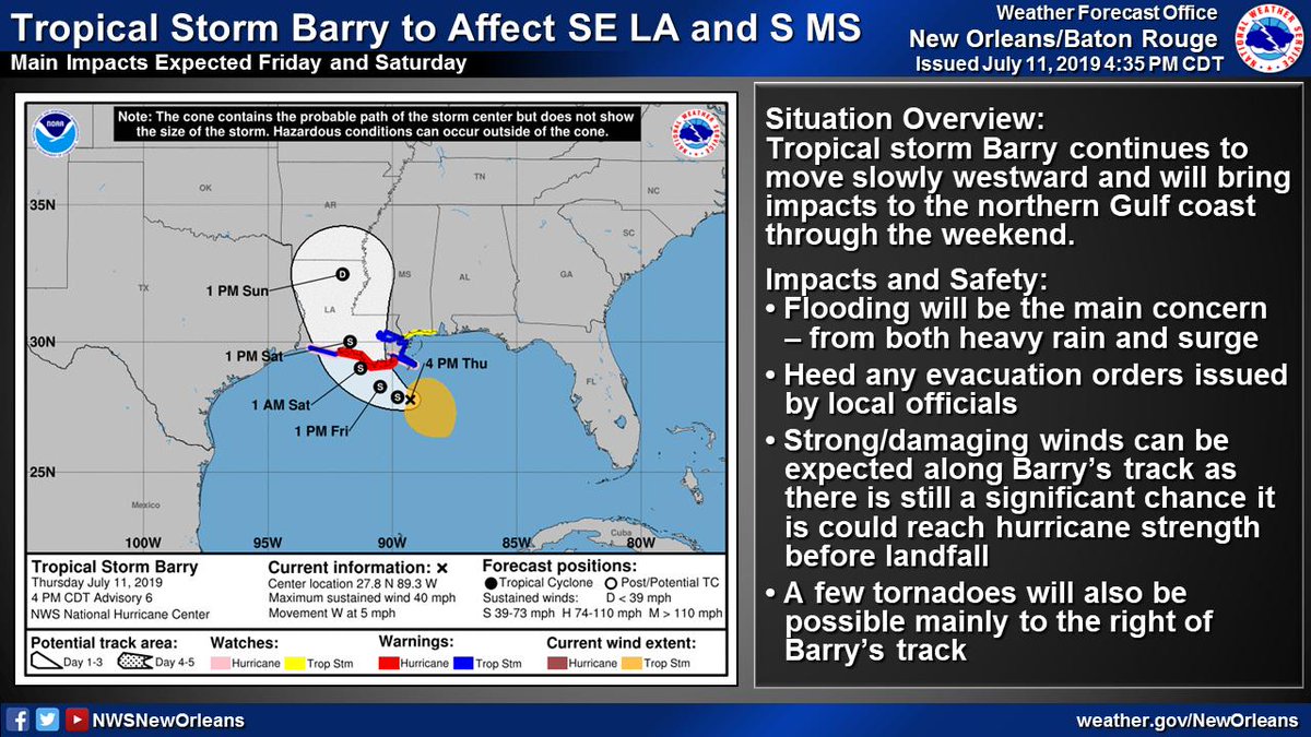
🌬️Strong/Damaging winds possible along Barry's track as it could still become a hurricane
🌪️A few tornadoes possible, especially near the coast
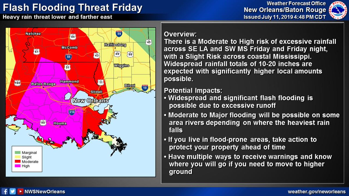
📏10-20" of rain with significantly higher local amounts possible
⏰Heaviest rain expected Friday through Saturday night
🌧️Heavy rain could lead to widespread/life-threatening flash flooding and moderate to major river flooding
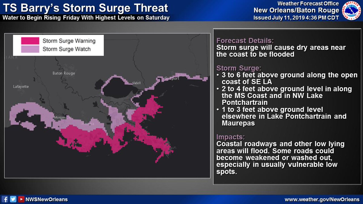
(3/6) TS #Barry will result in a storm surge threat across SE LA and coastal MS
📏3-6 ft of inundation possible along open coast of SE LA
⏰Water levels begin rising Friday with highest levels on Saturday
🌊Storm surge will flood coastal roadways and other low lying areas