Here's a thread on the latest local hazards expected from Hurricane #Delta.

Delta will bring potential for:
🌊 Life-threatening storm surge flooding
🌬️ Damaging winds
🌧️ Heavy rain and flash flooding

#lawx #mswx
(1/5) Delta will bring potential for life-threatening storm surge
Locally, the strongest winds from #Delta are expected across areas nearest the Atchafalaya River.

Strong winds could result in:
🔌 power outages
🌳 minor to moderate damage to trees/power lines
🏠 damage to a few structures from falling branches/trees

#lawx #mswx
(2/5) Strong to potentially damaging winds will be possible Friday
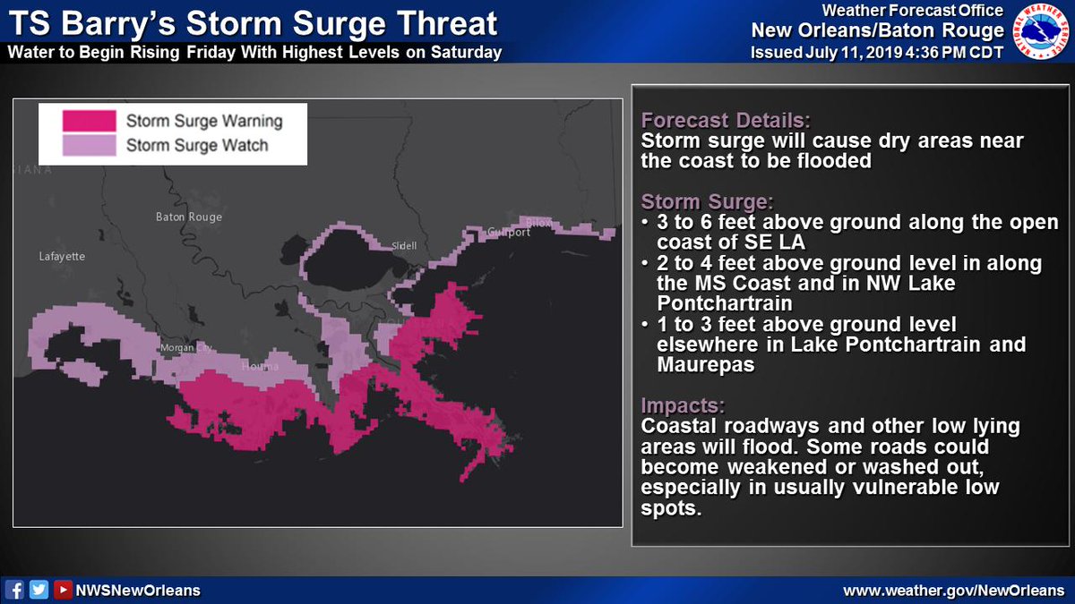
Life-threatening storm surge fro m#Delta will be possible across coastal areas of SE LA & MS.

Low lying roads could become flooded & some areas could become cut off in the most vulnerable areas.

If an evacuation order is issued by local officials, leave!

#lawx #mswx
(3/5) Peak inundation levels could reach: * 7 to 11 ft west of Por
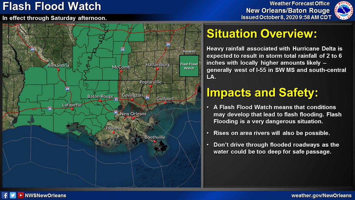
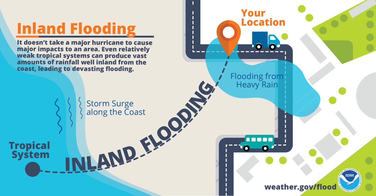
Heavy rainfall could lead to flash flooding depending on where any of #Delta's bands set up across the area.

Generally, the heaviest rain is expected west of I-55.

#lawx #mswx
(4/5) 2-6" of rain with locally higher amounts will be possib
In summary, #Delta could bring sig impacts in the way of strong to potentially damaging winds, storm surge flooding, & heavy rainfall.

Greatest impacts expected Friday into Friday night, so be sure all of your preparations are complete by Friday morning.

#lawx #mswx
(5/5)

• • •

Missing some Tweet in this thread? You can try to force a refresh
 

Keep Current with NWS New Orleans

NWS New Orleans Profile picture

Stay in touch and get notified when new unrolls are available from this author!

Read all threads

This Thread may be Removed Anytime!

PDF

Twitter may remove this content at anytime! Save it as PDF for later use!

Try unrolling a thread yourself!

how to unroll video
  1. Follow @ThreadReaderApp to mention us!

  2. From a Twitter thread mention us with a keyword "unroll"
@threadreaderapp unroll

Practice here first or read more on our help page!

More from @NWSNewOrleans

8 Oct
🌀 (1/5): Here's the latest with Hurricane #Delta as of 10AM CDT. Some slight strengthening was noted by recent aircraft recon observations with a steady strengthening trend now expected through the day today. Impacts still remain likely across our area Friday. #lawx #mswx ImageImage
💨(2/5): No changes to the Tropical Storm Watches and Warnings that remain in effect. Expect winds to increase across coastal areas of SE LA later today/tonight, and spread inland during the day on Friday. #lawx #mswx ImageImage
💧 (3/5) Locally heavy rainfall remains likely - with the greatest threat for flash flooding west of I-55 where a Flash Flood Watch remains in effect through Saturday afternoon. #lawx #mswx ImageImageImage
Read 5 tweets
8 Oct
Here is the 4AM update on Hurricane #Delta along with a thread on the latest local hazards expected from Hurricane #Delta.

Delta will bring potential for:
🌊Life-threatening storm surge flooding
🌬️Damaging winds
⛈️Heavy rain and flash flooding

#lawx #mswx
(1/5) Image
Locally, the strongest winds from #Delta are expected across areas nearest the Atchafalaya River.

Strong winds could result in:
🔌Power outages
🌳Minor to moderate damage to trees/power lines
🏠Damage to a few structures from falling branches/trees

#lawx #mswx
(2/5) Image
Life-threatening storm surge from #Delta will be possible across coastal areas of SE LA and MS.

Low lying roads could become flooded and some areas could become cut off in the most vulnerable areas.

If an evacuation order is issued by local officials, leave!

#lawx #mswx
(3/5) Image
Read 5 tweets
7 Oct
🌀 (1/6): Tweet thread with the latest on Hurricane #Delta. The 10AM position has #Delta continuing to cross the Yucatan & will emerge into the Gulf later today. No major changes to the forecast track as impacts, some significant, may be likely later this week/weekend #lawx #mswx
🌀 (2/6) Tropical Storm and Hurricane Watches are now in effect for portions of SE LA and S MS. Expect gusty winds to increase across the area late Thursday and into Friday - lasting into early Saturday. #lawx #mswx
🌀 (3/6) Storm Surge Watches are now in effect for all coastal areas of SE LA and S MS. Expect coastal flooding from storm surge to begin as early as Thurs night across these areas. Have preparations IN PLACE before THURSDAY if you live in a storm surge prone location #lawx #mswx
Read 6 tweets
6 Oct
🌀 (1/3) 10AM CDT Update on TS #Delta: Delta is now a major hurricane in the west-central Caribbean. No major changes to the forecast track as impacts remain likely along the northern Gulf coast late this week and this weekend. #lawx #mswx Image
🌀 (2/3) As a reminder, NOW is the time to have a plan! Don't let the recent cool temperatures fool you - it is still Hurricane Season! Impacts remain likely with this system across portions of the northern Gulf coast and you should take it seriously! #lawx #mswx ImageImageImage
🌀 (3/3) Do you know which NWS office serves your area? Our neighbors include @NWSLakeCharles to our west including SW LA, @NWSJacksonMS to the north across most of MS, & @NWSMobile to our E including the AL/FL beaches. Follow your local office for the latest updates! #lawx #mswx Image
Read 4 tweets
26 Aug
Here's a thread with the latest on Hurricane #Laura. It continues to strengthen as it moves toward the NW Gulf Coast. Minor to moderate impacts are expected across portions of SE LA and S MS. #lawx #mswx (1/5)
🌊 Life-threatening storm surge flooding is possible across coastal portions of SE LA generally west of Grand Isle.

🌊 Water levels will be highest during high tide today and tomorrow

🌊 Expect several roads to become impassible and some areas to become inaccessible

(2/5)
🌬️ Tropical storm force winds, especially in gusts, will be possible across much of the area

🌬️ The greatest threat for damaging winds will be across areas generally near the Atchafalaya River

🌬️ These winds could cause damage to trees, powerlines, and weak structures.

(3/5)
Read 5 tweets
11 Jul 19
(1/6) 5:15p Thu TS #Barry Update

🌧️🌊Flooding continues to be the greatest threat - both from heavy rain and storm surge
🌬️Strong/Damaging winds possible along Barry's track as it could still become a hurricane
🌪️A few tornadoes possible, especially near the coast

#lawx #mswx
(2/6) Significant flood threat associated w/ #Barry

📏10-20" of rain with significantly higher local amounts possible
⏰Heaviest rain expected Friday through Saturday night
🌧️Heavy rain could lead to widespread/life-threatening flash flooding and moderate to major river flooding
(3/6) TS #Barry will result in a storm surge threat across SE LA and coastal MS

📏3-6 ft of inundation possible along open coast of SE LA
⏰Water levels begin rising Friday with highest levels on Saturday
🌊Storm surge will flood coastal roadways and other low lying areas
Read 6 tweets

Did Thread Reader help you today?

Support us! We are indie developers!


This site is made by just two indie developers on a laptop doing marketing, support and development! Read more about the story.

Become a Premium Member ($3/month or $30/year) and get exclusive features!

Become Premium

Too expensive? Make a small donation by buying us coffee ($5) or help with server cost ($10)

Donate via Paypal Become our Patreon

Thank you for your support!

Follow Us on Twitter!