
,
6 tweets,
4 min read
Read on Twitter
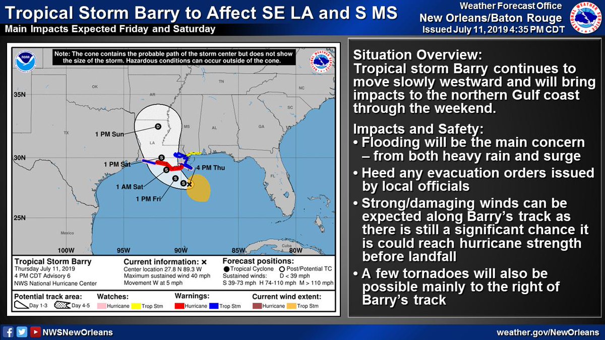
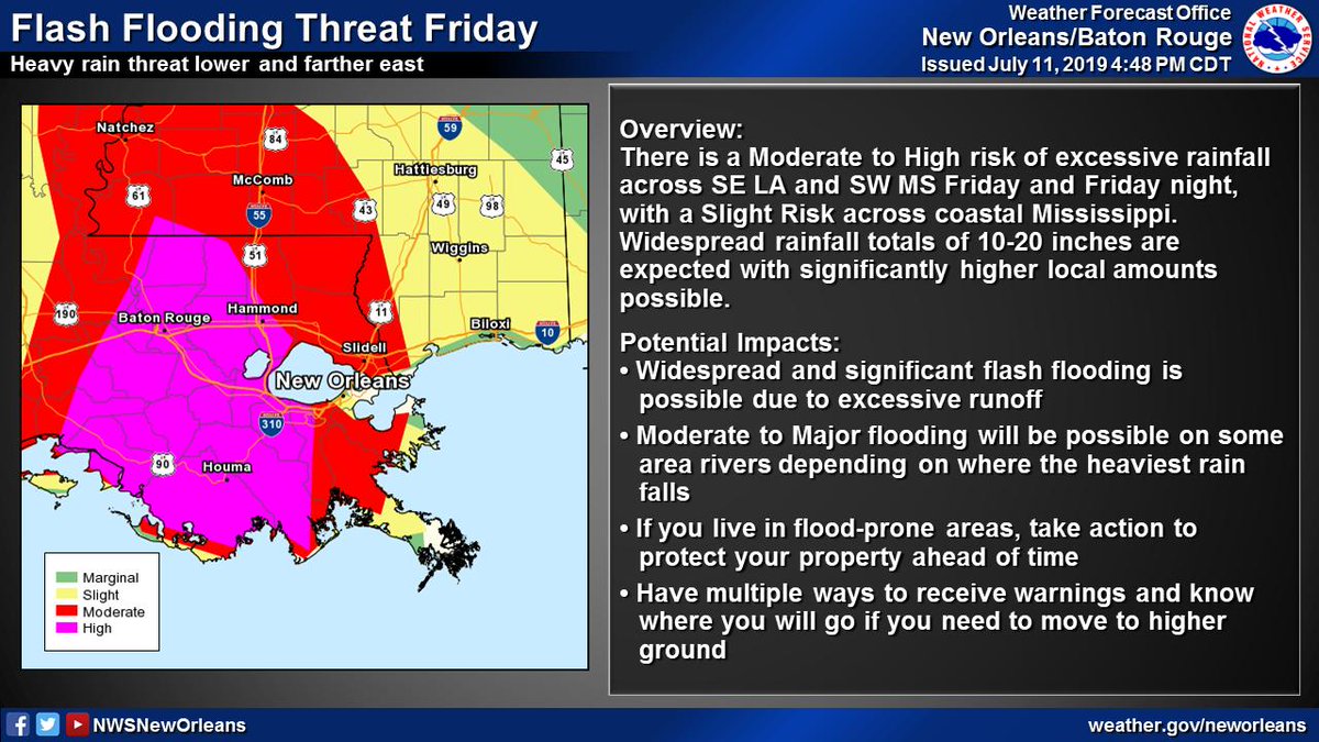
(2/6) Significant flood threat associated w/ #Barry
📏10-20" of rain with significantly higher local amounts possible
⏰Heaviest rain expected Friday through Saturday night
🌧️Heavy rain could lead to widespread/life-threatening flash flooding and moderate to major river flooding
📏10-20" of rain with significantly higher local amounts possible
⏰Heaviest rain expected Friday through Saturday night
🌧️Heavy rain could lead to widespread/life-threatening flash flooding and moderate to major river flooding
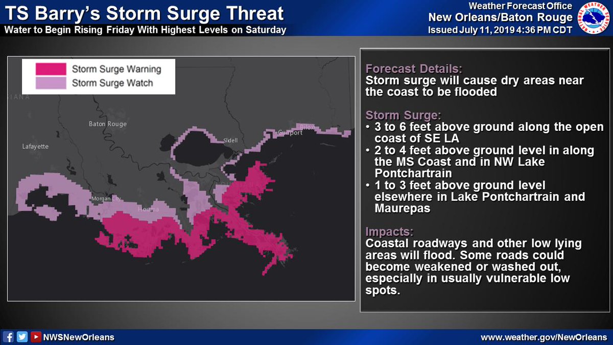
(3/6) TS #Barry will result in a storm surge threat across SE LA and coastal MS
📏3-6 ft of inundation possible along open coast of SE LA
⏰Water levels begin rising Friday with highest levels on Saturday
🌊Storm surge will flood coastal roadways and other low lying areas
📏3-6 ft of inundation possible along open coast of SE LA
⏰Water levels begin rising Friday with highest levels on Saturday
🌊Storm surge will flood coastal roadways and other low lying areas
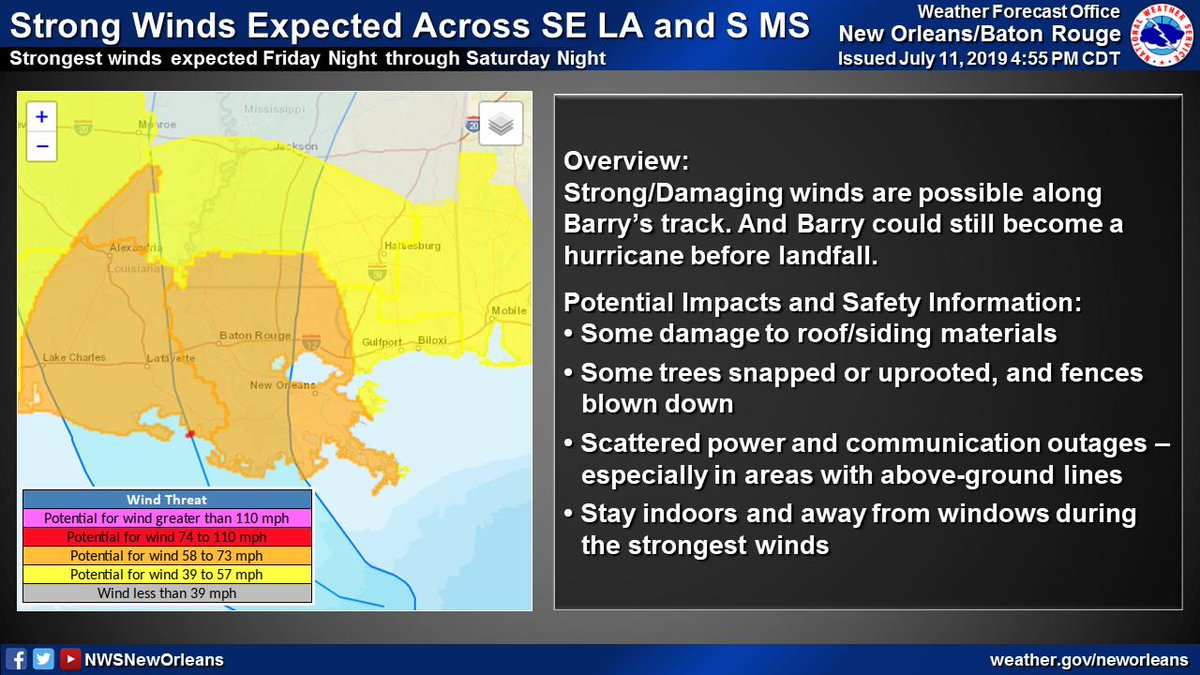
(4/6) There is a significant chance #Barry could become a hurricane before landfall
🌬️Damaging winds possible along Barry's track
⏰Highest winds expected Saturday
🌬️Damaging winds possible along Barry's track
⏰Highest winds expected Saturday
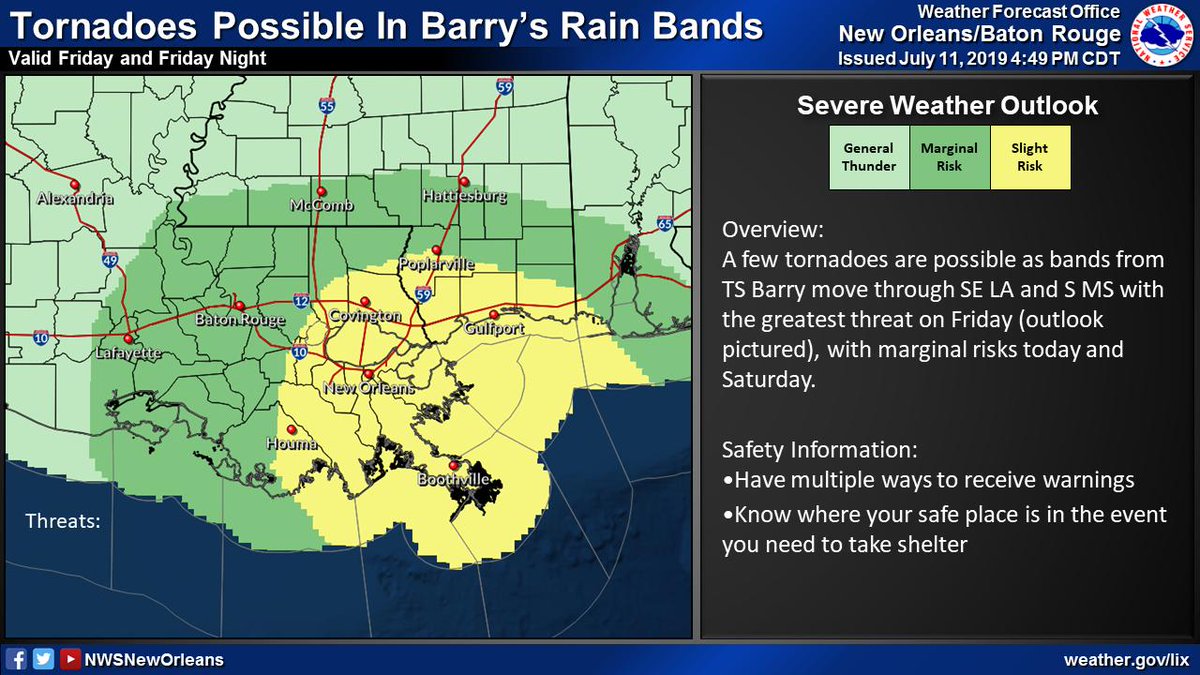
(5/6) A few tornadoes are also possible from TS #Barry
🌪️A few tornadoes possible in Barry's outer bands
⏰Greatest threat of tornadoes will be on Friday, though marginal risks exist through tonight and on Saturday
🌪️A few tornadoes possible in Barry's outer bands
⏰Greatest threat of tornadoes will be on Friday, though marginal risks exist through tonight and on Saturday
(6/6) NOW is the time to complete your preparations for TS #Barry.
🚗 If ordered to evacuate by local officials, leave!
🎒Have your hurricane supply kit on hand if you are riding it out
⚠️ Have multiple ways to receive warnings and know where your safe place will be
🚗 If ordered to evacuate by local officials, leave!
🎒Have your hurricane supply kit on hand if you are riding it out
⚠️ Have multiple ways to receive warnings and know where your safe place will be


