THREAD. A seriously muddy walk across one of the high, flat, clay plateaux of S Cambs. today, was full of reminders that this land, too heavy for ox-drawn ploughs, was medieval common pasture studded with managed woodland..
2. The fields were full of water despite being at the top of the hills - too flat to drain well, studded with small pockets of low land that made temporary ponds..
3. Coming across Eversden Wood in this waterlogged landscape reminded me of the great Oliver Rackham’s truism that #medieval #woods are not found on land that’s good for woods, but on land that’s no good for anything else - and of his advice on how to recognise them..
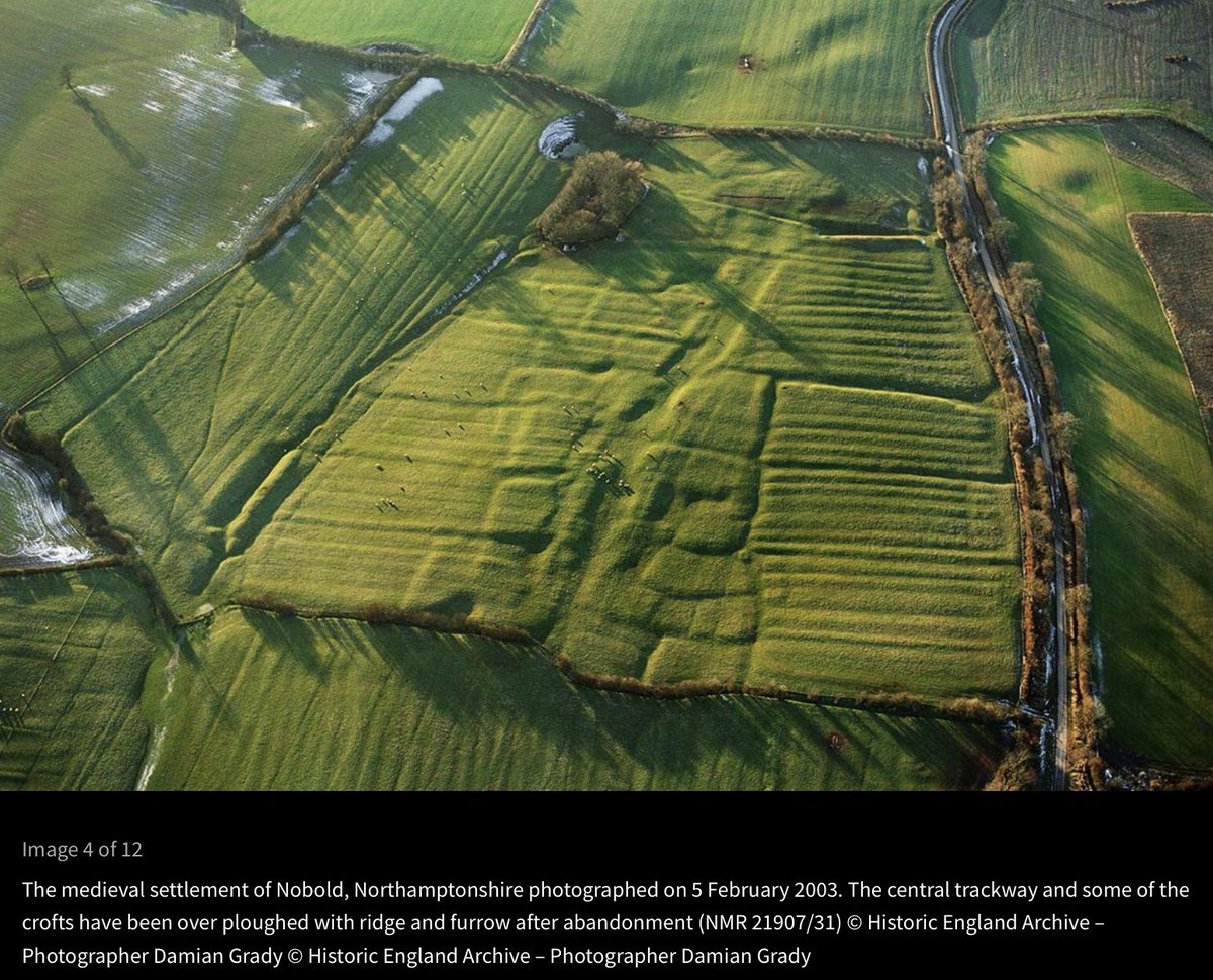
4. First, he suggested that ancient woods tend to have irregular boundaries: either sinuous (like the N boundary of Eversden wood) or zigzag with abrupt corners (like its S boundary). The curves along the N boundary reflect those of medieval ploughlands where men desperate ..
5. .. to make living in the land-hungry later 13th/early 14thC grubbed up woodland for arable fields. Sometimes those fields were lost to woods again, as the now-wooded ridge & furrow in the lower figure shows.
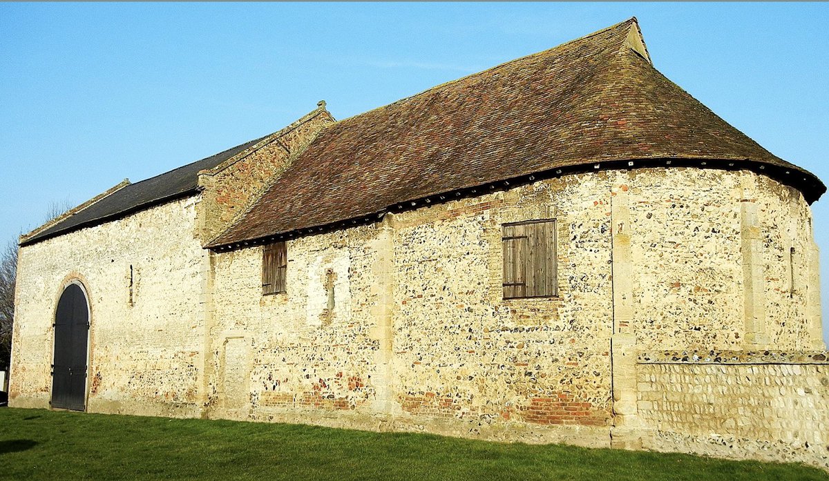
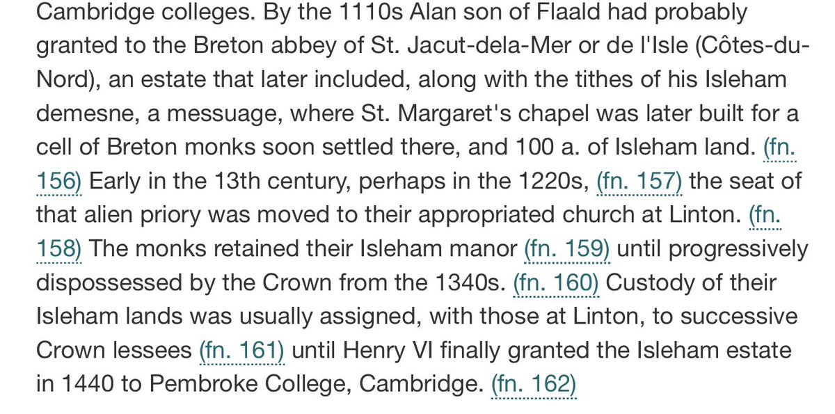
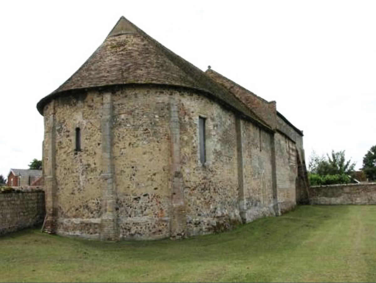
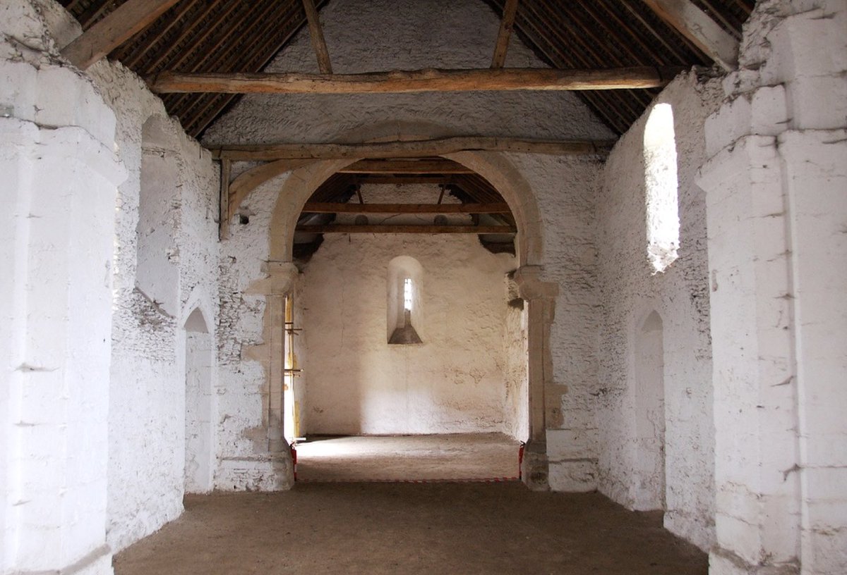
6. Sometimes they were cleared for other reasons: the moated site on the W of the wood was made by (men working for) the nuns of Clerkenwell, for a small manorial centre for to manage land nearby, given to them by 1182 british-history.ac.uk/vch/cambs/vol5…. It too has been reabsorbed.
7. Which reminds me that ancient woods often (though not invariably, lie across parish boundaries (the ... dots on the map): Eversden to N and E, Kingston on the SW, and Wimpole to the S.
8. Rackham remarked, too, that many medieval woods tend to be marked by characteristic banks & ditches: a ditch on the outside, & a bank on the inside, originally hedge-topped, to make it difficult for grazing animals to get in. This was because
9. .. such woods were managed to create crops for different purposes: some trees (eg ash, hazel) were coloured (cut to the ground at intervals of 4-8 years to make eg wood for fences, handles for tools; some trees (standards) were allowed to grow tall ..

blog.rowleygallery.co.uk/hayley-wood/
10. .. to produce wood for houses; and brushwood was collected for firing ovens and hearths. (Photo: coppicing at Hayley Wood wildlifebcn.org/blog/rob-ender…).
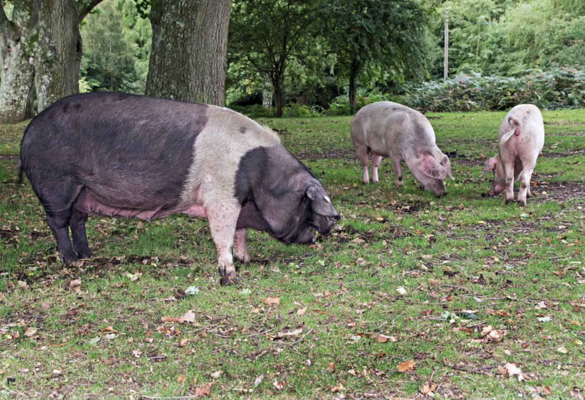
11. Woodland managed for cropping can often be identified in Domesday Book. Eversden wood was managed for fences (and no doubt other purposes) in 1086. The original Latin is useful, too, as it tends to use ‘nemus’ (a grove) for managed woodland and
12. .. ‘silva’ for unmanaged woodland where animals were allowed in, since there were no coppices whose spring leaves they could eat. Most often Domesday Bk mentions pigs like these in the New Forest, allowed to roam in autumn for beechmast etc. (newforestcommoner.co.uk/2014/09/22/pan…)
13. The high plateau on which Eversden Wood gave its name to Wetherley Hundred, one of the ancient subdivisions of Cambs. The Hundred met about a mile away, so I think the wood lay on ‘Wetherley’ = pasture studded with trees & grazed by sheep kept for their wool.
14. Rackham also identified 2 plant species which he said were diagnostic of ancient woodland because they are so slow to colonise areas: dogs mercury (L) and oxlips (R) - & we’re just the right side of the solstice to be able to look forward to seeing these in spring.
15. All this & much more in Rackham’s ‘Trees & Woodland in the British Landscape’ 👇, one of the many books offering straightward clues to landscape history that make a muddy winter walk so much fun for us all. END
PS Apologies: the photographs of dog’s mercury & oxlip are from the Woodland Trust woodlandtrust.org.uk
COPPICED, not coloured, spell-check 🙃

• • •

Missing some Tweet in this thread? You can try to force a refresh
 

Keep Current with Prof Susan Oosthuizen

Prof Susan Oosthuizen Profile picture

Stay in touch and get notified when new unrolls are available from this author!

Read all threads

This Thread may be Removed Anytime!

PDF

Twitter may remove this content at anytime! Save it as PDF for later use!

Try unrolling a thread yourself!

how to unroll video
  1. Follow @ThreadReaderApp to mention us!

  2. From a Twitter thread mention us with a keyword "unroll"
@threadreaderapp unroll

Practice here first or read more on our help page!

More from @DrSueOosthuizen

10 Dec
THREAD. This news from @NTChedworth has significant implications.
1. The mosaic was laid around 2 generations after Roman administration & armies were withdrawn from Britain.
2. The creation of a mosaic is a highly-skilled task. That means either (a) the craft survived in ...
.. practice over the intervening +/- half century, ie mosaics continued to be laid across OR (b) the craftsmen were brought over from the continent. There is no reason, as far as I know, to suppose (b).
3. The industry making the tiles also continued to operate.
4. The addition of a new room suggests that the economy of the villa continued to thrive. That depended on
5. ..continued input from an (at least fairly) undiminished agricultural workforce, and continuing management under the villa owners.
6. It also suggests that sufficient ..
Read 8 tweets
1 Dec
THREAD. The fun of landscape history is that, quite often, it’s little, insignificant details in plain sight that reveal past now-lost landscapes. They turn a country walk into a detective story - like this amble in Comberton, Cambs., reconstructing its vanished village green.
2. All that’s left today is this small grassy area and duck pond at the centre of the village - jam-packed with signals to its communal function: village sign, gritting box, benches, litter bin, & a bus stop just out of shot on the L. The 19thC OS map shows even more of them ...
3. The duck pond is the rounded feature 117 just NW of the crossroads near the bottom of the map. Communal facilities in 1880 included a smithy, a malting for brewing beer, & the Red Lion (all plot 119); & a school & schoolteacher’s house across the road, as well as a maze ...
Read 24 tweets
14 Oct
THREAD. Here’s a story about how I went looking for the obvious in a landscape and found something much more interesting. The place was Isleham, on the NE Cambs fen-edge & the initial hook was an early 12thC chapel, almost all that remains of a Breton priory..
2. ...founded within a generation of the Conquest. Today, only the priory chapel remains. It was converted into a barn & remained in agricultural use until the mid-20thC.
british-history.ac.uk/vch/cambs/vol1…
3. The lovely chapel is said to be ‘the best example in the country of a small .. substantially unaltered.. Benedictine priory church’. Its original 12th-century walls all survive; the raised nave roof is the only major change. More interesting tho ... english-heritage.org.uk/visit/places/i…
Read 28 tweets
31 Aug
Brilliant evisceration by #Stefan #Collini of consumerism in higher education & analysis of what’s needed so that #universities can properly play their part (& it’s only a part) in supporting a drive to social equity & justice
theguardian.com/commentisfree/…
‘One of the most obvious is between our de facto endorsement of a bitterly class-divided society and our fantasy that universities can not only escape the consequences of this but can positively correct it. We seem, for example, to be willing to allow wealthy parents to buy...
educational advantage for their children up to the age of 18, but then we believe that this advantage can somehow be made to have no consequences for their educational trajectory thereafter....’
Read 8 tweets
19 Aug
The Iron Age earthwork at Borough Fen is one of several #prehistoric enclosures built near the borders of the fen wetlands to manage large #communal herds of cattle grazing on the damp #pastures in summer, were centres for autumn roundups & seasonal assemblies for managing both. ImageImage
It lies in the same #common wetland grazed by the whole of the #medieval Soke of Peterborough; that was the early medieval common pasture of the 5th/6thC Gyrwe (‘fen people’); & which, @PryorFrancis’s work suggests, had been common through prehistory. Image
There’s another at Stonea Camp, and others at Tattershall Thorpe in Lincs. and Arbury Camp on the outskirts of Cambridge https://t.co/y0atadNEZD
Read 5 tweets
9 Aug
The atmospheric earthworks of the deserted #medieval village of Nobold, Northants., first recorded in 1284 - the main street, house plots & their back yards clearly visible. Most of the house sites & yards were ploughed up after abandonment (of which more, in a moment) ... (1/3)
2. You can tell ploughing happened after the village was abandoned as the blocks of ridges are bounded by the ditches that divided one property from the next. Is it possible to tell when it was abandoned? Well, maybe ...
3. First: when was it deserted? We don’t know. There are only some fragmentary records. In 1459 there were just 2 houses standing on 1 of the 3 manors with tenants in the village; but we don’t know the situation on the other 2 manors. By the early 18thC abandonment was complete.
Read 7 tweets

Did Thread Reader help you today?

Support us! We are indie developers!


This site is made by just two indie developers on a laptop doing marketing, support and development! Read more about the story.

Become a Premium Member ($3/month or $30/year) and get exclusive features!

Become Premium

Too expensive? Make a small donation by buying us coffee ($5) or help with server cost ($10)

Donate via Paypal Become our Patreon

Thank you for your support!

Follow Us on Twitter!