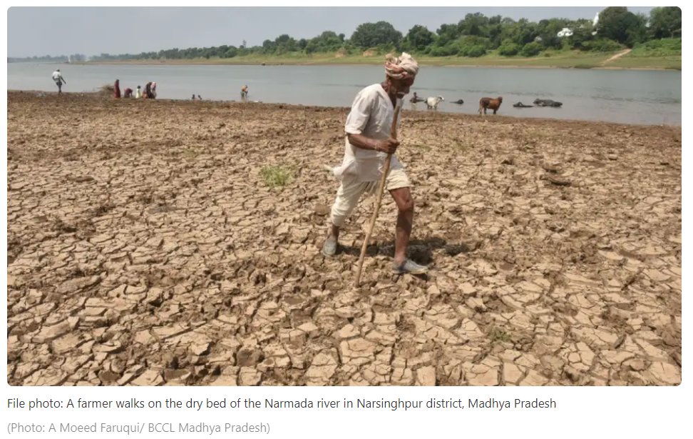
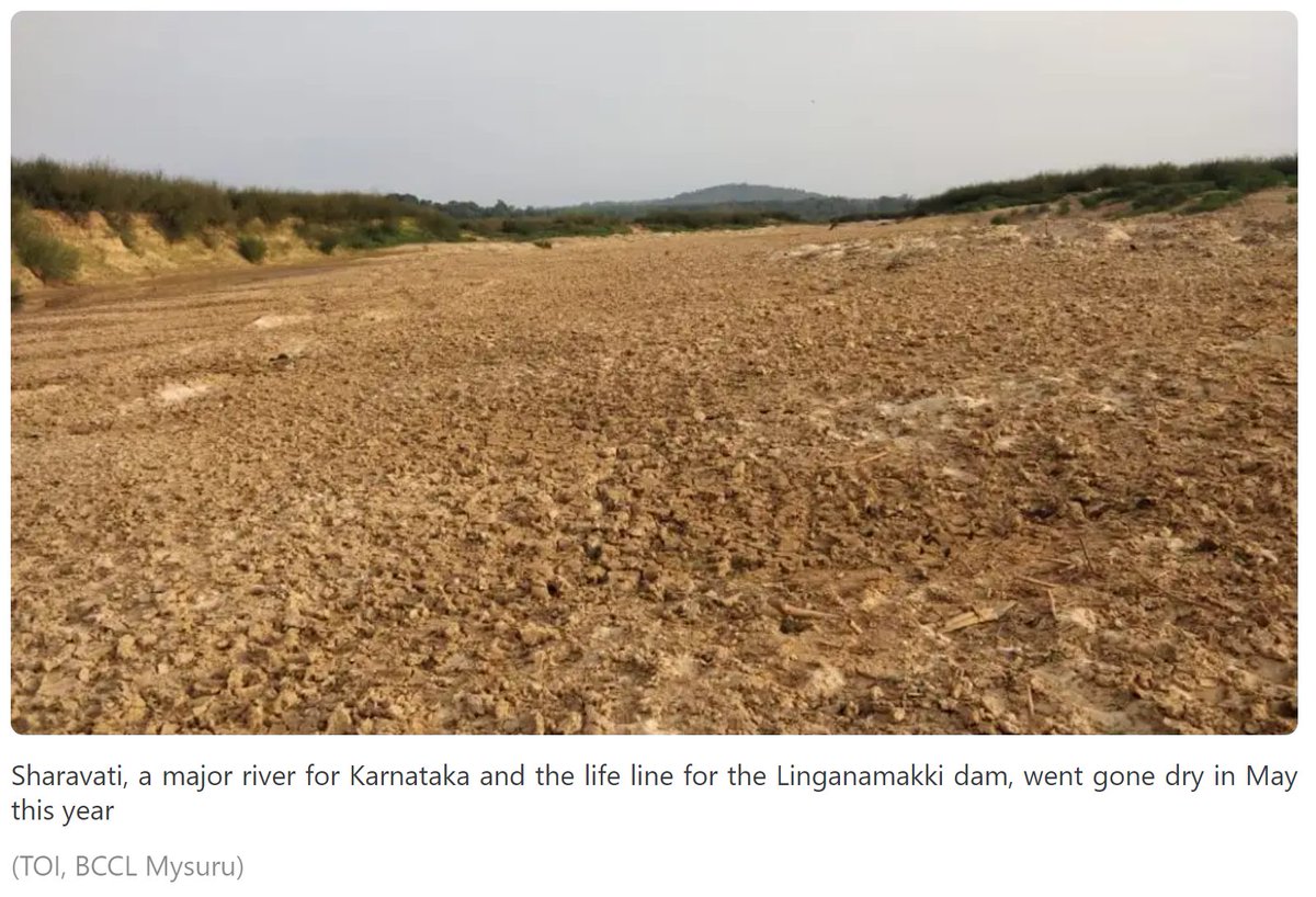
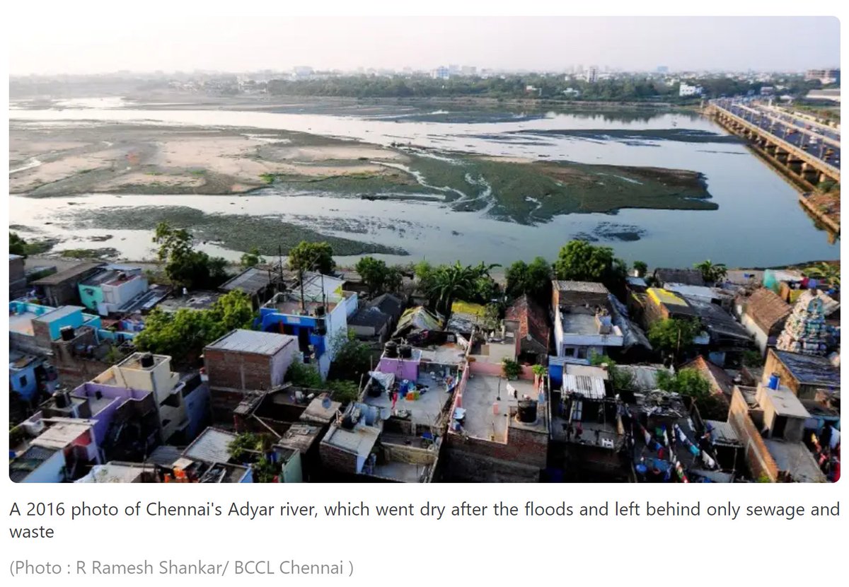
#Thread: Peninsular rivers in India are drying up at a phenomenal rate. Some of them dry up immediately after a flood! This not natural for India's relatively wet climate.
Here's an explainer on the contribution of Groundwater baseflow in keeping our rivers flowing.
Here's an explainer on the contribution of Groundwater baseflow in keeping our rivers flowing.

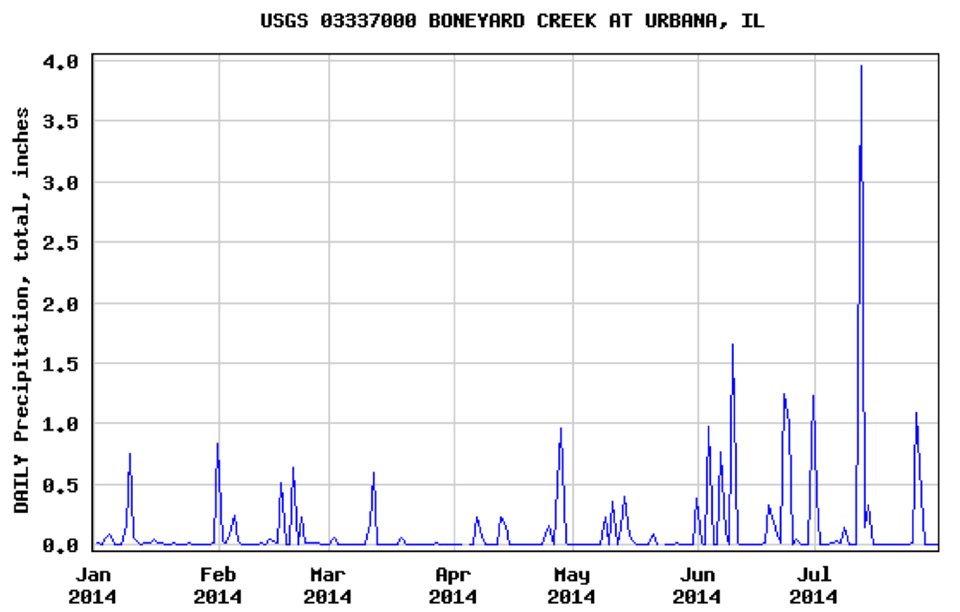
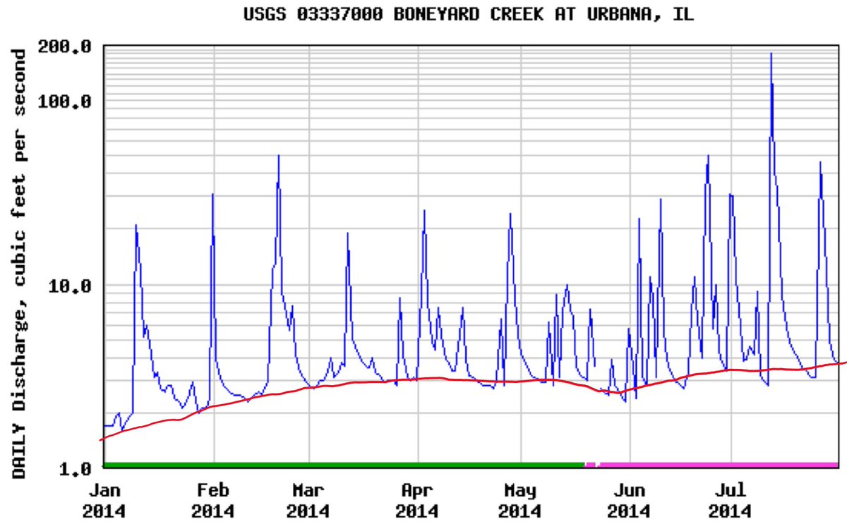
This is how catchments should respond to rain:
1st pic: Rain events in a US watershed
2nd pic: Corresponding streamflow events
Almost all the water below the red line is GW's contribution. Without it, you'd see flow only when it rains - THE NEW NORMAL in many rivers.
1st pic: Rain events in a US watershed
2nd pic: Corresponding streamflow events
Almost all the water below the red line is GW's contribution. Without it, you'd see flow only when it rains - THE NEW NORMAL in many rivers.
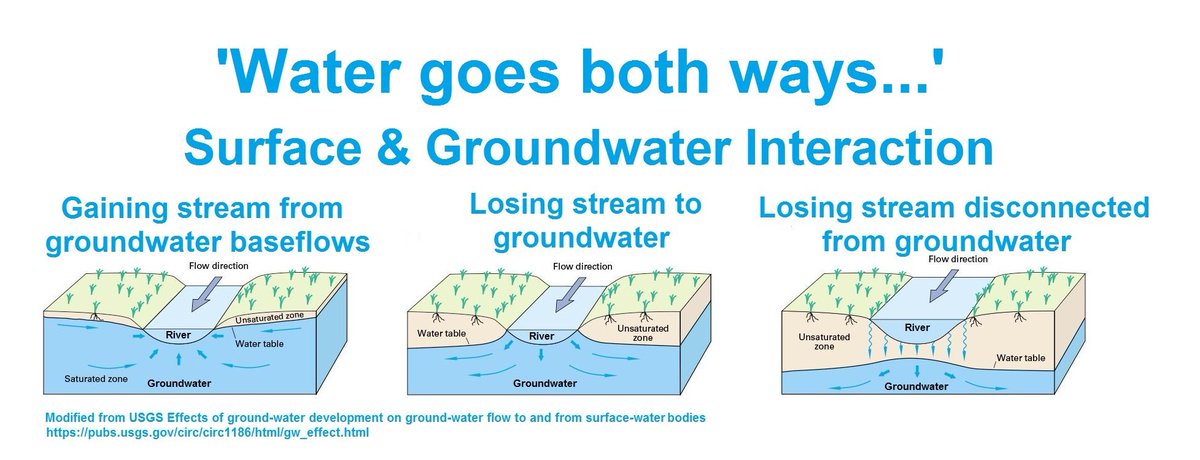
Rivers have constant give and take with GW. Why do you think its sides are called banks?
In the dry season: River's level drops below GW level and it borrows.
In the monsoon: River's level rises & pays back.
3rd illustration now happens all year round for many: THE NEW NORMAL
In the dry season: River's level drops below GW level and it borrows.
In the monsoon: River's level rises & pays back.
3rd illustration now happens all year round for many: THE NEW NORMAL
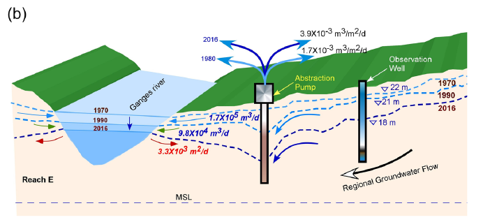
While snow-melt will ensure that Ganga (and similar rivers) will not dry-up soon, buts its flow has decreased by ~55% in some reaches
This is the work done by IIT KGP's @AbhijitGroup published in Nature (2018) on simulated GW-river interaction in Ganga in lower reaches.
This is the work done by IIT KGP's @AbhijitGroup published in Nature (2018) on simulated GW-river interaction in Ganga in lower reaches.
In the US, smaller streams are often called "washes". Maybe because they are not central enough in the watershed, and only wash away the rainwater. A river on the contrary, has a deeper existence.
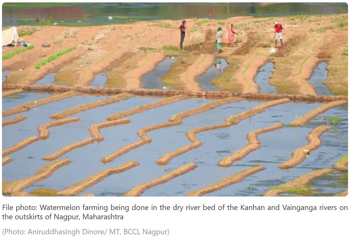
We are turning our peninsular rivers into "washes".
We are turning our peninsular rivers into "washes".

*Baseflow has decreased by ~55%
@FFFIndia @LicypriyaK @sunitanar @bahardutt @drvandanashiva @medhanarmada @ParveenKaswan @drqayumiitk @subodhyadav111 @supriyasahuias @anadish @VishnuNDTV @GargiRawat @saurabhtop @dhruv_rathee @_YogendraYadav @IndiaClimCollab @ICD_climate Please Retweet!
• • •
Missing some Tweet in this thread? You can try to
force a refresh