An #eruption of #Nyiragongo #volcano (#DRC) began in the evening of May 22. #Meteosat satellite data (from @CIRA_CSU) show a strong thermal anomaly appearing at 17:15 UTC, and a small #volcanic plume amidst widespread regional convection. Follow @CharlesBalagizi for updates.
If you're looking for background info on #Nyiragongo and its previous flank #eruptions in 1977 and 2002, there's a collection of papers in the Italian Acta Vulcanologica journal available here (with free PDFs):
libraweb.net/articoli.php?c…
libraweb.net/articoli.php?c…
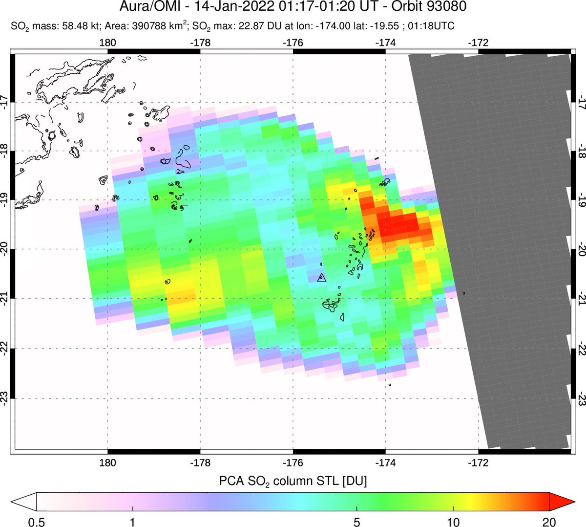
#Sentinel5P #Tropomi data on May 23 show SO₂ emissions from the #Nyiragongo #eruption. SO₂ to the SE over #Tanzania is at higher altitude (perhaps to tropopause level) and was emitted during the initial, more energetic phase of the eruption (17:00 UTC, May 22). @VirungaSupersit 
Nice @WeAreVolcanica paper on the viscosity of #Nyiragongo lavas. Lava flow hazards at the #volcano are significant due to low #lava viscosity, exacerbated by atypically steep slopes for a #basaltic volcano (as anyone who has climbed it will attest).
https://twitter.com/agwhittington/status/1396562303391354885?s=20
A @googleearth #timelapse showing #Goma's recent growth & exposure to #volcanic hazards. The animation spans 1984-2020; #lava flows from the previous flank #eruption of #Nyiragongo appear in 2002, & subsequent development covers the flows as the city expands towards the #volcano.
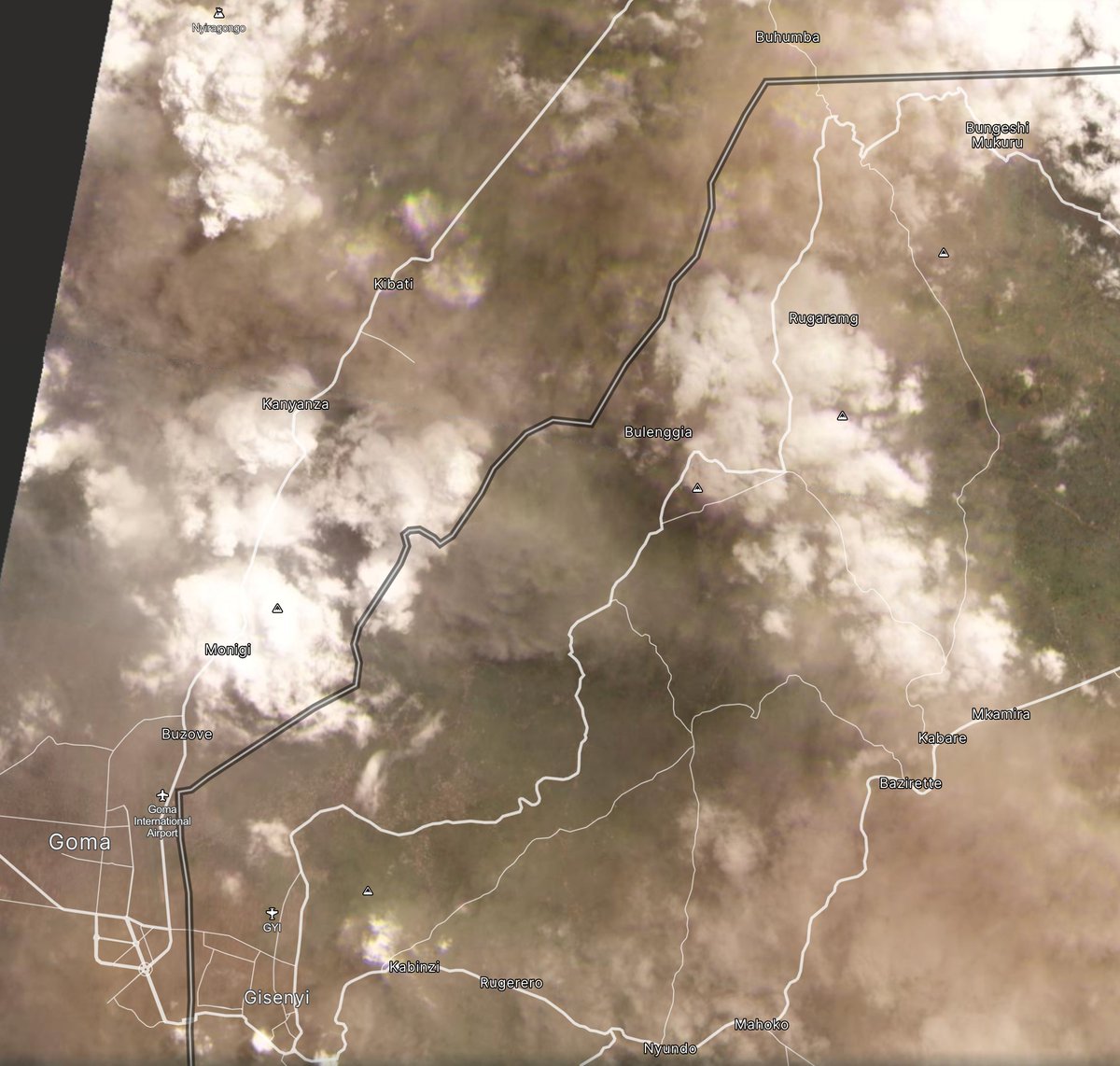
A pall of ash hangs over #Goma on May 25; #Nyiragongo is obscured by plume/clouds. Source of ash unclear but possibly from collapses within the Nyiragongo crater after #lava lake drainage.
↙️ @CopernicusEU #Sentinel3 OLCI True Color
↘️ @planet PlanetScope image of Goma-Gisenyi
↙️ @CopernicusEU #Sentinel3 OLCI True Color
↘️ @planet PlanetScope image of Goma-Gisenyi

Just in - new @CopernicusEU #Sentinel1 VH radar image of #Nyiragongo and #Goma on May 25 showing the flank #lava flows erupted on May 22 (pre-eruption image is from May 19). Upper flows appear to originate near the Shaheru crater on the S flank of Nyiragongo. @VirungaSupersit
Here's a look inside the #Nyiragongo #crater (#Sentinel1 VV data; May 13-25). Looks like a substantial intra-crater collapse has occurred. @sentinel_hub @smetsbenoit @CharlesBalagizi
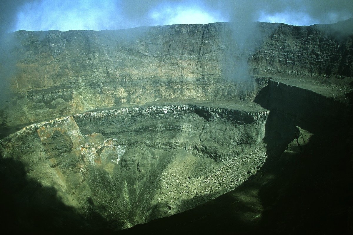
Crater subsidence is common during/after flank eruptions of basaltic volcanoes. #Nyiragongo's crater also collapsed a few days after the January 2002 #eruption; these photos were taken in March 2002.
📷 J. Durieux
More context in this #openaccess paper: agupubs.onlinelibrary.wiley.com/doi/10.1029/20…
📷 J. Durieux
More context in this #openaccess paper: agupubs.onlinelibrary.wiley.com/doi/10.1029/20…


Intense seismicity followed the 2002 #eruption; similar to the current situation that has triggered evacuations in #Goma. In Jan 2002, a limited seismic network hindered estimates of earthquake location & depth, but the network is now much improved: georiska.africamuseum.be/en/news/nyirag…
There are parallels with the recent #Iceland #eruption. Recall the pre-eruptive seismicity there and the uncertainty over if/when/where magma would erupt.
Now imagine a similar situation but with millions of people, an international border and a large lake above the active zone.
Now imagine a similar situation but with millions of people, an international border and a large lake above the active zone.
• • •
Missing some Tweet in this thread? You can try to
force a refresh