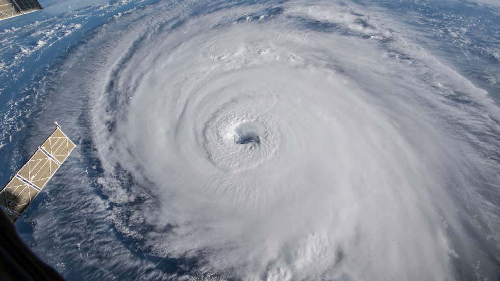
#CycloneYaas: What is Landfall? How ‘Very Severe Cyclonic Storm’ Could Impact Coastal Parts During Landfall?
weather.com/en-IN/india/ne…
(📸: TOI Kolkata, BCCL)
weather.com/en-IN/india/ne…
(📸: TOI Kolkata, BCCL)

What is #landfall?
A landfall, in simple words, is the storm moving over the land after its intensification in the ocean (heat source). Therefore, a cyclone is said to make landfall when the centre of the storm (eye) moves across the coast.
A landfall, in simple words, is the storm moving over the land after its intensification in the ocean (heat source). Therefore, a cyclone is said to make landfall when the centre of the storm (eye) moves across the coast.

The landfall usually brings with it high-speed winds, severe storm surge and torrential downpour, all of which can have a severe impact on the region. The storm usually weakens rapidly after landfall as the ocean heat and moisture that fuels the storm are no longer available. 

Impact of Very Severe #CycloneYaas’s landfall
The cyclone is most likely to impact coastal districts of Odisha and West Bengal along with the adjoining regions like Jharkhand, Bihar and northeast India.
#CycloneYaasUPDATE
The cyclone is most likely to impact coastal districts of Odisha and West Bengal along with the adjoining regions like Jharkhand, Bihar and northeast India.
#CycloneYaasUPDATE

Especially, destructive winds with a strength of storm force (i.e., approx. 90 kmph or more) are expected in eastern coastal Odisha from dawn to before noon on Wednesday.
#CycloneYaasUPDATE #CycloneYaas
#CycloneYaasUPDATE #CycloneYaas
During landfall, devastating winds blowing at more than 150 kmph could batter coastal districts of Odisha and West Bengal like Jagatsinghpur, Kendrapara, Bhadrak and Balasore.
#CycloneYaasUPDATE #CycloneYaas
#CycloneYaasUPDATE #CycloneYaas
Other districts like Puri, Cuttack, West Midnapore and North 24 Paraganas could also witness gale winds of around 100 kmph during the early hours of Wednesday.
#CycloneYaasUPDATE #CycloneYaas
#CycloneYaasUPDATE #CycloneYaas

Some of the main threats after cyclone landfall are likely to be flooding, swollen rivers, lightning, the collapse of kutcha houses, and fallen trees due to gale winds. A power outage is also possible due to potential damage near the coastal areas.
#CycloneYaas
#CycloneYaas
Extremely heavy rainfall
Cyclone Yaas is expected to bring very heavy—locally extremely heavy—rains across east, central and northeast India from Tuesday through Thursday, with total rainfall reaching 200-300 mm for these three days.
#CycloneYaasUPDATE #CycloneYaas
Cyclone Yaas is expected to bring very heavy—locally extremely heavy—rains across east, central and northeast India from Tuesday through Thursday, with total rainfall reaching 200-300 mm for these three days.
#CycloneYaasUPDATE #CycloneYaas

Torrential rain is expected over northern inland and eastern coastal Odisha from Tuesday to Wednesday night with accumulated precipitation of up to 250 mm within 24 hours.
#CycloneYaasUPDATE #CycloneYaas
#CycloneYaasUPDATE #CycloneYaas
Owing to these extremely rough conditions, Odisha, Jharkhand and Gangetic West Bengal have been placed under a red weather warning for May 26, while Bihar, as well as Jharkhand, will be under this warning for May 27.
#CycloneYaasUPDATE #CycloneYaas
#CycloneYaasUPDATE #CycloneYaas
Rough sea and tidal waves
The very intense cyclonic storm is expected to induce rough sea conditions over the region.
#CycloneYaasUPDATE #CycloneYaas
The very intense cyclonic storm is expected to induce rough sea conditions over the region.
#CycloneYaasUPDATE #CycloneYaas
As per IMD, the sea conditions are likely to gain pace from ‘Very High’ to ‘Phenomenal’ over northern parts of central Bay of Bengal, the north Bay of Bengal and along the coast of north Andhra Pradesh-Odisha–West Bengal-Bangladesh from the evening of May 25 to May 26 evening. 

The Indian National Centre for Ocean Information Services (INCOIS) has forecast significant wave height and swell height of up to 3.5 m for the coastal region into the ocean up to 10 km off Odisha and West Bengal from Tuesday afternoon till Wednesday night.
#CycloneYaasUPDATE
#CycloneYaasUPDATE
Fishers are strictly advised not to venture into the central Bay of Bengal till Wednesday, May 26. A similar warning remains for the north Bay of Bengal and along & off north Andhra Pradesh-Odisha-West Bengal–Bangladesh on Tuesday and Wednesday.
#CycloneYaasUPDATE #CycloneYaas
#CycloneYaasUPDATE #CycloneYaas

Damage expected
During the landfall, substantial damage to life and property is possible across coastal districts of north Odisha, West Bengal and adjoining interior districts of these states.
#CycloneYaasUPDATE #CycloneYaas
During the landfall, substantial damage to life and property is possible across coastal districts of north Odisha, West Bengal and adjoining interior districts of these states.
#CycloneYaasUPDATE #CycloneYaas

• • •
Missing some Tweet in this thread? You can try to
force a refresh


