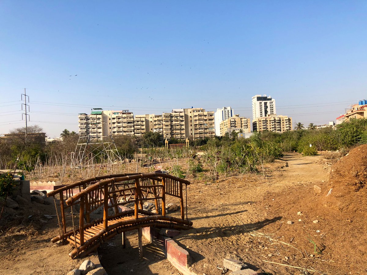
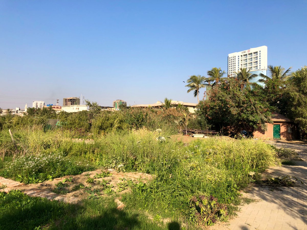
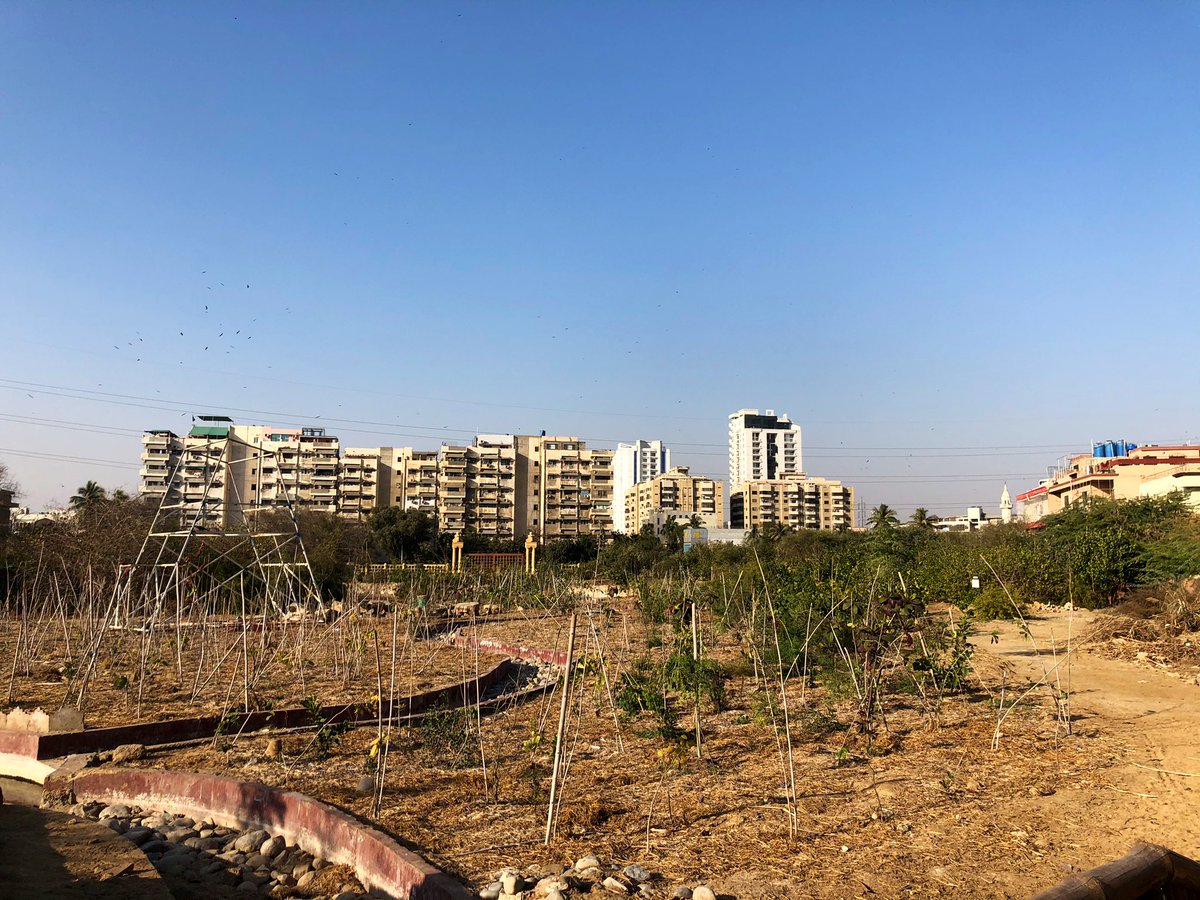
Here is Karachi’s “model” thoroughfare, Shahrah-e-Faisal (SEF). 15 kms from Metropole to the Airport, it falls under 2 Cantonments & 2 Districts. Before 2004, it had 3 bridges. Now it has 12. That hasn’t changed its capacity & it continues to be a nightmare. Here’s why.
Nine flyovers & underpasses, costing billions, have been added over the last two decades to make this “signal-free,” & a thoroughfare for cars to speed through. Significant chunks were widened. What the planners ignored was that most parts of SEF are destinations.
In Districts East, Malir & Karachi Cantt, SEF passes through densely populated areas. This means one thing: lots of cuts for cars & bikes from these areas to access the road. The red dots on the map. Over 200 along the entire 30km stretch. As Faisal Cantt builds up, this will ⬆️.
So sure, you can speed up & down at 2am, or in off-traffic hour, but once the rush hour kicks in every morning & evening, the bridges & underpasses all just become funnels for the bumper-to-bumper traffic. More cuts means more disruption, which makes congestion worse.
There’s no escaping the truth. SEF will never be a thoroughfare. It is just a badly designed road with a shameful capacity of 500k cars. It needs to be redesigned, from the ground up, to be a transit-way, so it’s carrying capacity can be increased several folds.
I’ll write in more details about specifics later, but the purpose of sharing this now is to show @LHRDevAuthority the mistake they are making with Mall Rd. No amount of underpasses will turn Mall into a thoroughfare for cars. You have SEF’s example. Stop the madness.

• • •

Missing some Tweet in this thread? You can try to force a refresh
 

Keep Current with Gulraiz Khan

Gulraiz Khan Profile picture

Stay in touch and get notified when new unrolls are available from this author!

Read all threads

This Thread may be Removed Anytime!

PDF

Twitter may remove this content at anytime! Save it as PDF for later use!

Try unrolling a thread yourself!

how to unroll video
  1. Follow @ThreadReaderApp to mention us!

  2. From a Twitter thread mention us with a keyword "unroll"
@threadreaderapp unroll

Practice here first or read more on our help page!

More from @gulraizkhan

7 Feb
Clifton’s Emerald Necklace.

Clifton, & District South, have the largest concentration of designated parks in the city. From Nehr-e-Khayyam to the beach & back up along the Boat Basin, they form a chain, which, if connected, can provide the city a valuable recreation space.
Nehr-e-Khayyam is right now a dumpster & dumping ground. Several attempts have been made to encroach along its banks. Few attempts made to restore the drain & develop it as a linear park. Say hello to these excited neighborhood pups.
The first park along its banks is the Urban Forest, which is visibly struggling. Entrance along the Nehr is closed, but the one in the street behind open. The place is overgrown, but promising as a space for engagement. This experiment of stewardship should not fail.
Read 18 tweets
17 Jan
Went on the Orange Line Metro, Pakistan’s first rail-based mass transit system, accompanied by @theLahorewala. What a beautiful piece of public infrastructure! Don’t want to dismiss the displacement it caused, but here’s some of the highlights:
Happy to report it has the new train shine & smell✨ 🌺. Commuters were almost all working class folks, quiet, reverent & respectful of this public property. It’s only been a few months, but the silence & non-chalance of the riders shows how quickly good transit can embed itself.
Here it is, pulling into an above-ground station, complete with the shrieks & the rush of air🚇💨. Everyone seems to be respectfully grappling with the system: ticket issuers, guards at platform, folks at turnstiles. It’s a whole new universe of interactions & I’m here for it 🙌🏽
Read 7 tweets
16 Jan
Lahore’s greatest assets are its sprawling public parks: esp Race Course/Jilani & Lawrence Gardens/Bagh-e-Jinnah. @asim_minahil suggested we walk through them, and up the Mall to Lahore Museum, as we caught up on our lives. Here’s them in all their glory, with no/few people.
Special mentions at Race Course: a thriving cactus display 🌵; a tree planted by filmstar/glookaara Megha Ji 💃🏽; a garden of yellow and Orange Marigolds 🌼; and curated, thick grooves of trees that look like an enchanted forest in this fog/smog 🌳🌴🌲
Here’s a cricket match in one of the two cricket fields, ensconced by these beautiful, neatly-planted trees along the boundary.
Read 6 tweets
3 Jan
Atlas of (Dys)Function: Power (& lack thereof) in Karachi & the region.

Here is the 1st chapter of my proposed atlas that I’ve completed over the last 10, wrist-breaking days. I’d taken time off from work to focus on this labour of love, & produce at least 1 complete artifact.
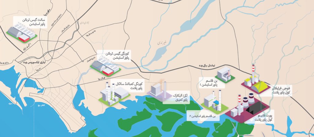
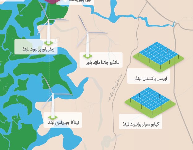
On the front is a map, geographically accurate, & slightly exaggerated, laying out all power production facilities (> 50 MWs) in & around the city. I added the missing ones from the last iterations, cleaned up the icons & standardised the colours for clarity.
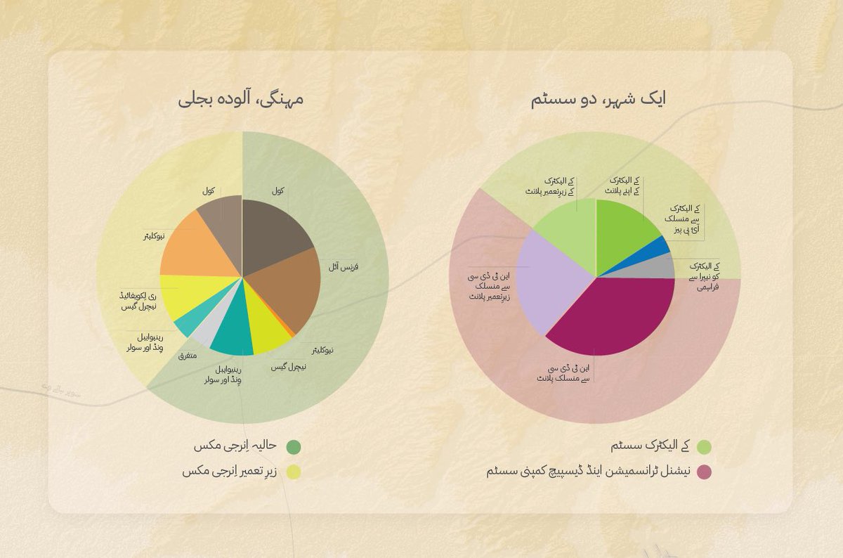
On the top right are two charts: 1 showing the challenge of the network divided into two T&D systems (with little connectivity) & the other shows the energy mix as it will shape up over the next two years.
Read 7 tweets
31 Dec 20
Here’s my New Year’s present for fellow Karachiites: Charaagh Talaay Andhera, a map of power produced in & around Karachi. By the end of 2021, there will be more than 1GW of electricity produced in the region, almost the same as Dubai. Khi needs around 3,500 MWs.
The bulk of this new capacity will come from new coal and RLNG based power plants that have already come online, or are on the way. They’re clustered on the west, around Hub, or on the east, around Port Qasim.
@KElectricPk, meanwhile depends on its existing 5 plants (on green squares), a bunch of existing & polluting IPPs (Gul Ahmed & Tapal), and some renewables that it gets itself (solar) or is provided by NEPRA (wind) along Gharo.
Read 7 tweets
5 Dec 20
Here is the promised fictitious map of a public tram network 🚃 in the south of #Karachi, with connections to #KCR 🚊 and the Green and Yellow BRTs 🚌. I didn’t dream it up. I read through hundreds of pages of JICA reports, so you don’t have to. Here’s what I learnt ...
There are some Japanese folks who know Gurumandir, Daakkhana, Lalookhait & Surjani way better than most of us. They spent years conducting surveys, detailed drawings, maps and studies, all compiled into 2 key outputs: KTIP Masterplan (2013) & KCR Preperatory Survey (2013)
Each of those documents is a treasure trove 🎁 and available online. Fun facts: KCR was proposed in the 1952 Master Plan of Karachi, & a slightly modified version was built by 1969. First major piece of civic infrastructure built post partition in Karachi. 🚂
Read 11 tweets

Did Thread Reader help you today?

Support us! We are indie developers!


This site is made by just two indie developers on a laptop doing marketing, support and development! Read more about the story.

Become a Premium Member ($3/month or $30/year) and get exclusive features!

Become Premium

Too expensive? Make a small donation by buying us coffee ($5) or help with server cost ($10)

Donate via Paypal Become our Patreon

Thank you for your support!

Follow Us on Twitter!

:(