About to head out for my first storm chase of the season here in #MEwx.
Maine chasing options are extremely limited by visibility thanks to lots of hills and even more trees. I have pre-scouted spots ready to go once storms develop.
Today’s target prob the hill N of Auburn.
Now for the classic dilemma of which storm to target. Skowhegan looks too far north, a couple cells along the pre-frontal trough farther south look meh, that cell north of MWN though...
ZDR says aim for Andover or Canton
Alright let’s play the cells developing on the leading edge of the subtle MCV left over from AM storms near BTV
Following severe storms through the Southeast this week, it's been hard not to notice some large gaps in radar coverage of the area.
Overlaying demographic data with radar coverage data, it's hard not to notice how the areas most underserved by NEXRAD are also majority-Black.
Of course, there are many areas across the country that lack good low-level NEXRAD coverage and are majority white. Plains, Midwest, west, Northeast, etc.
But it's hard for me not look at this map and think that the pattern of coverage in the South specifically is coincidental.
A couple quick takeaways from watching @spann tornado coverage most of yesterday:
-A few short & understandable key messages are repeated frequently
-"You know what to do" and "we've talked about this" are repeated often, helping viewers feel more in control of the situation.
@spann -There are frequent and detailed descriptions of what exact conditions specific areas are experiencing. I think this is valuable because it may reduce the urge to step outside and "double check", especially when tornadoes are visible from spotter streams or skycams
@spann -He's always up front with what, exactly, we know and don't know at any given moment
-Uncertainty is balanced by constant info on if/when certain questions will be answered i.e. "we'll know in the next five minutes if the warning will be extended into X towns"
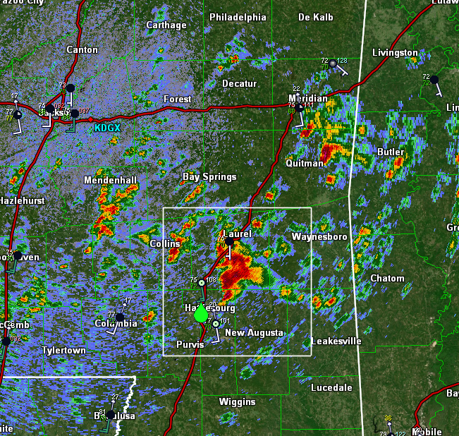
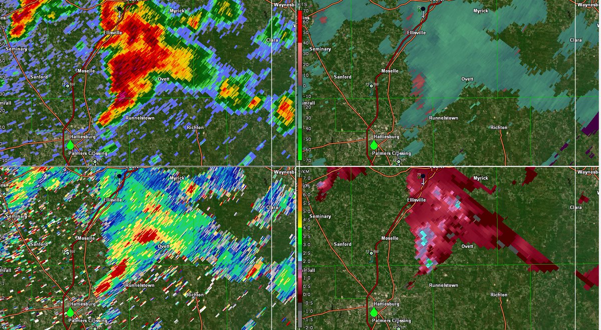
Cell near Hattiesburg #MSwx has rapidly punched up to about 50,000 feet which means it has broken through the capping inversion.
It is already exhibiting rotation on radar and is likely not far off from producing severe weather given the very favorable environment.
Looking at dual-pol data (ZDR bottom left), it appears this cell is already size-sorting raindrops with highest ZDR values along the forward flank gust front and lower ZDR values farther west/NW of the mesocyclone.
This helps infer the presence of rotation within the storm.
[11:49 AM EST 3/17/21] - looks like we have two strong mesocyclones in SE #MSwx, one near Sandersville and the other south of Myrick.
No warnings on these cells yet as rotation isn't strong enough to support a tornado as of now, but these cells are two to keep a close eye on.
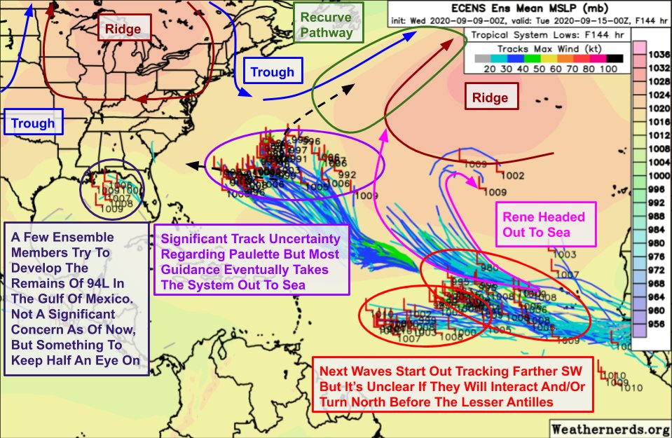
Quick roundup of overnight model guidance for tropical systems in the Atlantic.
Key idea is that a "recurve pathway" opens up in the central Atlantic this weekend. Rene definitely goes through, not clear if Paulette does or not.
Then we watch next waves emerging off Africa.
These "recurve pathways" will show up every few days as troughs move east/southeast from Atlantic Canada.
If storms are close enough, they recurve N/NE through those pathways. If not, they continue W or WNW.
But even if recurve chance 1 is missed, there will be another later.
Overall, I think the threat for significant tropical cyclone impacts (not counting the breezy showers from 94L) in the US during the next seven days is low.
Parts of the Caribbean (Lesser Antilles) should keep a close eye on the next wave emerging off Africa for possible impacts