Tim Ehrhart Profile picture
Oct 29 3 tweets 3 min read
Thanks to a tip from @bayraktar_1love about Russian presence at #Chornobaivka chicken farm in #Kherson. It appears that the Russians used at least part of the facility. Locals say that the Russians used the nearby quarry for a firing range. Today it all appears abandoned.
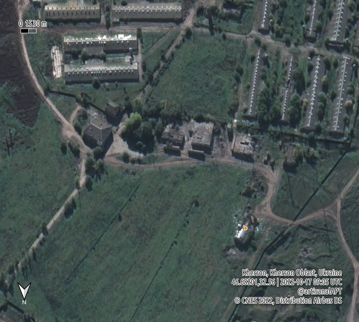
Some time in early September, a building on the north edge of the #Chornobaivka chicken farm was destroyed. According to locals, from incoming Ukrainian rockets. 46.68282 32.5588
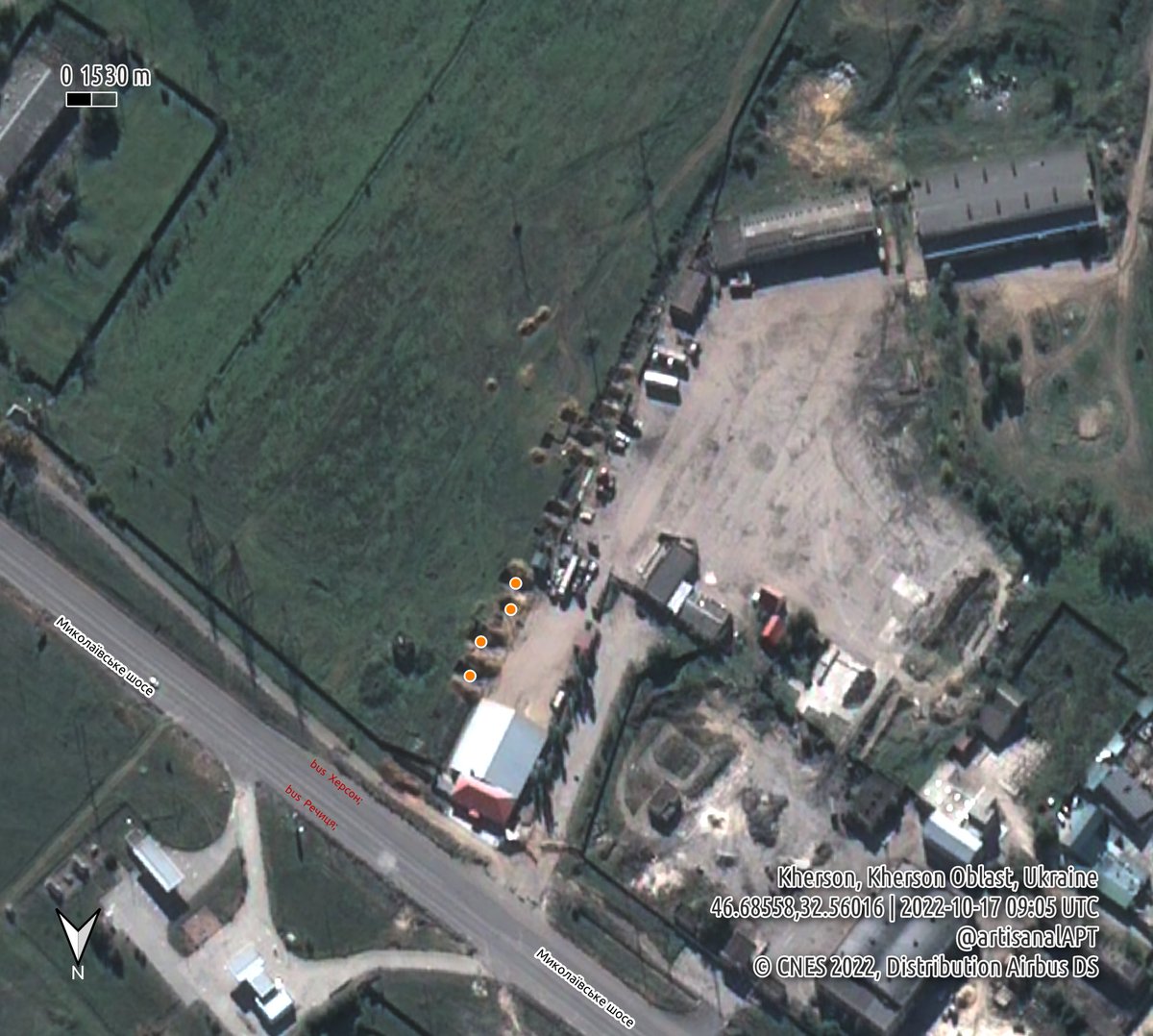
During the month of June, closer to the highway, it appears that the Russians dug 3-4 vehicle revetments into the side of a parking lot and used the building along the road. 46.6864 32.5605

Just like the #Chornobaivka airbase, it's all been deserted.

• • •

Missing some Tweet in this thread? You can try to force a refresh
 

Keep Current with Tim Ehrhart

Tim Ehrhart Profile picture

Stay in touch and get notified when new unrolls are available from this author!

Read all threads

This Thread may be Removed Anytime!

PDF

Twitter may remove this content at anytime! Save it as PDF for later use!

Try unrolling a thread yourself!

how to unroll video
  1. Follow @ThreadReaderApp to mention us!

  2. From a Twitter thread mention us with a keyword "unroll"
@threadreaderapp unroll

Practice here first or read more on our help page!

More from @ArtisanalAPT

Oct 19
Looks like the Russians finished creating a barge bridge over the #Dnipro near #Kherson in the past 24 hours. Imagery from Oct 18 show a barge pushing the last parts into place at 0814 UTC. This allows Russia to resupply faster or to evacuate quickly. It's also an easy target.🤔 Satellite overview of Antonovsky bridge near Kherson, UkrainClose up satellite view of the south side of Antonovsky brid
@GeoConfirmed Barge bridge complete at #Kherson on 18 October. Last barge being placed at 46.6658 32.7206.
And on the 17th there was more activity of Russian military vehicles waiting while others crossed by ferry. Same waiting location in a field around 46.7 32.8, just north of Prydniprovs'ke, east of #Kherson. Lots of trucks headed away from Kherson.
Read 4 tweets
Oct 2
Since Aug, 70km of a natural gas pipeline was laid between #Melitopol and Marynivka, #Zaporizhia Oblast, #Ukraine. This will likely connect to #Berdyansk. Melitopol has been without gas for months. The connection could be complete within the next few weeks. @GeoConfirmed
A KML version of the pipeline trace can be downloaded here for import into your favorite mapping tools. This was created based on satellite imagery from August and September 2022. drive.proton.me/urls/TES5W9RE8…
Read 4 tweets
Sep 25
The occupation government in #Luhansk, #Ukraine is pushing people to a telegram channel to get info about the referendum. Good #OSINT feed? t.me/budem_zhit 🤔
Apparently the LPR occupation authorities need to take a break while counting the ballots...
"The Department of the People's Militia of the Luhansk People's Republic reports that during the period of the referendum, the departments of the military commissariat will not work."
Read 4 tweets
Sep 16
Situation around #antonovskiybridge in #Kherson hasn't changed. Sep 15 images show the ferries in use nearby, and empty barges. But... 🧵 1/
Looking back at radar and optical imagery since Sep 6 we can see many boats, some confirmed as pontoon ferries, operating east of the rail bridge near #Kherson. Here's a map with the locations plotted on different dates. Where does the ferry land? 🤔2/
For a little more context and pictures... 3/
Read 5 tweets
Sep 2
Looking at imagery over #Kherson for 31 Aug we can see more Russian military vehicle movement than ever before. In this first image, we can see ~20 vehicles on the pontoon ferries transiting in each direction near 32.8035 46.6614.🧵 1/
11x Russian military vehicles waiting at 46.6442 32.8161 to move up the queue towards the military ferry across the #Dnipro 2/
16x Russian military vehicles queuing at 46.6287 32.8075. 3/
Read 6 tweets
Aug 29
Major movement of Russian equipment identified in 25 August 2022 imagery near #Kherson crossing the #Dnipro river. About 100 military vehicles seen moving in imagery, mostly northwards toward Kherson, at 08:48 UTC (11:48 Kyiv time) on 25 August. 1/ Image
At the edge of the image, we can see a convoy of at least 40 military vehicles waiting to move northward near the intersection at 46.6439 32.8159. 2/ Image
10 more Russian military vehicles wait at the military pontoon ferry landing point at 46.6614 32.8037 3/ Image
Read 9 tweets

Did Thread Reader help you today?

Support us! We are indie developers!


This site is made by just two indie developers on a laptop doing marketing, support and development! Read more about the story.

Become a Premium Member ($3/month or $30/year) and get exclusive features!

Become Premium

Don't want to be a Premium member but still want to support us?

Make a small donation by buying us coffee ($5) or help with server cost ($10)

Donate via Paypal

Or Donate anonymously using crypto!

Ethereum

0xfe58350B80634f60Fa6Dc149a72b4DFbc17D341E copy

Bitcoin

3ATGMxNzCUFzxpMCHL5sWSt4DVtS8UqXpi copy

Thank you for your support!

Follow Us on Twitter!

:(