@GeoConfirmed Barge bridge complete at #Kherson on 18 October. Last barge being placed at 46.6658 32.7206.


 A KML version of the pipeline trace can be downloaded here for import into your favorite mapping tools. This was created based on satellite imagery from August and September 2022. drive.proton.me/urls/TES5W9RE8…

 Looking back at radar and optical imagery since Sep 6 we can see many boats, some confirmed as pontoon ferries, operating east of the rail bridge near #Kherson. Here's a map with the locations plotted on different dates. Where does the ferry land? 🤔2/
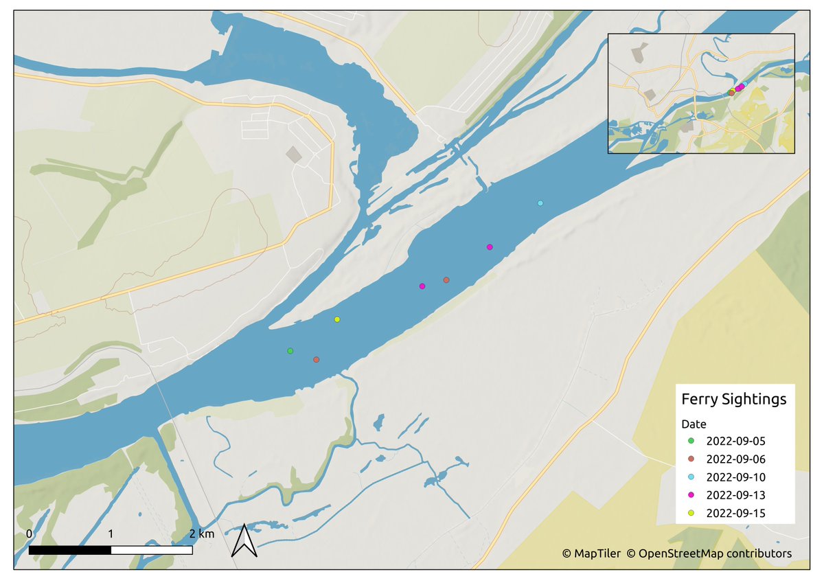

 11x Russian military vehicles waiting at 46.6442 32.8161 to move up the queue towards the military ferry across the #Dnipro 2/
 At the edge of the image, we can see a convoy of at least 40 military vehicles waiting to move northward near the intersection at 46.6439 32.8159. 2/


 Sentinel-2 imagery from 7 August over Kherson was clear and showed all four pontoons in different locations at the same time. 2 were in use at the #AntonovskiyBridge, as expected, and two more were hiding in the Konka river, as discussed previously. 2/

 Looking along the #Konka for the past week, I think there was another pontoon hidden to the east of the launch point in the marsh on 2022-08-02 at 46.6362 32.7709. It's SPOT imagery, so it's not super sharp, but it looks like a pontoon measuring about 60x12m and small boat. 2/
 Why are they moving military vehicles *here* instead of at the easier crossing point? What's the landing point on the south side of the river? There's no road directly across this point to support vehicles. 2/
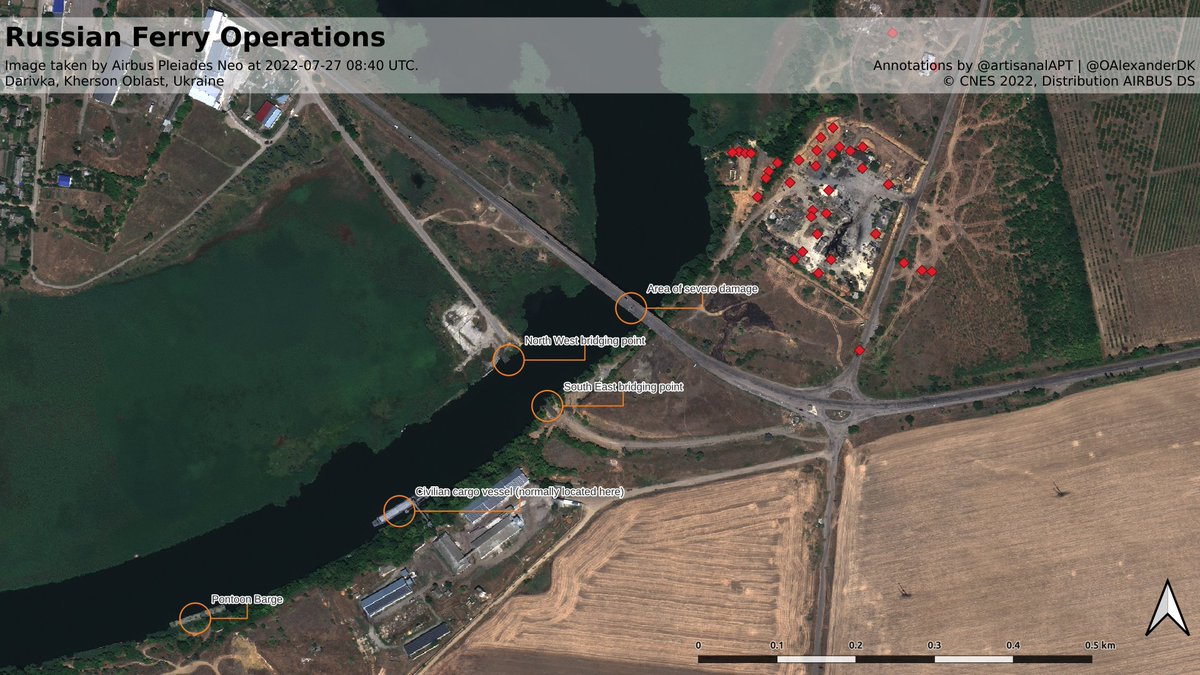
 Additionally, while comparing 27 and 30 June imagery we discovered a possible Russian military post located in a building in the village, based on visiting military vehicles and a tent set up behind the building at 46.7468, 32.8034 in #Darivka.


 Russian military license plate... 1137EK??