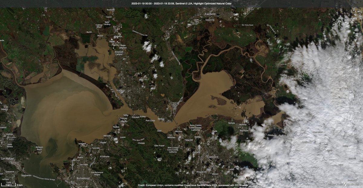
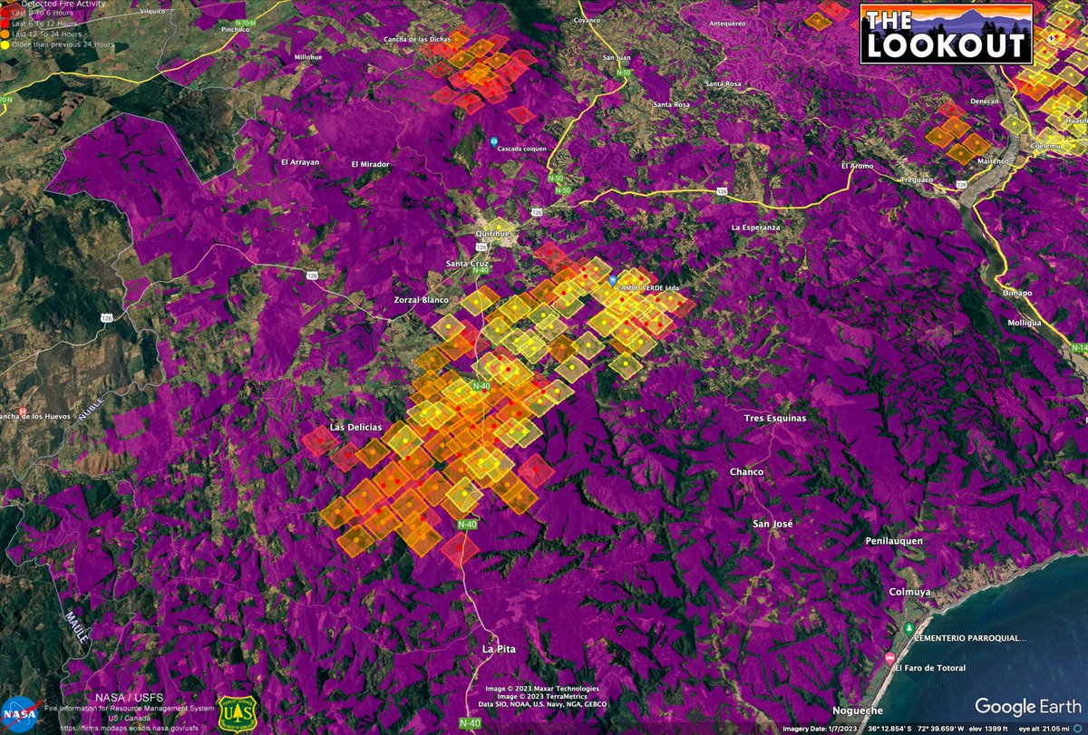
The large #wildfires in #Chile are spreading quickly across large areas of non-native plantations of radiata pine and eucalyptus, many of them planted by foreigners during a dictatorship. These maps show recent MODIS heat detections on top of mapping of plantations (purple). 1/x
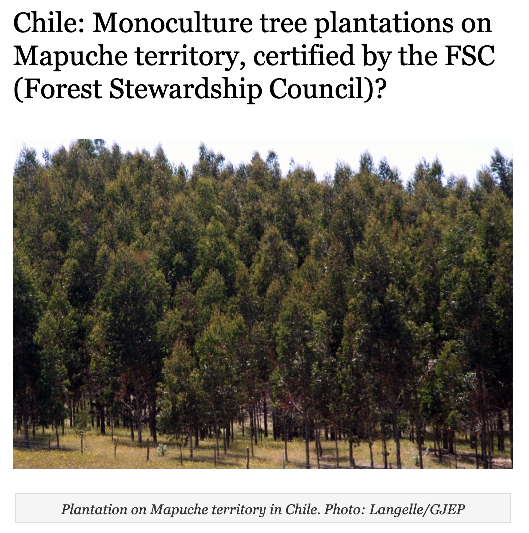
Over 3 million acres of plantations were established in this region in the 80s and 90s. As seen in the American West, during severe weather, conifer tree farms burn like the sun. Even-aged forestry is turning out to be an ecological disaster, all over the globe. 2/x Source: Patagon Journal
The @FSC_IC has certified over 3M acres of Chilean plantations as being 'sustainably managed'. But as in the USA, they failed to imagine the potential scale of wildfire losses in managed forests. Wildfire is a structural problem in tree farms, not easily mitigated. 3/x
The World Bank's take on Chilean forests? Spend lots of money on planning, give Chile money to plant 300k acres more conifers by 2025 (but beef up firefighting), teach small landowners how to manage their tree farms like the big ones do, lots of feel-good language. 4/x
The EU, World Bank, IMF, and many mega-NGOs continue to promote tree planting as one of the primary ways we can combat climate change, but storing carbon in matchsticks turns out to be a bad idea. Forest carbon offsets are 10 pounds of bullshit in a 5 pound bag. Think twice. 5/x
Back to Chile - it's a terrible situation, but it didn't just come out of nowhere. Don't just blame climate change. Dictatorship, privatization, native land rights, global markets, international fire-war profiteering - there is a lot more to this story. 6/x
Plantation data from CONAF. #GISorSIT #InternationalGIS #gischat sit.conaf.cl
Unfortunately, megafires are pushing us harder into even-aged forest management - even for companies that didn't want to go there. Adapting to the new normal, figuring out how to reforest in ways that acknowledge the inevitability of wildfire is the challenge of our times.

• • •

Missing some Tweet in this thread? You can try to force a refresh
 

Keep Current with Zeke Lunder ~ The Lookout

Zeke Lunder ~ The Lookout Profile picture

Stay in touch and get notified when new unrolls are available from this author!

Read all threads

This Thread may be Removed Anytime!

PDF

Twitter may remove this content at anytime! Save it as PDF for later use!

Try unrolling a thread yourself!

how to unroll video
  1. Follow @ThreadReaderApp to mention us!

  2. From a Twitter thread mention us with a keyword "unroll"
@threadreaderapp unroll

Practice here first or read more on our help page!

More from @wildland_zko

Jan 21
First cloud-free #Sentinel2 satellite images in a month dropped yesterday. Great to check out snow levels, reservoirs, and wet wet wet in the Butte Basin/Lower Sacramento River. First image compares Colusa area now vs 12/15/2022. #Geography #RemoteSensing #CaWx #CaStorm 1/x
Imagery paints a picture of soil types. Along the River, coarser soils settle quickly once floodwaters slow down. Blue areas have more clay, because super-fine soil particles can stay suspended longer, travel farther in slow-moving floodwaters. Orchards prefer coarse soils. 2/x
Plumes of sediment from the Pajaro and Salinas Rivers are still very visible in the Monterey Bay on 1/19/2023. Two visualizations of sediment in the lower Delta and San Pablo Bay. 3/x
Read 6 tweets
Nov 10, 2020
It's been two years since the #campfire burned here in Butte County. This thread is a narrative about the fire with satellite images I created of the fire at the peak of it's rampage, and aerial photos we flew. This image shows the long-range spotting which spread the fire. 1/x
The fire started in the Feather River Canyon, near Pulga, and raced up Flea Valley Creek. Once the fire reached the rim of the Canyon, it rained embers all over the Concow Basin. It raced thru heavy fuels in the Concow area, which still had tall dead brush from fires in 2008. 2/x
By the time the leapt across the West Branch Feather River, it was nearly 5 miles wide. Every bright yellow dot in this image is a burning structure. This view looks North. Fire spread from right to left. 3/x #WUI #planning #paradiseca
Read 9 tweets

Did Thread Reader help you today?

Support us! We are indie developers!


This site is made by just two indie developers on a laptop doing marketing, support and development! Read more about the story.

Become a Premium Member ($3/month or $30/year) and get exclusive features!

Become Premium

Don't want to be a Premium member but still want to support us?

Make a small donation by buying us coffee ($5) or help with server cost ($10)

Donate via Paypal

Or Donate anonymously using crypto!

Ethereum

0xfe58350B80634f60Fa6Dc149a72b4DFbc17D341E copy

Bitcoin

3ATGMxNzCUFzxpMCHL5sWSt4DVtS8UqXpi copy

Thank you for your support!

Follow Us on Twitter!

:(