My Authors
Read all threads
1) This is a thread for young Indians to understand China:

I will explain -
How Communist China got a border with India which it didn't have in 1949.

Where are the potential flash points for long term?

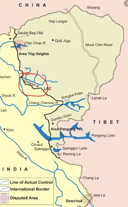
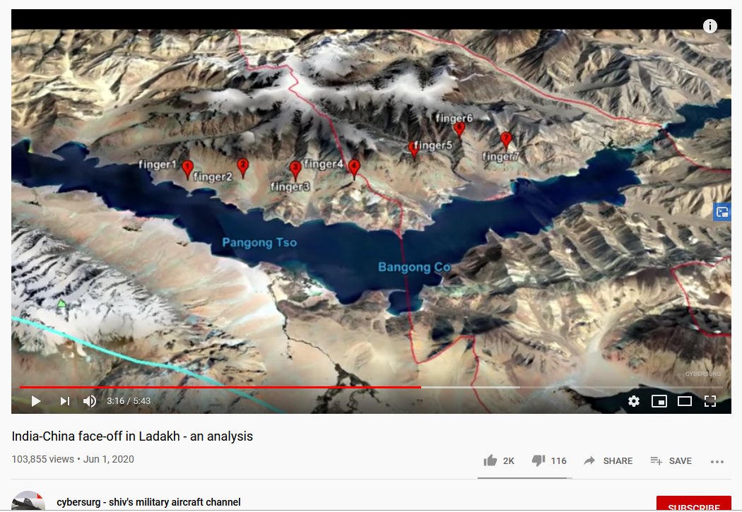
Where are the conflict zones of 2020? Why #IndiaChinaFaceOff now?
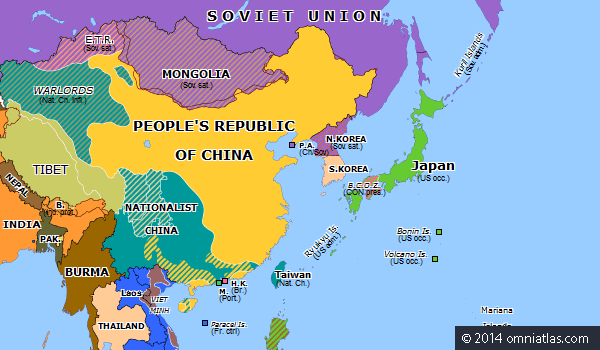
2) China NEVER had a border with India historically. India's border was mostly with Tibet and to some extent central Asian East Turkestan.

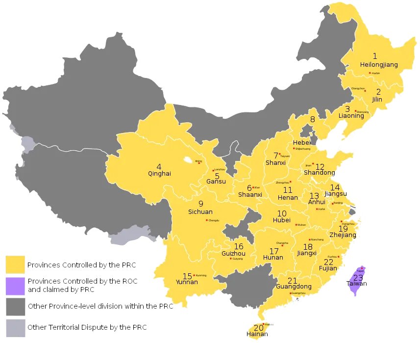
What you see in Yellow here was 1949 China when Communists took over.
They drove away socialists to Taiwan. Gobbled Tibet, Xinjiang & more.
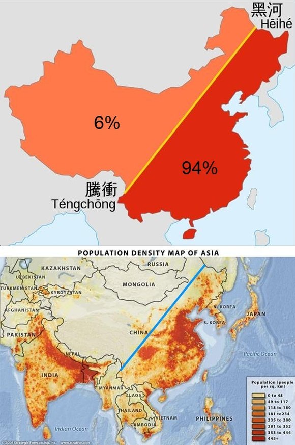
3) There are 2 places in China called Heihe & Tengchong. If you draw an imaginary line connecting them, it roughly divides today's China into 2 halves.

The Eastern half has 94% of China's population! That was historic China.

Most of the Western half was acquired with land grab
4) This map shows how China claims territory in India.

They claim Aksai Chin, parts of Ladakh, Shaksgam valley, parts of Uttarakhand and entire Arunachal Pradesh. Their approach is simple.

They probe you with token land grab. If you blink, that's it. You will lose everything.
5) Communist China gobbling the Buddhist majority Tibet was the biggest tragedy of 20th century. Tibet was India's cultural, religious, historical neighbour for 1000+ years.

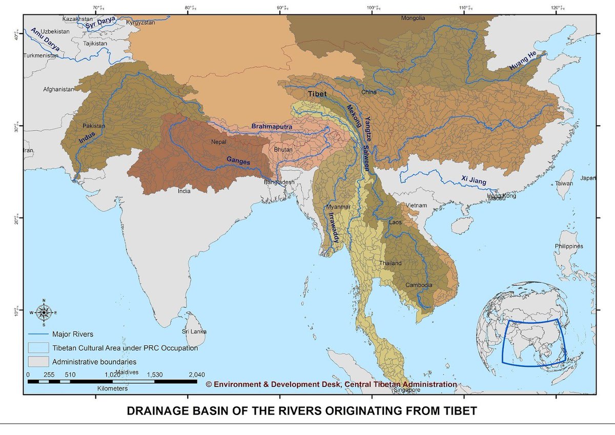
More importantly, Tibet is the origin of nine major rivers of Asia. Communists took over water control 😑
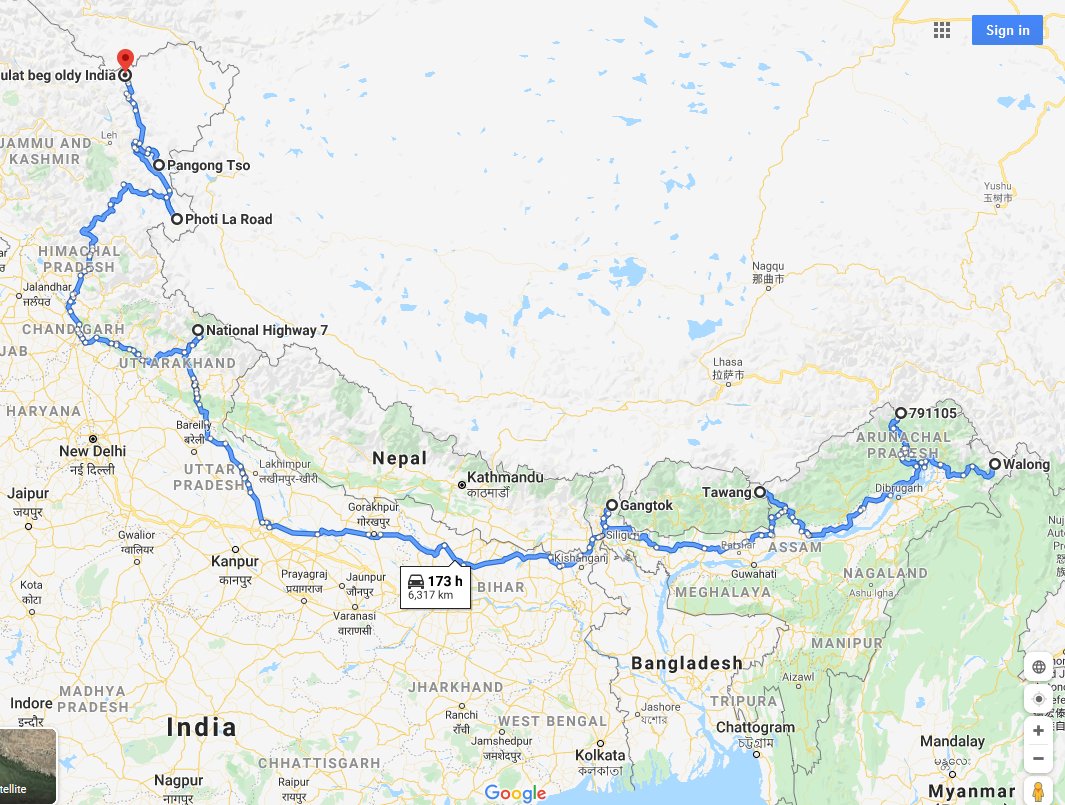
6) Where are the areas along India border that China might initiate a war?

From West to East:
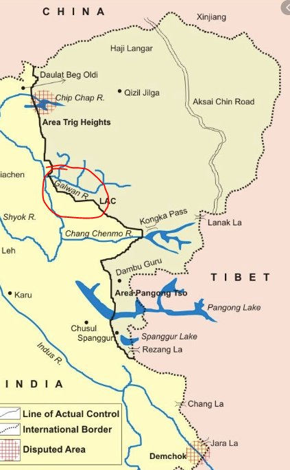
DBO and Galwan Valley (this week)
Pangong Lake
Sindhu river's origin area
Uttarakhand north of Kedarnath.
Sikkim Bhutan junction.
Tawang
Siang valley
Walong. Last 3 in Arunachal Pradesh
7) Why #IndiaChinaFaceOff now?

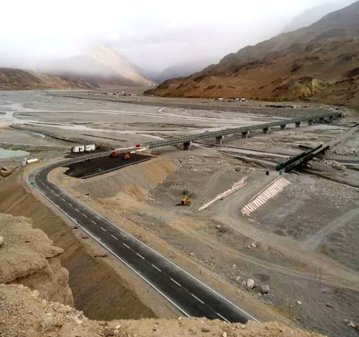
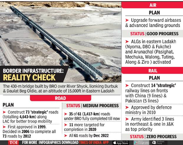
Because China is worried that if India completes all 61 border roads by 2022, it won't be able to bully. India built the highest bridge in Ladakh.

China pushing westward on Pangong lake (beyond finger 6), and encroaching Galwan for this only.
8) What if there is a conventional war in Ladakh between India and China?

Indian army has advantages. Supply lines within 200-400 km. China has 1500- 2500 km supply line from *real* China.

Indian air force has advantage. China can't operate fully loaded planes in Tibet.
9)
Chinese attack on India at #GalwanValley is a serious lesson to #Nepal and Bhutan too.

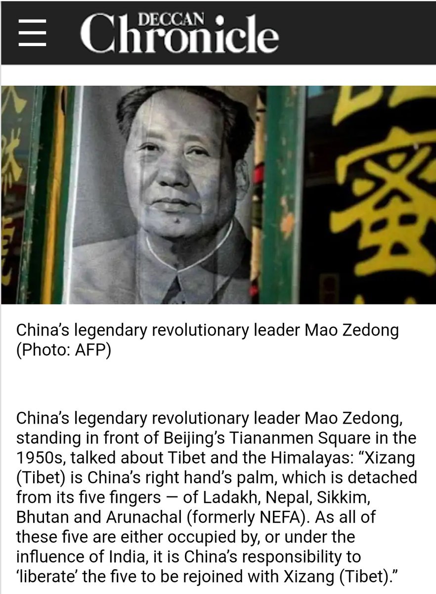
Nepali Communists in particular should read what the Communist Dictator Mao Zedong said about "five fingers" when Nehru was romanticizing Hindi Chini Bhai Bhai. Nepal is in that phase now.
Missing some Tweet in this thread? You can try to force a refresh.

Keep Current with Kiran Kumar S

Profile picture

Stay in touch and get notified when new unrolls are available from this author!

Read all threads

This Thread may be Removed Anytime!

Twitter may remove this content at anytime, convert it as a PDF, save and print for later use!

Try unrolling a thread yourself!

how to unroll video

1) Follow Thread Reader App on Twitter so you can easily mention us!

2) Go to a Twitter thread (series of Tweets by the same owner) and mention us with a keyword "unroll" @threadreaderapp unroll

You can practice here first or read more on our help page!

Follow Us on Twitter!

Did Thread Reader help you today?

Support us! We are indie developers!


This site is made by just two indie developers on a laptop doing marketing, support and development! Read more about the story.

Become a Premium Member ($3.00/month or $30.00/year) and get exclusive features!

Become Premium

Too expensive? Make a small donation by buying us coffee ($5) or help with server cost ($10)

Donate via Paypal Become our Patreon

Thank you for your support!