
This morning's rainfall forecast is actually last nights (I am in the process of moving - a bit stretched. There is a lot going on.
Here we see the ongoing impacts of a #WestAfricaWaterPlume coming into the Middle East and 2 large storms, one over Syria and one over Medina
Here we see the ongoing impacts of a #WestAfricaWaterPlume coming into the Middle East and 2 large storms, one over Syria and one over Medina
Here are last night's 10-day rainfall forecasts for North Africa which are nothing short of astonishing with respect especially to what is expected in #Algeria and #Mauritania. The largest forecast #DesertRain event to date. 


This animation is from the is morning and shows the current status of both #WestAfricanMonsoon events. The Plume directed at the #MiddleEast is continuing and the one in the west Sahara is strengthening.
This animation shows the #MiddleEast stream yesterday morning, a little bit later in the morning.
This animation CMC model shows the next three days of activity in the West Sahara as modeled. If you look closely you can also see the activity over Chad and the Sudan directed at the #MiddleEast and the comparative size of the events is obvious.
But it doesn't stop there. This animation shows the remainder of the week and through next weekend. Note that the CMC is the most bullish of the models when it comes to this phenomena. Both about the strength of the plume and its resulting #DesertRain impacts.
Rain forecasts.
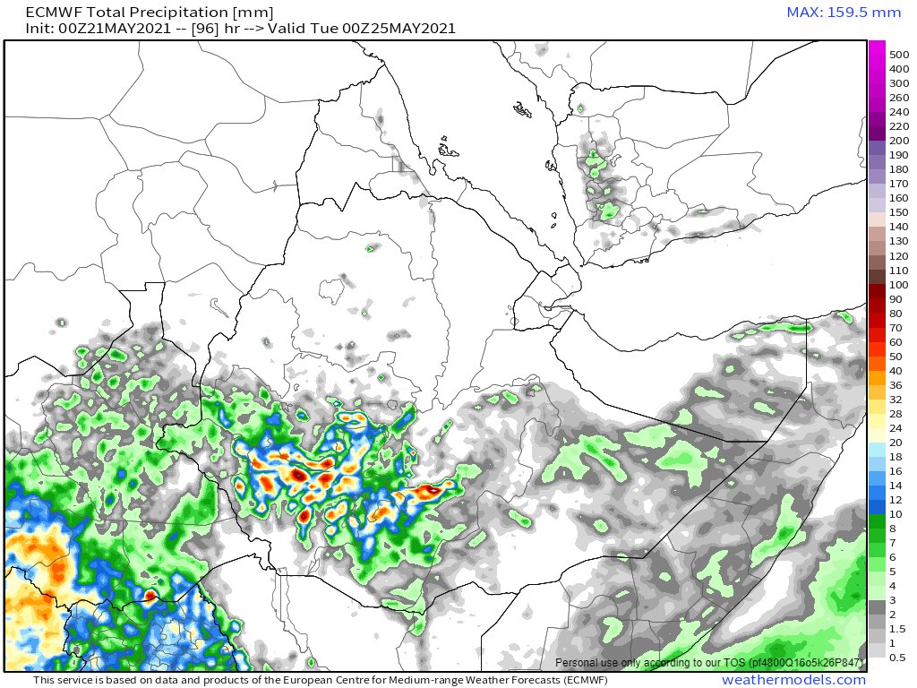
Here are the10-Day forecasts for the #HornOfAfrica #Ethiopia and the Blue and White #NileBasin.
Here are the10-Day forecasts for the #HornOfAfrica #Ethiopia and the Blue and White #NileBasin.


.. and their three day counterparts. The skies are relatively clear over the area today providing possibly some needed respite from the massive levels of precipitation since April 13th.


These images from yesterday show the extent of growth underway in Eastern Ethiopia Sudan and South Sudan.


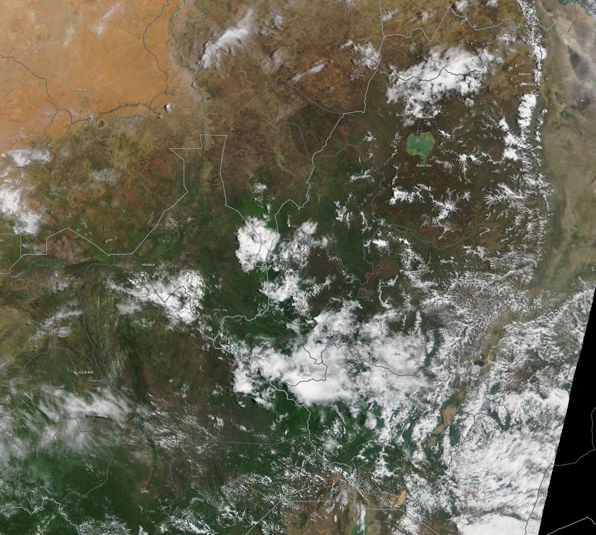
This image shows the same areas in January for comparison.

Moving to the Middle East here are last night's 10-day rainfall forecasts. The KMA model seems to be the first to be incorporating the #WestAfricaWaterPlume impact.

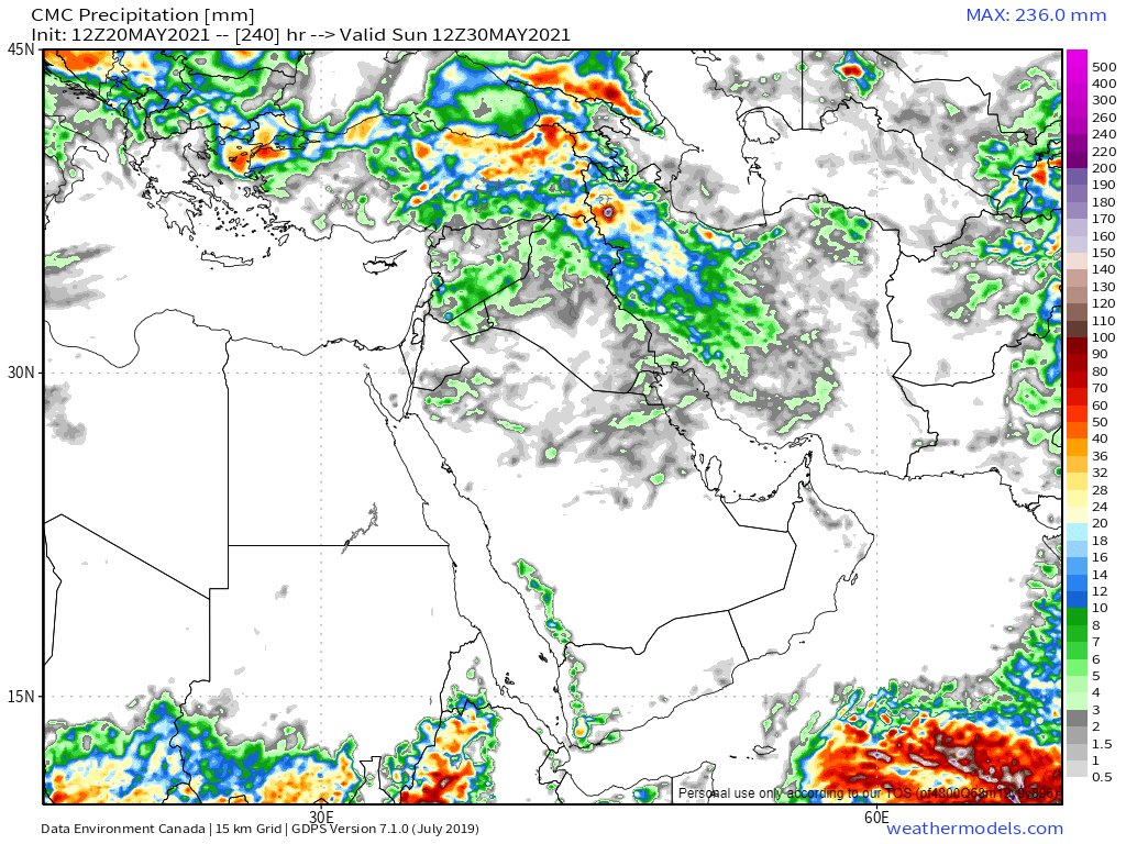


And here are the longer range forecasts. Again so far only the KMA is capturing the reality on the ground. And the impact seems to be mainly in the north of the #MiddleEast over the Levant. and Iraq.


Moving further east all the models are now in agreement about the arrival of a #BayOfBengal Tropical Storm mid next week over the Ganges Delta.


This animation from this morning shows the two active cyclone formation areas one in the Bay of Bengal which shows #Invest93B which has now strengthened from a disturbance to a depression.
You can follow the storm in real time via @zoom_earth here >> zoom.earth/storms/93b-202…
You can follow the storm in real time via @zoom_earth here >> zoom.earth/storms/93b-202…
Here are this mornings 10 day rainfall expectations for the area from the latest model runs. Note however that the predictions around the strength of #Tauktae fell significantly short of the reality. So people in the region should be planning for a possible catastrophic landfall.


ENDS/
@ThreadReaderApp unroll
@ThreadReaderApp unroll
• • •
Missing some Tweet in this thread? You can try to
force a refresh


