New analysis published by @janesintel with @stanfordcisac powerfully shows some of the future possibilities of satellite imagery analysis: intra-minute collection by @BlackSky_Inc shows a vehicle in motion at the #Natanz Uranium Enrichment Complex. h/t @puccioni1#Iran
The vehicle is moving back and forth over the same area, suggesting it is possibly hardening the road in preparation for heavier vehicles or the transport of sensitive equipment, according to the analysis.
An increasing number of companies are offering intra-day or intra-minute imagery collection, offering exciting opportunities for journalists, incl. ship tracking, monitoring activities at detention camps… Would love to hear other ideas!
The new analysis also took advantage of advances in automated object identification and processing. For example, one of @orbital_insight’s algorithms counted vehicles in more than 80 satellite images over 3 years, producing insights into patterns of life.
The analysis also found that by March of this year there were some signs of a slowdown of tunnel construction, such as a stagnation in the expansion of the spoil piles, pointing towards a possible completion of some of the underground excavations.
Where are the graves of Louisiana’s enslaved people? Our latest story combines historical maps, aerial photos & contemporary satellite images analyzed by @ForensicArchi with compelling field reporting to uncover hidden burial sites. nytimes.com/video/us/10000…
The maps allow us to go back in time. 19th century maps show cemeteries or other markings; aerial photos, starting in 1940, often show groves of trees in the same locations. Several of these landscape anomalies persist today, marking possible grave sites.
Today, that area is dominated by petrochemical companies, giving it the notorious nickname “cancer alley.” The continued industrialization of the former plantations is putting some of the possible burial sites at risk of destruction.
A mysterious tanker. Oil transfers at sea. A retired sailor & a multinational oil trader. What do these four things have in common? They are part of the same convoluted web that helps explain one way #NorthKorea evades sanctions. w/ @RUSI_org & @C4ADSnyti.ms/3vNlYdM
For our newest Visual Investigation, we spent months reviewing ship tracking data and corporate records, satellite imagery and interviewing some of the key players to find out how #NorthKorea sidesteps strict international sanctions.
We focused on a ship called the Diamond 8, the largest foreign oil tanker delivering oil to North Korea. The U.N. Panel of Experts publicly identified the ship in April 2020, and has detailed three trips to North Korea. I found a fourth one. 🛰️📷@maxarnyti.ms/3vNlYdM
In our latest story, I break down some of the recent construction at the Natanz nuclear facility, #Iran. Using satellite images, we identify likely new tunnel entrances for an apparent new underground facility. nytimes.com/2020/12/09/wor…
The article is a snapshot of ongoing developments in Natanz. Here are some of the things we can see as of early December. With analysis by @ArmsControlWonk & graphics by @arielle_designs
The ongoing construction is around 1km south of the main Natanz complex and takes shape five months after an explosion destroyed a centrifuge assembly hall in Natanz. Iran defiantly vowed to rebuild it “in the heart of the mountains.” 🛰️📷 @Maxar
The Almeda Drive fire left a path of destruction as it tore through an #Oregon valley. Using satellite images, videos and social media posts, our video reconstructs what happened. nytimes.com/video/us/10000…
The fire destroyed so many homes because it started in a well populated area, after a period of hot and dry weather. And the direction of the strong winds that day perfectly aligned with the valley, pushing it quickly through several towns.
This is one of the first structures that burned in Ashland that day. Many more followed as the fire spread and grew. Ashland police told me they suspect that the fire was man made and that they’ve launched a criminal investigation. 📷 Joe Salamone
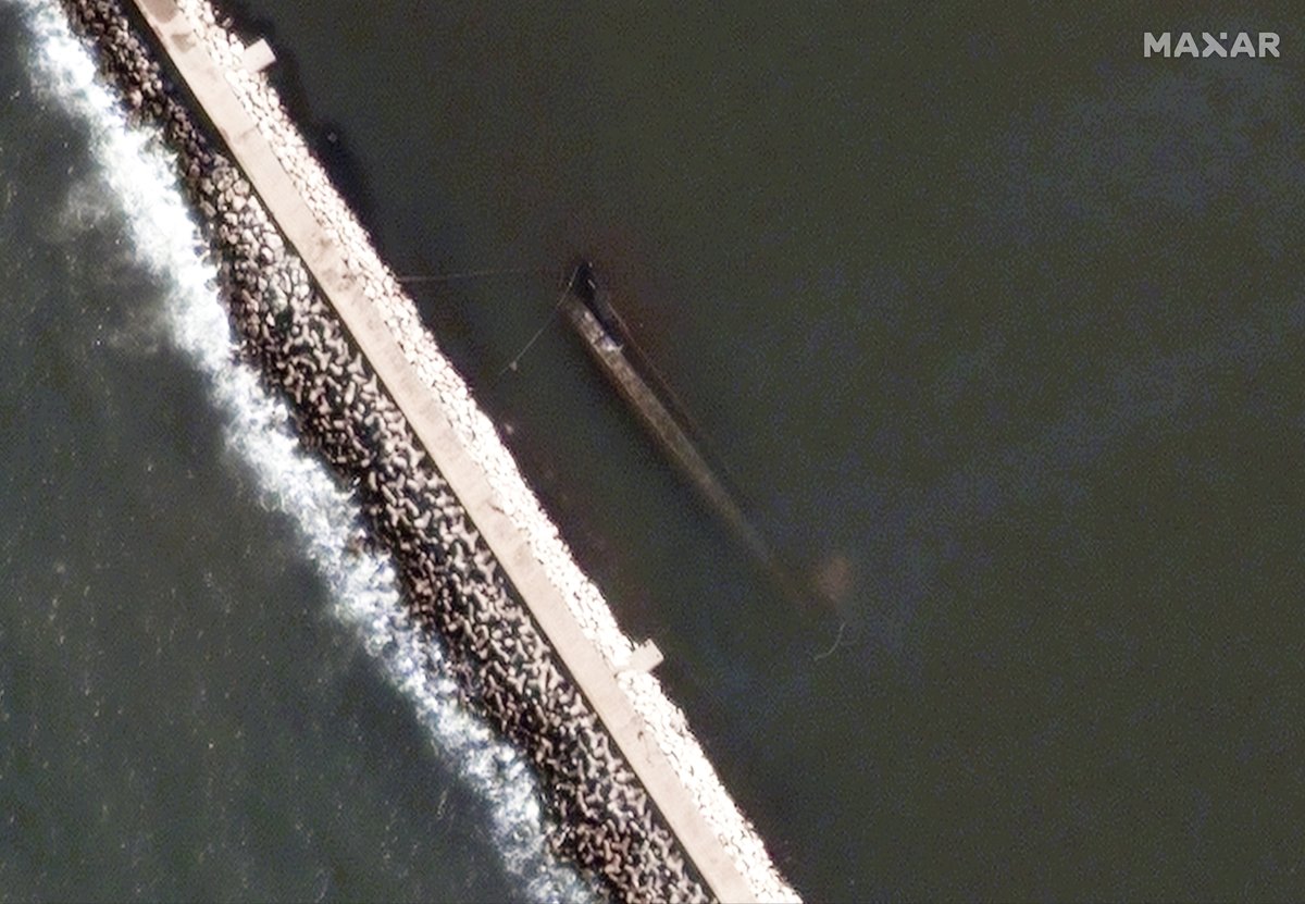
The cargo ship #Rhosus brought 2,750 bags of ammonium nitrate to the port of #Beirut in 2013. I tracked what happened next. The story ends with a massive explosion — and a hidden ship. 🛰️📷 @maxar nytimes.com/2020/08/07/wor…
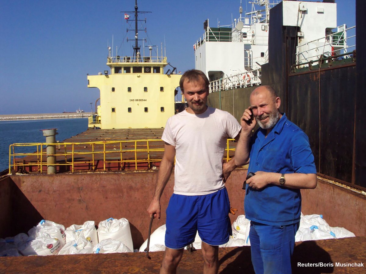
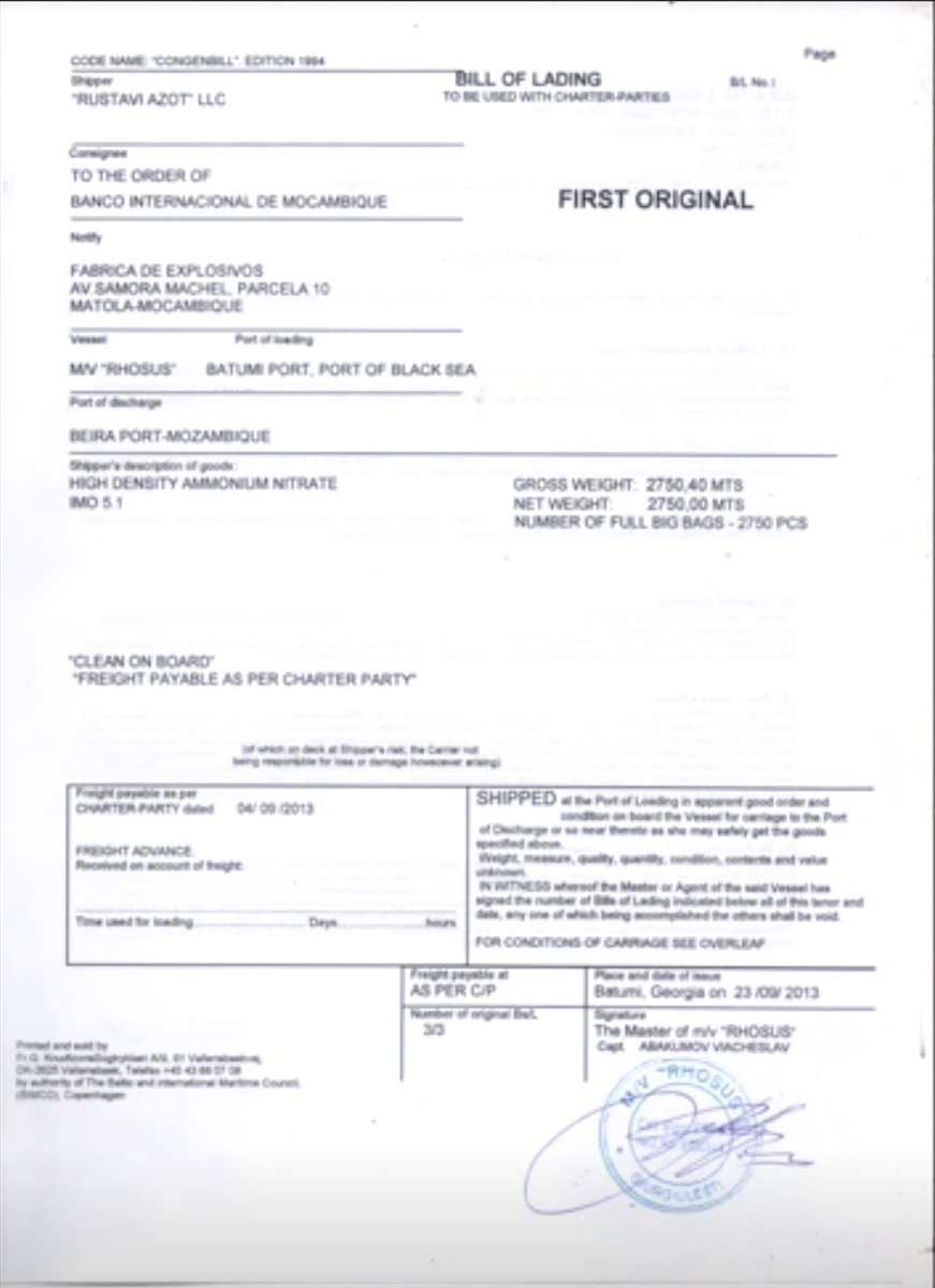
Here's the ship in 2014 at the docks. The captain is in front of ammonium nitrate bags, which match the ones in the warehouse that blew up. Photos from @DimaSadek also show the Georgian company Rustavi Azot, listed as the shipper in documents from 2013
I tracked the ship to two locations in the port. First, at coordinates 33.904934, 35.515357. Earlier image is from September 30, 2014. The second one is from Jan 16, 2015. The open cargo bays and empty hold in the latter indicate that the cargo had been unloaded.
Our latest Visual Investigation reconstructs how @PhillyPolice violated its own use-of-force guidelines by using tear gas & pepper spray on a nonviolent group of protesters in #Philadelphia, some of whom were trapped on a highway. Watch what happened. nytimes.com/video/us/10000…
We went to the site, interviewed witnesses and analyzed dozens of videos. Many thanks to the witnesses Drew, Diamonik, Elias & Callan, who talked to us. Special thanks to Sunny Singh @hate5six — who filmed the whole episode — and to @rohinihaar for her analysis.
.@amnesty recently interviewed a former police officer, Graham Dossett, for its new website: teargas.amnesty.org Here’s an excerpt in which he spells out how not to use tear gas. Amnesty categorized the Philly incident as “unlawful police violence”: amnesty.org/en/latest/news…