Unfortunately, #Ida has continued to rapidly intensify this afternoon and is now an 80mph hurricane.
Cloud tops have warmed somewhat in the last hour or so as we approach DMIN and the center passes over the Isle of Youth.
This is expected, and doesn't preclude more RI tomorrow.
Cloud tops have warmed somewhat in the last hour or so as we approach DMIN and the center passes over the Isle of Youth.
This is expected, and doesn't preclude more RI tomorrow.
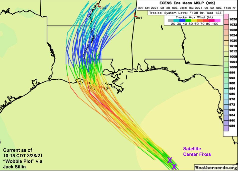
The official NHC forecast for #Ida now calls for landfall in SE #LAwx as a 140mph Cat 4.
The storm is overperforming intensity predictions, a trend that may well continue over the weekend.
Plan as if this could be a Category Five. Even if it's not, it may well feel like it.
The storm is overperforming intensity predictions, a trend that may well continue over the weekend.
Plan as if this could be a Category Five. Even if it's not, it may well feel like it.

Also remember that a storm's category only reflects the winds experienced by a few spots on the immediate coast.
The greater threat for most of #LAwx is water.
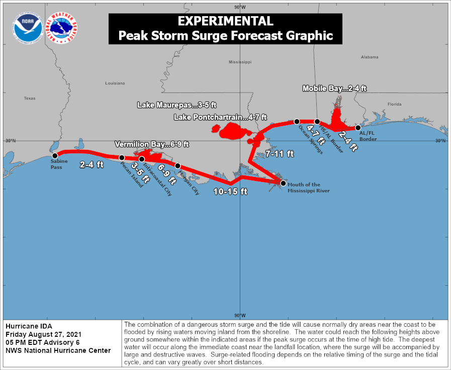
15-20" of rain and 10-15 feet of storm surge will strain even the best flood control systems.

The greater threat for most of #LAwx is water.
15-20" of rain and 10-15 feet of storm surge will strain even the best flood control systems.


I try hard not to sound dire, as I know from growing up in New England that folks in storm-prone regions are hardy and can handle a lot.
But *please* take #Ida seriously. This is rapidly approaching a worst-case scenario for SE #LAwx. Leave if instructed to do so by authorities.
But *please* take #Ida seriously. This is rapidly approaching a worst-case scenario for SE #LAwx. Leave if instructed to do so by authorities.
• • •
Missing some Tweet in this thread? You can try to
force a refresh


