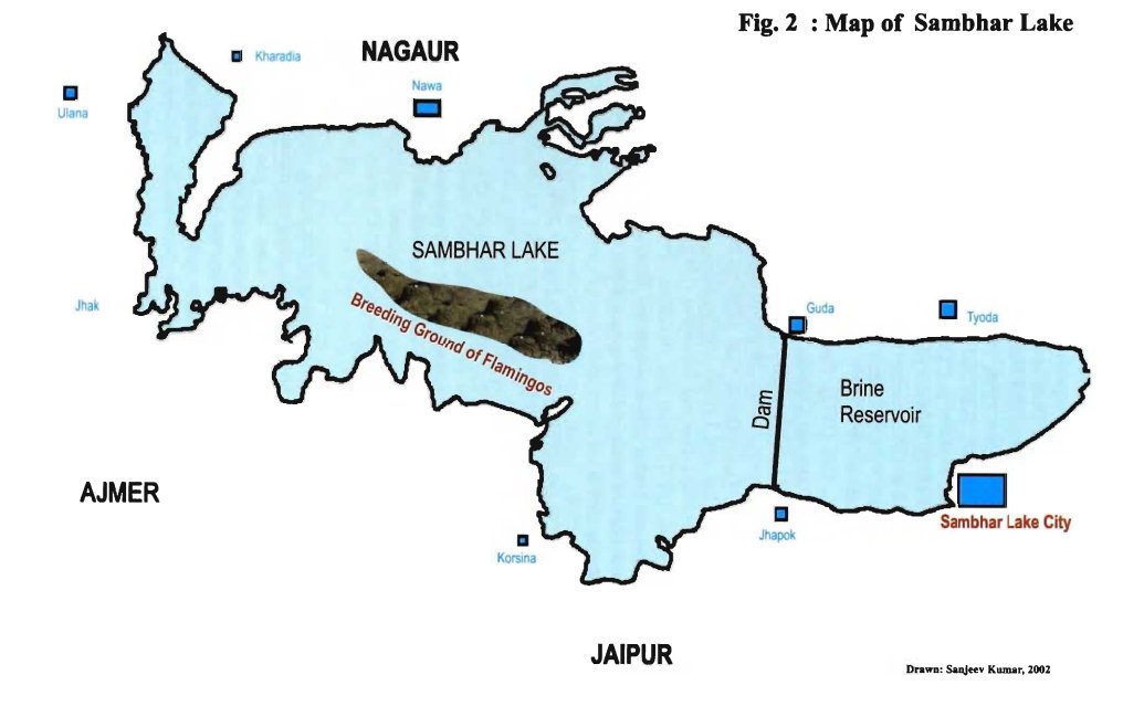
#Sambhar lake, a Ramsar wetland is the largest salt water inland lake in #India. This 230sqkm area lake located in borders of 3 districts in #Rajasthan. Sambhar lake is center of migratory birds incl flamingos. Due to manmade disaster, known as deathbed for Migratory birds 1/n 


#Rajasthan has numerous salt water lakes like Pachpadra, Sambhar, Didwana, Kanod, Lawan & Thob in Thar desert. Sambhar lake has a catchment of 7560sqkm. It is a endorheic basin with no outlet. Important river sources are Mendha(3600sqkm), Rupangarh(625sqkm), Kharian & Khandel 2/n 


Due to hyper salinity, #Sambhar lake has many unique haloalkaliphilic bacteria’s that provides different colors to its water. One of the largest salt production source in #India. Hindustan salt produces more than 2lakh tonne of salt every year. It has salty filled lake bed 3/n 


Sambhar lake catchment lies in the southern portion of endorheic #Shekhawati subbasin in #Rajasthan. This region has high saline soil and ground water, so rainwater harvesting is the main source of drinking water. Shekhawati region knowns for its beautiful haveli's & streets 4/n 


Due to many check dams in its source rivers & depletion of ground water by illegal salt manufactures. Pumping ground water, reducing water availability in shallow Sambhar lake. Lake is getting more saltier/saline and its area is shrinking. This lead to death of many birds. 5/n 

In 2019, more than 18000 migratory bird died in its bed due to unexplained Botulinum toxin. Once a paradise of migratory birds now loosing its ecology. Let save our largest inland salt water lake. 6/n 


• • •
Missing some Tweet in this thread? You can try to
force a refresh


