Mapper | IT | Geohipster and Garsdale 2025
🌐|🗺️|🗓️|🎓|🇹🇿|🐧|🎄
May 1, 2023 • 26 tweets • 16 min read
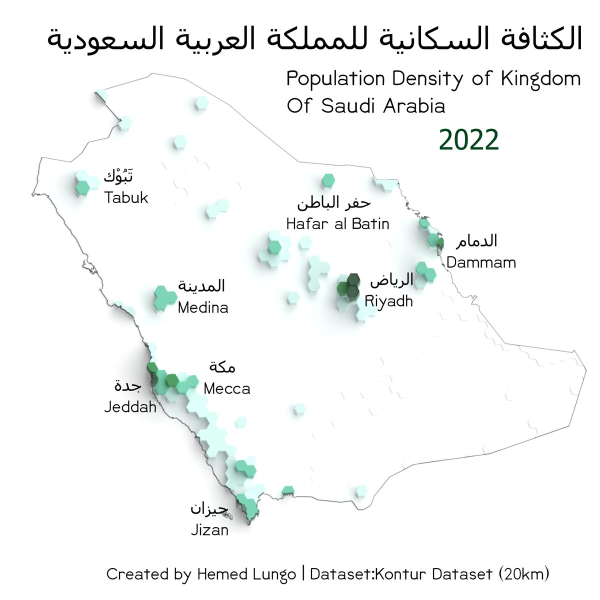
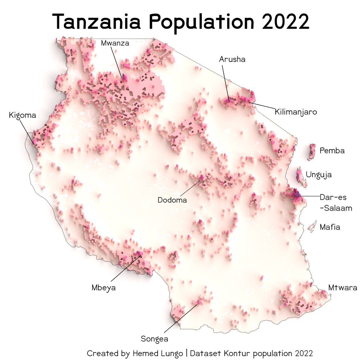
Tutorial thread Blender 3-D Population Density👥📊🗺️Maps through @KonturInc using #QGIS and #Blender....#esri users you can follow along too because it can be done in your software too #gischat#thread#geospatial
So I would divide this tutorial into four parts 1. Data Gathering(with @KonturInc ) 2. QGIS(Black map and Color Map) 3. Rendering in Blender(No geometry nodes) 4. QGIS or other softwares (final touches)
Apr 29, 2023 • 24 tweets • 12 min read
Tutorial thread Blender 3-D Maps🏔️🗺️🧵: In this tutorial I'm going to show how you can also create 3-D Maps like the one shown below. Using #QGIS and #Blender....#esri users you can follow along too because it can be done in your software too #gischat#thread#geospatial
So I would divide this tutorial into four parts 1. Data Gathering(with @OpenTopography ) or DIVA
GIS 2. QGIS(Black map and Color Map) 3. Rendering in Blender(No geometry nodes) 4. QGIS or other softwares (final touches)
Jan 7, 2023 • 21 tweets • 7 min read
Tutorial Thread🧵 on how to create Climate maps using R Language specifically ClimateR🌧️🌤️ package created by Mike Johnson...In this tutorial I'm going to use The Kingdom of Saudi Arabia 🇸🇦#gischat#cartography#GIS#geospatial#Remotesensing#dataviz#R#rspatial#mapping
So At first Climate R is package created specifically to deal with climate illustration ......So in order to get it working you have to Have Remote package already and you have to Install Using the codes below.


 So I would divide this tutorial into four parts
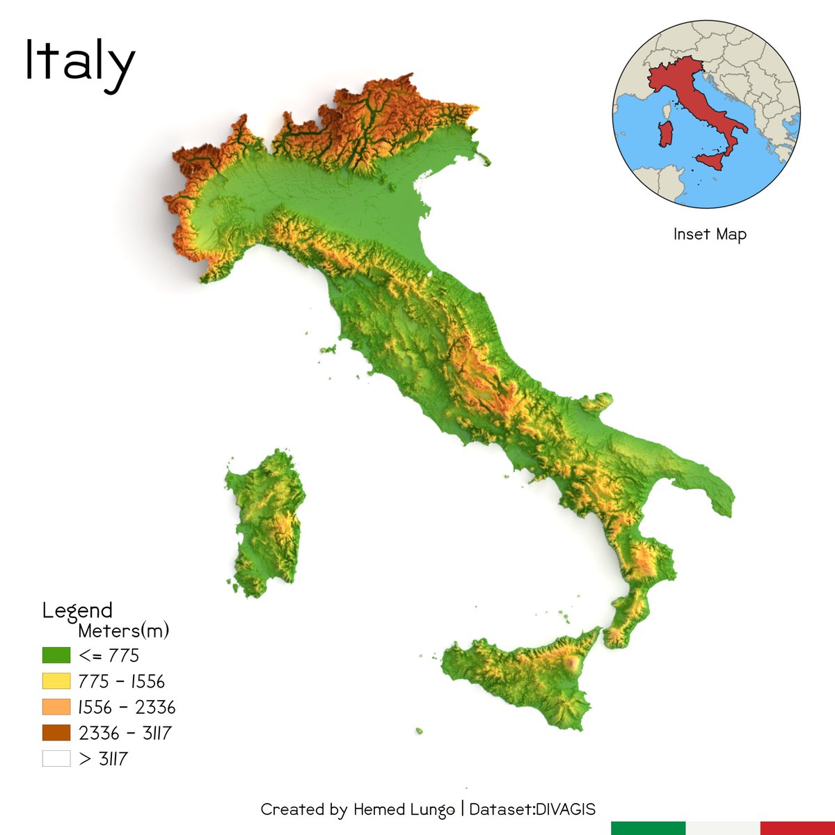


 So I would divide this tutorial into four parts