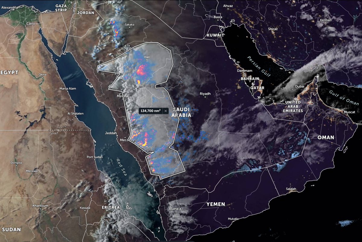
And a close up view of the storms sparking up. A quick scale reminder. The area covered in this .gif is larger than France+Spain.
The Mercator Projection has a lot to answer for.
The full cloud field associated with today's #ArabianStorms - stretching all the way to Tehran - has grown to 2.6 million square KMs. A bit bigger than Algeria and a bit smaller than Kazakhstan. The active storm portion of this is smaller, about the size of France + Spain.
Reduced back to the area of active recent convection we still have 177,000 sq kms an area larger than the state of California.
It hasn't rained yet in Mecca/Makkah this week, even though rain is forecast again for around now. There are many reports of rain near Mecca on twitter. See here - twitter.com/search?q=%D8%A… - Arabic twitter Search). And there's another chance tomorrow.
• • •
Missing some Tweet in this thread? You can try to
force a refresh
@anacascao It looks as if the West African Monsoon is having an unusually strong year. Historically much of the Sahara was forested until 5000 years ago.
It's possible monsoon like conditions are spreading north into the ME - where it also used to be less arid.
@anacascao Computer modelling based on physics also predict all this.
@anacascao For the #GERD the implications are massive. This year the white Nile is already having a massive year. The little rainy season has started in Ethiopia and forecasts consistently show good rainfall for 10-16 days ahead.
A series of images of a weekend burst of energy and water into the European weather system starting 8am on Saturday 17th.
2nd image: 3pm 17th - percussive impact as WMA water hits EU system over Aegean.
3rd image: 9.30am 18th - 5 separate weather systems. #EUClimateChange
The impact of an injection of rain bearing air from West Africa northwards on Europe weather is striking.
A low pressure system is forecast to develop over Western Russia. This displaces the ridge of high pressure which had briefly reversed the flow of cold arctic air south.
This happens almost immediately - and has an immediate catastrophic impact on anticipated European temperatures which are now set to plummet and stay low for a fortnight.
It’s frosty still, thanks to a spate of polar air breakouts up here in Europe. As sunrise approaches it’s getting colder. But should definitely have a good view of Big Red when he arrives.
Pretty much all the trees are now budding. We are on the precipice of a green explosion.