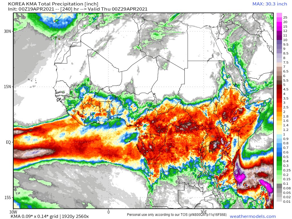
@MostafaELShakaa The fact of the matter is nobody knows how much water will flow down the Nile this year. Only God knows & there may be a lot more than 85 BCM. Last year and 2016 saw flooding. This year's West Africa Monsoon (WMA) looks unusually strong.
@MostafaELShakaa The small rainy season started on Ramadan, April 13th and rains have been steadily increasing.
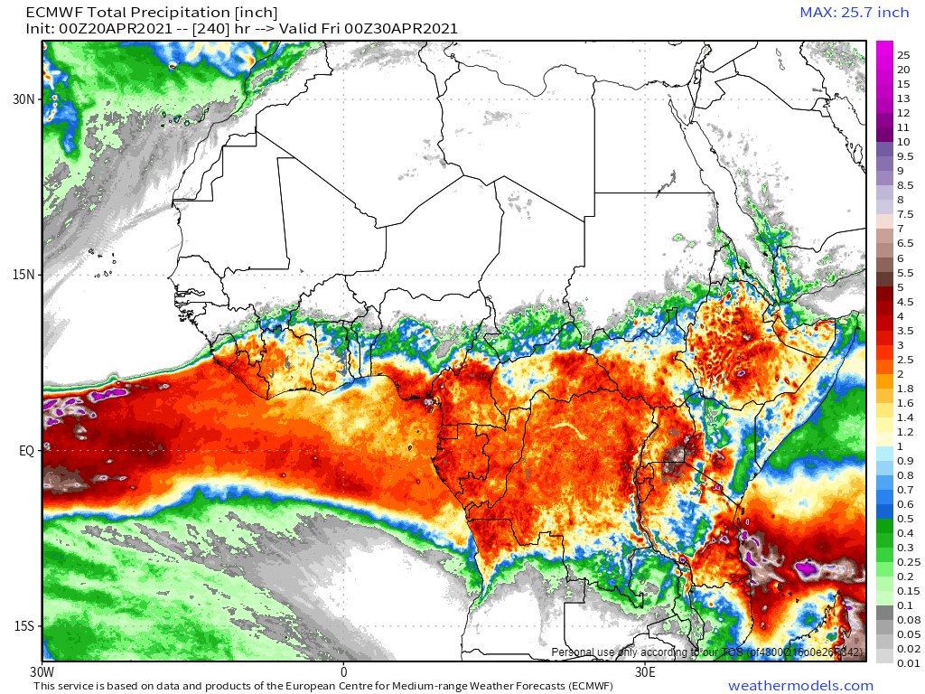
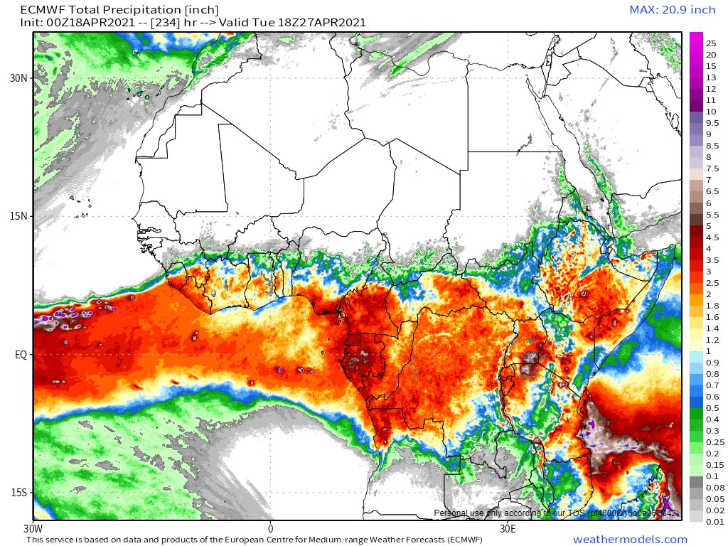
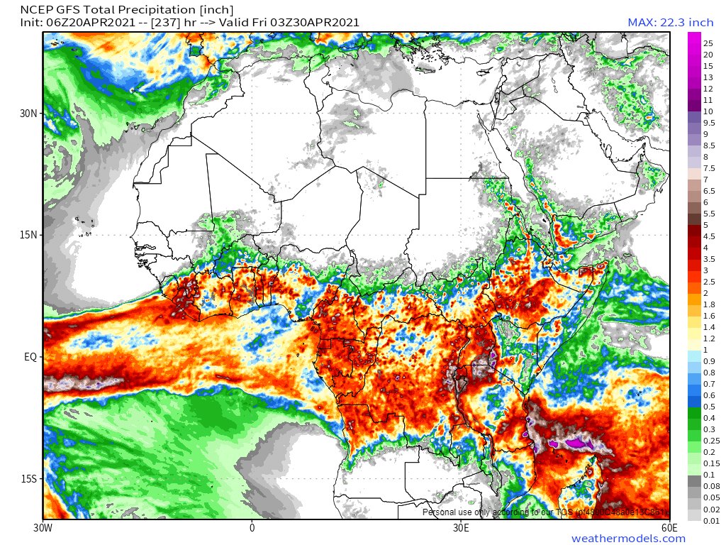
Today's forecasts (10 days of accumulated Rain) for the Horn of Africa are below from the EU/US and Korean weather models. These show very strong rainfall.


Today's forecasts (10 days of accumulated Rain) for the Horn of Africa are below from the EU/US and Korean weather models. These show very strong rainfall.


@MostafaELShakaa In response to your April 1st tweet. Ethiopia does not want to take any water from Egypt. It simply wants to generate electricity from it before it leaves Ethiopia. The storage capacity of the GERD will likely improve Egypt's ability to utilise Nile flow as it will make it even.
@MostafaELShakaa Ethiopia is seeking to negotiate how to arrange this years impound of water. Last year the impound took only 12 days.
It is possible that this year - if rains are heavy as expected, the #GERD will smooth the flow, avoiding flooding downstream. But this needs to be agreed.
It is possible that this year - if rains are heavy as expected, the #GERD will smooth the flow, avoiding flooding downstream. But this needs to be agreed.
@MostafaELShakaa Here is a live picture (as of 3pm today) of the upstream areas of the lower Nile Basin. As you can see there is plenty of cloud activity - and each day there is rain. The area of cloud cover is 1.3 million square kms - an area today which is 200k kms2 larger than Egypt. 


@MostafaELShakaa However, @MostafaELShakaa, 86% of the water that reaches Egypt comes from the Blue Nile Basin alone. Roughly speaking this part of the larger map below, which is 325,000 sq Kms... and most of that from the highlands part of this.
Does Ethiopia have no say over use of this?

Does Ethiopia have no say over use of this?


@MostafaELShakaa @threadreaderapp unroll
• • •
Missing some Tweet in this thread? You can try to
force a refresh
