The German storm has now, as forecasted move south east and is now centered over the Adriatic. Its presentation has the appearance of a storm which is receiving its energy from an Atmospheric River of water.
Here's a 90 hour accumulated forecast for Italy. The storm is continuing to move very slowly.
Here's the European @ECMWF model version which shows particularly highlevels of rain over the Slovenia, Croatia, & Bosnia & Herzegovina.
Here's a Precipitable Water simulation from the @ECMWF over 240 Hours. The high levels of atmospheric water have fully moved out by Wednesday.
And here is ECMWF's 6-hrly rainfall forecast - over 96 hours.
Note however that forecasting exact rainfall location and intensity over any longer than 24 hours is very tricky. The rainfall expectations here are closely tied to the accuracy of the precipitable water model.
• • •
Missing some Tweet in this thread? You can try to
force a refresh
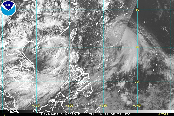
This attached thread from this morn looks at Typhoon #INFA ("In-fa" TS09W) which is poised to be extraordinarily disruptive to the 2021 Olympics in Japan.
It has since come clearer what we can expect from a dangerous and unusual weather system developing over the West Pacific.
And here it is today. It still has a clearly defined circulation over the Adriatic Sea.
This shows the jet stream forecast for today which pretty perfectly matches what we are seeing here from the satellite imagery.
But while the circulation is gone the jet remains. This jet looks like it is going to move into the business of delivering moisture to the Middle East.
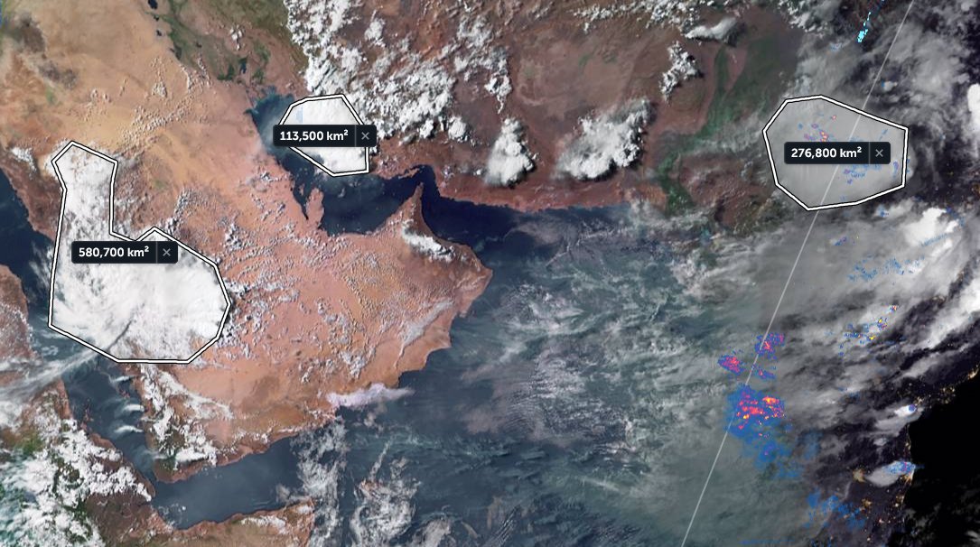
The presentation of the #ArabianMonsoonBurst has changed dramatically today with the consolidation of activity over the Arabian Peninsula into a single huge storm which is currently moving into the Red Sea over Makkah and Jeddah.
Today's rainfall forecasts follow.
The scale of the storm over Islam's holiest city is huge, larger than France. Two more huge storms loom over the greater region tonight. One on the Iranian Gulf coast and another supercell thunderstorm complex over New Delhi/Rajastan, India, the size of the United Kingdom.
The last six hours in three animations, first India which is experiencing a massive monsoon day today in the north.
[Here the initial frames show a blank SEA as their was a satellite data outage.]
This thread provides a tour of the global biosphere in pictorial form.
The animations were acquired from @zoom_earth on July 14th, and take us on a journey beginning in the North East Pacific over the course of a single day.
There has been a sharp increase in discussion of climate change weather extremes in the context of the flood calamity in Western Europe, wildfires in the North West US, and the #ArabianMonsoonBurst
This thread looks at the big picture right now. What's next?
The image above from @meteoblue shows most of the Northern Hemisphere & rainfall at the moment. The intense blobs of colour indicate high rainfall from thunderstorms.
What is immediately apparent looking at this is that there is an immediate issue now in the West Pacific.
What will soon be Typhoon In-Ha is forecast to make landfall in Taiwan and then stall bringing massive rainfall to the Philippines, China and Taiwan.
There is second tropical storm to the left of what will soon be In-ha which is simultaneously bringing extreme weather to HK.
The German and European low country flooding of last week is astonishing and terrifying. This thread compiles youtube videos of the coverage. The death toll is still expected to rise significantly.
The previous video was @Channel4News 16th July report. Here is their 17th July report.